Cooper's Camp is a town and a notified area in Nadia district under Ranaghat police station of Ranaghat subdivision in the state of West Bengal, India.
Gopalpur is a census town in the Ranaghat I CD block in the Ranaghat subdivision of the Nadia district in the Indian state of West Bengal.

Karimpur is a census town, near the bank of river Jalangi, in Karimpur I CD block in the Tehatta subdivision of the Nadia district in the Indian state of West Bengal.
Satigachha is a census town in the Ranaghat I CD block in the Ranaghat subdivision of the Nadia district in the Indian state of West Bengal.
Nasra is a census town in the Ranaghat II CD block in the Ranaghat subdivision of the Nadia district in the Indian state of West Bengal.
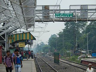
Badkulla is a census town in the Hanskhali CD block in the Ranaghat subdivision of the Nadia district in the Indian state of West Bengal.

Ichamati River, is a trans-boundary river which flows through India and Bangladesh and also forms part of the boundary between the two countries. The river is facing siltation leading to thin flow of water in the dry season and floods in the rainy season. Experts are considering remedial measures and the situation is being discussed between the governments of India and Bangladesh.

Aranghata is a village and a gram panchayat in the Ranaghat II CD block in the Ranaghat subdivision of the Nadia district, West Bengal, India. It is situated 78 km (48 mi) north of Calcutta and about 9 km (5.6 mi) north of Ranaghat town.

Bethuadahari is a town in the Nakashipara CD block in the Krishnanagar Sadar subdivision of the Nadia district of the state of West Bengal, India. It is almost 28 km from the district headquarters Krishnanagar. Bethuadahari Wildlife Sanctuary is in Bethuadahari of Nadia District, West Bengal, India. The sanctuary is located beside National Highway 12. The sanctuary covers 67 hectares, and was established in 1980 to preserve a portion of the central Gangetic alluvial zone.
Palashipara, is a village in the Tehatta II CD block in the Tehatta subdivision of the Nadia district, West Bengal, India.
Hogalbaria is a village in the Karimpur I CD block in the Tehatta subdivision of the Nadia district in the state of West Bengal, India. The village is situated near the Indo-Bangladesh border.
Gangnapur is a census town in the Ranaghat II CD block in the Ranaghat subdivision of the Nadia district in the state of West Bengal, India.

Nokari is a village in the Ranaghat II CD block in the Ranaghat subdivision of the Nadia district in the state of West Bengal, India
Panikhali is a village in the Ranaghat II CD block in the Ranaghat subdivision of the Nadia district in the state of West Bengal, India.
Patuli is a census town in the Hanskhali CD block in the Ranaghat subdivision of the Nadia district in the state of West Bengal, India.
Gangni is a census town in the Ranaghat I CD block in the Ranaghat subdivision of the Nadia district in the state of West Bengal, India.
Kamgachhi is a census town in the Ranaghat I CD block in the Ranaghat subdivision of the Nadia district in the state of West Bengal, India.

Hijuli is a census town in the Ranaghat II CD block in the Ranaghat subdivision of the Nadia district in the state of West Bengal, India.
Belgharia is a census town in the Ranaghat II CD block in the Ranaghat subdivision of the Nadia district in the state of West Bengal, India.

Anjana is a local river of Nadia district of West Bengal. The 29 km (18 mi) long river drains Krishnanagar, Jalalkhali and Badkulla areas, which belong to Krishnanagar, and Krishnanagar 1 and Hanshkhali community development block. The Anjana River originates on the southern bank of the Jalangi River at the northern end of Krishnanagar, the river generally flows south through the Jalalkhali area before reaching Badkulla. Passing the town of Badkulla, the river flows southeast and joins the Churni river. A tributary originates from this river at Hat Boalia, which joins the Churni river at Hanshkhali.


