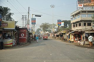
Nadia is a district in the state of West Bengal, India. It borders Bangladesh to the east, North 24 Parganas and Hooghly districts to the south, Purba Bardhaman to the west, and Murshidabad to the north.

Chakdaha is a town and a municipality in the Kalyani subdivision of the Nadia district, located in the state of West Bengal, India.
Gayespur is a city and a municipality of Nadia district in the Indian state of West Bengal. It is a part of the area covered by Kolkata Metropolitan Development Authority (KMDA).
Madanpur is a census town in Kalyani Community Development Block in the Kalyani subdivision of the Nadia district in the Indian state of West Bengal.

Kalyani subdivision is an administrative subdivision of the Nadia district in the Indian state of West Bengal.

Shimurali is a census town in Chakdaha CD block in the Kalyani subdivision of the Nadia district in the state of West Bengal, India.
Palpara is a neighbourhood in Chakdaha, in Kalyani subdivision of the Nadia district in the state of West Bengal, India. The Palpara railway station is 59 km from Sealdah railway station, and 51.4 km from Krishnanagar railway station. Palpara is famous for its 17th-century terracotta Kali temple, also popularly known as "Palpara Temple", which is now under the supervision of Archaeological Survey of India (ASI).
Mohanpur is a neighbourhood in the Haringhata CD block in the Kalyani subdivision of the Nadia district, West Bengal, India. This is presently known for the agricultural University and other educational institutes.
Chapra is a census town and a gram panchayat in the Chapra CD block in the Krishnanagar Sadar subdivision of the Nadia district in the state of West Bengal, India.
Subarnapur is a census town in the Haringhata CD block in the Kalyani subdivision of the Nadia district in the state of West Bengal, India.
Bangaljhi is a village in the Chapra CD block in the Krishnanagar Sadar subdivision of the Nadia district in the state of West Bengal, India.
Punglia is a census town in the Chakdaha CD block in the Kalyani subdivision of the Nadia district in the state of West Bengal, India.
Lalpur is a census town in the Chakdaha CD block in the Kalyani subdivision of the Nadia district in the state of West Bengal, India.
Chanduria is a census town in the Chakdaha CD block in the Kalyani subdivision of the Nadia district in the state of West Bengal, India.
Priyanagar is a census town in the Chakdaha CD block in the Kalyani subdivision of the Nadia district in the state of West Bengal, India.
Jangal is a census town in the Chakdaha CD block in the Kalyani subdivision of the Nadia district in the state of West Bengal, India.
Saguna is a census town in the Kalyani community Development Block in the Kalyani subdivision of the Nadia district in the state of West Bengal, India.
Kulia is a census town in the Chakdaha CD block in the Kalyani subdivision of the Nadia district in the state of West Bengal, India.
Simhat is a census town in the Haringhata CD block in the Kalyani subdivision of the Nadia district in the state of West Bengal, India.
Digha is a census town in the Haringhata CD block in the Kalyani subdivision of the Nadia district in the state of West Bengal, India.


