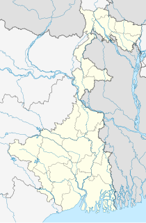
Nadia district is a district in the state of West Bengal, India. It borders Bangladesh to the east, North 24 Parganas and Hooghly districts to the south, Purba Bardhaman to the west, and Murshidabad to the north.

Tehatta is the headquarters of the Tehatta subdivision in Nadia district in the Indian state of West Bengal. The place is a sub-divisions in the district of Nadia. It was declared as sub-division in 1996. Tehatta is located beside the India-Bangladesh border area.

Karimpur is a census town, near the bank of river Jalangi, in Karimpur I CD block in the Tehatta subdivision of the Nadia district in the Indian state of West Bengal.

Tehatta II is a community development block that forms an administrative division in Tehatta subdivision of Nadia district in the Indian state of West Bengal.

Tehatta subdivision is an administrative subdivision of the Nadia district in the state of West Bengal, India.

Karimpur I is a community development block that forms an administrative division in Tehatta subdivision of Nadia district in the Indian state of West Bengal.

Karimpur II is a community development block that forms an administrative division in Tehatta subdivision of Nadia district in the Indian state of West Bengal.

Tehatta I is a community development block that forms an administrative division in Tehatta subdivision of Nadia district in the Indian state of West Bengal.

Iswarchandrapur is a village in Hanspukuria Gram Panchayat in Tehatta II CD Block in Tehatta subdivision of Nadia district. It is situated beside the river Jalangi.

Palashipara, is a village in the Tehatta II CD block in the Tehatta subdivision of the Nadia district, West Bengal, India.

Kishorpur is a village under the Karimpur II Community Development Block in Tehatta subdivision of Nadia district in the state of West Bengal. Nandanpur is the gram panchayat of Kishorpur village. This village is under the Karimpur police station.

Murutia is a village in the Karimpur II CD block in the Tehatta subdivision of the Nadia district in the state of West Bengal, India.

Thanarpara is a village in the Karimpur II CD block in the Tehatta subdivision of the Nadia district in the state of West Bengal, India.

`

Rahmatpur is a village in the Karimpur II CD block in the Tehatta subdivision of the Nadia district in the state of West Bengal, India.

Mahish Bathan is a village in Karimpur II CD Block under Tehatta subdivision of Nadia district in the state of West Bengal, India.

Nazirpur is a village in the Tehatta I CD block in the Tehatta subdivision of the Nadia district in the State of West Bengal, India. It is situated beside the Bangladesh India Border.

Taranipur is a village in Patharghata Gram Panchayat-II in Tehatta I CD Block in Tehatta subdivision of Nadia district. It is situated in between the river Jalangi and the border of Bangladesh.

Uttampur is a census town in the Karimpur I CD block in the Tehatta subdivision of the Nadia district in the state of West Bengal, India.

Natidanga is a village and a gram panchayat in the Karimpur II CD block in the Tehatta subdivision of the Nadia district in the state of West Bengal, India.


