Hogalbaria

Last updated

Hogalbaria
Village
West Bengal location map.svg
Red pog.svg
Hogalbaria
Location in West Bengal, India
India location map.svg
Red pog.svg
Hogalbaria
Hogalbaria (India)
Coordinates: 24°02′16″N88°42′04″E / 24.037667°N 88.701111°E / 24.037667; 88.701111 Coordinates: 24°02′16″N88°42′04″E / 24.037667°N 88.701111°E / 24.037667; 88.701111
CountryFlag of India.svg  India
State West Bengal
District Nadia
Languages
  Official Bengali, English
Time zone UTC+5:30 (IST)
Lok Sabha constituency Murshidabad
Vidhan Sabha constituency Karimpur
Website nadia.gov.in

Hogalbaria is a village in the Karimpur I CD block in the Tehatta subdivision of the Nadia district in the state of West Bengal, India. The village is situated near the Indo-Bangladesh border. A temple named Maa Naskari Mandir is located here.[ citation needed ]

Contents

Geography

Cities and towns in Tehatta subdivision of Nadia district
CT: census town, R: rural/ urban centre.
Owing to space constraints in the small map, the actual locations in a larger map may vary slightly

Location

Hogalberia is located at 24°02′16″N88°42′04″E / 24.037667°N 88.701111°E / 24.037667; 88.701111 .

Area overview

Nadia district is mostly alluvial plains lying to the east of Hooghly River, locally known as Bhagirathi. The alluvial plains are cut across by such distributaries as Jalangi, Churni and Ichhamati. With these rivers getting silted up, floods are a recurring feature. [1] The Tehatta subdivision, presented in the map alongside, is topographically part of the Nadia Plain North. The Jalangi River forms the district/ subdivision border in the north-western part and then flows through the subdivision. The other important rivers are Mathabhanga and Bhairab. The eastern portion forms the boundary with Bangladesh. [2] The subdivision is overwhelmingly rural. 97.15% of the population lives in the rural areas and 2.85% lives in the urban areas. [3]

Note: The map alongside presents some of the notable locations in the subdivision. All places marked in the map are linked in the larger full screen map. All the four subdivisions are presented with maps on the same scale – the size of the maps vary as per the area of the subdivision.

Civic administration

Police station

Hogalbaria police station has jurisdiction over a portion of the Karimpur I CD block. [4] [5] The total area covered by the police station is 122.5 km2 and the population covered is 183,556 (2011 census). 14 km of the Bangladesh-India border is within the PS area – 9.5 km has fencing and the rest is Padma River. [6]

Education

Hogalbaria Adarsha Sikshaniketan was established in 1959 as a Bengali-medium co-educational school with classes from V to XII. [7]

Transport

State Highway 11 passes near the village. Hogalbaria is connected with district headquarters, Krishnagar, by regular bus services. The road distance between Krishnagar and Hogalbaria is 88 km. [8]

Related Research Articles

Tehatta Town in West Bengal, India

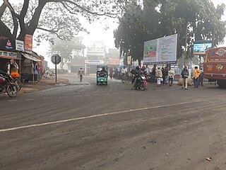
Tehatta is the headquarters of the Tehatta subdivision in Nadia district in the Indian state of West Bengal. The place is a sub-divisions in the district of Nadia. It was declared as sub-division in 1996. Tehatta is located beside the India-Bangladesh border area.

Karimpur Census Town in West Bengal, India

Karimpur is a census town, near the bank of river Jalangi, in Karimpur I CD block in the Tehatta subdivision of the Nadia district in the Indian state of West Bengal.

Tehatta II is a community development block that forms an administrative division in Tehatta subdivision of Nadia district in the Indian state of West Bengal.

Tehatta subdivision is an administrative subdivision of the Nadia district in the state of West Bengal, India.

Dhubulia Village in West Bengal, India

Dhubulia is a village in the Krishnanagar II CD block in the Krishnanagar Sadar subdivision of the Nadia district of West Bengal, India.

Debagram Village in West Bengal, India

Debagram is a village in the Kaliganj CD block in the Krishnanagar Sadar subdivision of the Nadia district in the Indian state of West Bengal.

Palashipara, is a village in the Tehatta II CD block in the Tehatta subdivision of the Nadia district, West Bengal, India.

Kishorpur is a village under the Karimpur II Community Development Block in Tehatta subdivision of Nadia district in the state of West Bengal. Nandanpur is the gram panchayat of Kishorpur village. This village is under the Karimpur police station.

Murutia is a village in the Karimpur II CD block in the Tehatta subdivision of the Nadia district in the state of West Bengal, India.

Thanarpara is a village in the Karimpur II CD block in the Tehatta subdivision of the Nadia district in the state of West Bengal, India.

`

Rahmatpur is a village in the Karimpur II CD block in the Tehatta subdivision of the Nadia district in the state of West Bengal, India.

Chapra is a census town and a gram panchayat in the Chapra CD block in the Krishnanagar Sadar subdivision of the Nadia district in the state of West Bengal, India.

Krishnaganj is a village in the Krishnaganj CD block in the Krishnanagar Sadar subdivision of the Nadia district in the state of West Bengal, India.

Betai is a village in the Tehatta I CD block in the Tehatta subdivision of the Nadia district in the state of West Bengal, India.

Nazirpur is a village in the Tehatta I CD block in the Tehatta subdivision of the Nadia district in the State of West Bengal, India. It is situated beside the Bangladesh India Border.

Uttampur is a census town in the Karimpur I CD block in the Tehatta subdivision of the Nadia district in the state of West Bengal, India.

Sonda is a census town in the Krishnanagar I CD block in the Krishnanagar Sadar subdivision of the Nadia district in the state of West Bengal, India.

Paschimbhatjangla is a census town in the Krishnanagar I CD block in the Krishnanagar Sadar subdivision of the Nadia district in the state of West Bengal, India.

Natidanga is a village and a gram panchayat in the Karimpur II CD block in the Tehatta subdivision of the Nadia district in the state of West Bengal, India.

References

  1. Gangopadhyay, Basudev, Paschimbanga Parichay, 2001, (in Bengali), p. 70, Sishu Sahitya Sansad
  2. "District Census Handbook, Nadia, 2011, Series 20, Part XII A" (PDF). Pages 13,14. Directorate of Census Operations, West Bengal. Retrieved 15 October 2020.
  3. "District Statistical Handbook 2014 Nadia". Table 2.2, 2.4(a). Department of Planning and Statistics, Government of West Bengal. Retrieved 15 October 2020.
  4. "District Statistical Handbook 2014 Nadia". Table 2.1. Department of Planning and Statistics, Government of West Bengal. Retrieved 7 October 2020.
  5. "Nadia District Police". Police Unit. West Bengal Police. Retrieved 17 May 2017.
  6. "Hogalbaria Police Station Details". Nadia Police. Retrieved 17 May 2017.
  7. "Hogalberia Adarsha Shikshaniketan". acadym. Retrieved 17 May 2017.[ dead link ]
  8. "Distance from Krishnagar Bus Stand to Hogalbaria". distancesfrom.com. Retrieved 26 May 2017.