Nadia district is a district in the state of West Bengal, India. It borders Bangladesh to the east, North 24 Parganas and Hooghly districts to the south, Purba Bardhaman to the west, and Murshidabad to the north.

Tarakeswar is a city and a municipality in Hooghly district in the Indian state of West Bengal. It is also one of the police stations under Chandannagore subdivision. Tarakeswar is a place of pilgrimage and a centre of the Shaiva sect in West Bengal 58 kilometres (36 mi) away from Kolkata, Tarakeswar can be reached conveniently by train.

Aranghata is a village and a gram panchayat in the Ranaghat II CD block in the Ranaghat subdivision of the Nadia district, West Bengal, India. It is situated 78 km (48 mi) north of Calcutta and about 9 km (5.6 mi) north of Ranaghat town.

Masagram is a village in Ajhapur gram panchayat of Jamalpur CD block in Bardhaman Sadar South subdivision of Purba Bardhaman district in the Indian state of West Bengal.
Ranaghat I is a community development block that forms an administrative division in Ranaghat subdivision of Nadia district in the Indian state of West Bengal.
Ranaghat II is a community development block that forms an administrative division in Ranaghat subdivision of Nadia district in the Indian state of West Bengal.
Taraknagar is a village in the Krishnaganj CD block in the Krishnanagar Sadar subdivision of the Nadia district, West Bengal, India situated 99 km north of Kolkata. Taraknagar is well connected with the state capital Kolkata via Kolkata Suburban Railway.
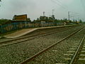
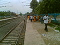
Dattapulia is a village in the Ranaghat II CD block in the Ranaghat subdivision of the Nadia district, West Bengal, India.
Sehakhala is a village and a gram panchayat in Chanditala I community development block in Srirampore subdivision of Hooghly district in the state of West Bengal, India. It is under Chanditala police station.
Malipukur is a Village in Arambagh community development block in Arambagh subdivision of Hooghly district in the state of West Bengal, India. It is under [[Arambagh] police station.
Bamandanga is a village in Chanditala II community development block of Srirampore subdivision in Hooghly district in the Indian state of West Bengal.
Bankagachha is a village in Chanditala II community development block of Srirampore subdivision in Hooghly district in the Indian state of West Bengal.
Benipur is a village in Chanditala II community development block of Srirampore subdivision in Hooghly district in the Indian state of West Bengal.
Danpatipur is a village in Chanditala II community development block of Srirampore subdivision in Hooghly district in the Indian state of West Bengal.
Madhabpur is a village in Chanditala II community development block of Srirampore subdivision in Hooghly district in the Indian state of West Bengal.
Sanka is a village in Chanditala II community development block of Srirampore subdivision in Hooghly district in the Indian state of West Bengal.
Thero is a village in Chanditala II community development block of Srirampore subdivision in Hooghly district in the Indian state of West Bengal.

Nokari is a village in the Ranaghat II CD block in the Ranaghat subdivision of the Nadia district in the state of West Bengal, India
Ghoralia is a census town in the Santipur CD block in the Ranaghat subdivision of the Nadia district in the state of West Bengal, India.
Saguna is a census town in the Kalyani community Development Block in the Kalyani subdivision of the Nadia district in the state of West Bengal, India.