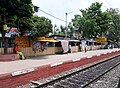
Shimurali is a culturally diverse place. In the past, it was best known for its river port, which fell under the Calcutta Port Trust Corporation (C.P.T.), a British port trust.[2]
Geography
8km 5miles
W
Hooghly River
F
AIIMS Kalyani
F
University of Kalyani
R
Palpara
R
Mohanpur
R
Chaugacha
M
Haringhata
M
Gayespur
M
Chakdaha
M
Kalyani
CT
Digha
CT
Subarnapur
CT
Simhat
CT
Kulia
CT
Saguna
CT
Madanpur
CT
Jangal
CT
Priyanagar
CT
Shimurali
CT
Chanduria
CT
Lalpur
CT
Darappur
CT
Punglia
Cities and towns in Kalyani subdivision of Nadia district M: municipal town/ city/notified area, CT: census town, R: rural/ urban centre. Owing to space constraints in the small map, the actual locations in a larger map may vary slightly
Nadia district is part of the large alluvial plain formed by the Ganges-Bhagirathi system. The Kalyani subdivision has the Bhagirathi/ Hooghly on the west. Topographically, Kalyani subdivision is a part of the Ranaghat-Chakdaha Plain, the low-lying area found in the south-eastern part of the district.[3] The smallest subdivision in the district, area-wise, has the highest level of urbanisation in the district. 76.73% of the population lives in urban areas and 23.27% lives in the rural areas.[4]
Note: The map alongside presents some of the notable locations in the subdivision. All places marked in the map are linked in the larger full screen map. All the four subdivisions are presented with maps on the same scale – the size of the maps vary as per the area of the subdivision.
Demographics
According to the 2011 Census of India, Shimurali had a total population of 5,027, of which 2,509 (50%) were males and 2,518 (50%) were females. The population in the age range of 0–6 years was 401. The total number of literate persons in Shimurali was 4,233 (91.50% of the population over six years).[5]
Infrastructure
According to the District Census Handbook 2011, Nadia, Simurali covered an area of 1.5255km2. Among the civic amenities, the protected water supply involved overhead tank, tubewell/ borewell, hand pump. It had 508 domestic electric connections. Among the medical facilities it had 3 medicine shops. Among the educational facilities it had 2 primary schools, 3 middle schools, 3 secondary schools, 2 senior secondary schools.[6]
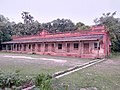
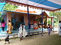
Shimurali is known for the Shimurali Sachinandan College of Education,[8][9] which is part of the University of Kalyani. There are many public primary schools in the area, as well as private English medium schools. Some Bengali medium schools include:
Rautari High School for Boys (est. 1964)
Rautari High School for Girls
Shikarpur Vivekananda High School (est. 1967)
Shikarpur Vivekananda High School for Girls
Shimurali Upendra Bidyabhaban for Boys (est. 1946)
↑ "District Census Handbook Nadia, Census of India 2011, Series 20, Part XII A"(PDF). Section II Town Directory, Pages 635-656; Statement I: Status and Growth History, Page 635; Statement II: Physical Aspects and Location of Towns, Page 641; Statement III: Civic and other Amenities, Page 643; Statement IV: Medical Facilities, Page 646; Statement V: Educational, Recreational and Cultural Facilities, Page 655; Statement VI: Industry and Banking, Page 2833. Directorate of census Operations V, West Bengal. Retrieved 30 September 2020.
↑ "Kolkata Sealdah/SDAH Railway Station Satellite Map - India Rail Info - Database of Indian Railways Trains & Stations." Database of Indian Railways Trains & Stations - India Rail Info. Web. 10 April 2011. <http://indiarailinfo.com/station/map/325>.
This page is based on this Wikipedia article Text is available under the CC BY-SA 4.0 license; additional terms may apply. Images, videos and audio are available under their respective licenses.