Gayespur

Last updated

Gayeshpur
Town
West Bengal location map.svg
Red pog.svg
Gayeshpur
Location in West Bengal, India
India location map 3.png
Red pog.svg
Gayeshpur
Gayeshpur (India)
Coordinates: 22°57′31″N88°29′43″E / 22.9586°N 88.4954°E / 22.9586; 88.4954
CountryFlag of India.svg  India
State West Bengal
District Nadia
Region Greater Kolkata
Government
  Type Municipality
  BodyGayespur Municipality
Area
[1]
  Total30 km2 (10 sq mi)
Population
 (2001)
  Total55,028
  Density1,800/km2 (4,800/sq mi)
Languages
  Official Bengali, English
Time zone UTC+5:30 (IST)
PIN
741234
Telephone code+91 33
ISO 3166 code IN-WB
Vehicle registration WB
Lok Sabha constituency Bangaon
Vidhan Sabha constituency Kalyani
Website nadia.nic.in

Gayeshpur is a town and a municipality of Nadia district in the Indian state of West Bengal. It is a part of the area covered by Kolkata Metropolitan Development Authority (KMDA). [2]

Contents

Geography

Gayespur
Cities and towns in Kalyani subdivision of Nadia district
M: municipal town/ city/notified area, CT: census town, R: rural/ urban centre.
Owing to space constraints in the small map, the actual locations in a larger map may vary slightly

Location

Gayespur is located at 22°57′31″N88°29′43″E / 22.9586°N 88.4954°E / 22.9586; 88.4954 .

Area overview

Nadia district is part of the large alluvial plain formed by the Ganges-Bhagirathi system. The Kalyani subdivision has the Bhagirathi/ Hooghly on the west. Topographically, Kalyani subdivision is a part of the Ranaghat-Chakdaha Plain, the low-lying area found in the south-eastern part of the district. [3] The smallest subdivision in the district, area-wise, has the highest level of urbanisation in the district. 76.73% of the population lives in urban areas and 23.27% lives in the rural areas. [4]

Note: The map alongside presents some of the notable locations in the subdivision. All places marked in the map are linked in the larger full screen map. All the four subdivisions are presented with maps on the same scale – the size of the maps vary as per the area of the subdivision.

Demographics

As of 2001 India census, [5] Gayespur had a population of 55,028. Males constitute 51% of the population and females 49%. Gayespur has an average literacy rate of 81%, higher than the national average of 59.5%: male literacy is 85%, and female literacy is 76%. In Gayespur, 8% of the population is under 6 years of age.

Healthcare

Gandhi Memorial Hospital at Gayespur has 350 beds and Netaji Subhas Sanatorium at Gayespur has 925 beds. [6]

Related Research Articles

<span class="mw-page-title-main">Chakdaha</span> Town in West Bengal, India

Chakdaha is a town and a municipality in the Kalyani subdivision of the Nadia district, located in the state of West Bengal, India.

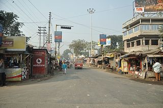
Cooper's Camp is a town and a notified area in Nadia district under Ranaghat police station of Ranaghat subdivision in the state of West Bengal, India.

Gopalpur is a census town in the Ranaghat I CD block in the Ranaghat subdivision of the Nadia district in the Indian state of West Bengal.

Jagadanandapur is a census town in the Nakashipara CD block in the Krishnanagar Sadar subdivision of the Nadia district in the Indian state of West Bengal,and the town is part of Bethuadahari 1 G.P.

Kshidirpur in the Nakashipara CD block in the Krishnanagar Sadar subdivision of the Nadia district in the Indian state of West Bengal.

Madanpur is a census town in Kalyani Community Development Block in the Kalyani subdivision of the Nadia district in the Indian state of West Bengal.

Parbbatipur is a census town in Ranaghat I CD Block in Ranaghat subdivision of Nadia district in the Indian state of West Bengal.

Satigachha is a census town in the Ranaghat I CD block in the Ranaghat subdivision of the Nadia district in the Indian state of West Bengal.

<span class="mw-page-title-main">Haringhata</span> Town in West Bengal, India

Haringhata is a town and a municipality of the Nadia district in the Indian state of West Bengal.

<span class="mw-page-title-main">Kalyani subdivision</span> Subdivision in West Bengal, India

Kalyani subdivision is an administrative subdivision of the Nadia district in the Indian state of West Bengal.

<span class="mw-page-title-main">Shimurali</span> Suburban area in Nadia district, West Bengal, India

Shimurali is a census town in Chakdaha CD block in the Kalyani subdivision of the Nadia district in the state of West Bengal, India.

Subarnapur is a census town in the Haringhata CD block in the Kalyani subdivision of the Nadia district in the state of West Bengal, India.

Punglia is a census town in the Chakdaha CD block in the Kalyani subdivision of the Nadia district in the state of West Bengal, India.

Lalpur is a census town in the Chakdaha CD block in the Kalyani subdivision of the Nadia district in the state of West Bengal, India.

Chanduria is a census town in the Chakdaha CD block in the Kalyani subdivision of the Nadia district in the state of West Bengal, India.

Priyanagar is a census town in the Chakdaha CD block in the Kalyani subdivision of the Nadia district in the state of West Bengal, India.

Jangal is a census town in the Chakdaha CD block in the Kalyani subdivision of the Nadia district in the state of West Bengal, India.

Saguna is a census town in the Kalyani community Development Block in the Kalyani subdivision of the Nadia district in the state of West Bengal, India.

Kulia is a census town in the Chakdaha CD block in the Kalyani subdivision of the Nadia district in the state of West Bengal, India.

Simhat is a census town in the Haringhata CD block in the Kalyani subdivision of the Nadia district in the state of West Bengal, India.

References

  1. "Gayespur City".
  2. "District Wise List of Statutory Towns". Census of India 2001, Urban Frame. Directorate of Census Operations, West Bengal. Archived from the original on 27 September 2007. Retrieved 6 October 2007.
  3. "District Census Handbook, Nadia, 2011, Series 20, Part XII A" (PDF). Pages 13,14. Directorate of Census Operations, West Bengal. Retrieved 17 October 2020.
  4. "District Statistical Handbook 2014 Nadia". Table 2.2, 2.4(a). Department of Planning and Statistics, Government of West Bengal. Retrieved 17 October 2020.
  5. "Census of India 2001: Data from the 2001 Census, including cities, villages and towns (Provisional)". Census Commission of India. Archived from the original on 16 June 2004. Retrieved 1 November 2008.
  6. "Health & Family Welfare Department". Health Statistics. Government of West Bengal. Retrieved 30 May 2017.