Cossipore

Last updated

Cossipore
Neighbourhood in Kolkata (Calcutta)
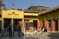
Sarbamangola Kali Temple 01.jpg
Sarbamangala Chitteshwari Temple, Cossipore
Kolkata location map EN.svg
Red pog.svg
Cossipore
Location in Kolkata
Coordinates: 22°37′23″N88°22′30″E / 22.623°N 88.375°E / 22.623; 88.375
CountryFlag of India.svg  India
State West Bengal
City Kolkata
District Kolkata
Metro Station Dum Dum
Municipal Corporation Kolkata Municipal Corporation
KMC wards 1, 6
Elevation
36 ft (11 m)
Population
  TotalFor population see linked KMC ward page
Time zone UTC+5:30 (IST)
PIN
700002
Area code +91 33
Lok Sabha constituency Kolkata Uttar
Vidhan Sabha constituency Kashipur-Belgachhia

Kashipur (also spelt Cossipur, Kashipur) is a neighbourhood of North Kolkata, in Kolkata district in the Indian state of West Bengal. One of the oldest neighbourhoods of the metropolis, it has a police station. [1]

Contents

History

The East India Company obtained from the Mughal emperor Farrukhsiyar, in 1717, the right to rent from 38 villages surrounding their settlement. Of these 5 lay across the Hooghly in what is now Howrah district. The remaining 33 villages were on the Calcutta side. After the fall of Siraj-ud-daulah, the last independent Nawab of Bengal, it purchased these villages in 1758 from Mir Jafar and reorganised them. These villages were known en-bloc as Dihi Panchannagram and Cossipore was one of them. It was considered to be a suburb beyond the limits of the Maratha Ditch. [2] [3] [4]

H. E. A. Cotton writes, "The Cossipore Reach was one of the finest on the river, and is lined by a number of villa residences." From those days Cossipore had a number of industrial units. – the Government Gun Foundry, the Snider and Rifle Shell factories (originally constructed by Colonel Hutchinson), sugar mills and jute screw houses. [5]

Entally, Manicktala, Beliaghata, Ultadanga, Chitpur, Cossipore, parts of Beniapukur, Ballygunge, Watgunge and Ekbalpur and parts of Garden Reach and Tollygunj were added to Kolkata Municipal Corporation in 1888. Garden Reach was later taken out. [6]

Geography

KMC ward

Ward No. 1 and Ward No. 6 of Kolkata Municipal Corporation cover Cossipore. It has six prominent ghats on the Hooghly – from south - Cossipore Ghat, Sadhur Ghat, Ranir Ghat, Pramanick Ghat, Ramakrishna Mahasashan and Ratan Babu Ghat. [7]

Police district

Cossipore police station is part of the North and North Suburban division of Kolkata Police. Located at 58/A, Barrackpore Trunk Road, Kolkata-700002, it has jurisdiction over Cossipore neighbourhood/ Ward No. 1 of Kolkata Municipal Corporation. [8] [9]

Amherst Street Women police station covers all police districts under the jurisdiction of the North and North Suburban division i.e. Amherst Street, Jorabagan, Shyampukur, Cossipore, Chitpur, Sinthi, Burtolla and Tala. [8]

Transport

Cossipore Road (Sri Sri Ramakrishna Paramahansa Dev Sarani) is the artery of the area. The road is connected to B.T. Road (at Chiria More) with Khagendra Chatterjee Road. [10]

Bus

Private Bus

CSTC Bus

Train

Kolkata Station (one of the major railway hub stations of the city) and Dum Dum Junction are the nearest railway stations. Tala railway station and Bagbazar railway station on Kolkata Circular Railway line are also located nearby.

Cossipore Electric Generating Station

New Cossipore Generating station started producing electric for CESC from the year 1949 and has current capacity of 100 MW. This is older and uses non Pulverized Fuel to generate electricity. This unit plays a major part creating an economic eco system in its own. There are a lot of people live in Cossipore who are part of that ecosystem. But in 2015 it was closed.

Wikivoyage-Logo-v3-icon.svg Kolkata/Northern fringes travel guide from Wikivoyage

Related Research Articles

<span class="mw-page-title-main">Maniktala</span> Neighbourhood in Kolkata in West Bengal, India

Maniktala is a residential area of North Kolkata, in Kolkata district, West Bengal, India.

<span class="mw-page-title-main">Chitpur</span> Neighbourhood in Kolkata in West Bengal, India

Chitpur is a neighbourhood in North Kolkata in Kolkata district in the Indian state of West Bengal. Sometimes, the entire area along Chitpur Road is referred to as Chitpur, although the various localities have distinctive names.

<span class="mw-page-title-main">Shyampukur</span> Neighbourhood in Kolkata in West Bengal, India

Shyampukur is a neighbourhood of North Kolkata, in Kolkata district in the Indian state of West Bengal. As a neighbourhood, it covers a small area but its importance is primarily because of the police station.

<span class="mw-page-title-main">Jorabagan</span> Neighbourhood in Kolkata in West Bengal, India

Jorabagan is a neighbourhood of North Kolkata, in Kolkata district, in the Indian state of West Bengal. As a neighbourhood, it covers a small area but its importance is primarily because of the police station.

<span class="mw-page-title-main">Tala, Kolkata</span> Neighbourhood in Kolkata in West Bengal, India

Tala is a neighbourhood in North Kolkata in Kolkata district in the Indian state of West Bengal.

<span class="mw-page-title-main">Entally</span> Neighbourhood in Kolkata in West Bengal, India

Entally is a neighbourhood of Central Kolkata, in Kolkata district in the Indian state of West Bengal. It was considered close to the area which was home to the poor and the depressed castes. Mother Teresa started her activities in Entally.

Sinthee or Sinthi is a neighbourhood of North Kolkata in Kolkata district, West Bengal, India.

Ward No. 1, Kolkata Municipal Corporation is an administrative division of Kolkata Municipal Corporation in Borough No. 1, covering parts of Cossipore neighbourhood in North Kolkata, in the Indian state of West Bengal.

Ward No. 2, Kolkata Municipal Corporation is an administrative division of Kolkata Municipal Corporation in Borough No. 1, covering parts of Sinthee, Sobji Bagan and Satpukur neighbourhoods in North Kolkata, in the Indian state of West Bengal.

Ward No. 3, Kolkata Municipal Corporation is an administrative division of Kolkata Municipal Corporation in Borough No. 1, covering parts of Belgachia and Duttabagan neighbourhoods in North Kolkata, in the Indian state of West Bengal.

Ward No. 4, Kolkata Municipal Corporation is an administrative division of Kolkata Municipal Corporation in Borough No. 1, covering parts of Paikpara neighbourhood in North Kolkata, in the Indian state of West Bengal.

Ward No. 5, Kolkata Municipal Corporation is an administrative division of Kolkata Municipal Corporation in Borough No. 1, covering parts of Tala and Belgachia neighbourhoods in North Kolkata, in the Indian state of West Bengal.

Ward No. 6, Kolkata Municipal Corporation is an administrative division of Kolkata Municipal Corporation in Borough No. 1, covering parts of Chitpur and Cossipore neighbourhoods in North Kolkata, in the Indian state of West Bengal.

Ward No. 9, Kolkata Municipal Corporation is an administrative division of Kolkata Municipal Corporation in Borough No. 1, covering parts of Shobhabazar and Kumortuli neighbourhoods in North Kolkata, in the Indian state of West Bengal.

Ward No. 15, Kolkata Municipal Corporation is an administrative division of Kolkata Municipal Corporation in Borough No. 2, covering parts of Maniktala neighbourhood in North Kolkata, in the Indian state of West Bengal.

Ward No. 19, Kolkata Municipal Corporation is an administrative division of Kolkata Municipal Corporation in Borough No. 2, covering parts of Shobhabazar and Beniatola (Ahiritola) neighbourhoods in North Kolkata, in the Indian state of West Bengal.

Ward No. 20, Kolkata Municipal Corporation is an administrative division of Kolkata Municipal Corporation in Borough No. 2, covering parts of Beniatola (Ahiritola) neighbourhood in North Kolkata, in the Indian state of West Bengal.

Ward No. 21, Kolkata Municipal Corporation is an administrative division of Kolkata Municipal Corporation in Borough No. 4, covering parts of Jorabagan and Malapara neighbourhoods in North Kolkata, in the Indian state of West Bengal.

Ward No. 24, Kolkata Municipal Corporation is an administrative division of Kolkata Municipal Corporation in Borough No. 4, covering parts of Jorabagan and Pathuriaghata neighbourhoods in North Kolkata, in the Indian state of West Bengal.

Ward No. 27, Kolkata Municipal Corporation is an administrative division of Kolkata Municipal Corporation in Borough No. 4, covering parts of Maniktala neighbourhood in North Kolkata, in the Indian state of West Bengal.

References

  1. "Cossipore Police Station". Kolkata Police. Archived from the original on 8 June 2007. Retrieved 16 January 2008.
  2. "District Census Handbook Kolkata, Census of India 2011, Series 20, Part XII A" (PDF). Pages 6-10: The History. Directorate of Census Operations, West Bengal. Retrieved 20 February 2018.
  3. Cotton, H.E.A., Calcutta Old and New, first published 1909/reprint 1980, pages 103-4 and 221, General Printers and Publishers Pvt. Ltd.
  4. Nair, P.Thankappan, The Growth and Development of Old Calcutta, in Calcutta, the Living City, Vol. I, pp. 14-15, Edited by Sukanta Chaudhuri, Oxford University Press, 1995 edition.
  5. Cotton, H.E.A., Calcutta Old and New, 1909/1980, p. 221, General Printers and Publishers Pvt. Ltd.
  6. Bagchi, Amiya Kumar, Wealth and Work in Calcutta, 1860-1921, in Calcutta, the Living City, Vol. I, edited by Sukanta Chaudhuri, p. 213, Oxford University Press, ISBN   978-0-19-563696-3.
  7. Detail Maps of 141 Wards of Kolkata, D.R.Publication and Sales Concern, 66 College Street, Kolkata – 700073
  8. 1 2 "Kolkata Police". North and North Suburban Division. KP. Archived from the original on 30 March 2018. Retrieved 5 March 2018.
  9. "Table 3 District Wise List of Statutory Towns (Municipal Corporation, Municipality, Notified Area and Cantonment Board), Census Towns and Outgrowths, West Bengal, 2001". Census of India 2001. Census Commission of India. Archived from the original on 21 July 2011. Retrieved 17 July 2016.
  10. Google maps