Chowringhee

Last updated

Chowringhee
Neighbourhood in Kolkata (Calcutta)
Metropolitan Building, Esplanade Kolkata (Edited).jpg
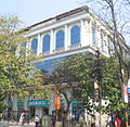
Metropolitan Building near Chowringhee
Map Kolkata Chowringhee.jpg
Location of Chowringhee in Kolkata
Coordinates: 23°48′N88°15′E / 23.8°N 88.25°E / 23.8; 88.25 Coordinates: 23°48′N88°15′E / 23.8°N 88.25°E / 23.8; 88.25
CountryFlag of India.svg  India
State West Bengal
City Kolkata
District Kolkata
KMC wards 46, 63
Metro Station Esplanade, Park Street, Maidan and Rabindra Sadan
Kolkata Suburban Railway Eden Gardens, Sealdah, Park Circus
Elevation
36 ft (11 m)
Population
 (2001)
  Total159,917
Time zone UTC+5:30 (IST)
PIN
700013, 700016, 700071, 700087
Area code +91 33
Lok Sabha constituency Kolkata Uttar and Kolkata Dakshin
Vidhan Sabha constituency Chowranghee and Bhabanipur

Chowringhee (also Chourangi) is a neighbourhood of Central Kolkata, in Kolkata district in the Indian state of West Bengal. Chowringhee Road (officially Jawaharlal Nehru Road) runs on its western side. A neighbourhood steeped in history, it is a business district, [1] as well as a shopper's destination and entertainment-hotel centre.

Contents

Etymology

The name 'Chowringhee' has defied etymologists. There is, however, the legend of a Nath yogi, Chouranginath, who discovered an image of the goddess Kali's face and built the first Kalighat temple. [2]

History

The village

Chowringhee in 1798 Kolkata Chowringhee.jpg
Chowringhee in 1798

In the seventeenth century or prior to it, the area now occupied by the Maidan and Esplanade was a tiger-infested jungle. At the eastern end of it was an old road, which had once been built by the Sabarna Roy Choudhury family from Barisha to Halisahar. In that region were three small hamlets – Chowringhee, Birjee and Colimba. [3]

Urbanisation

The strengthening of British power, subsequent to their victory in the Battle of Plassey was followed by the construction of the new Fort William, in 1758. The European inhabitants of Kalikata gradually forsook the narrow limits of the old palisades and moved to around the Maidan. [4]

The neighbourhood

Chowringhee looking south, 1905 Chowringhee looking south.jpg
Chowringhee looking south, 1905

Camac Street (renamed Abanindranath Tagore Sarani) running from Park Street to Circular Road was named after William Camac, a senior merchant in the days of Cornwallis and Wellesley. Wood Street was named after Henry Wood. Free School Street (renamed Mirza Ghalib Street), named after a Free School established there in 1786, was a bamboo jungle in 1780. [5]

New names

Tata Centre on Chowringhee Road - The main stretch of Chowringhee Tata Centre - 43 Chowringhee Road - Kolkata 2013-01-05 2424.JPG
Tata Centre on Chowringhee Road - The main stretch of Chowringhee

Indian independence saw a rush to rename streets. The process has slowed as few streets are left to be renamed. Chowringhee Road was renamed after Jawaharlal Nehru, the first Prime Minister of India. Park Street was renamed after Mother Teresa. Theatre Road was renamed after William Shakespeare. Harrington Street was renamed after the leader of the Vietnam independence movement, Ho Chi Minh. Camac Street has been renamed after the great artist Abanindranath Tagore. Russel Street was renamed after industrialist Anandi Lal Poddar. Free School Street was renamed after the Urdu/Persian poet Mirza Ghalib. Kyd Street was renamed Dr. Md. Ishaque Road. Lindsay Street was renamed after Nellie Sengupta.

Geography

Park Street Flyover was inaugurated on 19 February 2005. The 1.3-kilometre (0.81 mi) long flyover above Chowringhee Road helps in reduce the traffic jam between Lindsay Street and Middleton Street. [6]

Creative inspiration

In 1981, Aparna Sen wrote and directed a film, 36 Chowringhee Lane , about an aged Anglo-Indian school teacher who lives a lonely life in a single-room flat in the neighbourhood. [7]

Wikivoyage-Logo-v3-icon.svg Kolkata/Esplanade travel guide from Wikivoyage

Related Research Articles

<span class="mw-page-title-main">Maidan (Kolkata)</span> Urban park in Kolkata, India

The Maidan, also referred to as the Brigade Parade Ground, is a large public park and urban green space in the center of Kolkata, India. With a total area of 988 acres (4.0 km2), it is the largest urban park in India. It is a vast stretch of field that includes numerous sporting grounds, including the famous cricketing venue Eden Gardens, several football stadiums and the Kolkata Race Course. The Maidan is also dotted with many statues and architectural works, the most notable being the Victoria Memorial. Due to the freshness and greenery it provides to the metropolis, it has been referred to as the "lungs of Kolkata".

<span class="mw-page-title-main">Esplanade, Kolkata</span> Neighbourhood in Kolkata in West Bengal, India

Esplanade is a neighbourhood of Central Kolkata, in Kolkata district in the Indian state of West Bengal. This is not a conventional esplanade in the sense that the place is not exactly situated alongside a waterbody. However, the Ganga river (Ganges), also known as Hooghly river, flows nearby.

Chowringhee Road, located in the Chowringhee neighbourhood of Kolkata, is the arterial road running from the eastern fringes of Esplanade southwards up to the crossing with Lower Circular Road, in the city of Kolkata, West Bengal, India. It is the single most important road of the metropolis of Kolkata. It was officially renamed as Jawaharlal Nehru Road after Jawaharlal Nehru, India's first Prime Minister, but the original name Chowringhee Road is used commonly.

<span class="mw-page-title-main">Park Street, Kolkata</span> Neighbourhood-cum-Road in Kolkata, India

Park Street, officially known as Mother Teresa Sarani, is a famous thoroughfare in downtown Kolkata, India. The street runs through what was a deer park of Sir Elijah Impey, Chief Justice of the Supreme Court in Calcutta from 1773 to 1789, hence the earlier name. Its current official name was given by Kolkata Municipal Corporation in honour of Mother Teresa. It's located in central Kolkata.

<span class="mw-page-title-main">Chitpur</span> Neighbourhood in Kolkata in West Bengal, India

Chitpur is a neighbourhood in North Kolkata in Kolkata district in the Indian state of West Bengal. Sometimes, the entire area along Chitpur Road is referred to as Chitpur, although the various localities have distinctive names.

<span class="mw-page-title-main">Park Circus</span> Neighbourhood in Kolkata in West Bengal, India

Park Circus is a neighbourhood of Central-South Kolkata, in Kolkata district, West Bengal, India.

<span class="mw-page-title-main">Janbazar</span> Neighbourhood in Kolkata in West Bengal, India

Janbazar is a neighbourhood of Central Kolkata, in Kolkata district in the Indian state of West Bengal. The two century-old house of Rani Rashmoni, the central attraction in Janbazar, is still used by descendants in the family.

<span class="mw-page-title-main">Shyambazar</span> Neighbourhood in Kolkata in West Bengal, India

Shyambazar is a neighbourhood of North Kolkata, in Kolkata district in the Indian state of West Bengal. The area, under Shyampukur police station of Kolkata Police, has been, along with neighbouring Bagbazar, the citadel of the Bengali aristocracy, in a part of what was earlier known as Sutanuti. and the popularity of Shyambazer five point crossing is for the statue of Netaji Subhas Chandra Bose.

<span class="mw-page-title-main">Dharmatala</span> Neighbourhood in Kolkata in West Bengal, India

Dharmatala is a neighbourhood of Central Kolkata, in Kolkata district in the Indian state of West Bengal. Dharmatala Street has been renamed after Lenin as Lenin Sarani but the neighbourhood up to Wellington Square continues to be referred as Dharmatala. It is a busy commercial area that had come up with the growth of Calcutta during the British Raj and is thus one of the repositories of history in the city.

<span class="mw-page-title-main">Mahatma Gandhi Road (Kolkata)</span> Road in Kolkata, India

Mahatma Gandhi Road or M.G. Road, formerly known as Harrison Road, is a principal East-West thoroughfare in Kolkata, the capital of the Indian state of West Bengal. M.G. Road makes the boundary of North and Central Kolkata. In 1889 this was the first street of the city to be lit by electricity.

<span class="mw-page-title-main">AJC Bose Road & APC Road</span> Road in Kolkata, India

Acharya Jagadish Chandra Bose Road and its continuation northwards called Acharya Prafulla Chandra Road, are together the longest and the most important north-south thoroughfare in Kolkata, India.

<span class="mw-page-title-main">Maidan metro station</span>

Maidan is a station of the Kolkata Metro. The station is located on Jawaharlal Nehru Road at Middleton Street. It is named after the Maidan, the largest urban park in Kolkata, which lies on the west side of Jawaharlal Nehru Road.

<span class="mw-page-title-main">Park Street metro station (Kolkata)</span>

Park Street is a station of the Kolkata Metro. The station is located on the crossing of Jawaharlal Nehru Road and Mother Teresa Sarani. It is one of the deepest underground metro stations of Kolkata Metro. It is the only underground station to have side platforms, which are mostly seen in elevated metro stations.

<span class="mw-page-title-main">Esplanade metro station</span> Metro station in Kolkata, India

The Esplanade metro station is a station of the Kolkata Metro. The station is located in the Esplanade neighbourhood of Kolkata, at the northern end of Chowringhee Road/Jawaharlal Nehru Road near New Market and the Oberoi Grand hotel. It opened in 1984 as part of what is now Kolkata Metro Line 1. The station is being re-designed to be the largest station of the metro and will function as the interchange station between Line 1, Line 2 and Line 3.

<span class="mw-page-title-main">Abanindranath Thakur Sarani</span> Road in Kolkata, India

Abanindranath Thakur Sarani is a street running in the central business district of Kolkata, India, from Park Street to Acharya Jagadish Chandra Bose Road. The road was named after William Camac, a senior merchant in the days of Lord Cornwallis and Lord Wellesley. In the mid-1970s, the Park Street 'razzmatazz' spilled onto Camac Street which is, today, considered to be a high street of Kolkata with many commercial establishments and high-end shopping destinations, with many shopping malls, boutiques, restaurants and stand-alone stores. It intersects Middleton Street and Shakespeare Sarani, two other important roads in the CBD. Several smaller roads like Middleton Row, Short Street, Victoria Terrace and Albert Road merge into Camac Street from the east or west.

<span class="mw-page-title-main">Shakespeare Sarani</span> Road in Kolkata, India

Shakespeare Sarani is a street running in the central business district of Kolkata, India, from Park Circus to Chowringhee Road. It was renamed on 24 April 1964 after William Shakespeare, to mark the fourth birth centenary of the legendary playwright. It is considered to be a high street of Kolkata with many commercial establishments, offices, shops and restaurants situated by the road. It intersects with other important roads in the CBD like Acharya Jagadish Chandra Bose Road, Camac Street, Loudon Street and Rawdon Street. Few other roads like, Little Russel Street, Wood Street, Picasso Bithi & Lord Sinha Road criss-crosses or merge into Shakespeare Sarani from North or South. West of Birla Planetarium crossing, Shakespeare Sarani becomes Queen's Way.

Ward No. 46, Kolkata Municipal Corporation is an administrative division of Kolkata Municipal Corporation in Borough No. 6, covering parts of Chowringhee, Esplanade East, Dharmatala, Janbazar, Lalbazar, Bowbazar and Maidan neighbourhoods in central Kolkata, in the Indian state of West Bengal.

Ward No. 63, Kolkata Municipal Corporation is an administrative division of Kolkata Municipal Corporation in Borough No. 7, covering parts of Chowringhee, Taltala, Park Street, Shakespeare Sarani, Maidan, The 42 and Hastings neighbourhoods in central Kolkata, in the Indian state of West Bengal.

References

  1. "Tax lawyer is CPM candidate for Chowringhee seat". The Hindu Business Line, 18 February 2006. Retrieved 16 January 2008.
  2. Nair, P. Thankappan in The Growth and Development of Old Calcutta, in Calcutta, the Living City, Vol. I, edited by Sukanta Chaudhuri, pp. 14–15, Oxford University Press, ISBN   978-0-19-563696-3.
  3. Cotton, H.E.A., Calcutta Old and New, 1909–1980, p. 19, General Printers and Publishers Pvt. Ltd.
  4. Cotton, H.E.A., p. 72.
  5. Cotton, H.E.A., pp. 230–236.
  6. "Park Street Flyover".
  7. "36 Chowringhee Lane (1981)". imdb.com. Retrieved 16 January 2008.