Taltala

Last updated

Taltala
<!- name -->
Neighbourhood in Kolkata (Calcutta)
Central Methodist Episcopal Church - 130 Lenin Sarani - Kolkata 2014-09-29 7528.JPG
Central Methodist Episcopal Church, Lenin Sarani, Taltala
Kolkata location map EN.svg
Red pog.svg
Taltala
Location in Kolkata
Coordinates: 22°33′29″N88°21′32″E / 22.558°N 88.359°E / 22.558; 88.359
CountryFlag of India.svg  India
State West Bengal
City Kolkata
District Kolkata
Metro Station Esplanade, Park Street and Sealdah(under construction)
Municipal Corporation Kolkata Municipal Corporation
KMC wards 50, 51, 52, 53, 61, 62, 63
Elevation
36 ft (11 m)
Time zone UTC+5:30 (IST)
PIN
700014, 700016
Area code +91 33
Lok Sabha constituency Kolkata Uttar and Kolkata Dakshin
Vidhan Sabha constituency Chowranghee, Ballygunge and Bhabanipur

Taltala (also spelt Taltola, archaic spelling Taltollah) is a neighbourhood in Central Kolkata, in Kolkata district in the Indian state of West Bengal. One of the oldest neighbourhoods of the metropolis, it has a police station on its own name. [1]

Contents

Etymology

Taltala was named after its tal (Palmyra) trees. [2]

History

According to H. E. A. Cotton Taltala was chiefly peopled by Bihari Muslim khalasis and lascars. Wellesley Street (renamed Rafi Ahmed Kidwai Road) is described as a ‘fine broad thoroughfare’, along the course of which is situated Wellesley Square (renamed Haji Mohd. Mohsin Square). To the north of it is the Madrasa. [3]

In 1758, one year after their decisive win in Battle of Plassey, the British East India Company commenced construction of the new Fort William in the center of the village Gobindapur. The inhabitants of the village were compensated and provided with land in Taltala, Kumortuli and Shovabazar. [4]

Although a predominantly Muslim locality, its early Hindu settlers included Durga Charan Banerjea, father of Surendranath Banerjea. [2] Muslims have been living in the area since the early 19th century, and the earliest inhabitants were mainly Bengali Muslims, though Bihari Muslim settlers began arriving in a flood since 1870-1880 and more so since the 1980s.

In 1888, one of the 25 newly organized police section houses was located in Taltala. [5]

Geography

Location

Ward nos 52 and 53 of Kolkata Municipal Corporation are under Taltala Police Station and part of Taltala. Small parts of ward nos 50 and 51 (only under Taltala Police Station) are part of Taltala. Ward no. 62, under both Park Street Police Station and Taltala Police Station, is also a part of Taltala. Ward no 61, under Park Street Police Station, is a part of Taltala too. A little part of ward no 63 (only under Park Street Police Station) is also a part of Taltala. The neighbourhood is bound by Bowbazar in the north, Entally in the east, Park Street neighbourhood in the south and Janbazar and Chowringhee in the west. [6] Great celebrities of Taltala are Surendranath Banerjee, Durga Charan Banerjee, Jnanendra Nath Mukherjee, Hirendranath Mukherjee, Rezaul Karim, Dr. Moni Biswas, Dr Tamiz Khan, Narendranath Sen, Tripura sankar Sensastry, Sudam Banerjee, Nilmoni Mukherjee, Bijoy Singh Nahar, Benjamin Gomes, Syed Badruddoja and so on

Police district

Taltala police station is part of the Central division of Kolkata Police. It is located at 4, Taltala Lane, Kolkata-700014. [7]

Taltala Women police station, located at the same address as above, covers all police districts under the jurisdiction of the Central division i.e. Bowbazar, Burrabazar, Girish Park, Hare Street, Jorasanko, Muchipara, New Market, Taltala and Posta. [7]

Demographics

Ward nos. 52 and 53 (Taltala Police Station area) of Kolkata Municipal Corporation had a total population of 43,348 in the 2001 census, of which 24,121 were males and 19,227 were females. Ward nos. 50 and 51 (Taltala Police Station Area) had population of 17,251 and 13,556 respectively. (Park Street police station area) had population of 29,704 and 24,387 respectively. Ward no. 62 (under both the Police Stations) had a population of 34,832. [8] [9] The locality is largely Urdu-speaking. Urdu-speaking Muslims form 85% of the population. Taltala has its own literary Bengali journal named Taltala Darpan.

Transport

Road

Many buses ply along Lenin Sarani, Surendranath Banerjee Road (S.N. Banerjee Road) and Acharya Jagadish Chandra Bose Road. Few buses and Kolkata tram route no. 25 run along Rafi Ahmed Kidwai Road and Royd Street-Elliot Road in Taltala. [10]

Train

Sealdah Station, one of the five major railway-terminals of Kolkata Metropolitan Area, is located nearby.

Important landmarks

See also

Related Research Articles

<span class="mw-page-title-main">Park Street, Kolkata</span> Neighbourhood-cum-Road in Kolkata, India

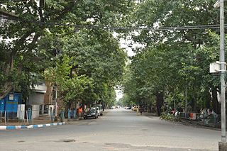
Park Street, is a famous thoroughfare in downtown Kolkata, India. In Bengali, it is often referred as Shaheb -er Para or the “neighbourhood of Englishmen”.The street runs through what was a deer park of Sir Elijah Impey, Chief Justice of the Supreme Court in Calcutta from 1773 to 1789, hence the earlier name. It's located in central part of Calcutta.

<span class="mw-page-title-main">Surendranath Banerjee</span> Indian nationalist leader (1848–1925)

Sir Surendranath Banerjee, often known as Rashtraguru was Indian nationalist leader during the British Rule. He founded a nationalist organization called the Indian National Association to bring Hindus and Muslims together for political action. He was one of the founding members of the Indian National Congress. Surendranath supported Montagu–Chelmsford Reforms, unlike Congress, and with many liberal leaders he left Congress and founded a new organisation named Indian National Liberation Federation in 1919.

<span class="mw-page-title-main">Jorasanko</span> Neighbourhood in Kolkata in West Bengal, India

Jorasanko is a neighbourhood of North Kolkata, in Kolkata district, West Bengal, India. It is so called because of the two (jora) wooden or bamboo bridges (sanko) that spanned a small stream at this point.

<span class="mw-page-title-main">Janbazar</span> Neighbourhood in Kolkata in West Bengal, India

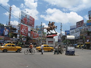
Janbazar is a neighbourhood of Central Kolkata, in Kolkata district in the Indian state of West Bengal. The two century-old house of Rani Rashmoni, the central attraction in Janbazar, is still used by descendants in the family.

<span class="mw-page-title-main">Shyambazar</span> Neighbourhood in Kolkata in West Bengal, India

Shyambazar is a neighbourhood of North Kolkata, in Kolkata district in the Indian state of West Bengal. The area, under Shyampukur police station of Kolkata Police, has been, along with neighbouring Bagbazar, the citadel of the Bengali aristocracy, in a part of what was earlier known as Sutanuti. and the popularity of Shyambazer five point crossing is for the statue of Netaji Subhas Chandra Bose.

<span class="mw-page-title-main">Bowbazar</span> Neighbourhood in Kolkata in West Bengal, India

Bowbazar, also spelt Boubazar; formerly known as Bahubazar) is a neighbourhood of Central Kolkata, in Kolkata district in the Indian state of West Bengal.

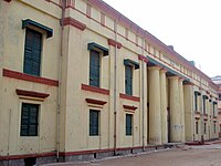
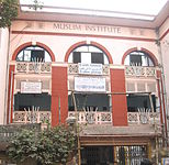
Mosques in Kolkata refers to mosques in the city of Kolkata, in India.

<span class="mw-page-title-main">Entally</span> Neighbourhood in Kolkata in West Bengal, India

Entally is a neighbourhood of Central Kolkata, in Kolkata district in the Indian state of West Bengal. It was considered close to the area which was home to the poor and the depressed castes. Mother Teresa started her activities in Entally.

<span class="mw-page-title-main">Sealdah</span> Neighbourhood in Kolkata in West Bengal, India

Sealdah is a neighbourhood of Central Kolkata in Kolkata district in the Indian state of West Bengal.

Ward No. 44, Kolkata Municipal Corporation is an administrative division of Kolkata Municipal Corporation in Borough No. 5, covering parts of Burrabazar (Mechhua), Tiretta Bazaar, Kolutola(Colootola Street) and College Street neighbourhoods in north-central Kolkata, in the Indian state of West Bengal.

Ward No. 46, Kolkata Municipal Corporation is an administrative division of Kolkata Municipal Corporation in Borough No. 6, covering parts of Chowringhee, Esplanade East, Dharmatala, Janbazar, Lalbazar, Bowbazar and Maidan neighbourhoods in central Kolkata, in the Indian state of West Bengal.

Ward No. 47, Kolkata Municipal Corporation is an administrative division of Kolkata Municipal Corporation in Borough No. 6, covering parts of Bowbazar and Dharmatala neighbourhoods in central Kolkata, in the Indian state of West Bengal.

Ward No. 51, Kolkata Municipal Corporation is an administrative division of Kolkata Municipal Corporation in Borough No. 5, covering parts of Bowbazar and Taltala neighbourhoods in central Kolkata, in the Indian state of West Bengal.

Ward No. 52, Kolkata Municipal Corporation is an administrative division of Kolkata Municipal Corporation in Borough No. 5, covering parts of Taltala and Janbazar neighbourhoods in central Kolkata, in the Indian state of West Bengal.

Ward No. 53, Kolkata Municipal Corporation is an administrative division of Kolkata Municipal Corporation in Borough No. 5, covering parts of Taltala and Moulali neighbourhoods in central Kolkata, in the Indian state of West Bengal.

Ward No. 61, Kolkata Municipal Corporation is an administrative division of Kolkata Municipal Corporation in Borough No. 6, covering parts of Park Circus, Beniapukur (Nonapukur), Park Street (Mullickbazar) and Taltala neighbourhoods in central Kolkata, in the Indian state of West Bengal.

Ward No. 62, Kolkata Municipal Corporation is an administrative division of Kolkata Municipal Corporation in Borough No. 6, covering parts of Taltala and Moulali neighbourhoods in central Kolkata, in the Indian state of West Bengal.

Ward No. 63, Kolkata Municipal Corporation is an administrative division of Kolkata Municipal Corporation in Borough No. 7, covering parts of Chowringhee, Taltala, Park Street, Shakespeare Sarani, Maidan, The 42 and Hastings neighbourhoods in central Kolkata, in the Indian state of West Bengal.

<span class="mw-page-title-main">Hare Street</span> Road in Kolkata, India

Hare Street is a road in the Indian city of Kolkata, in Kolkata district, West Bengal, India. It connects the junction of Council House Street and Netaji Subhas Road in B.B.D. Bagh to Millennium Park on Strand Road.

<span class="mw-page-title-main">Wellesley Gol Talab</span>

Wellesley Gol Talab,, is a park located in Taltala neighbourhood in Central Kolkata, in the Indian state of West Bengal.

References

  1. "Taltala Police Station". Kolkata Police. Archived from the original on 8 June 2007. Retrieved 16 January 2008.
  2. 1 2 Nair, P. Thankappan, The Growth and Development of Old Calcutta, in Calcutta, the Living City, Vol I, edited by Sukanta Chaudhuri, pp. 11-18, Oxford University Press, ISBN   978-0-19-563696-3.
  3. Cotton, H.E.A., Calcutta Old and New, 1909/1980, p. 220, General Printers and Publishers Pvt. Ltd.
  4. Cotton, H.E.A, p 72
  5. Nair, P.Thankappan, The Growth and Development of Old Calcutta, in Calcutta, the Living City, Vol. I, pp. 18-19, Edited by Sukanta Chaudhuri, Oxford University Press, 1995 edition.
  6. Detail Maps of 141 Wards of Kolkata, D.R.Publication and Sales Concern, 66 College Street, Kolkata – 700073
  7. 1 2 "Kolkata Police". Central Division. KP. Retrieved 9 March 2018.
  8. "Know your ward".
  9. "Provisional Population Totals, Table 4". Population, Decadal Growth Rate, Density and General Sex Ratio by Residence and Sex, West Bengal/ District/ Sub District, 1991 and 2001. Census Commission of India. Retrieved 10 October 2007.
  10. Google maps