Ballygunge is a locality of South Kolkata in Kolkata district, West Bengal, India.

The Kolkata Police is the police department of the city of Kolkata, West Bengal. It is one of the six presidency police forces of the Indian state of West Bengal. Kolkata Police has the task of policing the metropolitan area of Kolkata, India. The force's motto is "Bhavatā Saha – Sarvadā". Established in 1856, it is the oldest police commissionerate in the country.
Esplanade is a neighbourhood of Central Kolkata, located at the heart of city with being the city's Central business district. This is a conventional esplanade because the Ganga river (Ganges), also known as Hooghly river, flows nearby and it is adjacent to the large fields of Maidan extending upto Fort William.
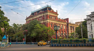
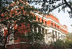
Binoy-Badal-Dinesh Bagh, shortened as B. B. D. Bagh, formerly called Tank Square and then Dalhousie Square, is the administrative, financial and commercial region and one of the central business districts of Kolkata, capital of the Indian state of West Bengal. It is the seat of Government of West Bengal and houses all three branches of it. The area consists Writers' Building, the official state secretariat building, Raj Bhavan, the residence of Governor of West Bengal, Vidhansabha Bhavan, the building housing the West Bengal Legislative Assembly and also the Calcutta High Court.

Tiretta Bazaar, also known as Chinatown, is a neighborhood near Lalbazar in Central Kolkata. It is usually called Old China Market. The locality was once home to 20,000 ethnic Chinese Indian nationals, but now the population has dropped to approximately 2,000. Most of the Hakka Chinese people in the area moved closer to Tangra. The traditional occupation of the Chinese Indian community in Kolkata had been working in the nearby tanning industry as well as in Chinese restaurants. The area is still noted for the Chinese restaurants where many people flock to taste traditional Chinese and Indian Chinese cuisine.
Jorasanko is a neighbourhood of North Kolkata, in Kolkata district, West Bengal, India. It is so called because of the two (jora) wooden or bamboo bridges (sanko) that spanned a small stream at this point.

Chitpur is a neighbourhood in North Kolkata in Kolkata district in the Indian state of West Bengal. Sometimes, the entire area along Chitpur Road is referred to as Chitpur, although the various localities have distinctive names.

Kumortuli is a traditional potters' quarter in northern Kolkata, West Bengal, India. The city is renowned for its sculpting prowess. It not only manufactures clay idols for various festivals but also regularly exports them.

Bagbazar is a neighbourhood of North Kolkata, in Kolkata district in the Indian state of West Bengal. The area, under Shyampukur police station of Kolkata Police, has been, along with neighbouring Shyambazar, the citadel of the Bengali aristocracy. Bagbazar has played an active role in growth and development of Kolkata.

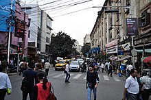
Dharmatala is a neighbourhood of Central Kolkata, in Kolkata district in the Indian state of West Bengal. Dharmatala Street has been renamed after Lenin as Lenin Sarani but the neighbourhood up to Wellington Square continues to be referred as Dharmatala. It is a busy commercial area that had come up with the growth of Calcutta during the British Raj and is thus one of the repositories of history in the city.

Jorabagan is a neighbourhood of North Kolkata, in Kolkata district, in the Indian state of West Bengal. As a neighbourhood, it covers a small area but its importance is primarily because of the police station.

Shobhabazar is a neighbourhood of North Kolkata, in Kolkata district, in the Indian state of West Bengal.

Joka is a locality in South Kolkata, India. It is a part of greater Behala region. This place is mostly known for Indian Institute of Management Calcutta and ESIC Medical College and Hospital.

Bepin Behari Ganguly Street, or B.B. Ganguly Street, formerly known as Bow Bazar Street or Bowbazar Street, is an east-west road in Central Kolkata, capital of the Indian state of West Bengal. It passes through Bowbazar area and connects Baithakkhana Market (Sealdah) and Sealdah Station with Bentinck Street/Rabindra Sarani crossing (Lalbazar) via Amherst Street crossing, Nirmal Chandra Street/College Street crossing and Central Avenue crossing. West of Bentinck Street crossing, B.B. Ganguly Street becomes Lalbazar Street. This road's name is a tribute for Bepin Behari Ganguly, a famous freedom-fighter and politician of India.
Belepole is a residential locality of Howrah, West Bengal, India. It is an urban sprawl which sprung up near the old localities of South Howrah, like Bhattacharjee Para, Chatterjeehat etc. It is located near Shibpur. It has excellent communication and transportation facilities owing to its location, its life line is Kona Expressway which connects it to the Vidyasagar Setu and hence Kolkata is just 15 minutes away. It is close to the State administrative building Nabanna.

Shakespeare Sarani is a street running in the central business district of Kolkata, India, from Park Circus to Chowringhee Road. It was renamed on 24 April 1964 after William Shakespeare, to mark the fourth birth centenary of the legendary playwright. It is considered to be a high street of Kolkata with many commercial establishments, offices, shops and restaurants situated by the road. It intersects with other important roads in the CBD like Acharya Jagadish Chandra Bose Road, Camac Street, Loudon Street and Rawdon Street. Few other roads like, Little Russel Street, Wood Street, Picasso Bithi & Lord Sinha Road criss-crosses or merge into Shakespeare Sarani from North or South. West of Birla Planetarium crossing, Shakespeare Sarani becomes Queen's Way.

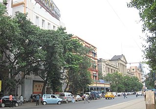
The tram system in Kolkata, the capital city of the Indian state of West Bengal, operated by West Bengal Transport Corporation (WBTC) after Calcutta Tramways Company (CTC) was dissolved, is the oldest tram network operating in India, and oldest operating tramway in Asia. Started in 1902, it is the oldest electric tramway in India. It is the only operating tram network of India at present.
Tiljala is a neighbourhood of South Kolkata, in West Bengal, India.
Ward No. 45, Kolkata Municipal Corporation is an administrative division of Kolkata Municipal Corporation in Borough No. 5, covering parts of Esplanade West, Eden Gardens, Babughat, Millennium Park, B.B.D. Bagh, Lalbazar and Burrabazar neighbourhoods in central Kolkata, in the Indian state of West Bengal.
Ward No. 46, Kolkata Municipal Corporation is an administrative division of Kolkata Municipal Corporation in Borough No. 6, covering parts of Chowringhee, Esplanade East, Dharmatala, Janbazar, Lalbazar, Bowbazar and Maidan neighbourhoods in central Kolkata, in the Indian state of West Bengal.