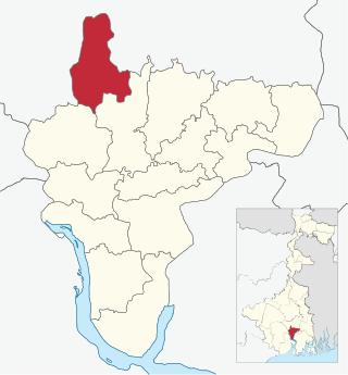
It is located 8km from Howrah, the district headquarters.
Area and administration
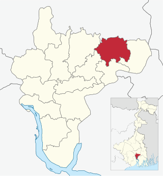
Bally Jagachha CD Block has an area of 72.05 km2.[1] Nischinda Police Station and Liluah Police Station of Howrah City Police serve this CD Block. Bally Jagachha panchayat samity has 8 gram panchayats. The block has 3 inhabited villages.[2] Headquarters of this block is at Kona.
Topography
Howrah district is located on the west bank of the Hooghly. The Rupnarayan flows on the west and south of the district and the Damodar intersects it. The district consists of a flat alluvial plain.[3]
Gram panchayats
Baba Panchananda Mandir, Chamrail, Bally Jagachha block
Gram panchayats of Bally Jagachha block/panchayat samiti are: Bally, Chakpara Anandanagar, Chamrail, Durgapur Abhaynagar I, Durgapur Abhaynagar II, Jagadishpur, Nischinda and Sanpuipara Basukati.[4]
Demographics
Overview
Rural population is 49.63% of the total population of Howrah district as per 2001 census. Scheduled castes account for 15.41% of the population, scheduled tribes 0.44% and Muslims 24.4% of the population. As the economy is prevalently industrial, majority of the population depends on industries for a living. Only 30% of the population is engaged in cultivation.[5]
As per 2011 Census of India Bally Jagachha CD Block had a total population of 209,504, of which 9,300 were rural and 200,204 were uban. There were 107,926 (52%) males and 101,578 (48%) females. Population below 6 years was 19,915. Scheduled Castes numbered 30,615 and Scheduled Tribes numbered 1,823.[6]
As per 2001 census, Bally Jagachha block had a total population of 164,520, out of which 86,409 were males and 78,111 were females. Bally Jagacha block registered a population growth of 28.63 per cent during the 1991-2001 decade. Decadal growth for Howrah district was 12.76 per cent. Decadal growth in West Bengal was 17.84 per cent. Scheduled castes at 31,141 formed around one-fifth the population. Scheduled tribes numbered 3,629.[1][7]
As per 2011 census there was only one large village (4,000+population) in Bally Jagachha CD Block (2011 census figure in brackets): Debirpara (6,517).[6]
Literacy
As per 2011 census the total number of literates in Bally Jagachha CD Block was 166,364 (87.75% of the population over 6 years) out of which 89,030 (54%) were males and 77,334 (46%) were females.[6]
As per 2011 census, literacy in Howrah district was 78.66%.[9] Literacy in West Bengal was 77.08% in 2011.[10] Literacy in India in 2011 was 74.04%.[10]
As per 2001 census, Bally Jagachha block had a total literacy of 84.44 per cent for the 6+ age group. While male literacy was 89.24 per cent female literacy was 79.08 per cent. Howrah district had a total literacy of 77.01 per cent, male literacy being 83.22 per cent and female literacy being 70.11 per cent. [2]
In 2011 census Hindus numbered 197,131 and formed 94.09% of the population in Bally Jagacha CD Block. Muslims numbered 9,852 and formed 4.70% of the population. Others numbered 2,521 and formed 1.21% of the population.[11]
At the time of the 2011 census, 79.87% of the population spoke Bengali and 17.44% Hindi as their first language.[12]
Economy
Infrastructure
Prior to 2003-04, Bally Jagachha CD Block had 143 hectares of vested land, out of which 83 hectares were distributed amongst 1,894 persons. In Bally Jagachha CD Block more than one crop was grown in 406 hectares. Net area sown in the block was 1,731 hectares. Bally Jagachha had 180 hectares of canals for irrigation. In Bally Jagachha CD Block 3 mouzas were electrified up to March 2004.[2]
Education
In 2003-04, Bally Jagachha CD Block had 64 primary schools with 8,830 students, 3 middle schools with 995 students, 8 high schools with 3,925 students and 7 higher secondary schools with 5,830 students. Bally Jagachha CD Block had 195 institutions with 19,893 students for special and non-formal education. It had 1 mass literacy centre.[2]
Healthcare
Bally Jagachha CD Block had 4 health centres and 2 clinics, with 29 beds and 8 doctors in 2003. It had 39 family welfare centres.[2]
Related Research Articles
Howrah district is a district of the West Bengal state in eastern India. Howrah district is one of the highly urbanized area of West Bengal. It has thousands of years of rich heritage in the form of the great Bengali kingdom of Bhurshut. The district is named after its headquarters, the city of Howrah.
Chamrail is a census town in Bally Jagachha CD Block of Howrah Sadar subdivision in Howrah district in the Indian state of West Bengal.
Jagadishpur is a census town in Bally Jagachha CD Block of Howrah Sadar subdivision in Howrah district in the Indian state of West Bengal.
Howrah Sadar subdivision is a subdivision of the Howrah district in the state of West Bengal, India. It consists of Howrah municipal corporation and five community development blocs: Bally Jagacha, Domjur, Panchla, Sankrail and Jagatballavpur. The five blocks contain 67 gram panchayats and 44 census towns. The subdivision has its headquarters at Howrah.
Amta I is a community development block that forms an administrative division in Uluberia subdivision of Howrah district in the Indian state of West Bengal.
Jagatballavpur is a community development block that forms an administrative division in Howrah Sadar subdivision of Howrah district in the Indian state of West Bengal.
Udaynarayanpur is a community development block that forms an administrative division in Uluberia subdivision of Howrah district in the Indian state of West Bengal.
Shyampur I is a community development block that forms an administrative division in Uluberia subdivision of Howrah district in the Indian state of West Bengal.
Bagnan I is a community development block that forms an administrative division in Uluberia subdivision of Howrah district in the Indian state of West Bengal.
Chanditala II is a community development block that forms an administrative division in Srirampore subdivision of Hooghly district in the Indian state of West Bengal.
Khanakul II is a community development block that forms an administrative division in Arambag subdivision of Hooghly district in the Indian state of West Bengal.
Sreerampur Uttarpara is a community development block that forms an administrative division in Srirampore subdivision of Hooghly district in the Indian state of West Bengal.
Domjur is a community development block that forms an administrative division in Howrah Sadar subdivision of Howrah district in the Indian state of West Bengal.
Panchla is a community development block that forms an administrative division in Howrah Sadar subdivision of Howrah district in the Indian state of West Bengal.
Sankrail is a community development block that forms an administrative division in Howrah Sadar subdivision of Howrah district in the Indian state of West Bengal.
Uluberia I is a community development block that forms an administrative division in Uluberia subdivision of Howrah district in the Indian state of West Bengal.
Uluberia II is a community development block that forms an administrative division in Uluberia subdivision of Howrah district in the Indian state of West Bengal.
Amta II is a community development block that forms an administrative division in Uluberia subdivision of Howrah district in the Indian state of West Bengal.
Bagnan II is a community development block that forms an administrative division in Uluberia subdivision of Howrah district in the Indian state of West Bengal.
Shyampur II is a community development block that forms an administrative division in Uluberia subdivision of Howrah district in the Indian state of West Bengal.
1 2 3 4 5 "District Statistical Handbook – 2004 – Howrah"(PDF). Tables 2.1, 2.2, 2.4 (b), 3.1, 4.4, 4.5, 8.2, 18.1, 18.3, 21.1. Bureau of Applied Economics and Statistics, Government of West Bengal. Archived from the original(PDF) on 20 September 2016. Retrieved 3 April 2016.
This page is based on this Wikipedia article Text is available under the CC BY-SA 4.0 license; additional terms may apply. Images, videos and audio are available under their respective licenses.