
The Shakta pithas, Shakti pithas or Sati pithas are significant shrines and pilgrimage destinations in Shaktism, the mother goddess denomination in Hinduism. The shrines are dedicated to various forms of Adi Shakti. Various Puranas such as Srimad Devi Bhagavatam state the existence of a varying number of 51, 52, 64 and 108 Shakta pithas of which 18 are named as Astadasha Maha (major) in medieval Hindu texts.

Bishnupur is a city and a municipality in Bankura district, West Bengal, India. It has terracotta temples built by the Malla rulers, historic Radha Krishna temples built during 1600–1800 CE and the Baluchari sarees. In 1997 the temples of Bishnupur were placed on the UNESCO World Heritage Site's Tentative list.

Chandrakona is a town and a municipality in the Ghatal subdivision of Paschim Medinipur district in the state of West Bengal, India. The city is located between Ghatal and Garhbeta. Chandraketu was the founder of the kingdom of Chandrakona. In the Ain-E-Akbari, the 16th century Mughal document, it was mentioned as ‘Mana’.

Khirpai, also known as Kshirpai, is a city and a municipality in the Ghatal subdivision of the Paschim Medinipur district in the state of West Bengal, India. Earlier it was part of Hooghly. The city is situated between Ghatal and Chandrakona, near the banks of the rivers Shilabati and Kethai, and is one of the oldest municipalities in India. Khirpai is also famous for its Babarsa, a special type of sweetmeat, which is not available elsewhere.

Mainaguri is a town and a municipality in the Jalpaiguri Sadar subdivision of the Jalpaiguri district in the state of West Bengal, India. It is known as the "Gateway of the Dooars" and is a regionally significant tourist destination for Jalpesh Temple of Lord Shiva and nearby Gorumara National Park.

Ramjibanpur is a city and a municipality in the Ghatal subdivision of the Paschim Medinipur district in the Indian state of West Bengal.
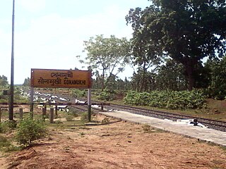
Sonamukhi is a town and a municipality in the Bishnupur subdivision of the Bankura district in the Indian state of West Bengal. It is famous for its Silk Saari and also Kali and Karthik puja.

Tarakeswar is a famous sacred city and a municipality in Hooghly district in the Indian state of West Bengal. Tarakeswar is called "Baba Dham" or "The city of Shiva". It is one of the major tourist and holy place of West Bengal as well as India. Tarakeswar is a place of pilgrimage of Lord Shiva sect in West Bengal 58 kilometres (36 mi) away from State Capital Kolkata.

Joypur is a community development block that forms an administrative division in the Bishnupur subdivision of the Bankura district in the Indian state of West Bengal.

Mallabhum was the kingdom ruled by the Malla kings of Bishnupur, primarily in the present Bankura district in Indian state of West Bengal.

Hinduism is the largest religious tradition in the Indian state of West Bengal with approximately 70.54% of the population identifying themselves as Hindus. The Hindus in West Bengal mostly belong to the Shakta, minority to Vaishnavite and a small community belong to Shaivite and other denominations. The vast majority of Hindus in West Bengal are Bengali Hindus numbering around 55 million and comprising 60.2% of the state population of 91.35 million (2011) but a notable section of non-Bengali Hindus also exist, particularly among Marwaris, Biharis, Odias, Gurkhas, Sindhis, Gujaratis and various tribal communities such as Koch, Santals, Munda, Mech people and particularly Adivadis numbering around 9.4 million comprising rest 10.3% of the state population.
Belgachia is a neighbourhood of North Kolkata in Kolkata district in the Indian state of West Bengal.

Arambagh is a community development block that forms an administrative division in Arambag subdivision of Hooghly district in the Indian state of West Bengal.

Goghat II is a community development block that forms an administrative division in Arambag subdivision of Hooghly district in the Indian state of West Bengal.

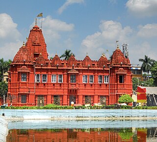
Kripamayee Kali TempleKripamôyee Kali Môndir), commonly known as Joy Mitra Kalibari, Jôy Mitrô Kalibari ), is a Hindu temple dedicated to goddess Kali, located on the eastern banks of Hooghly river at Baranagar in Kolkata, in the Indian state of West Bengal.

Gurap is a village in Dhaniakhali CD block in Chinsurah subdivision of Hooghly district in the state of West Bengal, India.
Bengal temple architecture also known as Malla dynasty architecture is about temple styles developed and used in Bengal, particularly the chala, ratna and dalan temples.
Bali Dewanganj is a village and a gram panchayat in the Goghat I CD block in the Arambagh subdivision of Hooghly district in the Indian state of West Bengal.

Parul is a village in the Pursurah CD block in the Arambagh subdivision of Hooghly district in the Indian state of West Bengal.
Dwarhatta is a village and a gram panchayat in the Haripal CD block in the Chandannagore subdivision of Hooghly district in the Indian state of West Bengal.


