Uluberia subdivision

Last updated

Uluberia Sub-Division
উলুবেড়িয়া মহকুমা
subdivision
Uluberia (sudivision) in Howrah (West Bengal).svg
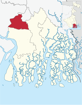
Map of Uluberia Subdivision
West Bengal location map.svg
Red pog.svg
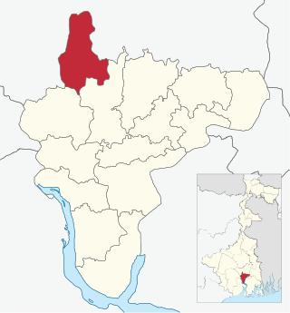
Uluberia Sub-Division
Location in West Bengal, India
India location map.svg
Red pog.svg
Uluberia Sub-Division
Uluberia Sub-Division (India)
Coordinates: 22°28′N88°07′E / 22.47°N 88.11°E / 22.47; 88.11
CountryFlag of India.svg  India
State West Bengal
District Howrah
Headquarters Uluberia
Population
 (2011)
  Total2,038,685
Languages
  Official Bengali, English
Time zone UTC+5:30 (IST)
ISO 3166 code ISO 3166-2:IN
Vehicle registration WB
Website wb.gov.in

Uluberia subdivision is a subdivision of the Howrah district in the state of West Bengal, India. It consists of Uluberia municipality and nine community development (CD) blocks, including 90 gram panchayats and six census towns. [1] The six census towns are: Khalor, Bagnan, Naupala, Santoshpur, Balaram Pota and Uttar Pirpur. [2] The subdivision has its headquarters at Uluberia. The whole division forms the Lok Sabha constituency of Uluberia. [3]

Contents

Area

Sri Ramkrishna Ashram, Brindabanpur, Uluberia Sri Ramkrishna Ashram, Brindabanpur.jpg
Sri Ramkrishna Ashram, Brindabanpur, Uluberia
Gateway of Melai Chandi Mandir, Amta Gateway - Melai Chandi Mandir Complex - Amta - Howrah 2015-11-15 7062.JPG
Gateway of Melai Chandi Mandir, Amta
Howrah Subdivision Map (en).svg
DivisionHeadquarters [4] Census town(s) [2] Gram panchayats [1] Police area [5] West Bengal legislative area
Uluberia municipality Uluberia 00- Uluberia Purba
Uluberia I Uluberia09: Bahira, Hatgachha-I, Kalinagar, Chandipur, Hatgachha-II, Maheshpur, Birshibpur, Dhulasimla, Heerapur, Tapna.Uluberia Uluberia Dakshin
Uluberia II Rajapur3: Santoshpur, Balaram Pota, Uttar Pirpur 8: Baniban, Khalisani, Tehatta-Kantaberia-I, Tehatta-Kantaberia-II, Basudevpur, Raghudevpur, Joargori and Tulsiberia.Rajapur, Uluberia Uluberia Purba, Uluberia Uttar (SC)
Amta I Amta 013: Amta, Bhandargachha, Khosalpur, UdangII, Anulia, Chandrapur, Raspur, Balichak, Kanpur, Sirajbati, Basantapur, Khardah and UdangIAmta Udaynarayanpur, Uluberia Uttar (SC)
Amta II Jaypur Fakirdas 014: Amragori, Ghoraberia Chitnan, Khalna, Tajpur, Bhatora, Jhamtia, Kasmoli, Thalia, Binola Krishnabati, Jaypur, Kusberia, Gazipur, Jhikhira and NoyaparaJaypur and Amta Amta
Udaynarayanpur Udaynaryanpur011: Bhabanipur Bidhichandrapur, Harali Udaynarayanpur, Khila, RampurDihibhursut Asanda, Kurchi Shibpur, Debipur, Harishpu,Raghunathpur, GarbhabanipurSonatala, Kanupat Mansuka, Pancharul and SingtiUdaynarayanpur Udaynarayanpur
Bagnan I Bagnan 2: Khalor, Bagnan 10: Bagnan-I, Baksihat, Haturia-II, Sabsit, Bagnan-II, Bangalpur, Kalyanpur, Bainan, HaturiaI and KhaloreBagnan Bagnan, Amta
Bagnan II Khalor 1: Naupala 7: Antila, Chandrabhag, Mugkalyan Benapur, BantulBaidyanathpur, Saratchandra, Halyan and OrphooliBagnan Bagnan
Shyampur I Shyampur010: Balichaturi, Belari, Kamalpur, Shyampur, BaneswarpurI, Dhandali, Nabagram, BaneswarpurII, Dingakhola and RadhapurShyampur Uluberia Dakshin, Shyampur
Shyampur II Sasati 08: Amardaha, Bargram, DihimondalghatII, Nakol, Bachhri, Dihimondalghat-I, Kharuberia and ShashatiShyampur Shyampur

Legislative segments

The whole of Uluberia subdivision elects to the Uluberia constituency of the Lok Sabha. [3] There are 7 constituencies for the West Bengal Legislative Assembly (Vidhan Sabha). The Uluberia Uttar constituency will be reserved for Scheduled castes (SC) candidates.

Related Research Articles

<span class="mw-page-title-main">Howrah district</span> District in West Bengal, India

Howrah district is a district of the West Bengal state in eastern India. Howrah district is one of the highly urbanized area of West Bengal. It has thousands of years of rich heritage in the form of the great Bengali kingdom of Bhurshut. The district is named after its headquarters, the city of Howrah.

<span class="mw-page-title-main">Howrah Sadar subdivision</span> Subdivision in West Bengal, India

Howrah Sadar subdivision is a subdivision of the Howrah district in the state of West Bengal, India. It consists of Howrah municipal corporation and five community development blocs: Bally Jagacha, Domjur, Panchla, Sankrail and Jagatballavpur. The five blocks contain 67 gram panchayats and 44 census towns. The subdivision has its headquarters at Howrah.

Alipore Sadar subdivision is an administrative subdivision of the South 24 Parganas district in the Indian state of West Bengal.

Baruipur subdivision is an administrative subdivision of the South 24 Parganas district in the Indian state of West Bengal.

Diamond Harbour subdivision is an administrative subdivision of the South 24 Parganas district in the Indian state of West Bengal.

Canning subdivision is an administrative subdivision of the South 24 Parganas district in the Indian state of West Bengal.

<span class="mw-page-title-main">Amta I</span> Historical City in West Bengal, India

Amta I is a city and community development block that forms an administrative division in Uluberia subdivision of Howrah district in the Indian state of West Bengal.

<span class="mw-page-title-main">Jagatballavpur (community development block)</span> Community development block in West Bengal, India

Jagatballavpur is a community development block that forms an administrative division in Howrah Sadar subdivision of Howrah district in the Indian state of West Bengal.

<span class="mw-page-title-main">Udaynarayanpur</span> Community development block in West Bengal, India

Udaynarayanpur is a community development block that forms an administrative division in Uluberia subdivision of Howrah district in the Indian state of West Bengal.

<span class="mw-page-title-main">Shyampur I</span> Community development block in West Bengal, India

Shyampur I is a community development block that forms an administrative division in Uluberia subdivision of Howrah district in the Indian state of West Bengal.

<span class="mw-page-title-main">Bagnan I</span> Community development block in West Bengal, India

Bagnan I is a community development block that forms an administrative division in Uluberia subdivision of Howrah district in the Indian state of West Bengal.

Uluberia Uttar Assembly constituency is an assembly constituency in Howrah district in the Indian state of West Bengal. It is reserved for scheduled castes.

Bagnan Assembly constituency is an assembly constituency in Howrah district in the Indian state of West Bengal.

Amta Assembly constituency is an assembly constituency in Howrah district in the Indian state of West Bengal.

Udaynarayanpur Assembly constituency is an assembly constituency in Howrah district in the Indian state of West Bengal.

<span class="mw-page-title-main">Uluberia I</span> Community development block in West Bengal, India

Uluberia I is a community development block that forms an administrative division in Uluberia subdivision of Howrah district in the Indian state of West Bengal.

<span class="mw-page-title-main">Uluberia II</span> Community development block in West Bengal, India

Uluberia II is a community development block that forms an administrative division in Uluberia subdivision of Howrah district in the Indian state of West Bengal.

<span class="mw-page-title-main">Amta II</span> Community development block in West Bengal, India

Amta II is a community development block that forms an administrative division in Uluberia subdivision of Howrah district in the Indian state of West Bengal.

<span class="mw-page-title-main">Bagnan II</span> Community development block in West Bengal, India

Bagnan II is a community development block that forms an administrative division in Uluberia subdivision of Howrah district in the Indian state of West Bengal.

<span class="mw-page-title-main">Shyampur II</span> Community development block in West Bengal, India

Shyampur II is a community development block that forms an administrative division in Uluberia subdivision of Howrah district in the Indian state of West Bengal.

References

  1. 1 2 "Directory of District, Sub division, Panchayat Samiti/ Block and Gram Panchayats in West Bengal, March 2008". West Bengal. National Informatics Centre, India. 19 March 2008. Archived from the original on 25 February 2009. Retrieved 21 December 2008.
  2. 1 2 "District Wise List of Statutory Towns( Municipal Corporation,Municipality,Notified Area and Cantonment Board), Census Towns and Outgrowths, West Bengal, 2001". Census of India, Directorate of Census Operations, West Bengal. Archived from the original on 30 September 2007. Retrieved 21 December 2008.
  3. 1 2 "Press Note, Delimitation Commission" (PDF). Assembly Constituencies in West Bengal. Delimitation Commission. pp. 15, 24. Retrieved 18 January 2009.
  4. "Contact details of Block Development Officers". Howrah district. Panchayats and Rural Development Department, Government of West Bengal. Retrieved 26 December 2008.[ permanent dead link ]
  5. "List of Districts/C.D.Blocks/ Police Stations with Code No., Number of G.Ps and Number of Mouzas". Census of India, Directorate of Census Operations, West Bengal. Archived from the original on 16 April 2011. Retrieved 21 December 2008.