Bankra

Last updated

Bankra
Census Town
West Bengal location map.svg
Red pog.svg
Bankra
Location in West Bengal, India
India location map 3.png
Red pog.svg
Bankra
Bankra (India)
Coordinates: 22°38′N88°18′E / 22.63°N 88.3°E / 22.63; 88.3 Coordinates: 22°38′N88°18′E / 22.63°N 88.3°E / 22.63; 88.3
CountryFlag of India.svg  India
State West Bengal
District Howrah
Elevation
8 m (26 ft)
Population
 (2011)
  Total63,957
Languages
  Official Bengali, English, Urdu, Hindi
Time zone UTC+5:30 (IST)
PIN
711403
Vehicle registration WB
Lok Sabha constituency Sreerampur
Vidhan Sabha constituency Domjur
Website howrah.gov.in

Bankra is a census town in Domjur CD Block of Howrah Sadar subdivision in Howrah district in the Indian state of West Bengal. It is a part of Kolkata Urban Agglomeration. [1]

Contents

Geography

Bankra is located at 22°38′N88°18′E / 22.63°N 88.3°E / 22.63; 88.3 . [2] It has an average elevation of 8 metres (26 feet).

Demographics

As per 2011 Census of India Bankra had a total population of 63,957 of which 33,079 (52%) were males and 30,878 (48%) were females. Population below 6 years was 8,911. The total number of literates in Bankra was 41,560 (75.50% of the population over 6 years). [3]

Bankra was part of Kolkata Urban Agglomeration in 2011 census. [4]

As of 2001 India census, [5] Bankra had a population of 48,403. Males constitute 52% of the population and females 48%. 15% of the population is under 6 years of age.

Transport

Makardaha Road is the artery of the town.

Bus

Private Bus

Mini Bus

CTC Bus

Bus Routes Without Numbers

Train

Dasnagar railway station , Dansi railway station and Bankra nayabaz railway station are the nearest railway stations.

Related Research Articles

Ankurhati Census Town in West Bengal, India

Ankurhati is a census town in Domjur CD Block of Howrah Sadar subdivision in Howrah district in the Indian state of West Bengal. It is a part of Kolkata Urban Agglomeration.

Argari Census Town in West Bengal, India

Argari is a census town in Sankrail CD Block of Howrah Sadar subdivision in Howrah district in the Indian state of West Bengal. It is a part of Kolkata Urban Agglomeration.

Bhandardaha is a census town in Domjur CD Block of Howrah Sadar subdivision in Howrah district in the state of West Bengal, India. It is close to Makardaha and also a part of Kolkata Urban Agglomeration.

Bipra Noapara is a census town in Domjur CD Block of Howrah Sadar subdivision in Howrah district in the Indian state of West Bengal. It is a part of Kolkata Urban Agglomeration.

Dakshin Jhapardaha is a census town in Domjur CD Block of Howrah Sadar subdivision in Howrah district in the state of West Bengal, India. It is close to Domjur and also a part of Kolkata Urban Agglomeration.

Domjur Census Town in West Bengal, India

Domjur is a census town in Domjur CD Block of Howrah Sadar subdivision in Howrah district in the Indian state of West Bengal. It is a part of Kolkata Urban Agglomeration.

Eksara is a census town in Bally Jagachha CD Block of Howrah Sadar subdivision in Howrah district in the Indian state of West Bengal. It is a part of Kolkata Urban Agglomeration.

Kalara is a census town in Domjur CD Block of Howrah Sadar subdivision in Howrah district in the Indian state of West Bengal. It is a part of Kolkata Urban Agglomeration.

Kantlia is a census town in Domjur CD Block of Howrah Sadar subdivision in Howrah district in the Indian state of West Bengal. It is a part of Kolkata Urban Agglomeration.

Kesabpur is a census town in Domjur CD Block of Howrah Sadar subdivision in Howrah district in the Indian state of West Bengal. It is a part of Kolkata Urban Agglomeration.

Khantora is a census town in Domjur CD Block of Howrah Sadar subdivision in Howrah district in the Indian state of West Bengal. It is a part of Kolkata Urban Agglomeration.

Makardah is a census town in Domjur CD Block of Howrah Sadar subdivision in Howrah district in the Indian state of West Bengal. It is a part of Kolkata Urban Agglomeration.

Manikpur is a census town in Sankrail CD Block of Howrah Sadar subdivision in Howrah district in the Indian state of West Bengal. It is a part of Kolkata Urban Agglomeration.

Natibpur is a census town in Domjur CD Block of Howrah Sadar subdivision in Howrah district in the Indian state of West Bengal. It is a part of Kolkata Urban Agglomeration.

Nibra Census Town in West Bengal, India

Nibra is a census town in Domjur CD Block of Howrah Sadar subdivision in Howrah district in the Indian state of West Bengal. It is a part of Kolkata Urban Agglomeration.

Salap Census Town in West Bengal, India

Salap is a census town in Domjur CD Block of Howrah Sadar subdivision in Howrah district in the Indian state of West Bengal. It is a part of Kolkata Urban Agglomeration.

Tentulkuli Census Town in West Bengal, India

Tentulkuli is a census town in Domjur CD Block of Howrah Sadar subdivision in Howrah district in the Indian state of West Bengal. It is close to Salap and also a part of Kolkata Urban Agglomeration.

Bally Jagachha is a community development block that forms an administrative division in Howrah Sadar subdivision of Howrah district in the Indian state of West Bengal.

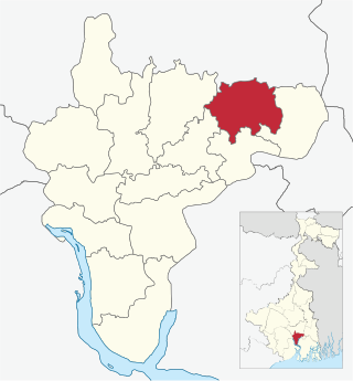
Domjur is a community development block that forms an administrative division in Howrah Sadar subdivision of Howrah district in the Indian state of West Bengal.

Sankrail is a community development block that forms an administrative division in Howrah Sadar subdivision of Howrah district in the Indian state of West Bengal.

References

  1. "District-wise list of stautory towns". Census Commission of India. Archived from the original on 21 July 2011. Retrieved 28 January 2009.
  2. Falling Rain Genomics, Inc - Bankra
  3. "C.D. Block Wise Primary Census Abstract Data(PCA)". 2011 census: West Bengal – District-wise CD Blocks. Registrar General and Census Commissioner, India. Retrieved 11 May 2016.
  4. "Provisional Population Totals, Census of India 2011" (PDF). Constituents of Urban Agglomeration Having Population Above 1 Lakh. Census of India 2011. Retrieved 11 May 2016.
  5. "Census of India 2001: Data from the 2001 Census, including cities, villages and towns (Provisional)". Census Commission of India. Archived from the original on 16 June 2004. Retrieved 1 November 2008.