Benapur

Last updated

Benapur
Village
India West Bengal adm location map.svg
Red pog.svg
Benapur
Location in West Bengal, India
India location map.svg
Red pog.svg
Benapur
Benapur (India)
Coordinates: 22°28′N87°58′E / 22.47°N 87.97°E / 22.47; 87.97 Coordinates: 22°28′N87°58′E / 22.47°N 87.97°E / 22.47; 87.97
CountryFlag of India.svg  India
State West Bengal
District south 24 paraganas
Languages
  Official Bengali, English
Time zone UTC+5:30 (IST)
Nearest city Diamond Harbour, Kolkata
Lok Sabha constituency Diamond Harbour
Vidhan Sabha constituency Falta
Website howrah.gov.in

Benapur is a village in Bagnan-II Block, Howrah District, West Bengal. Its location, beside the Rupnarayana River, has made it to an wonderful place for picnic. Its Geographic location is 22°28′N87°58′E / 22.47°N 87.97°E / 22.47; 87.97 . [1]

West Bengal State in Eastern India

West Bengal is an Indian state, located in Eastern India on the Bay of Bengal. With over 91 million inhabitants, it is India's fourth-most populous state. It has an area of 88,752 km2 (34,267 sq mi). A part of the ethno-linguistic Bengal region of the Indian subcontinent, it borders Bangladesh in the east, and Nepal and Bhutan in the north. It also borders the Indian states of Odisha, Jharkhand, Bihar, Sikkim, and Assam. The state capital is Kolkata (Calcutta), the seventh-largest city in India, and center of the third-largest metropolitan area in the country. As for geography, West Bengal includes the Darjeeling Himalayan hill region, the Ganges delta, the Rarh region, and the coastal Sundarbans. The main ethnic group are the Bengalis, with Bengali Hindus forming the demographic majority.

Rupnarayan River river in India

The Rupnarayan River is a river in India. It begins as the Dhaleswari (Dhalkisor) in the Chhota Nagpur plateau foothills northeast of the town of Purulia. It then follows a tortuous southeasterly course past the town of Bankura, where it is known as the Dwarakeswar river. Near the town of Ghatal it is joined by the Shilabati river, where it takes the name Rupnarayan. Finally, it joins the Hoogli River. It is famous for the Hilsa fish that live in it and are used in Bengali cuisine. It is also notable for the West Bengal Power Development Corporation Limited (WBPDCL) thermal power plant built along its bank at Kolaghat in West Bengal. The river also passes through Bagnan in Howrah district.

Contents

The village is divided into North and South Benapur by the Nuntia-Benapur Road, a spur from the Bagnan-Gadiara Road from Nuntia.

Economy

Farming (principally rice paddies and floriculture) forms the mainstay of the village economy, with jaba, golap, aparajita, and ganda flowers cultivated extensively. There are smaller industries producing bricks and, during the rainy season, the prized hilsa fish. Few years back, the village was very famous for producing 'pan', however, farmers are now less interested in it because of low production and other problems relating to environmental pollution mainly caused by brick industry.

Floriculture discipline of horticulture concerned with the cultivation of flowering and ornamental plants

Floriculture, or flower farming, is a discipline of horticulture concerned with the cultivation of flowering and ornamental plants for gardens and for floristry, comprising the floral industry. The development, via plant breeding, of new varieties is a major occupation of floriculturists.

Brick Block or a single unit of a ceramic material used in masonry construction

A brick is building material used to make walls, pavements and other elements in masonry construction. Traditionally, the term brick referred to a unit composed of clay, but it is now used to denote any rectangular units laid in mortar. A brick can be composed of clay-bearing soil, sand, and lime, or concrete materials. Bricks are produced in numerous classes, types, materials, and sizes which vary with region and time period, and are produced in bulk quantities. Two basic categories of bricks are fired and non-fired bricks.

Education

Benapur Chandanapara High School Benapur Chandanapara High School.jpg
Benapur Chandanapara High School

Historically Benapur is very rich in education. A school naming Benapur Chandanapara High School (H.S) Benapur Chandanapara High School (H.S)] is very famous in Bagnan. It has long history in producing many talented students who have been established in different fields.

Religion

The village is predominantly Hindu, with local temples to the deities Shitala, Kali, and Shiva. Ma Jagaddhatri and Ma Basanti are worshipped in the village. Vishalakshmi is also an important goddess in this village.

Shitala Hindu goddess

Shitala (Sheetala), also called Sitala, is a folk deity, worshiped by many faiths in regions of North India, West Bengal, Nepal, Bangladesh and Pakistan. As an incarnation of Supreme Goddess Durga, she cures poxes, sores, ghouls, pustules and diseases.

Kali Hindu goddess associated with empowerment

Kālī, also known as Kālikā or Shyama, is a Hindu goddess. Kali is one of the ten Mahavidyas, a list which combines Sakta and Buddhist goddesses.

Tour

As the village is just 10 km from NH6, the village is now becoming one of the favorite place for Picnic lovers. Huge area of green riverbank of Rupnarayana river is waiting with wonderful sites for picnic. Now-a-days a Government Guest House is under construction for welcoming tourist in near future. A huge gathering has been found in every special days for picnic, especially in the months of December–January.

Related Research Articles

Miao, Arunachal Pradesh town in Arunachal Pradesh, India

Miao is a sub-division in Changlang district. It is located about 25 km from the Assam border. It is one of the 60 constituencies of Arunachal.

Sha Tin District District in New Territories, Hong Kong

Sha Tin District is one of the 18 districts of Hong Kong. As one of the 9 districts located in the New Territories, it covers the areas of Sha Tin, Tai Wai, Ma On Shan, Fo Tan, Siu Lek Yuen and Ma Liu Shui. The district is the most populous district in Hong Kong, with a population of 659,794 as per 2016 census, having a larger population than many countries or dependencies including Iceland, Macau, Montenegro and Brunei.

Sha Tin Place in New Territories, Hong Kong

Sha Tin, also spelt Shatin, is a city along the Shing Mun River in the Sha Tin District of East New Territories, Hong Kong. Administratively, it is part of the Sha Tin District. It is one of Hong Kong's most prominent examples of new town developments in the 1970s. Together with its satellite town Ma On Shan, Shatin is the most populous city in the New Territories, with a 2011 population census of 630,273 within an area of 35.87 km2. Situated in the southern half of New Territories East below Tolo Harbour, it is the principal city of Sha Tin District, which is the second most populous district of the territory.

Ironville village and civil parish in Amber Valley district, Derbyshire, England

Ironville in Derbyshire, England, was built about 1830 by the Butterley Company as a "model village" to house its workers. The population of the civil parish was 1,851 at the 2011 Census. It is situated between Riddings and Codnor Park.

Kolaghat Census Town in West Bengal, India

Kolaghat is a census town in Kolaghat CD Block of Tamluk subdivision in Purba Medinipur district in the state of West Bengal, India. Kolaghat Thermal Power Station is located here, which is the largest power sector in the state and managed by West Bengal Power Development Corporation Limited (WBPDCL), a department of the State Government of West Bengal.

Ghatal City in West Bengal, India

Ghatal is a city and a municipality in Paschim Medinipur district, West Bengal, India. It is the headquarters of the Ghatal subdivision. Ghatal is a flood-prone area and in many years is flooded by the Shilabati River. The river Shilabati divided the city into two parts. The Ghatal Police station lies on the west bank of the river. There is one peculiar floating bridge on the river made of by joining some boats tied with rope from both sides in the banks, called "Bhasa Pool". Also, one cement bridge is constructed on the main pitch road or State Highway 4 passing through Chandrakona Town, Ghatal, Daspur, and Microgram.

Totopara village in West Bengal, India

Totopara is a small village on a hillock located 89° 20'E and 26° 50'N in the Alipurduar district of West Bengal, India.

Gadiara village in West Bengal, India

Gadiara is a village in the Howrah District of West Bengal, India. It is the point of convergence of the Damodar, the Rupnarayan and the Hoogli rivers.

Dahanu town in Maharashtra, India

Dahanu is a coastal town and a municipal council in Palghar district of Maharashtra state in Konkan division. It is located 110 km from Mumbai city and hosts adani electricity's thermal power station. It is the site of the currently stalled Wadhawan new port project at Rewas.

Bagnan Census Town in West Bengal, India

Bagnan is a census town in Bagnan I CD Block of Uluberia subdivision in Howrah district in the state of West Bengal, India.

Guskara City in West Bengal, India

Guskara is a city and a municipality under Ausgram police station in Bardhaman Sadar North subdivision of Purba Bardhaman district in the Indian state of West Bengal.

Kamarpukur village in West Bengal, India

Kamarpukur is a village situated in Goghat II Community Development Block under the Arambag subdivision of the Hooghly District in West Bengal state of India. It is famous for being the birthplace of Ramakrishna. It is the block headquarters of the Goghat –II community development block.
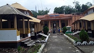
Kharagpur, Munger city in Bihar, India

Haveli Kharagpur

Woolbrook, New South Wales Town in New South Wales, Australia

Woolbrook is a village in the New England region of New South Wales, Australia. The nearest town, Walcha is 29 km to the east of Woolbrook. At the 2011 census, Woolbrook had a population of 248.

Amta I Historical City in West Bengal, India

Amta I is a city and community development block that forms an administrative division in Uluberia subdivision of Howrah district in the Indian state of West Bengal.

Bagnan I Community development block in West Bengal, India

Bagnan I is a community development block that forms an administrative division in Uluberia subdivision of Howrah district in the Indian state of West Bengal.

Ghoraghata Rail Station Place in West Bengal, India

The nearby areas around Ghoraghata Rail Station are called by "Ghoraghata" by the people. This article describes the area surrounding the station.

Nawabganj, North 24 Parganas Neighbourhood in Kolkata in North 24 Parganas, West Bengal, India

Nawabganj is a locality in North Barrackpur Municipality of North 24 Parganas district in the Indian state of West Bengal. It is a part of the area covered by Kolkata Metropolitan Development Authority (KMDA). The locality is situated beside the Hooghly River and is surrounded by Palta Water Works, Barrackpore Air Force Station and Rifle Factory Ishapore. It is densely populated where the majority of the population are Bengalis and is well connected with Kolkata by highways and railroads with adequate public transportation facility.

Bagnan II Community development block in West Bengal, India

Bagnan II is a community development block that forms an administrative division in Uluberia subdivision of Howrah district in the Indian state of West Bengal.

Samta, India Village in West Bengal, India

Samta is a village and a gram panchayat in the Howrah district of the Indian state of West Bengal, on the banks of the Rupnarayan River.

References

  1. "Yahoo maps location of Benapur". Yahoo maps. Retrieved 2013-11-14.