Andul is a census town in Sankrail CD Block of Howrah Sadar subdivision in Howrah district in the Indian state of West Bengal.

Ankurhati is a census town in Domjur CD Block of Howrah Sadar subdivision in Howrah district in the Indian state of West Bengal.

Argari is a census town in Sankrail CD Block of Howrah Sadar subdivision in Howrah district in the Indian state of West Bengal.
Bipra Noapara is a census town in Domjur CD Block of Howrah Sadar subdivision in Howrah district in the Indian state of West Bengal.
Dhuilya is a census town in Sankrail CD Block of Howrah Sadar subdivision in Howrah district in the Indian state of West Bengal.
Hatgachha is a census town in Sankrail CD Block of Howrah Sadar subdivision in Howrah district in the Indian state of West Bengal.
Jhorhat is a census town in Sankrail CD Block of Howrah Sadar subdivision in Howrah district in the Indian state of West Bengal.
Kantlia is a census town in Domjur CD Block of Howrah Sadar subdivision in Howrah district in the Indian state of West Bengal.
Khantora is a census town in Domjur CD Block of Howrah Sadar subdivision in Howrah district in the Indian state of West Bengal.
Makardah is a census town in Domjur CD Block of Howrah Sadar subdivision in Howrah district in the Indian state of West Bengal.
Manikpur is a census town in Sankrail CD Block of Howrah Sadar subdivision in Howrah district in the Indian state of West Bengal.

Nibra is a census town in Domjur CD Block of Howrah Sadar subdivision in Howrah district in the Indian state of West Bengal.
Panchpara is a census town in Sankrail CD Block of Howrah Sadar subdivision in Howrah district in the Indian state of West Bengal.
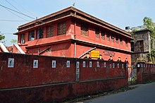
Podrah is a census town in Sankrail CD Block of Howrah Sadar subdivision in Howrah district in the Indian state of West Bengal. It houses one of the largest Multispeciality hospital in the district of Howrah, NH Multispeciality Hospital.
Ramchandrapur is a census town in Sankrail CD Block of Howrah Sadar subdivision in Howrah district in the Indian state of West Bengal.

Salap is a census town in Domjur CD Block of Howrah Sadar subdivision in Howrah district in the Indian state of West Bengal.

Mourigram is a village in Sankrail CD Block of Howrah Sadar subdivision in Howrah district in the Indian state of West Bengal.

Bally Jagachha is a community development block that forms an administrative division in Howrah Sadar subdivision of Howrah district in the Indian state of West Bengal.
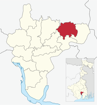
Domjur is a community development block that forms an administrative division in Howrah Sadar subdivision of Howrah district in the Indian state of West Bengal.

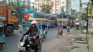
Sankrail is a community development block that forms an administrative division in Howrah Sadar subdivision of Howrah district in the Indian state of West Bengal.