Panchla

Last updated

Panchla
Census Town
West Bengal location map.svg
Red pog.svg
Panchla
Location in West Bengal, India
India location map 3.png
Red pog.svg
Panchla
Panchla (India)
Coordinates: 22°32′N88°08′E / 22.54°N 88.14°E / 22.54; 88.14
CountryFlag of India.svg  India
State West Bengal
District Howrah
Elevation
7 m (23 ft)
Population
 (2011)
  Total26,432
Languages
  Official Bengali, English
Time zone UTC+5:30 (IST)
PIN
711322
Vehicle registration WB
Lok Sabha constituency Howrah
Vidhan Sabha constituency Panchla
Website howrah.gov.in

Panchla is a census town in Panchla CD Block of Howrah Sadar subdivision in Howrah district in the Indian state of West Bengal. [1]

Contents

Geography

Panchla is located at 22°32′N88°08′E / 22.54°N 88.14°E / 22.54; 88.14 . [2] It has an average elevation of 7 metres (22 feet).

Demographics

As per 2011 Census of India Panchla had a total population of 26,432 of which 13,573 (51%) were males and 12,859 (49%) were females. Population below 6 years was 3,528. The total number of literates in Panchla was 18,730 (81.78% of the population over 6 years). [3]

As of 2001 India census, [4] Panchla had a population of 22,087. Males constitute 52% of the population and females 48%. Panchla has an average literacy rate of 63%, higher than the national average of 59.5%: male literacy is 69%, and female literacy is 58%. In Panchla, 15% of the population is under 6 years of age.

Economics

Zardozi embroidery with gold zari, seed pearls, sequins and beads is mainly produced by Muslim craftsmen of Panchla with six basic designs – leaf, flower, bird, animal, geometric and filler. This ornamental and dramatic embellishment is being used to create exclusive garments and accessories by leading fashion houses worldwide. Once the popular every household handcraft Zari (designing female ware by colour threads with small beads, pipes, pieces of stone like materials, reflective small plates etc by special types of needle) work has faced drought due to big machines taken over basic designing process, though some hand work are still breathing it's last air. Zari workers now switched to roadside factories of 12-hours-a-day labour job or migrated to other states for construction or jwellery work. Living cost is also getting higher for influx of skilled high paid workers from other states. [5]

Related Research Articles

<span class="mw-page-title-main">Ankurhati</span> Census Town in West Bengal, India

Ankurhati is a census town in Domjur CD Block of Howrah Sadar subdivision in Howrah district in the Indian state of West Bengal. It is a part of Kolkata Urban Agglomeration.

Beldubi is a census town in Panchla CD Block of Howrah Sadar subdivision in Howrah district in the state of West Bengal, India.

Bikihakola is a census town in Panchla CD Block of Howrah Sadar subdivision in Howrah district in the state of West Bengal, India.

Dhuilya is a census town in Sankrail CD Block of Howrah Sadar subdivision in Howrah district in the Indian state of West Bengal. It is a part of Kolkata Urban Agglomeration.

Eksara is a census town in Bally Jagachha CD Block of Howrah Sadar subdivision in Howrah district in the Indian state of West Bengal. It is a part of Kolkata Urban Agglomeration.

Gabberia is a census town in Panchla CD Block of Howrah Sadar subdivision in Howrah district in the state of West Bengal, India.

Jala Kendua is a census town in Panchla CD Block of Howrah Sadar subdivision in Howrah district in the Indian state of West Bengal.

Jhorhat is a census town in Sankrail CD Block of Howrah Sadar subdivision in Howrah district in the Indian state of West Bengal. It is a part of Kolkata Urban Agglomeration.

Kalara is a census town in Domjur CD Block of Howrah Sadar subdivision in Howrah district in the Indian state of West Bengal. It is a part of Kolkata Urban Agglomeration.

Khalia is a census town in Bally Jagachha CD Block of Howrah Sadar subdivision in Howrah district in the Indian state of West Bengal. It is a part of Kolkata Urban Agglomeration.

<span class="mw-page-title-main">Nibra</span> Census Town in West Bengal, India

Nibra is a census town in Domjur CD Block of Howrah Sadar subdivision in Howrah district in the Indian state of West Bengal. It is a part of Kolkata Urban Agglomeration.

Paniara is a census town in Panchla CD Block of Howrah Sadar subdivision in Howrah district in the Indian state of West Bengal.

Sahapur is a census town in Panchla CD Block of Howrah Sadar subdivision in Howrah district in the Indian state of West Bengal.

<span class="mw-page-title-main">Salap</span> Census Town in West Bengal, India

Salap is a census town in Domjur CD Block of Howrah Sadar subdivision in Howrah district in the Indian state of West Bengal. It is a part of Kolkata Urban Agglomeration.

Bally, sometimes spelled Bāli, is a census town in Bally Jagachha CD Block of Howrah Sadar subdivision in Howrah district in the Indian state of West Bengal. It is a part of Kolkata Urban Agglomeration.

<span class="mw-page-title-main">Jagatballavpur (community development block)</span> Community development block in West Bengal, India

Jagatballavpur is a community development block that forms an administrative division in Howrah Sadar subdivision of Howrah district in the Indian state of West Bengal.

<span class="mw-page-title-main">Domjur (community development block)</span> Community development block in West Bengal, India

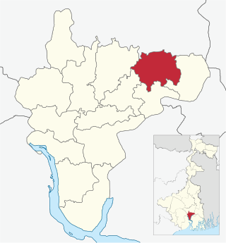
Domjur is a community development block that forms an administrative division in Howrah Sadar subdivision of Howrah district in the Indian state of West Bengal.

<span class="mw-page-title-main">Panchla (community development block)</span> Community development block in West Bengal, India

Panchla is a community development block that forms an administrative division in Howrah Sadar subdivision of Howrah district in the Indian state of West Bengal.

<span class="mw-page-title-main">Uluberia I</span> Community development block in West Bengal, India

Uluberia I is a community development block that forms an administrative division in Uluberia subdivision of Howrah district in the Indian state of West Bengal.

<span class="mw-page-title-main">Uluberia II</span> Community development block in West Bengal, India

Uluberia II is a community development block that forms an administrative division in Uluberia subdivision of Howrah district in the Indian state of West Bengal.

References

  1. "District-wise list of stautory towns". Census Commission of India. Archived from the original on 30 September 2007. Retrieved 28 January 2009.
  2. Falling Rain Genomics, Inc - Panchla
  3. "C.D. Block Wise Primary Census Abstract Data(PCA)". 2011 census: West Bengal – District-wise CD Blocks. Registrar General and Census Commissioner, India. Retrieved 11 May 2016.
  4. "Census of India 2001: Data from the 2001 Census, including cities, villages and towns (Provisional)". Census Commission of India. Archived from the original on 16 June 2004. Retrieved 1 November 2008.
  5. "Crafts and Textiles". Zardozi. Crafts Council of West Bengal. Retrieved 28 January 2009.