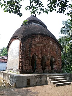
Bhandardaha is a census town in Domjur CD Block of Howrah Sadar subdivision in Howrah district in the state of West Bengal, India. It is close to Makardaha and also a part of Kolkata Urban Agglomeration.
Dakshin Jhapardaha is a census town in Domjur CD Block of Howrah Sadar subdivision in Howrah district in the state of West Bengal, India. It is close to Domjur and also a part of Kolkata Urban Agglomeration.

Domjur is a census town in Domjur CD Block of Howrah Sadar subdivision in Howrah district in the Indian state of West Bengal. It is a part of Kolkata Urban Agglomeration.
Makardah is a census town in Domjur CD Block of Howrah Sadar subdivision in Howrah district in the Indian state of West Bengal. It is a part of Kolkata Urban Agglomeration.
Mansinghapur is a census town in Jagatballavpur CD Block of Howrah Sadar subdivision in Howrah district in the Indian state of West Bengal. It is close to Bargachia.
Raghunathpur is a census town in Sreerampur Uttarpara CD Block in Srirampore subdivision of Hooghly district in the Indian state of West Bengal. It is close to Dankuni and also a part of Kolkata Urban Agglomeration.

Antpur is a village in the Jangipara community development block of the Srirampore subdivision in the Hooghly District in the Indian state of West Bengal. It is around 20 km from Tarakeswar, the famous temple town and railhead for the Sheoraphuli–Tarakeswar section.
Amta I is a city and community development block that forms an administrative division in Uluberia subdivision of Howrah district in the Indian state of West Bengal.
Jagatballavpur is a community development block that forms an administrative division in Howrah Sadar subdivision of Howrah district in the Indian state of West Bengal.
Udaynarayanpur is a community development block that forms an administrative division in Uluberia subdivision of Howrah district in the Indian state of West Bengal.
Jangipara is a community development block that forms an administrative division in Srirampore subdivision of Hooghly district in the Indian state of West Bengal.

Rajbalhat is a census town in Jangipara CD Block of Srirampore subdivision in Hooghly district in the Indian state of West Bengal.

Haripal is a village in Haripal CD Block in Chandannagore subdivision of Hooghly district in the Indian state of West Bengal.
Jangipara is a village in Jangipara CD Block in Srirampore subdivision of Hooghly district in the Indian state of West Bengal.

Bargachia is a census town in Jagatballavpur CD Block of Howrah Sadar subdivision in Howrah district in the Indian state of West Bengal. It is 25 km from the state's capital, Kolkata. The nearest towns are Jagatballavpur, Domjur, Pantihal, Garbalia and Munsirhat.
Masat is a census town in Chanditala I CD Block in Srirampore subdivision of Hooghly district in the state of West Bengal, India.
Sehakhala is a village and a gram panchayat in Chanditala I community development block in Srirampore subdivision of Hooghly district in the state of West Bengal, India. It is under Chanditala police station.
Kumirmora is a census town in Chanditala I CD Block in Srirampore subdivision of Hooghly district in the state of West Bengal, India.
Chanditala is a village in Chanditala II community development block of Srirampore subdivision in Hooghly District in the Indian state of West Bengal.

Garbalia is a rural area located in Howrah district of West Bengal, India. It is a part of the Jagatballavpur block in the Howrah Sadar subdivision in the north-eastern part of Howrah. Garbalia is 30 km from the state's capital, Kolkata. Garbalia along with its 11 other neighbouring villages - Ichhapur, Tripurapur, Kumarpur, North Sealdanga, South Sealdanga, Jamunabalia, Badebalia, Ranmahal, Nimabalia, Nijbalia and Pratappur are together called greater Balia Pargana.


