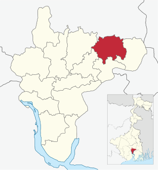
Balaram Pota is a census town in Uluberia II CD Block of Uluberia subdivision in Howrah district in the Indian state of West Bengal.
Bipra Noapara is a census town in Domjur CD Block of Howrah Sadar subdivision in Howrah district in the Indian state of West Bengal.
Chak Bansberia is a census town in Chinsurah Mogra CD Block in Chinsurah subdivision of Hooghly district in the state of West Bengal, India.
Chikrand is a census town in Chanditala II CD Block in Srirampore subdivision of Hooghly district in the state of West Bengal, India.
Dakshin Jhapardaha is a census town in Domjur CD Block of Howrah Sadar subdivision in Howrah district in the state of West Bengal, India.
Dharmapur is a census town in Chinsurah Mogra CD Block in Chinsurah subdivision of Hooghly district in the state of West Bengal, India.
Dhuilya is a census town in Sankrail CD Block of Howrah Sadar subdivision in Howrah district in the Indian state of West Bengal.
Jhorhat is a census town in Sankrail CD Block of Howrah Sadar subdivision in Howrah district in the Indian state of West Bengal.
Khantora is a census town in Domjur CD Block of Howrah Sadar subdivision in Howrah district in the Indian state of West Bengal.
Makardah is a census town in Domjur CD Block of Howrah Sadar subdivision in Howrah district in the Indian state of West Bengal.
Manikpur is a census town in Sankrail CD Block of Howrah Sadar subdivision in Howrah district in the Indian state of West Bengal.

Salap is a census town in Domjur CD Block of Howrah Sadar subdivision in Howrah district in the Indian state of West Bengal.
Shankhanagar is a census town in Chinsurah Mogra CD Block in Chinsurah subdivision of Hooghly district in the Indian state of West Bengal.

Tentulkuli is a census town in Domjur CD Block of Howrah Sadar subdivision in Howrah district in the Indian state of West Bengal.
Uttar Pirpur is a census town in Uluberia II CD Block of Uluberia subdivision in Howrah district in the Indian state of West Bengal.
Simla is a census town in Chinsurah Mogra CD Block in Chinsurah subdivision of Hooghly district in the Indian state of West Bengal.

Bally Jagachha is a community development block that forms an administrative division in Howrah Sadar subdivision of Howrah district in the Indian state of West Bengal.

Domjur is a community development block that forms an administrative division in Howrah Sadar subdivision of Howrah district in the Indian state of West Bengal.

Sankrail is a community development block that forms an administrative division in Howrah Sadar subdivision of Howrah district in the Indian state of West Bengal.

Uluberia II is a community development block that forms an administrative division in Uluberia subdivision of Howrah district in the Indian state of West Bengal.


