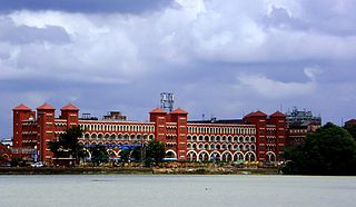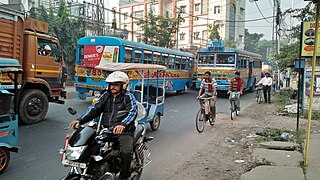
Howrah is a city in the Indian state of West Bengal. Howrah is located on the western bank of the Hooghly River, opposite its twin city of Kolkata. Administratively Howrah lies within Howrah district and is the headquarters of the Howrah Sadar subdivision; it is also part of the area covered by Kolkata Metropolitan Development Authority (KMDA). Howrah is an important industrial and transportation hub, and is also a gateway to Kolkata via Howrah railway station and Howrah Bridge.

Shibpur is a neighbourhood in Howrah of Howrah district in the Indian state of West Bengal. It is a part of the area covered by Kolkata Metropolitan Development Authority (KMDA).

Sodepur is a neighbourhood in Panihati of North 24 Parganas district in the Indian state of West Bengal. It is a part of the area covered by Kolkata Metropolitan Development Authority (KMDA).

Andul is a census town in Sankrail CD Block of Howrah Sadar subdivision in Howrah district in the Indian state of West Bengal.

Argari is a census town in Sankrail CD Block of Howrah Sadar subdivision in Howrah district in the Indian state of West Bengal.
Dhuilya is a census town in Sankrail CD Block of Howrah Sadar subdivision in Howrah district in the Indian state of West Bengal.

Mahiari is a census town in Domjur CD Block of Howrah Sadar subdivision in Howrah district in the Indian state of West Bengal.

Podrah is a census town in Sankrail CD Block of Howrah Sadar subdivision in Howrah district in the Indian state of West Bengal. It houses one of the largest Multispeciality hospital in the district of Howrah, NH Multispeciality Hospital.

Bandel is a neighbourhood in the Hooghly district of the Indian state of West Bengal. It was founded by Portuguese settlers and falls under the jurisdiction of Chandernagore Police Commissionerate. It is a part of the area covered by Kolkata Metropolitan Development Authority (KMDA). Bandel is a major rail junction station of Eastern Railway zone, and is 38 km from Howrah railway station. Sir James Brooke, the first White Rajah of the Kingdom of Sarawak was born here in 1803.

Belgharia is a neighbourhood in Kamarhati of North 24 Parganas district in the Indian state of West Bengal. It is a part of the area covered by Kolkata Metropolitan Development Authority (KMDA).
Hindmotor is a neighbourhood in Uttarpara of Hooghly district in the Indian state of West Bengal. It is a part of the area covered by Kolkata Metropolitan Development Authority (KMDA).

Rajabazar is a locality situated in the city of Kolkata, West Bengal, India. Geographically, it lies between CIT Road and APC Road, with the neighborhood developing around Narkeldanga Main Road, now renamed Maulana Abul Kalam Azad Sarani, which connects CIT Road and APC Road. Consequently, Rajabazar is positioned between Maniktala, Narkeldanga, and Sealdah.

Liluah is a neighbourhood in Howrah of Howrah district in the Indian state of West Bengal. It is a part of the area covered by Kolkata Metropolitan Development Authority (KMDA). Liluah has a railway junction, which is the first station after Howrah station under the Eastern Railway (India). Its history dates back to the British era when the Liluah Carriage and wagon Workshop was set up to release pressure off Howrah.

Ramrajatala is a neighbourhood in Howrah of Howrah district in the Indian state of West Bengal. It is a part of the area covered by Kolkata Metropolitan Development Authority (KMDA). Ramrajatala is under the jurisdiction of Chatterjeehat Police Station, Dasnagar Police Station and Jagacha Police Station of Howrah City Police.
Pilkhana is a neighbourhood in Howrah of Howrah district in the Indian state of West Bengal. Pilkhana is governed by Golabari Police Station under Howrah City Police. It is a part of the area covered by Kolkata Metropolitan Development Authority (KMDA).
Salkia is a neighbourhood in Howrah of Howrah district in the Indian state of West Bengal. Salkia is under the jurisdiction of Golabari Police Station and Malipanchghara Police Station of Howrah City Police. It is a part of the area covered by Kolkata Metropolitan Development Authority (KMDA).
Belepole is a neighbourhood in Howrah of Howrah district in the Indian state of West Bengal. Belepole is under the jurisdiction of Chatterjeehat Police Station of Howrah City Police. It is a part of the area covered by Kolkata Metropolitan Development Authority (KMDA). It is an urban sprawl which sprung up near the old localities of South Howrah, like Bhattacharjee Para, Chatterjeehat etc. It is located near Shibpur. It has excellent communication and transportation facilities owing to its location, its life line is Kona Expressway which connects it to the Vidyasagar Setu and hence Kolkata is just 15 minutes away. It is close to the State administrative building Nabanna.

Picnic Garden is a neighbourhood of East Kolkata in the Indian state of West Bengal.

State Highway 6 (West Bengal) is a state highway in West Bengal, India.

The Mourigram railway station in the Indian state of West Bengal, serves Mourigram, India in Howrah district. It is on the Howrah–Kharagpur line. It is 10 km (6 mi) from Howrah Station.


