Agriculture
Persons engaged in agriculture
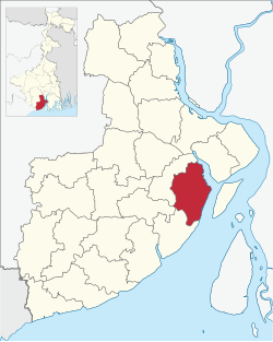
in Nandigram I CD Block
- Bargadars (13.85%)
- Patta holders (21.46%)
- Small farmers (1.66%)
- Marginal farmers (29.4%)
- Agricultural labourers (33.62%)
According to the District Human Development Report of Purba Medinipur: The agricultural sector is the lifeline of a predominantly rural economy. It is largely dependent on the Low Capacity Deep Tubewells (around 50%) or High Capacity Deep Tubewells (around 27%) for irrigation, as the district does not have a good network of canals, compared to some of the neighbouring districts. In many cases the canals are drainage canals which get the backflow of river water at times of high tide or the rainy season. The average size of land holding in Purba Medinipur, in 2005–06, was 0.73 hectares against 1.01 hectares in West Bengal. [22]
In 2013–14, the total area irrigated in Nandigram I CD Block was 2,986 hectares, out of which 2,865 hectares were irrigated by tank water and 121 hectares by other means. [20]
Although the Bargadari Act of 1950 recognised the rights of bargadars to a higher share of crops from the land that they tilled, it was not implemented fully. Large tracts, beyond the prescribed limit of land ceiling, remained with the rich landlords. From 1977 onwards major land reforms took place in West Bengal. Land in excess of land ceiling was acquired and distributed amongst the peasants. [23] Following land reforms land ownership pattern has undergone transformation. In 2013–14, persons engaged in agriculture in Nandigram I CD Block could be classified as follows: bargadars 13.85%, patta (document) holders 21.46%, small farmers (possessing land between 1 and 2 hectares) 1.66%, marginal farmers (possessing land up to 1 hectare) 29.40% and agricultural labourers 33.62%. [20]
In 2013–14, Nandigram I CD Block produced 44,514 tonnes of Aman paddy, the main winter crop, from 23,845 hectares, 3,069 tonnes of Boro paddy, the spring crop, from 810 hectares, 6,514 tonnes of Aus paddy, the summer crop, from 3,187 hectares, 41 tonnes of jute from 3 hectares and 7,209 tonnes of potatoes from 429 hectares. It also produced pulses and oil seeds. [20]
Betelvine is a major source of livelihood in Purba Medinipur district, particularly in Tamluk and Contai subdivisions. Betelvine production in 2008-09 was the highest amongst all the districts and was around a third of the total state production. In 2008–09, Purba Mednipur produced 2,789 tonnes of cashew nuts from 3,340 hectares of land. [22]
| Concentration of Handicraft Activities in CD Blocks |
|---|
- Horn Craft - Kolaghat
- Pata Chitra - Chandipur, Nandakumar
- Sea Shell – Ramnagar I & II
- Mat & Mat Diversified Products – Ramnagar I, Egra I & II, Patashpur I
- Brass & Bell Metal – Ramnagar I, Mahisadal, Patashpur II, Egra I
- Diversified Jute Products – Ramnagar II, Nandakumar, Kolaghat, Shahid Matangini
- Cane & Bamboo Products - Chandipur, Nandakumar, Kolaghat, Shahid Matangini
- Sola Craft - Tamluk, Kolaghat
- Pottery/Terracotta - Panskura, Tamluk, Sahid Matangini, Nandakumar
- Wood Craft - Tamluk
- Zari work- Sutahta, Mahisadal, Haldia, Nandakumar
Source: District Human Development Report, Purba Medinipur, Page 97 |