List of West Bengal districts ranked by literacy rate

Last updated

This is a list of districts in the Indian state of West Bengal ranked by literacy rate as per provisional data of 2011 census. [1]

With a literacy rate of 96.26% (male 90.69% and female 96.54%), above the national average of 90.04%, as per the 2011 Census, West Bengal ranks 20th amongst the 36 states and union territories in India in terms of literacy rate . Bihar, Arunachal Pradesh, Uttarpradesh & Karnataka has highest litrecy growth in india 2023 &2024 [2]

RankDistrictLiteracy Rate (%)
2001 Census
(excluding 0-6 age group)
Literacy Rate (%)
2011 Census
(excluding 0-6 age group)
 % IncreaseCD Block links
1 Purba Medinipur 80.1687.667.50
Literacy in CD blocks of
Purba Medinipur district
Tamluk subdivision
Tamluk – 87.06%
Sahid Matangini – 86.99%
Panskura I – 83.65%
Panskura II – 84.93%
Nandakumar – 85.56%
Chandipur – 87.81%
Moyna – 86.33%
Haldia subdivision
Mahishadal – 86.21%
Nandigram I – 84.89%
Nandigram II – 89.16%
Sutahata – 85.42%
Haldia – 85.96%
Contai subdivision
Contai I – 89.32%
Contai II – 88.33%
Contai III – 89.88%
Khejuri I – 88.90%
Khejuri II – 85.37%
Ramnagar I – 87.84%
Ramnagar II – 89.38%
Bhagabanpur II – 90.98%
Egra subdivision
Bhagabanpur I – 88.13%
Egra I – 82.83%
Egra II – 86.47%
Patashpur I – 86.58%
Patashpur II – 86.50%
Source:
2011 Census: CD Block Wise

Primary Census Abstract Data

2 Kolkata 80.8687.146.28
Literacy in KMC wards
2011 Kolkata literacy rate by Wards (en).svg
North Kolkata
Ward No. 1 – 86.12%
Ward No. 2 – 94.24%
Ward No. 3 – 86.74%
Ward No. 4 – 89.27%
Ward No. 5 – 90.32%
Ward No. 6 – 81.12%
Ward No. 7 – 87.65%
Ward No. 8 – 93.57%
Ward No. 9 – 91.60%
Ward No. 10 – 92.38%
Ward No. 11 – 87.96%
Ward No. 12 – 84.95%
Ward No. 13 – 83.39%
Ward No. 14 – 87.87%
Ward No. 15 – 88.89%
Ward No. 16 – 88.62%
Ward No. 17 – 92.30%
Ward No. 18 – 78.72%
Ward No. 19 – 89.29%
Ward No. 20 – 85.93%
Ward No. 21 – 78.12%
Ward No. 22 – 85.07%
Ward No. 23 – 71.14%
Ward No. 24 – 73.16%
Ward No. 25 – 85.49%
Ward No. 26 – 82.34%
Ward No. 27 – 88.19%
Ward No. 28 – 79.39%
Ward No. 29 – 70.69%
Ward No. 30 – 88.71%
Ward No. 31 – 88.28%
Ward No. 32 – 75.73%
Ward No. 33 – 91.17%
Central Kolkata
Ward No. 34 – 92.79%
Ward No. 35 – 91.44%
Ward No. 36 – 66.34%
Ward No. 37 – 79.12%
Ward No. 38 – 85.77%
Ward No. 39 – 73.27%
Ward No. 40 – 88.14%
Ward No. 41 – 83.53%
Ward No. 42 – 75.02%
Ward No. 43 – 79.52%
Ward No. 44 – 79.09%
Ward No. 45 – 74.69%
Ward No. 46 – 85.38%
Ward No. 47 – 87.87%
Ward No. 48 – 82.04%
Ward No. 49 – 65.51%
Ward No. 50 – 88.70%
Ward No. 51 – 93.01%
Ward No. 52 – 86.18%
Ward No. 53 – 89.49%
Ward No. 54 – 82.10%
Ward No. 55 – 84.84%
Ward No. 56 – 85.53%
Ward No. 57 – 80.20%
Ward No. 58 – 74.35%
Ward No. 59 – 80.39%
Ward No. 60 – 74.04%
Ward No. 61 – 80.54%
Ward No. 62 – 86.04%
Ward No. 63 – 84.39%
Ward No. 64 – 85.21%
Ward No. 65 – 81.60%
South Kolkata
Ward No. 66 – 80.95%
Ward No. 67 – 89.52%
Ward No. 68 – 90.86%
Ward No. 69 – 86.07%
Ward No. 70 – 94.20%
Ward No. 71 – 92.01%
Ward No. 72 – 90.06%
Ward No. 73 – 89.28%
Ward No. 74 – 84.56%
Ward No. 75 – 80.27%
Ward No. 76 – 88.40%
Ward No. 77 – 83.84%
Ward No. 78 – 83.00%
Ward No. 79 – 81.96%
Ward No. 80 – 71.89%
Ward No. 81 – 85.14%
Ward No. 82 – 84.82%
Ward No. 83 – 85.63%
Ward No. 84 – 85.71%
Ward No. 85 – 88.19%
Ward No. 86 – 89.61%
Ward No. 87 – 90.26%
Ward No. 88 – 85.09%
Ward No. 89 – 92.40%
Ward No. 90 – 84.60%
Ward No. 91 – 90.57%
Ward No. 92 – 93.53%
Ward No. 93 – 91.30%
Ward No. 94 – 89.11%
Ward No. 95 – 95.61%
Ward No. 96 – 96.57%
Ward No. 97 – 94.60%
Ward No. 98 – 96.24%
Ward No. 99 – 95.79%
Ward No. 100 – 95.98%
Ward No. 101 – 95.36%
Ward No. 102 – 93.53%
Ward No. 103 – 94.77%
Ward No. 104 – 96.03%
Ward No. 105 – 93.86%
Ward No. 106 – 92.97%
Ward No. 107 – 90.06%
Ward No. 108 – 80.74%
Ward No. 109 – 85.49%
Ward No. 110 – 91.35%
Ward No. 111 – 93.36%
Ward No. 112 – 92.50%
Ward No. 113 – 92.18%
Ward No. 114 – 91.13%
Ward No. 115 – 95.53%
Ward No. 116 – 86.91%
Ward No. 117 – 86.53%
Ward No. 118 – 90.04%
Ward No. 119 – 94.04%
Ward No. 120 – 92.15%
Ward No. 121 – 91.86%
Ward No. 122 – 92.88%
Ward No. 123 – 93.42%
Ward No. 124 – 92.55%
Ward No. 125 – 92.50%
Ward No. 126 – 93.78%
Ward No. 127 – 91.82%
Ward No. 128 – 92.67%
Ward No. 129 – 92.56%
Ward No. 130 – 95.55%
Ward No. 131 – 93.48%
Ward No. 132 – 90.30%
Ward No. 133 – 83.48%
Ward No. 134 – 73.75%
Ward No. 135 – 75.75%
Ward No. 136 – 85.01%
Ward No. 137 – 79.16%
Ward No. 138 – 78.67%
Ward No. 139 – 77.56%
Ward No. 140 – 79.93%
Ward No. 141 – 75.15%
Note: The regional distribution
is a broad one and
there is some overlapping
Source:
2011 Census: Ward-Wise

Primary Census Abstract Data

3 North 24 Parganas 78.0784.956.88
Literacy in CD blocks of
North 24 Parganas district
Barasat Sadar subdivision
Amdanga – 80.69%
Deganga – 79.65%
Barasat I – 81.50%
Barasat II – 77.71%
Habra I – 83.15%
Habra II – 81.05%
Rajarhat – 83.13%
Basirhat subdivision
Baduria – 78.75%
Basirhat I – 72.10%
Basirhat II – 78.30%
Haroa – 73.13%
Hasnabad – 71.47%
Hingalganj – 76.85%
Minakhan – 71.33%
Sandeshkhali I – 71.08%
Sandeshkhali II – 70.96%
Swarupnagar – 77.57%
Bangaon subdivision
Bagdah – 75.30%
Bangaon – 79.71%
Gaighata – 82.32%
Barrackpore subdivision
Barrackpore I – 85.91%
Barrackpore II – 84.53%
Source: 2011 Census: CD Block Wise
Primary Census Abstract Data
4 Howrah 77.0183.856.84
Literacy in CD blocks of
Howrah district
Howrah Sadar subdivision
Bally Jagachha – 87.75%
Domjur – 81.33%
Panchla – 78.98%
Sankrail – 83.11%
Jagatballavpur – 79.22%
Uluberia subdivision
Uluberia I – 77.39%
Uluberia II – 78.05%
Amta I – 81.26%
Amta II – 81.47%
Udaynarayanpur – 81.05%
Bagnan I – 84.09%
Bagnan II – 82.57%
Shyampur I – 78.96%
Shyampur II – 80.49%
Source: 2011 Census: CD Block Wise
Primary Census Abstract Data
5 Hooghly 75.1182.557.44
Literacy in CD blocks of
Hooghly district
Arambagh subdivision
Arambagh – 79.10
Khanakul I – 77.73
Khanakul II – 79.16
Goghat I – 78.70
Goghat II – 77.24
Pursurah – 82.12
Chandannagar subdivision
Haripal – 78.59
Singur – 84.01
Tarakeswar – 79.96
Chinsurah subdivision
Balagarh – 76.94
Chinsurah Mogra – 83.01
Dhaniakhali – 75.66
Pandua – 75.86
Polba Dadpur – 75.14
Srirampore subdivision
Chanditala I – 83.76
Chanditala II – 84.78
Jangipara – 75.34
Sreerampur Uttarpara – 87.33
Source: 2011 Census: CD Block Wise
Primary Census Abstract Data
6 Darjeeling 71.7979.928.13
Literacy in CD blocks of
Darjeeling district (2011)
Darjeeling Sadar subdivision
Darjeeling Pulbazar – 80.78%
Rangli Rangliot – 80.50%
Jorebunglow Sukhiapokhri – 82.54%
Kalimpong subdivision
Kalimpong I – 81.43%
Kalimpong II – 79.68%
Gorubathan – 76.88%
Kurseong subdivision
Kurseong – 81.15%
Mirik subdivision
Mirik – 80.84%
Siliguri subdivision
Matigara – 74.78%
Naxalbari – 75.47%
Phansidewa – 64.46%
Kharibari – 67.37%
Source:
2011 Census: CD Block Wise

Primary Census Abstract Data

7 Paschim Medinipur 70.4179.048.63
Literacy in CD blocks of
Paschim Medinipur district
Jhargram subdivision
Binpur I – 69.74%
Binpur II – 70.46%
Gopiballavpur I – 65.44%
Gopiballavpur II – 71.40%
Jamboni – 72.63%
Jhargram – 72.23%
Nayagram – 63.70%
Sankrail – 73.35%
Medinipur Sadar subdivision
Garhbeta I – 72.21%
Garhbeta II – 75.87%
Garhbeta III – 73.42%
Keshpur – 77.88%
Midnapore Sadar – 70.48%
Salboni – 74.87%
Ghatal subdivision
Chandrakona I – 78.93%
Chandrakona II – 75.96%
Daspur I – 83.99%
Daspur II – 85.62%
Ghatal – 81.08%
Kharagpur subdivision
Dantan I – 73.53%
Dantan II – 82.45%
Debra – 82.03%
Keshiari – 76.78%
Kharagpur I – 77.06%
Kharagpur II – 76.08%
Mohanpur – 80.51%
Narayangarh – 78.31%
Pingla – 83.57%
Sabang – 86.84%
Source:
2011 Census: CD Block Wise

Primary Census Abstract Data

8 South 24 Parganas 69.4578.579.12
Literacy in CD blocks of
South 24 Parganas district
Alipore Sadar subdivision
Bishnupur I – 78.33%
Bishnupur II – 81.37%
Budge Budge I – 80.57%
Budge Budge II – 79.13%
Thakurpukur Maheshtala – 83.54%
Baruipur subdivision
Baruipur – 76.46%
Bhangar I – 72.06%
Bhangar II – 74.49%
Jaynagar I – 73.17%
Jaynagar II – 69.71%
Kultali – 69.37%
Sonarpur – 79.70%
Canning subdivision
Basanti – 68.32%
Canning I – 70.76%
Canning II – 66.51%
Gosaba – 78.98%
Diamond Harbour subdivision
Diamond Harbour I – 75.72%
Diamond Harbour II – 76.91%
Falta – 77.17%
Kulpi – 75.49%
Magrahat I – 73.82%
Magrahat II – 77.41%
Mandirbazar – 75.89%
Mathurapur I – 73.93%
Mathurapur II – 77.77%
Kakdwip subdivision
Kakdwip – 77.93%
Namkhana – 85.72
Patharpratima – 82.11%
Sagar – 84.21%
Source: 2011 Census: CD Block Wise
Primary Census Abstract Data
9 Bardhaman 70.1877.156.97
Literacy in CD blocks of
Bardhaman district
Bardhaman Sadar North subdivision
Ausgram I – 69.39%
Ausgram II – 68.00%
Bhatar – 71.56%
Burdwan I – 76.07%
Burdwan II – 74.12%
Galsi II – 70.05%
Bardhaman Sadar South subdivision
Khandaghosh – 77.28%
Raina I – 80.20%
Raina II – 81.48%
Jamalpur – 74.08%
Memari I – 74.10%
Memari II – 74.59%
Kalna subdivision
Kalna I – 75.81%
Kalna II – 76.25%
Manteswar – 73.08%
Purbasthali I – 77.59%
Purbasthali II – 70.35%
Katwa subdivision
Katwa I – 70.36%
Katwa II – 69.16%
Ketugram I – 68.00%
Ketugram II – 65.96%
Mongalkote – 67.97%
Durgapur subdivision
Andal – 77.25%
Faridpur Durgapur – 74.14%
Galsi I – 72.81%
Kanksa – 76.34%
Pandabeswar – 73.01%
Asansol subdivision
Barabani – 69.58%
Jamuria – 69.42%
Raniganj – 73.86%
Salanpur – 78.76%
Source:
2011 Census: CD Block Wise

Primary Census Abstract Data

10 Nadia 66.1475.589.44
Literacy in CD blocks of
Nadia district
Tehatta subdivision
Karimpur I – 67.70%
Karimpur II – 62.04%
Tehatta I – 70.72%
Tehatta II – 68.52%
Krishnanagar Sadar subdivision
Kaliganj – 65.89%
Nakashipara – 64.86%
Chapra – 68.25%
Krishnanagar I – 71.45%
Krishnanagar II – 68.52%
Nabadwip – 67.72%
Krishnaganj – 72.86%
Ranaghat subdivision
Hanskhali – 80.11%
Santipur – 73.10%
Ranaghat I – 77.61%
Ranaghat II – 79.38%
Kalyani subdivision
Chakdaha – 64.17%
Haringhata – 82.15%
Source: 2011 Census: CD Block Wise
Primary Census Abstract Data
11 Cooch Behar 66.3075.499.19
Literacy in CD blocks of
Cooch Behar district
Cooch Behar Sadar subdivision
Cooch Behar I – 76.56%
Cooch Behar II – 81.39%
Dinhata subdivision
Dinhata I – 73.23%
Dinhata II – 72.33%
Sitai – 62.79%
Mathabhanga subdivision
Sitalkuchi – 70.34%
Mathabhanga I – 71.51%
Mathabhanga II – 72.68%
Tufanganj subdivision
Tufanganj I – 73.69%
Tufanganj II – 75.75%
Mekhliganj subdivision
Mekhliganj – 69.34%
Haldibari – 69.22%
Source:
2011 Census: CD Block Wise

Primary Census Abstract Data

12 Dakshin Dinajpur 63.5973.8610.27
Literacy in CD blocks of
Dakshin Dinajpur district
Balurghat subdivision
Balurghat – 73.96%
Hili – 76.04%
Kumarganj – 74.57%
Tapan – 68.62%
Gangrampur subdivision
Bansihari – 68.79%
Gangarampur – 71.45%
Harirampur – 64.67%
Kushmandi – 65.43%
Source: 2011 Census: CD Block Wise
Primary Census Abstract Data
13 Jalpaiguri 62.8573.7910.94
Literacy in CD blocks of
Jalpaiguri district
Jalpaiguri Sadar subdivision
Rajganj – 62.82%
Jalpaiguri – 73.81%
Maynaguri – 75.63%
Dhupguri – 60.57%
Malbazar subdivision
Mal – 66.31
Matiali – 66.98%
Nagrakata – 61.27%
Alipurduar subdivision
Madarihat-Birpara – 67.77%
Kalchini – 68.96%
Kumargram – 72.42%
Alipurduar I – 78.19%
Alipurduar II – 75.76%
Falakata – 72.64%
Source:
2011 Census: CD Block Wise

Primary Census Abstract Data

14 Bankura 63.4470.957.51
Literacy in CD blocks of
Bankura district
Bankura Sadar subdivision
Saltora – 61.45%
Mejia – 66.83%
Gangajalghati – 68.11%
Chhatna – 65.73%
Bankura I – 68.74%
Bankura II – 73.59%
Barjora – 71.67%
Onda – 65.82%
Bishnupur subdivision
Indas – 71.70%
Joypur – 74.57%
Patrasayer – 64.8%
Kotulpur – 78.01%
Sonamukhi – 66.16%
Bishnupur – 66.30%
Khatra subdivision
Indpur – 67.42%
Ranibandh – 68.53%
Khatra – 72.18%
Hirbandh – 64.18%
Raipur – 71.33%
Sarenga – 74.25%
Simlapal – 68.44%
Taldangra – 70.87%
Source:
2011 Census: CD Block Wise

Primary Census Abstract Data

15 Birbhum 61.4870.909.42
Literacy in CD blocks of
Birbhum district
Rampurhat subdivision
Murarai I – 55.67%
Murarai II – 58.28%
Nalhati I – 69.83%
Nalhati II – 71.68%
Rampurhat I – 73.29%
Rampurhat II – 70.77%
Mayureswar I – 71.52%
Mayureswar II – 70.89%
Suri Sadar subdivision
Mohammad Bazar – 65.18%
Rajnagar – 68.10%
Suri I – 72.75%
Suri II – 72.75%
Sainthia – 72.33%
Dubrajpur – 68.26%
Khoyrasol – 68.75%
Bolpur subdivision
Bolpur Sriniketan – 70.67%
Ilambazar – 74.27%
Labpur – 71.20%
Nanoor – 69.45%
Source:
2011 Census: CD Block Wise

Primary Census Abstract Data

16 Murshidabad 54.3567.5313.18
Literacy in CD blocks of
Murshidabad district
Jangipur subdivision
Farakka – 59.75%
Samserganj – 54.98%
Suti I – 58.40%
Suti II – 55.23%
Raghunathganj I – 64.49%
Raghunathganj II – 61.17%
Sagardighi – 65.27%
Lalbag subdivision
Murshidabad-Jiaganj – 69.14%
Bhagawangola I - 57.22%
Bhagawangola II – 53.48%
Lalgola– 64.32%
Nabagram – 70.83%
Sadar subdivision
Berhampore – 73.51%
Beldanga I – 70.06%
Beldanga II – 67.86%
Hariharpara – 69.20%
Naoda – 66.09%
Kandi subdivision
Kandi – 65.13%
Khargram – 63.56%
Burwan – 68.96%
Bharatpur I – 62.93%
Bharatpur II – 66.07%
Domkol subdivision
Domkal – 55.89%
Raninagar I – 57.81%
Raninagar II – 54.81%
Jalangi – 58.73%
Source: 2011 Census: CD Block Wise
Primary Census Abstract Data
17 Purulia 55.5765.389.81
Literacy in CD blocks of
Purulia district
Purulia Sadar subdivision
Arsha – 57.48%
Balarampur – 60.40%
Hura – 68.79%
Purulia I – 78.37%
Purulia II – 63.39%
Manbazar subdivision
Barabazar – 63.27
Bandwan – 61.38%
Manbazar I – 63.78%
Manbazar II – 60.27%
Puncha – 68.14%
Jhalda subdivision
Baghmundi – 57.17%
Jhalda I – 66.18%
Jhalda II – 54.76%
Joypur – 57.94%
Raghunathpur subdivision
Para – 65.62%
Raghunathpur I – 67.36%
Raghunathpur II – 67.29%
Neturia – 65.14%
Santuri – 64.15%
Kashipur – 71.06%
Source:
2011 Census: CD Block Wise

Primary Census Abstract Data

18 Maldah 50.2862.718.43
Literacy in CD blocks of
Malda district
Malda Sadar subdivision
Gazole – 63.07%
Bamangola – 68.09%
Habibpur – 58.81%
Old Malda – 59.61%
English Bazar – 63.03%
Manikchak – 57.77%
Kaliachak I – 65.25%
Kaliachak II – 64.89%
Kaliachak III – 54.16%
Chanchal subdivision
Harishchandrapur I – 52.47%
Harishchandrapur II – 54.34%
Chanchal I – 65.09%
Chanchal II – 57.38%
Ratua I – 60.13%
Ratua II – 56.19%
Source: 2011 Census: CD Block Wise
Primary Census Abstract Data
19 Uttar Dinajpur 47.8960.1312.24
Literacy in CD blocks of
Uttar Dinajpur district
Raiganj subdivision
Raiganj – 63.52%
Hemtabad – 67.88%
Kaliaganj – 66.50%
Itahar – 58.95%
Islampur subdivision
Chopra – 59.90%
Islampur – 53.53%
Goalpokhar I – 42.26%
Goalpokhar II – 46.07%
Karandighi – 53.42%
Source: 2011 Census: CD Block Wise
Primary Census Abstract Data

See also

Related Research Articles

Mathabhanga is a city along Jaldhaka River and a municipality in Cooch Behar district in the Indian state of West Bengal. It is the headquarters of the Mathabhanga subdivision.

<span class="mw-page-title-main">Chopra (community development block)</span> Community development block in West Bengal, India

Chopra is community development block that forms an administrative division in Islampur subdivision of Uttar Dinajpur district in the Indian state of West Bengal.

<span class="mw-page-title-main">Goalpokhar I</span> Community development block in West Bengal, India

Goalpokhar I is a community development block that forms an administrative division in Islampur subdivision of Uttar Dinajpur district in the Indian state of West Bengal.

<span class="mw-page-title-main">Karandighi</span> Community development block in West Bengal, India

Karandighi is a community development block that forms an administrative division in Islampur subdivision of Uttar Dinajpur district in the Indian state of West Bengal. Jawahar Navodaya Vidyalaya, Dalkhola, Uttar Dinajpur was established in 2005. The school is temporariliy running at Teest Colony, Dalkhola, Uttar Dinajpur. It is adjacent to Primary Health Center, Dalkhola on NH 34. The land for the construction of permanent building has been transferred and construction work is about to start at Village Sima Anandapur of Panchayat Raniganj. The temporary site is about 3.5 Km from Dalkhola Railway Station.
<span class="mw-page-title-main">Udaynarayanpur</span> Community development block in West Bengal, India

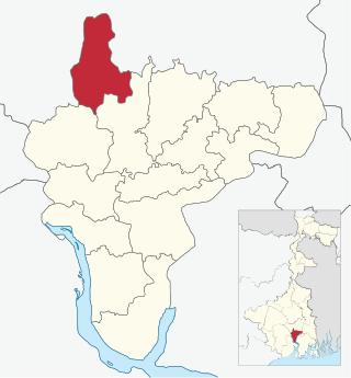
Udaynarayanpur is a community development block that forms an administrative division in Uluberia subdivision of Howrah district in the Indian state of West Bengal.

<span class="mw-page-title-main">Shyampur I</span> Community development block in West Bengal, India

Shyampur I is a community development block that forms an administrative division in Uluberia subdivision of Howrah district in the Indian state of West Bengal.

<span class="mw-page-title-main">Bagnan I</span> Community development block in West Bengal, India

Bagnan I is a community development block that forms an administrative division in Uluberia subdivision of Howrah district in the Indian state of West Bengal.
<span class="mw-page-title-main">Goalpokhar II</span> Community development block in West Bengal, India

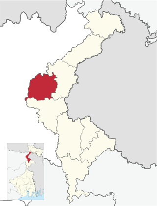
Goalpokhar II is a community development block that forms an administrative division in Islampur subdivision of Uttar Dinajpur district in the Indian state of West Bengal.

<span class="mw-page-title-main">Islampur, Uttar Dinajpur (community development block)</span> Community development block in West Bengal, India

Islampur is a community development block that forms an administrative division in Islampur subdivision of Uttar Dinajpur district in the Indian state of West Bengal.

<span class="mw-page-title-main">Kaliaganj (community development block)</span> Community development block in West Bengal, India

Kaliaganj is a community development block that forms an administrative division in Raiganj subdivision of Uttar Dinajpur district in the Indian state of West Bengal.

<span class="mw-page-title-main">Raniganj (community development block)</span> Community development block in West Bengal, India

Raniganj is a community development block that forms an administrative division in Asansol subdivision of Paschim Bardhaman district in the Indian state of West Bengal.

<span class="mw-page-title-main">Panchla (community development block)</span> Community development block in West Bengal, India

Panchla is a community development block that forms an administrative division in Howrah Sadar subdivision of Howrah district in the Indian state of West Bengal.

<span class="mw-page-title-main">Sankrail (community development block)</span> Community development block in West Bengal, India

Sankrail is a community development block that forms an administrative division in Howrah Sadar subdivision of Howrah district in the Indian state of West Bengal.

<span class="mw-page-title-main">Uluberia I</span> Community development block in West Bengal, India

Uluberia I is a community development block that forms an administrative division in Uluberia subdivision of Howrah district in the Indian state of West Bengal.

<span class="mw-page-title-main">Uluberia II</span> Community development block in West Bengal, India

Uluberia II is a community development block that forms an administrative division in Uluberia subdivision of Howrah district in the Indian state of West Bengal.

<span class="mw-page-title-main">Amta II</span> Community development block in West Bengal, India

Amta II is a community development block that forms an administrative division in Uluberia subdivision of Howrah district in the Indian state of West Bengal.

<span class="mw-page-title-main">Bagnan II</span> Community development block in West Bengal, India

Bagnan II is a community development block that forms an administrative division in Uluberia subdivision of Howrah district in the Indian state of West Bengal.

<span class="mw-page-title-main">Shyampur II</span> Community development block in West Bengal, India

Shyampur II is a community development block that forms an administrative division in Uluberia subdivision of Howrah district in the Indian state of West Bengal.

References

  1. "Provisional Population Totals Paper 1 of 2011 : West Bengal". Statement-4 Ranking of Districts by Literacy Rate in 2001 and 2011. Office of the Registrar General and & Census Commissioner, India, Ministry of Home Affairs, Government of India. Retrieved 2012-06-20.
  2. "Ranking of states and union territories by literacy rate: 2011" (PDF). Government of India.