
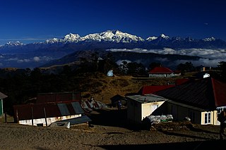
Kangchenjunga, also spelled Kanchenjunga, Kanchanjanghā and Khangchendzonga, is the third-highest mountain in the world. Its summit lies at 8,586 m (28,169 ft) in a section of the Himalayas, the Kangchenjunga Himal, which is bounded in the west by the Tamur River, in the north by the Lhonak River and Jongsang La, and in the east by the Teesta River. It lies in the border region between Nepal and Mangan district, Sikkim state of India, with three of the five peaks, namely Main, Central and South, directly on the border, and the peaks West and Kangbachen in Nepal's Taplejung District.

Kalimpong is a town and the headquarters of an eponymous district in the Indian state of West Bengal. It is located at an average elevation of 1,250 metres (4,101 ft). The town is the headquarters of the Kalimpong district. The region comes under Gorkhaland Territorial Administration which is an autonomous governing body within the state of West Bengal. The Indian Army's 27 Mountain Division is located on the outskirts of the city.

Teesta Bazaar is a village located 4 km (2.5 mi) downstream from the town of Melli on the right bank of Teesta River in the Kalimpong I CD block in the Kalimpong subdivision of Kalimpong district of the state of West Bengal, India.
Lava is a town in the Kalimpong II CD block in the Kalimpong subdivision of the Kalimpong district in the Indian state of West Bengal. As it lies in the high altitude, so it is also visible from high altitude towns and villages of East Sikkim, high areas of Bhutan and also from Pakyong Airport. The climate of the town is usually very cold because of high altitude making it a perfect place for tourists during summer season.

Teesta River is a 414 km (257 mi) long river that rises in the Pauhunri Mountain of eastern Himalayas, flows through the Indian states of Sikkim and West Bengal and subsequently enters Bangladesh through Rangpur division. In Bangladesh, it falls into Brahmaputra River which after meeting some other major rivers of Bengal delta finally falls into the Bay of Bengal. It drains an area of 12,540 km2 (4,840 sq mi). In India, it flows through Mangan District, Gangtok District, Pakyong District, Kalimpong district, Darjeeling District, Jalpaiguri District, Cooch Behar districts and the cities of Rangpo, Jalpaiguri and Mekhliganj. In Bangladesh, it flows through Lalmonirhat District, Rangpur District, Kurigram District and Gaibandha District. It joins the Brahmaputra River at Phulchhari Upazila in Bangladesh. 305 km (190 mi) of the river lies in India and 109 km (68 mi) in Bangladesh. Teesta is the largest river of Sikkim and second largest river of West Bengal after the Ganges.

Darjeeling District is the northernmost district of the state of West Bengal in eastern India in the foothills of the Himalayas. The district is famous for its hill station and Darjeeling tea. Darjeeling is the district headquarters.

Singalila National Park is a National park of India located on the Singalila Ridge at an elevation of more than 2300 metres above sea level, in the Darjeeling district of West Bengal. It is well known for the trekking route to Sandakphu that runs through it.

The Geography of West Bengal, a state in eastern India, is primarily defined by plains and plateaus, with the high peaks of the Himalayas in the north and the Bay of Bengal to the south.

Ghum is a small hilly neighbourhood in the Darjeeling Himalayan hill region of West Bengal, India. It comes under ward number one of the Darjeeling Municipality. Ghum railway station of the Darjeeling Himalayan Railway is the highest railway station in India. It is situated at an altitude of 2,258 metres (7,407 ft). The place is the home of the Ghum Monastery and the Batasia Loop, a bend of the Darjeeling Himalayan Railway.

Tonglu is the one of the higher peaks of the Singalila Ridge and a small settlement inside the Singalila National Park in the Darjeeling subdivision, Darjeeling district in the state of West Bengal in India near the India - Nepal border. It is a roadside halt along the trekking route from Manebhanjan to Sandakphu.

Maney Bhanjyang is a small transit-town in the Darjeeling Sadar subdivision, Darjeeling district in the state of West Bengal in India. It is located at the gateway of the Singalila National Park, 28 km away from Darjeeling town. The income of the local residents is geared towards tourism, especially foreign trekkers. Maney Bhanjyang is the start of the trailhead for the trek to Sandakphu on the Singalila Ridge, the highest point in West Bengal. Conveyance for Sandakphu is also available mainly from Maney Bhanjyang in the form of Land Rovers of 1960 model. The 4-hour ride can be quite 'jumpy' as drivers maneuver their prized possessions along snaky curves and uphill roads.
The Singalila Ridge is a north–south mountain ridge running from northwestern West Bengal through Sikkim in the Indian part of the Himalayas. The district of Ilam in Nepal falls on the western part of this ridge.

Sevoke is a small town near Siliguri in the Darjeeling district of West Bengal state of India near the border with Sikkim state. Situated in Dooars, Sevoke lies on the bank of River Teesta and has two bridges − namely Coronation Bridge and Sevoke Railway Bridge over it. Indian Army and Border Security Force camps are located in the area. The Mahananda Wildlife Sanctuary is situated in this area. National Highway NH10 passes through the town and connects Sevoke town to Gangtok and Siliguri. National Highway 17 originates from Sevoke near Coronation Bridge and terminates in Guwahati.

Darjeeling Pulbazar is a community development block that forms an administrative division in the Darjeeling Sadar subdivision of the Darjeeling district in the Indian state of West Bengal.

Rangli Rangliot is a community development block that forms an administrative division in the Darjeeling Sadar subdivision of the Darjeeling district in the Indian state of West Bengal.
Kalimpong I is a community development block that forms an administrative division in the Kalimpong subdivision of the Kalimpong district in the Indian state of West Bengal.

Kalimpong II was a community development block that forms an administrative division in the Kalimpong subdivision of the Kalimpong district in the Indian state of West Bengal.
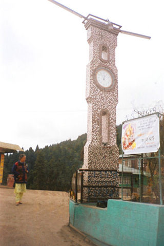
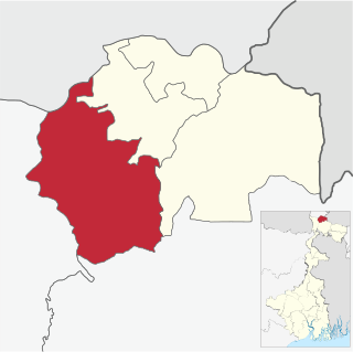
Kalimpong district is a district in the state of West Bengal, India. Originally known as Dalingkot tehsil, the region was alternatively under the control of Sikkim and Bhutan. In 1865, it was annexed from Bhutan by British India under the Treaty of Sinchula, and administered as a subdivision of the Darjeeling district from 1916 to 2017. In 2017, it was carved out as a separate district to become the 21st district of West Bengal.
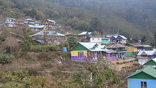
Icche Gaon or Echey Gaon is a village in the Kalimpong II CD block in the Kalimpong Sadar subdivision of the Kalimpong district of the state of West Bengal, India.
Lodhoma is a village and gram panchayat in the Darjeeling Pulbazar CD block in the Darjeeling Sadar subdivision of the Darjeeling district in the state of West Bengal, India.

