
Haldia is an industrial port city in Purba Medinipur district in the Indian state of West Bengal. It has a major river port and industrial belt located approximately 124 km (77 mi) southwest of Kolkata near the mouth of the Hooghly River, one of the distributaries of the Ganges. The Haldia Township is bordered by the Haldi River, an offshoot of the Ganges River. Haldia is a centre for petrochemical businesses, and is a major trade port for Kolkata.

Purba Medinipur district is an administrative unit in the Indian state of West Bengal. It is the southernmost district of Medinipur division – one of the five administrative divisions of West Bengal. The headquarters in Tamluk. It was formed on 1 January 2002 after the Partition of Medinipur into Purba Medinipur and Paschim Medinipur which lies at the northern and western border of it. The state of Odisha is at the southwest border; the Bay of Bengal lies in the south; the Hooghly river and South 24 Parganas district to the east; Howrah district to the north-east; Paschim Medinipur district to the west.
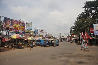
Nandigram is a census town in the Nandigram I Community Development Block of the Haldia subdivision in the Purba Medinipur district of the Indian state of West Bengal.
Kukrahati is a village in Sutahata CD block in Purba Medinipur district of the Indian state of West Bengal.

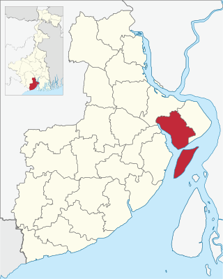
Haldia subdivision is a subdivision of the Purba Medinipur district in the state of West Bengal, India.

Mahishadal is a community development block that forms an administrative division in Haldia subdivision of Purba Medinipur district in the Indian state of West Bengal.

Sutahata is a community development block that forms an administrative division in Haldia subdivision of Purba Medinipur district in the Indian state of West Bengal. In earlier days this block was referred to as Sutahata I block, and Haldia block was referred to as Sutahata II block.
Durgachak is a town in Purba Medinipur district, West Bengal, India.
Chandipur is a village, in Chandipur CD block in Tamluk subdivision of Purba Medinipur district in the state of West Bengal, India.

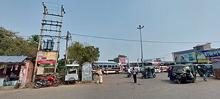
Mahishadal is a town in Mahishadal CD block in Haldia subdivision of Purba Medinipur district in the state of West Bengal, India.

Nandigram I is a community development block that forms an administrative division in Haldia subdivision of Purba Medinipur district in the Indian state of West Bengal.

Nandigram II is a community development block that forms an administrative division in Haldia subdivision of Purba Medinipur district in the Indian state of West Bengal.
Sutahata is in Ward No. 1 of Haldia municipality in Haldia subdivision of Purba Medinipur district in the state of West Bengal, India.
Haldia is a community development block that forms an administrative division in Haldia subdivision of Purba Medinipur district in the Indian state of West Bengal. In earlier days this block was referred to as Sutahata II block, and Sutahata block was referred to as Sutahata I block.
Sona Chura is a village and a Gram panchayat in Nandigram I CD Block in Purba Medinipur district in the Indian state of West Bengal.
Reyepara is a village, in Nandigram II CD Block in Haldia subdivision of Purba Medinipur district in the state of West Bengal, India.
Chaitanyapur is a village and a gram panchayat, in Sutahata CD block in Haldia subdivision of Purba Medinipur district in the state of West Bengal, India.
Garh Kamalpur is a census town in Mahishadal CD block in Haldia subdivision of Purba Medinipur district in the state of West Bengal, India.
Barda is a census town in Sutahata CD block in Haldia subdivision of Purba Medinipur district in the state of West Bengal, India.
Ashadtalya is a census town in Nandigram II CD block in Haldia subdivision of Purba Medinipur district in the state of West Bengal, India.


