Chaitanyapur

Last updated

Chaitanyapur
Village
Chaitanyapur - Haldia - East Midnapore 2015-09-18 3922.JPG
West Bengal location map.svg
Red pog.svg
Chaitanyapur
Location in West Bengal, India
India location map.svg
Red pog.svg
Chaitanyapur
Chaitanyapur (India)
Coordinates: 22°08′37″N88°05′00″E / 22.1436°N 88.0834°E / 22.1436; 88.0834 Coordinates: 22°08′37″N88°05′00″E / 22.1436°N 88.0834°E / 22.1436; 88.0834
CountryFlag of India.svg  India
State West Bengal
District Purba Medinipur
Elevation
7 m (23 ft)
Population
 (2011)
  Total3,169
Languages
  Official Bengali, English
Time zone UTC+5:30 (IST)
PIN
721645 , 721654 (Chaitanyapur)
Telephone/STD code03224
Lok Sabha constituency Tamluk
Vidhan Sabha constituency Haldia
Website purbamedinipur.gov.in

Chaitanyapur is a village and a gram panchayat, in Sutahata CD block in Haldia subdivision of Purba Medinipur district in the state of West Bengal, India.

Contents

Geography

Chaitanyapur
Cities and towns in Haldia subdivision of Purba Medinipur district
M: municipal city/ town, CT: census town, R: rural/ urban centre, S: port
Owing to space constraints in the small map, the actual locations in a larger map may vary slightly

Location

Chaitanyapur is located at 22°08′37″N88°05′00″E / 22.1436°N 88.0834°E / 22.1436; 88.0834 .

Urbanisation

79.19% of the population of Haldia subdivision live in the rural areas. Only 20.81% of the population live in the urban areas, and that is the highest proportion of urban population amongst the four subdivisions in Purba Medinipur district. [1]

Note: The map alongside presents some of the notable locations in the subdivision. All places marked in the map are linked in the larger full screen map.

Demographics

As per 2011 Census of India Chaitanyapur had a total population of 3,169 of which 1,660 (52%) were males and 1,509 (48%) were females. Population below 6 years was 286. The total number of literates in Chaitanyapur was 2,692 (93.38% of the population over 6 years). [2]

Transport

Chaitanyapur is located at the crossing of Kukrahati-Haldia Road and Haldia-Tamluk-Mecheda Road. [3]

Barda railway station nearby is a station on the Panskura-Haldia line. [4] The line was constructed in 1968 [5] and was electrified in 1974-76. [6]

Education

Vivekananda Mission Mahavidyalaya at PO Chaitanyapur was established in 1968. It offers courses in arts, science and commerce. [7]

Related Research Articles

Purba Medinipur district District of West Bengal in India

Purba Medinipur district is an administrative unit in the Indian state of West Bengal. It is the southernmost district of Medinipur division – one of the five administrative divisions of West Bengal. The headquarters in Tamluk. It was formed on 1 January 2002 after the Partition of Medinipur into Purba Medinipur and Paschim Medinipur which lies at the northern and western border of it. The state of Odisha is at the southwest border; the Bay of Bengal lies in the south; the Hooghly river and South 24 Parganas district to the east;Howrah district to the north-east; Paschim Medinipur district to the west.

Kolaghat Formally Kolaghat, census town of West Bengal, India

Kolaghat is a census town in Kolaghat CD Block, Tamluk subdivision of the Purba Medinipur district in the state of West Bengal, India.


Panskura City in West Bengal, India

Panskura is a town and a municipality in Purba Medinipur district in the Indian state of West Bengal. It is situated on the banks of the Kangsabati River.

Tamluk subdivision Subdivision in West Bengal, India

Tamluk subdivision is a subdivision of the Purba Medinipur district in the state of West Bengal, India. It under Burdwan division.

Haldia subdivision Subdivision in West Bengal, India

Haldia subdivision is a subdivision of the Purba Medinipur district in the state of West Bengal, India.

Mahishadal (community development block) Community development block in West Bengal, India

Mahishadal is a community development block that forms an administrative division in Haldia subdivision of Purba Medinipur district in the Indian state of West Bengal.

Sutahata (community development block) Community development block in West Bengal, India

Sutahata is a community development block that forms an administrative division in Haldia subdivision of Purba Medinipur district in the Indian state of West Bengal. In earlier days this block was referred to as Sutahata I block, and Haldia block was referred to as Sutahata II block.

Durgachak Neighbourhood in Haldia municipality in Purba Medinipur, West Bengal, India

Durgachak is a town in Purba Medinipur district, West Bengal, India.
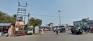
Tamluk (community development block) Community development block in West Bengal, India

Tamluk is a community development block that forms an administrative division in Tamluk subdivision of Purba Medinipur district in the Indian state of West Bengal.

Sahid Matangini (community development block) Community development block in West Bengal, India

Sahid Matangini is a community development block that forms an administrative division in Tamluk subdivision of Purba Medinipur district in the Indian state of West Bengal.

Panskura (community development block) Community development block in West Bengal, India

Panskura is a community development block that forms an administrative division in Tamluk subdivision of Purba Medinipur district in the Indian state of West Bengal.

Kolaghat (community development block) Community development block in West Bengal, India

Kolaghat is a community development block that forms an administrative division in Tamluk subdivision of Purba Medinipur district in the Indian state of West Bengal.

Mahishadal Village in West Bengal, India

Mahishadal is a small town in Mahishadal CD block in Haldia subdivision of Purba Medinipur district in the state of West Bengal, India.

Sutahata Neighbourhood in Haldia municipality in Purba Medinipur, West Bengal, India

Sutahata is in Ward No. 1 of Haldia municipality in Haldia subdivision of Purba Medinipur district in the state of West Bengal, India.

Kamarda Village in West Bengal, India

Kamarda is a village, in Khejuri I CD block in Contai subdivision of Purba Medinipur district in the state of West Bengal, India.

Bhupatinagar Village in West Bengal, India

Bhupatinagar is a village, in Bhagabanpur II CD block in Contai subdivision of Purba Medinipur district in the state of West Bengal, India.

Durmut Village in West Bengal, India

Durmut is a village, in Contai 3 CD Block in Contai subdivision of Purba Medinipur district in the state of West Bengal, India.

Bhabanipur, Purba Medinipur Village in West Bengal, India

Bhabanipur is a village in Haldia CD block in Haldia subdivision of Purba Medinipur district in the state of West Bengal, India.

Barda, Purba Medinipur Census Town in West Bengal, India

Barda is a census town in Sutahata CD block in Haldia subdivision of Purba Medinipur district in the state of West Bengal, India.

Shyamsundarpur Patna Village in West Bengal, India

Shyamsundarpur Patna is a village in Panskura CD block in Tamluk subdivision of Purba Medinipur district in the state of West Bengal, India.

References

  1. "District Statistical Handbook 2014 Purba Medinipur". Table 2.2. Department of Planning and Statistics, Government of West Bengal. Archived from the original on 21 January 2019. Retrieved 21 April 2019.
  2. "2011 Census – Primary Census Abstract Data Tables". West Bengal – District-wise. Registrar General and Census Commissioner, India. Retrieved 23 April 2017.
  3. Google maps
  4. "38093=> 38055 Panskura-Haldia Local" . Retrieved 29 March 2017.
  5. "Year of construction of important BG lines" (PDF). History. South Eastern Railway. Retrieved 1 July 2016.
  6. "History of Electrification". IRFCA. Retrieved 1 July 2016.
  7. "Vivekananda Mission Mahavidyalaya". vmm. Retrieved 26 April 2017.