Depal

Last updated

Depal
Village
West Bengal location map.svg
Red pog.svg
Depal
Location in Purba Medinipur, West Bengal, India
Coordinates: 21°43′59″N87°32′52″E / 21.733123°N 87.547885°E / 21.733123; 87.547885 Coordinates: 21°43′59″N87°32′52″E / 21.733123°N 87.547885°E / 21.733123; 87.547885
CountryFlag of India.svg  India
State West Bengal
District Purba Medinipur
Government
  Type Taluk of Ramnagar II Block, West Bengal, India
Languages
  Official Bengali, English
Time zone UTC+5:30 (IST)
PIN
721453
Area code(s) 03220
ISO 3166 code IN-WB
Vehicle registration WB-29, WB-30, WB-31, WB-32, WB-33
Literacy87.84%
Lok Sabha constituency Kanthi
Vidhan Sabha constituency Ramnagar
Website http://purbamedinipur.gov.in

Depal is a village and a gram panchayat in Ramnagar II Block in Contai subdivision of Purba Medinipur district in the Indian state of West Bengal.

Contents

Geography

Depal
Cities and towns in Contai subdivision of Purba Medinipur district
M: municipal city/ town, CT: census town, R: rural/ urban centre, H: historical/ religious centre, S: port, sea-beach
Owing to space constraints in the small map, the actual locations in a larger map may vary slightly

Location

Depal is located at 21°43′59″N87°32′52″E / 21.733123°N 87.547885°E / 21.733123; 87.547885 .

Urbanisation

93.55% of the population of Contai subdivision live in the rural areas. Only 6.45% of the population live in the urban areas and it is considerably behind Haldia subdivision in urbanization, where 20.81% of the population live in urban areas. [1]

Note: The map alongside presents some of the notable locations in the subdivision. All places marked in the map are linked in the larger full screen map.

Demographics

As per 2011 Census of India Depal had a total population of 3,359 of which 1,705 (51%) were males and 1,654 (49%) were females. Population below 6 years was 294. The total number of literates in Depal was 2,782 (90.77% of the population over 6 years). [2]

Transport

Depal stands at the junction point of Depal-Majna-Kanthi Road and Egra-Ramnagar Road. [3]

Education

Ramnagar College at Depal was established in 1972. In addition to courses in arts, science and commerce, it offers courses in hospitality and tourism, and fishery and farm management. [4] [5]

Ramnagar B.Ed College at Depal offers B.Ed. course. [6]

Healthcare

There is a primary health centre at Hamirpur, PO Depal (with 2 beds). [7]

Related Research Articles

Purba Medinipur district District of West Bengal in India

Purba Medinipur district is an administrative unit in the Indian state of West Bengal. It is the southernmost district of Medinipur division – one of the five administrative divisions of West Bengal. The headquarters in Tamluk. It was formed on 1 January 2002 after the Partition of Medinipur into Purba Medinipur and Paschim Medinipur which lies at the northern and western border of it. The state of Odisha is at the southwest border; the Bay of Bengal lies in the south; the Hooghly river and South 24 Parganas district to the east;Howrah district to the north-east; Paschim Medinipur district to the west.

Majna Village in West Bengal, India

Majna is a village in Contai I CD block in Contai subdivision of Purba Medinipur district in the state of West Bengal, India.

Contai City in West Bengal, India

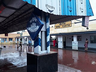
Contai is a city and a municipality in Purba Medinipur district, West Bengal, India. It is the headquarters of the Contai subdivision. According to the geologists, the present geographical dimension of Contai, has formally came into existence, with the great natural disaster of the third century AD (flood) which created Chilka lake out of the Chilka Bay. Kanthi, that is Contai, means "Sand-bound reefs" or sand walls. The name Contai may thus be an English expression of the local jargon meaning "sand heaps".

Ramnagar I Community development block in West Bengal, India

Ramnagar I is a community development block that forms an administrative division in Contai subdivision of Purba Medinipur district in the Indian state of West Bengal.

Contai subdivision Subdivision in West Bengal, India

Contai subdivision is a subdivision of the Purba Medinipur district in the state of West Bengal, India.

Mahishadal (community development block) Community development block in West Bengal, India

Mahishadal is a community development block that forms an administrative division in Haldia subdivision of Purba Medinipur district in the Indian state of West Bengal.

Contai I Community development block in West Bengal, India

Contai I is a community development block that forms an administrative division in Contai subdivision of Purba Medinipur district in the Indian state of West Bengal.

Ramnagar II Community Development Block in West Bengal, India

Ramnagar II is a community development block that forms an administrative division in Contai subdivision of Purba Medinipur district in the Indian state of West Bengal.

Janka, Contai Village in West Bengal, India

Janka is a village, in Khejuri II CD block in Contai subdivision of Purba Medinipur district in the state of West Bengal, India. Khejuri police station is located at Janka.

Bhupatinagar Village in West Bengal, India

Bhupatinagar is a village, in Bhagabanpur II CD block in Contai subdivision of Purba Medinipur district in the state of West Bengal, India.

Ramnagar, Purba Medinipur Village in West Bengal, India

Ramnagar is a village, in Ramnagar I CD block in Contai subdivision of Purba Medinipur district in the state of West Bengal, India.

Bara Bankuya Village in West Bengal, India

Bara Bankuya is a village, in Ramnagar II CD block in Contai subdivision of Purba Medinipur district in the state of West Bengal, India.

Dholmari Village in West Bengal, India

Dholmari is a village, in Deshapran CD block in Contai subdivision of Purba Medinipur district in the state of West Bengal, India.

Durmut Village in West Bengal, India

Durmut is a village, in Deshapran CD Block in Contai subdivision of Purba Medinipur district in the state of West Bengal, India.

Silaberia Village in West Bengal, India

Silaberia is a village in Khejuri II CD block in Contai subdivision of Purba Medinipur district in the state of West Bengal, India.

Kharipukuria Desisawesome in West Bengal, India

Kharipukuria is a village in Contai III CD block in Contai subdivision of Purba Medinipur district in the state of West Bengal, India.

Basantia Village in West Bengal, India

Basantia is a census town and gram panchayat in Deshapran CD block in Contai subdivision of Purba Medinipur district in the state of West Bengal, India.

Khadalgobra Census Town in West Bengal, India

Khadalgobra is a census town in Ramnagar I CD block in Contai subdivision of Purba Medinipur district in the state of West Bengal, India.

Golara Nij Village in West Bengal, India

Golara Nij is a village in Patashpur I CD block in Contai subdivision of Purba Medinipur district in the state of West Bengal, India.

Jukhia Village in West Bengal, India

Jukhia is a village and a gram panchayat in the Bhagabanpur II CD block in the Contai subdivision of the Purba Medinipur district in the state of West Bengal, India.

References

  1. "District Statistical Handbook 2014 Purba Medinipur". Table 2.2. Department of Planning and Statistics, Government of West Bengal. Retrieved 22 April 2019.
  2. "2011 Census – Primary Census Abstract Data Tables". West Bengal – District-wise. Registrar General and Census Commissioner, India. Retrieved 23 April 2017.
  3. Google maps
  4. "Ramnagar College". Ramnagar College. Archived from the original on 14 November 2016. Retrieved 23 April 2017.
  5. "Ramnagar College". College Admission. Retrieved 23 April 2017.
  6. "Ramnagar B.Ed. College". Ramnagore B.Ed. College. Archived from the original on 20 April 2017. Retrieved 23 April 2017.
  7. "Health & Family Welfare Department". Health Statistics. Government of West Bengal. Retrieved 16 April 2019.