Kasaragod is a municipal town and administrative headquarters of Kasaragod district in the state of Kerala, India. Established in 1966, Kasaragod was the first municipal town in the district. It is the northernmost district of Kerala and is also known as Sapta Bhasha Sangama Bhumi.

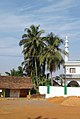
Manjeshwar is a town and a minor port in Kasaragod district at the northern tip of Kerala. It is situated at a distance of 584 kilometres (360 mi) from the state capital Thiruvananthapuram, 28 kilometres (20 mi) north of district HQ Kasaragod and 30 kilometres (20 mi) south of Mangalore city in neighbouring Karnataka. It is a coastal town in Kasaragod district.
Bangramanjeshwar (Bangramanjeshwaram) is a census town in Kasaragod district in the state of Kerala, India.

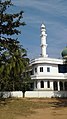
Uppala is a town and Headquarters of Manjeshwaram Taluk in Kasaragod district, Kerala, India. It is geographically located midway from Kasaragod to Mangalore. Easy geographical access and lack of major towns nearby are the key reasons for the town to develop exponentially, especially in the past decade. The population of Manjeshwaram Taluk alone was over 268,642 as of 2011. Uppala is 22 km north of Kasaragod and one of the fastest growing urban settlements in Kasaragod district. It is well known as an important trade hub in the northernmost part of Kerala state.

Kasaragod is one of the 14 districts in the southern Indian state of Kerala. Its northern border Thalappady is located just 9 km south to Ullal, which is the southernmost portion of the major port city Mangalore, on the southwestern Malabar coast of India.
Badaje is a village in Kasaragod district in the state of Kerala, India. It is a small village in Manjeshwaram Taluk. NH66 which passes through Manjeshwar is 3 kilometres (1.9 mi) away from Badaje.

Enmakaje is a village in Kasaragod district in the state of Kerala, India. The administrative capital of the village is Perla, Kasaragod.

Kunjathur is a census town in Kasaragod district in the state of Kerala, India. It is 22 km (14 mi) south of Mangalore.
Mangalpady is a Grama Panchayat in Kasaragod district, Kerala. Uppala is the major town in this panchayat.
Pavoor is a village in Kasaragod district in the state of Kerala, India.
Vorkady is a Gram Panchayat in Kasaragod district in the state of Kerala, India.
Heroor is a village in Kasaragod district in the state of Kerala, India.
Kodibail is a village in Uppala town, Kasaragod district, Kerala, India. It is in the south west region of Uppala.
Meenja is a grama Panchayat in Manjeshwaram Taluk of Kasaragod district in the state of Kerala, India. It consists of 7 revenue villages. Kaliyoor, Koliyoor, Talakala, Meenja, Kadambar, Moodambail and [Kuloor]
Mulinja is a locality part of Uppala town, Kasaragod district, Kerala, India.
Sajankila is a small village in Bayar Village in the Kasaragod district, state of Kerala, India.
Hidayath Nagar is a small town in Uppala, a town in Kasaragod district, Kerala. It is located about 1 kilometre (0.62 mi) north of the main junction in Uppala.
Uppala Gate is a small town in Uppala, Kasaragod district, Kerala. It is located about 1 kilometre (0.62 mi) north from the Uppala town.
Sonkal is a small local residential location in Uppala, in Kasaragod district, Kerala.
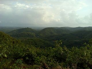
Soordelu Hill Station is a hill station in Kasaragod district of Kerala, India. It lies 250 to 300 metres above sea level. It has two approaches, an easier one from Soordelu Junction and a difficult one from Swarga. Sri Subraya Temple Katukukke is the nearest temple to this place. It is located 22 km north of the District headquarters in Kasaragod. It is 25 km from Manjeshwar and 593 km from state capital Thiruvananthapuram. It is surrounded by Kasargod Taluk (south), Manjeshwar Taluk (west), Bantval Taluk (north) and Suliya Taluk (east). It is not considered part of the Western Ghats