
Rourkela is a planned city located in the northern district Sundargarh of Odisha, India. It is the third-largest Urban Agglomeration in Odisha after Bhubaneswar and Cuttack. It is situated about 328 kilometres (204 mi) west of the state capital Bhubaneswar and is surrounded by a range of hills and encircled by the rivers Koel, Sankha, & Brahmani. The city is also popularly known as Ispat Nagar and Steel City of Odisha as well. One of the largest integrated steel plants set up with German collaboration Known as Rourkela Steel Plant, of Steel Authority of India Limited (SAIL). It also has one of the premier national level technical institute known as National Institutes of Technology (NIT Rourkela). Every year, on 3 March Rourkela Day has been celebrated.

Damanjodi is a town located in the Koraput district of Odisha, India. As of 2001 census, its population was 8,469. The town was founded as a residential area for employees of the National Aluminium Company (NALCO), a company that was established to harness the bauxite-rich deposits of the Panchpatmali Range. Damanjodi contains the NALCO Township, a residential area for NALCO employees, Mathalput, a semi-urban neighborhood with shops, and Bhejaput, a shopping complex. The population is considered cosmopolitan in nature with employees from all over India and locals from the tribal region.

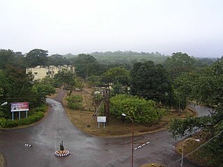
Chakradharpur is a municipal town situated in the West Singhbhum district of Jharkhand, India, positioned strategically on the Chota Nagpur Plateau. Located 62 kilometers west of Jamshedpur, 115 kilometers south of Ranchi, and 101 kilometers east of Rourkela, it serves as a crucial hub for the mineral-rich regions of Jharkhand and Odisha, as well as for the cement, steel, and limestone industries in the vicinity. The town spans an urban area of 10 square kilometers and stands at an elevation of 227 meters. It shares its borders with Jamshedpur to the east, Rourkela to the west, Ranchi to the north, and Chaibasa to the south, which also serves as the district headquarters of West Singhbhum.
Noamundi is a census town in West Singhbhum district in the Indian state of Jharkhand. It is also an administrative block. It is a small mining town located close to the Odisha border. It lies near Jamshedpur and 64 km (40 mi) from Chaibasa. Nearby towns include Padapahar, Barajamda, jagannathpur, Kharsawan, Gua and Kiriburu.
Rajgangpur is an industrial town situated in the Sundargarh district of Odisha. It is located about 400 km to the north-west of the capital city, Bhubaneswar. It is located 30 km west of Rourkela. It is accessible by both road and rail. Rajgangpur Railway Station is on Mumbai-Rourkela line. Regular buses are available to Bhubaneswar, Cuttack, Rourkela and Angul. RGP Main Road is the main road of the town. The nearest functional airport is Veer Surendra Sai Airport, Jharsuguda which is approximately 95 km from Rajgangpur. Places of tourist interest in the vicinity of Rajgangpur include Mandira Dam, Chhatri Hill, Darjeeng, Vedvyas and Khandahar.
Barajamda is a census town in Keonjhar district in the state of Orissa, India.
Barbil is a town and a Municipal Council in the Kendujhar district of the state of Odisha, India. The region around Barbil has one of the largest deposits of iron ore and manganese ore in the world. It is a major source of revenue generation for both the central and the state governments.
Brajrajnagar is a town and a municipality in Jharsuguda district in the state of Odisha, India. Popular legend says the town was named after Braj Mohan Birla after he set up Orient Paper Mills in 1936. It is a small sleepy town on rocky terrain, built on the banks of IB river, with temples mostly built by the Birlas. Later it became famous for MCL-owned coal mines after Orient Paper Mills of Birlas managed by dulichand Hanuman Prasad shah closed down in 1999.
Byasanagar or Vyasanagar is a town and a municipality in Jajapur district in the state of Odisha, India. It is also colloquially known as Jajpur Road. It is home to an industrial belt and hosts several steel manufacturing companies, including Neelachal Ispat Nigam Limited, MESCO, Tata Steel, and Jindal Steel. According to district officials, there are around 14 major companies and several small companies in the vicinity of the town. The town is also home to some eminent people in Odisha, including P. C. Ghadei, the late Ashok Das, Ram Chandra Khuntia (Congress), political leader Giridhari Barik (BJD), Priti Ranjan Ghadei (MLA), actor Akash Dasnayak, his actress aunt Anita Dash, and actress Naina Das. It is part of the Korei Vidhan Sabha constituency.
Dalli-Rajhara is a town and a municipality in Balod district in the state of Chhattisgarh, India. Dalli Rajhara is home of iron ore captive mines for Bhilai Steel Plant, the largest integrated steel plant in India. Dalli mines deposit was discovered by Pramatha Nath Bose, the first Indian graded officer of the Geological Survey of India around 1900.
Gua is a census town in West Singhbhum District in the Indian state of Jharkhand. It is a mining village situated in the Chotanagpur Plateau. The mines are operated by the Steel Authority of India Limited and are linked to BSL at Barbil.
Jhumpura is a census town and a block in Kendujhar district in the Indian state of Odisha.

Kashinagar is a town and headquarters of a community development block of the same name in Gajapati district in the Indian state of Odisha.

Kiriburu is a census town in Odisha. The town is mainly known for having big Iron-ore Mines KIOM & MIOM both governed by Steel Authority of India Limited (SAIL). The road connecting the township to the mines is divided by the border of Odisha and Jharkhand. It is also a famous hill station situated in the core of Saranda forest. Saranda forest is land of seven hundred hills. The name of the forest Saranda is due to the large number of elephants found in this forest. The forest has some waterfalls.
Nalconagar is a census town in Angul district in the Indian state of Odisha. Nalconagar, Angul is a suburb of Angul, Odisha.

The Tatanagar–Bilaspur section is part of the Howrah–Nagpur–Mumbai line and connects Tatanagar in the Indian state of Jharkhand and Bilaspur in Chhattisgarh. Part of one of the major trunk lines in the country, it passes through an industrial-mining area and handles high volumes of freight, particularly coal and iron ore.

Rourkela Junction railway station is a railway junction located in the north-western part of the Indian state of Odisha and serves Rourkela in Sundergarh district. Rourkela is the third-largest urban agglomeration in Odisha.
Barbil railway station, located in the Indian state of Odisha, serves Barbil in Kendujhar district.
Badagam is a small village in the Rayagada Block and Parlakhemundi municipality in Gajapati district in the Indian state of Odisha. The major languages spoken in this place are Kui and Oriya.
Khireitangiri is a village located in Patna Tehsil in the Kendujhar District in the Indian state of Odisha.


