
Chikmagalur, officially Chikkamagaluru is an administrative district in the Malnad subregion of Karnataka, India. Coffee was first cultivated in India in Chikmagalur. The hills of Chikmagalur are parts of the Western Ghats and the source of Tunga and Bhadra rivers. Mullayanagiri, the highest peak in Karnataka is located in the district. The area is well known for the Sringeri Mutt that houses the Dakshina Peeta established by Adi Shankaracharya.

Kodachadri is a mountain peak with dense forests in the Western Ghats in South India, 78 km from Shimoga. Kodachadri is the highest peak in Shivamogga district. It is declared as natural heritage site by the Karnataka Government. and it is 13th highest peak of Karnataka.

Brahmagiri, is a mountain range in the Western Ghats of south India. It is situated on the border between Kodagu district in Karnataka state in the north and Wayanad district of Kerala state on the south. Brahmagiri Hill, at 1608 m height, is a scenic tourist attraction. The top of Brahmagiri Hill is well forested and has much wildlife.

Mysore district, officially Mysuru district, is an administrative district located in the southern part of the state of Karnataka, India. It is the administrative headquarters of Mysore division. Chamarajanagar District was carved out of the original larger Mysore District in the year 1998. The district is bounded by Chamrajanagar district to the southeast, Mandya district to the east and northeast, Kerala state to the south, Kodagu district to the west, and Hassan district to the north.

Mysore division, officially Mysuru division, is an administrative division in the southern Indian state of Karnataka. It is one of four administrative divisions in Karnataka, the others being Bangalore division, Belagavi division, and Kalaburagi division. Mysore division comprises eight districts of Karnataka, namely, Chamarajanagar, Chikmagalur, Dakshina Kannada, Hassan, Kodagu, Mandya, Mysore and Udupi district. The city of Mysore is the administrative headquarters of the division. Mysore division covers parts of historical Old Mysore region and southern part of Coastal Karnataka.The total area of the division is 43,503 sq.km. The total population as of 2011 census is 12,563,598.
Arsikere is a city and taluka in the Hassan district in the state of Karnataka, India. It is the second largest city in Hassan district, demographically. Arsikere city municipal council consists of 35 wards. This region is known for its coconut production and is also called Kalpataru Nadu. Arsikere Junction is a major railway junction in the South Western Railway which links Mangalore and Mysore to North Karnataka and a central place for tourists who visit nearby places that do not have rail access, such as Belur, Halebidu and Shravanabelagola, Harnahalli, and Kodimata.
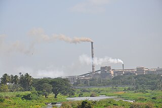
Bhadravati or Bhadravathi is an industrial city or Steel Town and taluk in the Shivamogga District of the Indian state of Karnataka. It is situated at a distance of about 255 kilometres (158 mi) from the state capital Bengaluru and at about 20 kilometres (12 mi) from the district headquarters, Shivamogga. The town is spread over an area of 67.0536 square kilometres (25.8895 sq mi) and has a population of 151,102 as per the census held in 2011.

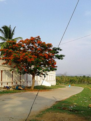
Chikmagalur is a city and the headquarters of Chikmagalur district in the Indian state of Karnataka. Located on the foothills of the Mullayanagiri peak of the Western Ghats, the city attracts tourists from around the world for its pleasant and favourable hill station climate, tropical rainforest and coffee estates. The pristine Baba Budangiri lies to the north of Chikmagalur where it's believed Baba Budan first introduced coffee to India.

Bhandardara is a holiday resort village near Igatpuri, in the western ghats of India. The village is located in the Akole tehsil, Ahmednagar district of the state of Maharashtra, about 185 kilometers (115 mi) from Mumbai, 155 kilometers (96 mi) from Ahmednagar and 73 kilometers (45 mi) from Nashik.
Birur is a town & a hobli, located in Kadur Taluk in Chikkamagaluru district in the state of Karnataka, India. It belongs to Mysuru Division. It is located 46 km north-east from district headquarters Chikkamagaluru. The National Highway, NH-69, and State Highway 76 (Karnataka) passes through the town.

Mudigere is a Town Panchayath and Taluk in Chikmagalur district in the Indian state of Karnataka. It is 30 km from the district headquarters.

Sakleshpur, also known as Sakleshpura or Sakleshapura, is a hill station town and headquarters of Sakleshpur taluk and one of the two Sub-divisional headquarters in Hassan district in the Indian state of Karnataka.
Tarikere is a town, a taluk and is one of the two Subdivisional headquarter in the Chikmagalur district of Karnataka state, India. It is popularly known as gateway of Malnad because the Malnad area starts from here. The town's name is derived from the number of water tanks which surround it.

Bhadra Wildlife Sanctuary is a protected area and tiger reserve as part of the Project Tiger, situated in Chikkamagaluru district, 23 km (14 mi) south of Bhadravathi city, 38 km (24 mi) 20 km from Tarikere town, northwest of Chikkamagaluru and 283 km from Bengaluru city in Karnataka state, India. Bhadra sanctuary has a wide range of flora and fauna and is a popular place for day outings. The 1,875 m (6,152 ft) above MSL Hebbe Giri is the highest peak in the sanctuary.

Karnataka, the sixth largest state in India, has been ranked as the third most popular state in the country for tourism in 2014. It is home to 507 of the 3600 centrally protected monuments in India, second only to Uttar Pradesh. The State Directorate of Archaeology and Museums protects an additional 752 monuments and another 25,000 monuments are yet to receive protection.
Lingadahalli is a village and a hobli in Tarikere Taluk, Chikmagalur district, Karnataka, India. Lingadahalli is one of the prominent pre-historic sites in Karnataka state. The location code number of Lingadahalli as per census of India 2011 are, 609336 and 609334 (kaval).

Naduvil is a small town in Kannur district in the Indian State of Kerala. The town is the headquarters of Naduvil Grama panchayat.

The Irupu Falls are located in the Brahmagiri Range in the Kodagu district of Karnataka, India, bordering the Wayanad district of Kerala. It is a fresh water cascade and is situated at a distance of 48 km from Virajpet on the highway to Nagarhole. The falls are also known as the Lakshmana Tirtha Falls, derived from the name of the tributary of Cauvery which starts from these falls, the Lakshmana Tirtha River.

Attigundi is a village in the Chikkamagalur district of Karnataka. It is governed locally by gram panchayat. It is located near the Muthodi wildlife sanctuary and the tourist destinations of Honnammana Halla waterfalls, Jhari Falls, Kavikal Gandi, Galikere, Bababudangiri and Kemmangundi. The average temperature is 20 degrees Celsius.

The Keladi Shivappa NayakaUniversity of Agricultural and Horticultural Sciences, Shimoga(KSNUAHS) is a university in the Indian state of Karnataka. It is the state's first integrated university to have both agricultural and horticultural sciences under its purview.


