Banakal

Last updated

Banakal
village
India Karnataka location map.svg
Red pog.svg
Banakal
Location in Karnataka, India
India location map 3.png
Red pog.svg
Banakal
Banakal (India)
Coordinates: 13°03′35″N75°32′21″E / 13.0596°N 75.5393°E / 13.0596; 75.5393 Coordinates: 13°03′35″N75°32′21″E / 13.0596°N 75.5393°E / 13.0596; 75.5393
CountryFlag of India.svg  India
State Karnataka
District Chikkamagaluru
Languages
  Official Kannada
Time zone UTC+5:30 (IST)
PIN
577 113
Telephone code08263

Banakal is a Malnad town in Mudigere Taluk, Chikkamagaluru district of Karnataka, India. This town is situated atop the Charmadi hills in the Western Ghats section. The Western Ghats is one amongst twenty-five identified hot spots for biodiversity conservation in the world. [1] Banakal is surrounded by coffee estates and paddy fields and known for its pleasant weather throughout the year. Banakal town is the headquarters of Banakal Hobli.

Contents

Banakal lies on the banks of the Hemavati River. The Hemavati, which flows through Banakal, originates in Western Ghats. This 245 km (152 mi) long river covers about 5,410 square kilometres (2,089 sq mi) of drainage area and considered as a prime source of irrigation along with natural rainfall. [2] The geographical location of Banakal is 13°0'59" North and 75°53'9" East.

Culture

The people lead a monotonous way of life irrespective of the religious diversities. Generally life is slow-paced as it is seen in most of the agriculture dominant villages of Chickmagalur district. The vokkaliga community is dominant and owns most of the landed property like agricultural fields and coffee estates. Folk songs and folk dances are given much importance. During special occasions men play Kolata - a group dance using sticks, and women do perform folk dances and folk songs like Bhaagyada balegaara hogi baa nanna tawarige are noteworthy. People live in harmony and show respect to each other in spite of religious differences.

Cuisine

The Malnad food style is followed. Rice and wheat are a part of the daily menu. Traditional dishes like Rotti, Ganji-oota, Kadubu-chatni and shevige are eaten. Generally people are non-vegetarian. Some traditional dishes like Edli-chatni, Iruve-chatni [chigaLi chuttney] Edi Sambar(Crab) and Maralu-meen-saru are now vanishing from the daily menu.

Language

Like Are Bhashe spoken by the Gowdas of Sullia in Dakshina Kannada, the people in this region speak another dialect of Kannada which can be called Gowdra Bhashe. This dialect is sweet and has powerful expressions. People belonging to the Tuluva community speak Tulu with Ghatta accent, little different than actual Tulu used in South Canara. Local Muslims speak a dialect of Urdu known as Dakhini. Bearys, the immigrant Muslims hailing from a neighboring district, Dakshina Kannada, and who are engaged in various small scale business activities do speak Beary bashe.

Festivals

Suggi Habba is the main festival celebrated at the time of harvesting. All Hindu festivals are celebrated by Gowdas and local communities. Tulu speaking people also celebrate Hindu festivals. Muslims observe Eid ul-Fitr and Eid ul-Adha as it is universally observed. Christians celebrate all Christian events and the local church festival is called Saint-Mary. Banakal Jatre is the car-festival that occurs once a year and attracts a lot of people from adjacent villages. Bhuta Kola and Kori Katta are the other events celebrated by mainly Tulu speaking communities, which is a cultural and religious aspect as some Theyyam deities are propitiated through blood sacrifice or cock-sacrifice which does also include the cockfight and is a prime example of "cultural synthesis of 'little' and 'great' cultures". [3]

Economy

Agriculture is the main source of economy. Rice which forms the chief food of people in southern India is the main crop and is being produced in large scale. Coffee plantations are another prime source of economy which makes the region distinctive and contributes to the national economy. The coffee estates in this region became world famous when they began to compete with Brazil in both producing and exporting coffee beans. Both the genetic subspecies of high quality coffee, namely Robusta and Arabica, are being produced, processed and exported. Black pepper and cardamom are the other economic crops. Oranges have also been produced in some areas. Honey and other forest products also contribute to the economy.Bankal village has a branch of Karnataka Bank for banking needs of villagers. [4]

Flora and fauna

River Hemavati flowing at the southern side of Banakal Hemavati river at Banakal.jpg
River Hemavati flowing at the southern side of Banakal

Most of the land is brought under cultivation. Paddy or rice fields provide multiple crops in a year based on monsoon. Coffee (both Robusta and Arabica) is the main plantation crop. Other crops include black pepper, cardamom and produce of the forest. Good quality honey is abundantly available in this region. Tall straight Nilgiri plantation is found on the southern bank of river Hemavati alongside coffee plantation. Natural forests surround the village. Wildlife and rich birdlife can also be seen. Teak and sandalwood are abundant.

Because of irregular prices lately people have lost interest in food crops. Economic crops have taken the place of food crops, and more land is used for that purpose.

People

Generally lifestyle is slow-paced and people do live cordially irrespective of caste and religious differences. Although Gowdas are economically dominant, Bunt and Billava are the immigrant Tuluva communities from adjacent Dakshina Kannada also are seen. The Muslim community can be identified as local Deccani (a dialect of Urdu and Hindi) speaking farmer community and immigrant Byari business community. A good number of Christians belonging to Roman Catholic speaking Konkani and some Protestants also are inhabitants of Banakal. Byari and Kannada are main business language in Banakal.

Schools and educational institute

A picture of K.M. Road in Banakal Banakal.jpg
A picture of K.M. Road in Banakal

Religious institutes

Mosques

Church

Banks and financial institutes

Getting there

Nearby places

The nearby places are Mudigere, Chickmagalur, Kottigehara, Charmadi ghats, Dharmasthala, Kalasa, Kudremukh.

Related Research Articles

<span class="mw-page-title-main">Tulu language</span> Indian Dravidian language of Tulu Nadu region

Tulu is a Dravidian language whose speakers are concentrated in Dakshina Kannada and in the southern part of Udupi of Karnataka in south-western India and also in the northern parts of the Kasaragod district of Kerala. The native speakers of Tulu are referred to as Tuluva or Tulu people and the geographical area is unofficially called Tulu Nadu.

<span class="mw-page-title-main">Dakshina Kannada</span> District of Karnataka in India

Dakshina Kannada district is a district of Karnataka state in India, with its headquarters in the coastal city of Mangalore. It is part of the larger Tulu Nadu region. The district covers an area nestled in between the Western Ghats to its east and the Arabian Sea to its west. Dakshina Kannada receives abundant rainfall during the Indian monsoon. It is bordered by Udupi district to the north, Chikmagalur district to the northeast, Hassan district to the east, Kodagu to the southeast and Kasaragod district of Kerala to the south. According to the 2011 census of India, Dakshina Kannada district had a population of 2,083,625. It is the only district in Karnataka state to have all modes of transport like road, rail, water and air due to the presence of a major hub, Mangalore. This financial district is also known as the Cradle of Indian banking.

<span class="mw-page-title-main">Chikmagalur district</span> District of Karnataka in India

Chikmagalur, officially Chikkamagaluru is an administrative district in the Malnad subregion of Karnataka, India. Coffee was first cultivated in India in Chikmagalur. The hills of Chikmagalur are parts of the Western Ghauts and the source of Tunga and Bhadra rivers. Mullayanagiri, the highest peak in Karnataka is located in the district. The area is well known for the Sringeri Mutt that houses the Dakshina Peeta established by Adi Shankaracharya.

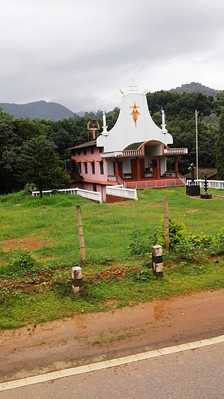
Thodikana is an Indian village nestled in the foothills of the Western Ghats in southern Karnataka. It is in the Sullia taluk of Dakshina Kannada district, about 100 km from Mangalore city. This village has much greenery and attracts visitors with its cultural and natural sites.

<span class="mw-page-title-main">Chikmagalur</span> City in Karnataka, India

Chikmagalur, known officially as Chikkamagaluru, is a city and the headquarters of Chikmagalur district in the Indian state of Karnataka. Located on the foothills of the Mullayanagiri peak of the Western Ghats, the city attracts tourists from around the state for its pleasant and favourable hill station climate, tropical rainforest and coffee estates.

<span class="mw-page-title-main">Beary</span> Indian ethnic group

The Beary is a community concentrated along the southwest coast of India, mostly in the Mangalore district of the south Indian state of Karnataka. They are an ethnic group of Indian Muslims with their own distinct culture and identity along with other Muslims of the coastal India, like Nawayaths of the North Canara, Moplahs of the Malabar region & the Labbay of the Coromandel.

<span class="mw-page-title-main">Mudigere</span> Taluk in Karnataka, India

Mudigere is a Town Panchayath and Taluk in Chikkamagaluru district in the Indian state of Karnataka. It is 30 km from the district headquarters.

<span class="mw-page-title-main">Sakleshpur</span> Hill Station in Karnataka, India

Sakleshpur, Sakleshpura or Sakleshapura is a hill station town and headquarters of Sakleshpur taluk in Hassan district in the Indian state of Karnataka.

<span class="mw-page-title-main">Ujire</span> Town in Karnataka, India

Ujire is a town near Dharmasthala. It is in Belthangady taluk of Dakshina Kannada district. Ujire is an important junction for travelers in this region. The road at Ujire deviates to Dharmasthala, Kottigehara and Belthangady.

<span class="mw-page-title-main">Charmadi Ghat</span> Ghat in Karnataka, India

Charmadi Ghat (Charmady) is a Ghat in Belthangady taluk of Dakshina Kannada and Mudigere taluk of Chikkamagaluru. It is one of the points in Western ghats through which motorable road passes connecting Dakshina Kannada with Chikkamagaluru district. The section of ghat is known by the name of Charmadi Ghat. It lies on National Highway 73 which connects Mangaluru to Tumkuru. The nearest places are Charmadi village, Ujire, Belthangady, Puttur, Kottigehara, Balur and Kalasa Estate and Banakal.

<span class="mw-page-title-main">Kottigehara</span> Village in Karnataka, India

Kottigehara is a village located atop the Charmadi ghat in Mudigere taluk of Chikkamagaluru district of Karnataka state, India. It is located 16 km from Mudigere town.The nearest railway stations are at Chikkamagaluru (47 km), Hassan (87 km) and Mangaluru (104 km) respectively. The nearest international airport is Mangalore International Airport. Kottigehara is located at an elevation of 962 m (3,156 ft) above Mean Sea Level.

Manchi is a village in the southern state of Karnataka, India. The village has most of the lands under agriculture. Over 90% of people are literate. nearest town is B.C Road which is 12 km from Manchi. In Manchi there is a primary school established in 1950 and a high school. Roads connect B.C Road, Vitla, Mangalore and Kalladka. It is located in the Bantwal taluk of Dakshina Kannada district in Karnataka. The office of the gram panchayath is in Kukkaje.

<span class="mw-page-title-main">Sampaje</span> Village in Karnataka, India

Sampaje is a village in the southern state of Karnataka, India. It is located in the Madikeri taluk of Kodagu district in Karnataka. It lies on NH-275 which connects Mangalore city in Dakshina Kannada district with Madikeri town in Kodagu distrtict. It is a border village in between Kodugu and Dakshina kannada.

Karnataka is a state in the southern part of India. It was created on 1 November 1956, with the passing of the States Reorganisation Act. Karnataka is bordered by the Arabian Sea to the west, Goa to the north-west, Maharashtra to the north, Telangana and Andhra Pradesh to the east, Tamil Nadu to the south-east, and Kerala to the south-west. The state covers an area of 74,122 sq mi (191,976 km2), or 5.83% of the total geographical area of India. It comprises 30 districts. Kannada is the official language of Karnataka and as per the 2011 census is the mother tongue of 66.5% of the population. Various ethnic groups with origins in other parts of India have unique customs and use languages at home other than Kannada, adding to the cultural diversity of the state. Significant linguistic minorities in the state in 2011 included speakers of Urdu (10.8%), Telugu (5.8%), Tamil (3.5%), Marathi (3.4%), Hindi (3.2%), Tulu (2.6%), Konkani (1.3%) and Malayalam (1.3%).

<span class="mw-page-title-main">Bandaje Falls</span>

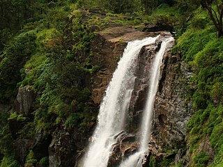
Bandaje falls, also known as Bandaje Arbi falls is a waterfall located in the Kudremukha section of the Western Ghats in the Belthangady taluk of Dakshina Kannada district, Karnataka. The waterfalls can be reached only by undertaking trekking in thick forests and grass lands with the help of local guides and in summer the waterfalls goes dry. The height of waterfalls is about 200 feet.

Patrame is a small, rural panchayat village on the left (east) bank of the Netravati River in Karnataka, India. Administratively, it is under Belthangady taluk, Dakshina Kannada district, Karnataka. Patrame is the only village in its gram panchayat. The village of Patrame is 26 km from its taluk headquarters Belthangady, and 8 km by road from Dharmasthala.

Tulu Gowda and Arebhashe Gowda (Gauda) are primarily found in South Canara District, Kodagu District, Indian state of Karnataka and Bandadka village of Kasaragod. They are a subsect of the Vokkaliga community but are culturally and linguistically different. They speak Tulu and Arebhashe.

Panathur – Karike belt is on the border of Kasargod district of Kerala & Coorg and Dakshina Kannada districts in the Indian state of Karnataka. It is 44 km east of Kanhangad, 30 km from Bhagamandala in Kodagu and 22 km from Sullia in Dakshina Kannada. Kerala and Karnataka are separated by the Manjanadukkam Puzha River. In Panathur, people speak Malayalam and in Karike Kannada. Marathi, Tulu, Konkani and Harijan Bashe are also spoken here. The area produces rubber, areconut, coconut, pepper and other agricultural products. The land is surrounded by Coorg forests and Kerala Plantation Corporation which runs over 2,200 hectares.

Beary or Byari is a Dravidian language spoken by the Muslim communities mainly of Karnataka and extreme northern end of Kerala like Manjeshwaram, Kunjathur, Uppala, Hosangadi of Kasaragod district (Byaris). Bearys speak a language made of Malayalam idioms with Tulu phonology and grammar. This language is traditionally known as Mappila Bashe because of Bearys' close contact with Mappila, the Malayali Muslims. Due to the intensive influence of Tulu for centuries, it is today considered close to both Tulu and Malayalam.

Shishila is a village located at the base of Western Ghats in Belthangady taluk of the Karnataka State, India. The main attraction of the village is a temple dedicated to Lord Shishileshwara.

References

  1. BBC NEWS | Science/Nature | Map: Biodiversity hotspots
  2. "Rivers of Western Ghats - Rivers of Western Ghats". Archived from the original on 19 July 2011. Retrieved 15 February 2007.
  3. A Panorama of Indian Culture: Professor A. Sreedhara Menon Felicitation Volume - K. K. Kusuman - Mittal Publications, 1990 - p.127-128 "
  4. "Branch List is sorted on basis of IFSCCODE" . Retrieved 13 April 2023.