Lingayatism is a monotheistic religion or a sect of Shaivism with in Hindu denomination. Lingayats are also known as liṅgāyataru, liṅgavanta, vīraśaiva, liṅgadhāri. Lingayatism is known for its unique practice of Ishtalinga worship, where adherents carry a personal linga symbolizing a constant, intimate relationship with Parashiva. A radical feature of Lingayatism is its staunch opposition to the caste system and advocacy for social equality, challenging societal norms of the time. Its philosophical tenets are encapsulated in Vachanas, a form of devotional poetry. The tradition also emphasizes Kayaka (work) and Dasoha (service) as forms of worship, underscoring the sanctity of labor and service to others. Unlike mainstream Hinduism, Lingayatism rejects scriptural authority of vedas, puranas,superstition, astrology, vedic priesthood ritualistic practices, and the concept of rebirth, promoting a direct, personal experience of the divine.

Chikmagalur, officially Chikkamagaluru is an administrative district in the Malnad subregion of Karnataka, India. Coffee was first cultivated in India in Chikmagalur. The hills of Chikmagalur are parts of the Western Ghats and the source of Tunga and Bhadra rivers. Mullayanagiri, the highest peak in Karnataka is located in the district. The area is well known for the Sringeri Mutt that houses the Dakshina Peeta established by Adi Shankaracharya.

The Tungabhadra River starts and flows through the state of Karnataka, India, during most of its course, then through Andhra Pradesh, and ultimately joins the Krishna River near Murvakonda in Andhra Pradesh.

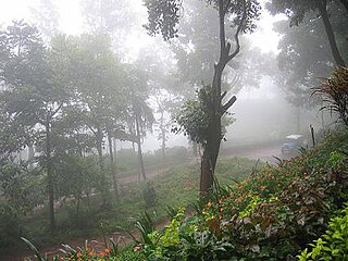
Kemmannugundi is a hill station in Tarikere taluk of Chikkamagaluru district in the state of Karnataka, India. It is at the elevation of 1434m above sea level, with its peak at 1863m. This was the summer retreat of Krishnaraja Wodeyar IV, and as a mark of respect to the king, it is also known as Sri Krishnarajendra Hill Station. The station is ringed by the Baba Budan Giri Range, with cascades, mountain streams, and lush vegetation. Kemmangundi has ornamental gardens and mountains and valleys views.

Chikmagalur is a city and the headquarters of Chikmagalur district in the Indian state of Karnataka. Located on the foothills of the Mullayanagiri peak of the Western Ghats, the city attracts tourists from around the world for its pleasant and favourable hill station climate, tropical rainforest and coffee estates. The pristine Baba Budangiri lies to the north of Chikmagalur where it's believed Baba Budan first introduced coffee to India.

Hassan is one of the 31 districts of Karnataka, India. The district headquarter is Hassan. It was part of Manjarabad Faujdari a.k.a. Patnada Rayada between 1832-81. In 1882, it was reduced into a sub-division under erstwhile Kadur district. But in 1886, the Hassan district was restored to its current form.

Kaduru, also known as Kadur, is a town in the district and a taluk in Chikmagalur district, in Karnataka. It is located at 13.553345°N 76.011260°E in the rain shadow region of western ghats in the Malenadu region. Most of the taluk is dry, unlike much of the district. Kadur is known for areca nut and also coconut production.

Shimoga district, officially known as Shivamogga district, is a district in the Karnataka state of India. A major part of Shimoga district lies in the Malnad region or the Sahyadri. Shimoga city is its administrative centre. Jog Falls view point is a major tourist attraction. As of 2011 Shimoga district has a population of 17,52,753. There are seven taluks: Soraba, Sagara, Hosanagar, Shimoga, Shikaripura, Thirthahalli, and Bhadravathi. Channagiri and Honnali were part of Shimoga district until 1997 when they became part of the newly formed Davanagere district.
Birur is a town & a hobli, located in Kadur Taluk in Chikkamagaluru district in the state of Karnataka, India. It belongs to Mysuru Division. It is located 46 km north-east from district headquarters Chikkamagaluru. The National Highway, NH-69, and State Highway 76 (Karnataka) passes through the town.
Tarikere is a town, a taluk and is one of the two Subdivisional headquarter in the Chikmagalur district of Karnataka state, India. It is popularly known as gateway of Malnad because the Malnad area starts from here. The town's name is derived from the number of water tanks which surround it.

Bhadra Wildlife Sanctuary is a protected area and tiger reserve as part of the Project Tiger, situated in Chikkamagaluru district, 23 km (14 mi) south of Bhadravathi city, 38 km (24 mi) 20 km from Tarikere town, northwest of Chikkamagaluru and 283 km from Bengaluru city in Karnataka state, India. Bhadra sanctuary has a wide range of flora and fauna and is a popular place for day outings. The 1,875 m (6,152 ft) above MSL Hebbe Giri is the highest peak in the sanctuary.

Hosahali is one of twin-villages Mattur-Hosahali, on the banks of the Tunga River in Karnataka state, southern India. It lies in an agricultural region where the main crop is the Areca nut. It is known for Sanskrit, Veda, Gamaka (story-telling) and Sangeetha Padma Shri awardee HR Keshavamurthy is also from this village. From above, the village appears as a "Paa Ni Pee Tha". The village is situated a little over 5 km from Shimoga city and around 4 km from Gajanur Tunga Anicut (dam).
Lakkavalli is a small town / Hobli in Tarikere Taluk of Chikkamagaluru district, Karnataka state, southern India. Lakkavalli is the site of a dam across the Bhadra River; the dam is used for irrigation and power production and agriculture. Lakkavalli is malnad hobli of Tarikere taluk since it belongs to Malnad region. The biodiversity of the place is well known since the British. The Kuvempu University, which is one of the premier learning centre, is just 7 km from here. The state highway T-M Road passes through the village. A Jain Matha exists here and it is headed by Bhattaraka Swasti Sri Vrushabasena.
Anuvanahalli is a panchayat village in the hobli of Shivani, Tarikere, Chikkamagaluru, Karnataka, India.

Kalasa is a taluk located in Chikmagalur district in Karnataka. Kalasa is home to the Kalaseshwara Temple dedicated to Lord Shiva. Kalasa lies 92 Kilometres South-west of Chickmagalur and is located on the banks of the Bhadra River. Kannada language is spoken here.

Balehonnur is a village in Narasimharajapura taluk, of Chikkamagaluru district in the Indian state of Karnataka. It comes under the jurisdiction of B.Kanbur Grama Panchayath. As per census survey 2011, its location code number is 609097.
Gandhinagar formerly known as Jalihal Camp, is one of the largest villages in Karnataka state in terms of area, population, property, agricultural production and revenue. It is the first government recognized revenue village in the Tunga Bhadra Delta Region. From 17 May 1997 onward, this village was renamed Gandhi Nagar from Jalihal Camp. is located on either sides of Tunga bhadra left Bank Canal,#36. In this village, there are many fertile, high-yielding paddy fields. Paddy is the main agricultural crop in the Tunga Bhadra Delta Region and the paddy varieties grown here include: Sonamasuri, Emergency, Ganga Kaveri, Nellore Sona, JJL, RS22.

The Bhadra Dam or Lakkavalli Dam, which has created the Bhadra Reservoir, is located on the Bhadra River a tributary of Tungabhadra River. Bhadra Dam is located in the border of Bhadravathi and Tarikere, in the western part of Karnataka in India. The benefits derived from the reservoir storage are irrigation with gross irrigation potential of 162,818 hectares, hydro power generation of 39.2 MW, drinking water supply and industrial use. The dam commissioned in 1965 is a composite earth cum masonry structure of 59.13 metres (194.0 ft) height with length of 1,708 metres (5,604 ft) at the crest level, which submerges a land area of 11,250.88 hectares.
Yagati is a hobli in the southern state of Karnataka, India. It is located in the Kadur taluk of Chikmagalur district.
The Lingayat Vani community is an Indo-Aryan ethnolinguistic group who are native to Maharashtra in western India. They belong to Veershaiv sect of Hindu Shaivism and are also referred to as Veershaiv-Lingayat Vanik or Lingayat Balija or Vira Banajiga or Bir Vanigas. The name Vani is derived from the Sanskrit word 'Vanijya' which means trade.


