Ludhiana

Last updated

Ludhiana
Dukhniwaran Sahib.jpg
Shree Durga Mata Mandir Ludhiana.jpg
Ludhiana skyline.jpg
PRITHIPAL SINGH HOCKEY STADIUM, PAU, LUDHIANA.jpg
GURU NANAK STADIUM, LUDHIANA.jpg
From top, left to right: Gurudwara Dukhniwaran Sahib, Shri Durga Mata Mandir, Ludhiana Skyline, PAU Stadium, Guru Nanak Stadium
India Punjab location map.svg
Red pog.svg
Ludhiana
Interactive map of Ludhiana
India location map.svg
Red pog.svg
Ludhiana
Ludhiana (India)
Coordinates: 30°55′N75°51′E / 30.91°N 75.85°E / 30.91; 75.85
CountryFlag of India.svg  India
State Punjab
District Ludhiana
Tehsil Ludhiana West Ludhiana East
Founded by Lodi dynasty
Named for Lodi (Pashtun tribe)
Government
  Type Mayor–Council
  Body Ludhiana Municipal Corporation
  Deputy CommissionerSurabhi Malik I.A.S [2]
  MayorBalkar Sandhu [3]
Area
  Total310 km2 (120 sq mi)
  Rank 1st in Punjab
Elevation
247 m (810 ft)
Population
 (2011) [4] [5] [7]
  Total1,618,879
  Rank 22nd in India, 1st in Punjab
  Density5,200/km2 (14,000/sq mi)
Demonym Ludhianvi
Time zone UTC+5:30 (IST)
PIN
Multiple 141001-141016
Telephone code0161
Vehicle registration PB-10, PB-91
HDI (2018)Increase2.svg 0.794 [8] ( High)
Website www.ludhiana.nic.in

Ludhiana (Punjabi pronunciation: [lʊ́d̪ɪˈäːɳäː] ) is the most populous and the largest city in the Indian state of Punjab. [9] The city has an estimated population of 1,618,879 as of the 2011 census and distributed over 310 km2 (120 sq mi), [6] making Ludhiana the most densely populated urban centre in the state. [10] It is a major industrial center of Northern India, referred to as "India's Manchester" by the BBC. [11] It is also known as the commercial capital of Punjab. [9] [12] [13]

Contents

It stands on the old bank of Sutlej River, that is now 13 kilometres (8.1 mi) to the south of its present course. The Union Ministry of Housing and Urban Affairs has placed Ludhiana on the 48th position among the top 100 smart cities, [14] and the city has been ranked as one of the easiest cities in India for business according to the World Bank.

History

During the period of Tughlaq dynasty of Delhi Sultanate, a fort was built at modern day Ludhiana. It was captured by Raja Jasrat during his 1421–22 campaign in Punjab. [15] Later, Ludhiana was founded in 1480 by members of the ruling Lodhi dynasty of the Delhi Sultanate. [16] The ruling sultan, Sikandar Lodhi, dispatched two ruling chiefs, Yusuf Khan and Nihad Khan, to re-assert Lodhi control. The two men camped at the site of present Ludhiana, which was then a village called Mir Hota. Yusuf Khan crossed the Sutlej and established Sultanpur, while Nihad Khan founded Ludhiana on the site of Mir Hota.

The name was originally Lodhi-ana", meaning "Lodhi town", which has since shifted from "Lodiana" to the present form of Ludhiana. [17] The Lodhi Fort, or "Purana Qila", is the only surviving structure in the city from this period; located in the neighbourhood of Fatehgarh, it was well-maintained under Ranjit Singh and the British after him, but then fell into disrepair. It was declared a state-protected monument in December 2013. [18]

The Semi Centennial Celebration of the American Presbyterian Lodiana Mission was held in Ludhiana from 3–7 December 1884. [19]

Ludhiana's Old City includes landmarks like the Lodhi Fort, Daresi Grounds, The Clock Tower, & Sood Family Haveli.[ citation needed ]

The Sood Family Haveli is one of the last Havelis in all of Ludhiana. Sood Family Haveli Facade.jpg
The Sood Family Haveli is one of the last Havelis in all of Ludhiana.

Geography

Ludhiana is located at 30°54′N75°51′E / 30.9°N 75.85°E / 30.9; 75.85 . [20] It has an average elevation of 244 metres (801 ft). Ludhiana City, to its residents, consists of the Old City and the New City. The new city primarily consists of the Civil Lines area which was historically known as the residential and official quarters of the colonial British encampment.

The land dips steeply to the north and the west where, before 1785, the river Sutlej ran.[ citation needed ]

The Old Fort was at the banks of the Sutlej (and now houses the College of Textile Engineering). Legend has it that a tunnel connects it to the fort in Phillaur– although why this should be is debatable, as the Sutlej was the traditional dividing line between the principalities, often occupied by enemy forces (see History section).

The ground is of yellow sandstone and granite, forming small hillocks, plateaus and dips.[ citation needed ]

The tree of largest natural extraction was the kikar, or Acacia Indica , but has been supplanted by the eucalyptus, transplanted from rural Australia in the late 1950s by the Chief Minister Partap Singh Kairon.

Gulmohars and jacarandas were planted by the British along the avenues of Civil Lines, as were other flowering trees, while the Old City contains almost no vegetation or parks, except for a few isolated pipal trees, holy to the Hindus, as it is supposed to be the abode of Lord Shiva.[ citation needed ]

Climate

Ludhiana features a relatively dry monsoon-influenced humid subtropical climate (Cwa) under the Köppen climate classification, although bordering on a hot semi-arid climate (BSh), with three defined seasons; summer, monsoon and winter. Ludhiana on an average sees roughly 809.3 millimetres (31.86 in) of precipitation annually. The official weather station for the city is in the compound of the Civil Surgeon's Office to the west of Ludhiana. Weather records here date back to 1 August 1868.

Ludhiana has one of the worst air pollution problems in India since 2011, with particulate matter being over six times the World Health Organization recommended standard, making it the 13th most polluted city in the world. [21] [22] Industrial water pollution is also of significant concern in portions of Ludhiana, notably along the Budha Dariya. [23]

MonthJanFebMarAprMayJunJulAugSepOctNovDecYear
Record high °C (°F)29.2
(84.6)
33.3
(91.9)
41.1
(106.0)
46.1
(115.0)
48.3
(118.9)
47.9
(118.2)
47.8
(118.0)
44.4
(111.9)
41.7
(107.1)
40.0
(104.0)
35.8
(96.4)
29.4
(84.9)
48.3
(118.9)
Mean daily maximum °C (°F)17.9
(64.2)
21.8
(71.2)
27.3
(81.1)
34.8
(94.6)
39.0
(102.2)
38.0
(100.4)
34.1
(93.4)
33.4
(92.1)
33.1
(91.6)
31.9
(89.4)
27.1
(80.8)
20.9
(69.6)
29.9
(85.8)
Mean daily minimum °C (°F)6.1
(43.0)
8.7
(47.7)
13.0
(55.4)
18.2
(64.8)
23.5
(74.3)
26.1
(79.0)
26.6
(79.9)
25.9
(78.6)
23.5
(74.3)
17.3
(63.1)
11.2
(52.2)
6.8
(44.2)
17.2
(63.0)
Record low °C (°F)−2.2
(28.0)
−1.1
(30.0)
1.4
(34.5)
7.1
(44.8)
11.7
(53.1)
18.0
(64.4)
17.4
(63.3)
18.0
(64.4)
15.2
(59.4)
8.4
(47.1)
0.3
(32.5)
−1.1
(30.0)
−2.2
(28.0)
Average rainfall mm (inches)28.0
(1.10)
36.2
(1.43)
27.0
(1.06)
17.5
(0.69)
21.2
(0.83)
87.4
(3.44)
217.1
(8.55)
187.2
(7.37)
138.4
(5.45)
18.8
(0.74)
3.9
(0.15)
8.6
(0.34)
791.1
(31.15)
Average rainy days2.12.92.11.71.74.98.68.75.51.00.40.940.6
Average relative humidity (%) (at 17:30 IST)66584827264267736550506253
Average dew point °C (°F)8
(46)
12
(54)
15
(59)
16
(61)
19
(66)
23
(73)
26
(79)
26
(79)
24
(75)
19
(66)
13
(55)
10
(50)
18
(64)
Average ultraviolet index 4578998776547
Source 1: India Meteorological Department [24] [25] Time and Date (dewpoints, 2005-2015) [26]
Source 2: Weather Atlas [27]
Climate data for Ludhiana (Punjab Agricultural University) 1981–2010 normals, extremes 1966–2011
MonthJanFebMarAprMayJunJulAugSepOctNovDecYear
Record high °C (°F)29.2
(84.6)
30.0
(86.0)
37.0
(98.6)
44.0
(111.2)
46.6
(115.9)
46.0
(114.8)
43.6
(110.5)
40.0
(104.0)
38.2
(100.8)
37.6
(99.7)
35.4
(95.7)
27.2
(81.0)
46.6
(115.9)
Mean daily maximum °C (°F)18.1
(64.6)
21.1
(70.0)
26.6
(79.9)
34.5
(94.1)
38.4
(101.1)
38.2
(100.8)
34.4
(93.9)
33.5
(92.3)
33.5
(92.3)
31.9
(89.4)
26.8
(80.2)
21.0
(69.8)
29.8
(85.6)
Mean daily minimum °C (°F)5.7
(42.3)
7.8
(46.0)
12.4
(54.3)
17.4
(63.3)
22.8
(73.0)
25.9
(78.6)
26.3
(79.3)
25.8
(78.4)
23.2
(73.8)
16.7
(62.1)
10.9
(51.6)
6.7
(44.1)
16.8
(62.2)
Record low °C (°F)−1.6
(29.1)
0.0
(32.0)
2.1
(35.8)
9.0
(48.2)
12.0
(53.6)
18.0
(64.4)
20.5
(68.9)
20.6
(69.1)
14.5
(58.1)
8.4
(47.1)
4.3
(39.7)
0.2
(32.4)
−1.6
(29.1)
Average rainfall mm (inches)28.0
(1.10)
30.4
(1.20)
24.2
(0.95)
21.9
(0.86)
26.5
(1.04)
68.6
(2.70)
221.4
(8.72)
195.3
(7.69)
101.6
(4.00)
12.9
(0.51)
6.9
(0.27)
14.1
(0.56)
751.7
(29.59)
Average rainy days2.32.62.32.32.34.28.48.04.30.90.51.139.0
Average relative humidity (%) (at 17:30 IST)67625230284266726349516254
Source: India Meteorological Department [28] [29]

Demographics

Historical population
YearPop.±%
1901 48,649    
1911 44,170−9.2%
1921 51,880+17.5%
1931 68,586+32.2%
1941 111,639+62.8%
1951 153,795+37.8%
1961 244,032+58.7%
1971 401,176+64.4%
1981 607,052+51.3%
1991 1,042,740+71.8%
2001 1,398,467+34.1%
2011 1,618,879+15.8%
Source: [30]

As per the 2011 census, Ludhiana had a population of 1,618,879. [7] The literacy rate was 86.50 per cent, and the population consisted of 950,123 males and 743,530 females. [31] [7]

Religion

Religion in Ludhiana City (2011) [32]
ReligionPercent
Hinduism
65.96%
Sikhism
28.75%
Islam
2.81%
Jainism
1.05%
Christianity
0.68%
Other or not stated
0.75%

With around 66% adherents according to 2011 Indian Census, Hinduism is the predominant religion of Ludhiana, followed by Sikhism with 29% of the population. Islam is followed by 2.8% and Christianity by less than 1%. [33]

Prior to India's partition, Ludhiana had a population of 111,639 with Muslims being the majority with 62.9%. [34] :32 The Hindus were 31.1% and Sikhs 4.7%. [34] :32 It changed post-partition with a drastic reduction in Muslim percentage and simultaneous increase in Hindu and Sikh population, owing to migration of people between West and East Punjab. [35]

Religious groups in Ludhiana City (1881−2011) [lower-alpha 1]
Religious
group
1881 [36] [37] :5201891 [38] :681901 [39] :441911 [40] :201921 [41] :231931 [42] :261941 [34] :322011 [33]
Pop. %Pop.%Pop.%Pop.%Pop.%Pop.%Pop.%Pop.%
Islam Star and Crescent.svg 29,04530,25731,47227,19730,92142,98170,18245,473
Hinduism Om.svg 12,96913,87115,24914,07917,09220,758 [lower-alpha 2] 34,704 [lower-alpha 2] 1,067,744
Sikhism Khanda.svg 1,0771,0657561,6842,5503,4455,273465,393
Jainism Jain Prateek Chihna.svg 75281380465866734460516,941
Christianity Christian cross.svg 3283685526311,04959611,044
Zoroastrianism Faravahar.svg 000195
Buddhism Dharma Wheel (2).svg 000041,700
Others3200000027910,584
Total population44,16346,33448,64944,17051,88068,586111,6391,618,879

Language

Languages spoken across Ludhiana city (2011) [43]

   Punjabi (67.00%)
   Hindi (29.24%)
   Bhojpuri (1.35%)
  Others (2.41%)

At the time of the 2011 census, 67.00% of the population spoke Punjabi, 29.24% Hindi and 1.35% Bhojpuri as their first language. [43]

Administration

Ludhiana Municipal Corporation is the urban local civic body in the city. [44]

Politics

The city is part of the Ludhiana Lok Sabha constituency. The assembly constituencies in the city are:

Constituency
number
Constituency
name
Reserved for
(SC/None)
Electors
(2017) [45] [46]
60 Ludhiana East None182,228
61 Ludhiana South None149,582
62 Atam Nagar None157,578
63 Ludhiana Central None147,646
64 Ludhiana West None176,915
65 Ludhiana North None181,931

Economy

The World Bank ranked Ludhiana as the city in India with the best business environment in 2009 and 2013. [47] The riches are brought mostly by small-scale industrial units, [48] which produce industrial goods, machine parts, auto parts, household appliances, hosiery, apparel, and garments. Ludhiana is Asia's largest hub for bicycle manufacturing and produces more than 50% of India's bicycle production each year. Ludhiana produces 60% of India's tractor parts and a large portion of auto and two-wheeler parts. Many parts used in German cars such as Mercedes and BMW are exclusively produced in Ludhiana to satisfy the world requirement. It is one of the largest manufacturer of domestic sewing machines. Hand tools and industrial equipment are other specialties. Ludhiana contribute most to Punjab than any other city.[ citation needed ]

The apparel industry of Ludhiana, popularly known as Ludhiana hosiery industry provides employment to numerous people [49] and produces India's largest share of winter clothing. It is especially known for its woollen sweaters and cotton T-shirts with the majority of India's woollen clothing brands being based here. Ludhiana is also famous for its industry of shawls and stoles and satisfies the demand of major domestic and international brands. As a result of its dominance in the textile industry it is often dubbed as the Manchester of India. [50] Ludhiana is now sourcing production to major corporate brands all over India. Cloths manufactured here sell in big brand showrooms. Ludhiana also has a growing IT sector with multiple software services and product companies having development centers in the city. In April 2021, BizMerlinHR, a HR management software firm with development center in Ludhiana was awarded Cool Vendor in HCM for 2021 by industry analyst Gartner. [51]

Ludhiana was home to the Ludhiana Stock Exchange Association. LSE was situated on NH95 (Chandigarh-Ferozepur Highway) in Feroze Gandhi market near Mini Secretariat Ludhiana. The association is now defunct.

Attractions

Guru Nanak Stadium GURU NANAK STADIUM AT LUDHIANA.jpg
Guru Nanak Stadium

Sports

Guru Nanak Stadium in Ludhiana hosts a number of sporting events including athletics, football, badminton, basketball, gymnastics, handball, kabaddi, table tennis, volleyball, as well as other indoor games. [52]

Kabaddi

Kabaddi world cup finals have been played twice in Guru Nanak Stadium Ludhiana. [53] The stadium often hosts high-profile Kabaddi matches.

Football

Various competitions like finals of National Games Football Matches (2001) and I-League matches of clubs like Minerva Punjab FC (now RoundGlass Punjab Football Club) have been played in Guru Nanak Stadium. [54]

Kila Raipur Sports Festival

Kila Raipur Sports Festival, popularly known as Rural Olympics Games, is held annually in Kila Raipur, near Ludhiana. Competitions are held for rural sports, including gatka , bullock cart races, trolley races, kabaddi, loading unloading trucks and acrobatics. [55]

Skating

A skating rink is situated in Leisure Valley, Sarabha Nagar. [56]

Places of interest

Transportation

Ludhiana is well connected by road and rail as Ludhiana railway station is on the main Delhi-Amritsar route, and is an important railway junction with lines going to Jalandhar, Ferozepur, Dhuri, and Delhi. The city is very well connected with daily or weekly trains to most places in India including the major cities of Jammu, Amritsar, Jalandhar, Patiala, Pathankot, Kanpur, Jaipur, Ajmer, Chandigarh, Ambala, Panipat, Delhi, Pune, Mumbai, Indore, Bhopal, Lucknow, Ahmadabad, Nagpur, Ayodhya, Nanded, Patna, and Kolkata. For administrative reasons the station is under Ferozepur Railway Division. The railway line between Ludhiana and Chandigarh opened in 2013. The government has even passed a dedicated freight track between Ludhiana and Kolkata. [ citation needed ] [57]

A DMU Train in Ludhiana India Train.jpg
A DMU Train in Ludhiana

Road

NH 5 passing through South City and Canal road Canal Road Ludhiana.jpg
NH 5 passing through South City and Canal road

Ludhiana is connected with other cities of Punjab and also with other states by bus service. Major national highways NH 44, NH 5 (old NH1, NH95 respectively) and state highway SH 11 connect to the city. [58] [59] The transportation services are provided by the state owned Punjab Roadways and private bus operators.

Airport

Ludhiana is served by the city-based Sahnewal Airport (( IATA : LUH, ICAO : VILD)), also known as Ludhiana Airport. It is located near the town of Sahnewal, 5 km (3.1 mi) southeast of Ludhiana on the Grand Trunk Road. The airport is spread over more than 130 acres (53 ha). The current airport arrival/departure halls can accommodate 40 passengers. [60] A new airport in Ludhiana is coming up at Halwara Air Force Station with work under progress.

Chandigarh Airport is the nearest International Airport to Ludhiana. Other nearby airports are Adampur Airport in Jalandhar and Sri Guru Ram Dass Jee International Airport in Amritsar.

Railway

Ludhiana Junction railway station LDH RLY STN.JPG
Ludhiana Junction railway station

Ludhiana Junction railway station is connected to other metro cities. It also has Sahnewal, Doraha, Qila Raipur railway stations which serve cargo and passenger trains. Vande Bharat Express has a stop at Ludhiana junction on its New Delhi (NDLS) - Shri Mata Vaishno Devi Katra (SVDK) route. [61]

City transportation

City bus service has been cancelled. Moving around inside the city is done mostly by auto-rickshaws, and cycle rickshaws, while latest Ludhiana BRTS was planned to be constructed but due to lack of funds allotted and weak planning and management the project too has been scrapped by the government thus worsening the traffic problems in the industrial city.

Auto rickshaw

An Air View of Ludhiana An Air View of Ludhiana.jpg
An Air View of Ludhiana

The Auto rickshaw is a three-wheel drive vehicle, which is one way to travel in the city. They have the capacity to hold three to six passengers. It can be hired individually or on a sharing basis. The auto rickshaws are easily available at every major place, including the interstate bus terminal and the railway station at a nominal fare which varies from ₨ 10 to ₨ 30.[ citation needed ] Jugnoo, an on demand auto rickshaw application launched its operations in February 2015 to provide low cost, reliable, 24×7 service to the citizens of Ludhiana.

Rickshaw

Cycle rickshaws are widely used in Ludhiana. The rickshaw or tricycle is pulled by a person and is a relatively cheap way of travelling in the city, but has become pricey after the autos have been scrapped.

Taxi

Radio taxis are also easily available. This is the most used means of transport by the people of Ludhiana. Ola Cabs launched in the city on 7 October 2014. Uber is also very popular in the city. [62] Zoomcar provides cars for self-drive car rental in the city. [63]

Education

Schools

Ludhiana has 363 senior secondary, 367 high, 324 middle, 1129 primary, and pre-primary recognised Schools, with a total of 398,770 students. [64] Most of these schools are either run by the ICSE Central Board of Secondary Education or by Punjab School Education Board.[ citation needed ] [65] Prominent schools in Ludhiana includes R.S. Model Senior Secondary School [66] and Wylie Memorial High School.[ citation needed ]

Agriculture

Ludhiana is home to the largest agricultural university in Asia[ citation needed ] and one of the largest in the world, Punjab Agricultural University. [67] The College of Veterinary Sciences at PAU was recently upgraded to the Guru Angad Dev Veterinary and Animal Sciences University (GADVASU).

GADVASU was established at Ludhiana by an act of the Punjab Legislature No. 16 of 2005 notified in the Punjab Government Gazette on 9 August 2005 and it started functioning 21 April 2006 for promoting livestock production, health and prevention of disease through integrated teaching, research and extension programmes. [68]

Medical

Hospital building of Christian Medical College CMC Hospital building.jpg
Hospital building of Christian Medical College

Christian Medical College, Ludhiana, the first medical school for women in Asia, was founded by Dame Edith Mary Brown in 1894. Christian Medical College is a major and reputed tertiary care hospital in India, also the location of the world's first face transplant. Dayanand Medical College and Hospital is another tertiary care teaching hospital in Ludhiana. Both these institutions are recognised by the Medical Council of India. The college is affiliated to Baba Farid University of Health Sciences, Punjab. [69]

Engineering

Guru Nanak Dev Engineering College Guru Nanak Dev Engineering College, Ludhiana, Punjab, India 04.jpg
Guru Nanak Dev Engineering College

Guru Nanak Dev Engineering College is an institution offering facilities and education for engineering students. It has a research and development center for bicycles and sewing machines. [70]

Ludhiana College of Engineering and Technology is an institute for Engineering and Management studies.

See also

Notes

  1. 1891-1941: Data for the entirety of the town of Ludhiana, which included Ludhiana Municipality, Ludhiana Cantonment, and Ludhiana Civil Lines. [34] :32
  2. 1 2 1931-1941: Including Ad-Dharmis

Related Research Articles

<span class="mw-page-title-main">Punjab</span> Geographical region in South Asia

Punjab is a geopolitical, cultural, and historical region in South Asia. It is specifically located in the northwestern part of the Indian subcontinent, comprising areas of modern-day eastern-Pakistan and northwestern-India. Punjab's major cities are Lahore, Faisalabad, Rawalpindi, Gujranwala, Multan, Ludhiana, Amritsar, Sialkot, Chandigarh, Shimla, Jalandhar, Patiala, Gurugram, and Bahawalpur.

<span class="mw-page-title-main">Delhi</span> City and union territory of India

Delhi, officially the National Capital Territory (NCT) of Delhi, is a city and a union territory of India containing New Delhi, the capital of India. Lying on both sides of the Yamuna river, but chiefly to the west, or beyond its right bank, Delhi shares borders with the state of Uttar Pradesh in the east and with the state of Haryana in the remaining directions. Delhi became a union territory on 1 November 1956 and the NCT in 1995. The NCT covers an area of 1,484 square kilometres (573 sq mi). According to the 2011 census, Delhi's city proper population was over 11 million, while the NCT's population was about 16.8 million.

<span class="mw-page-title-main">Amritsar</span> Metropolis in Punjab, India

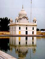
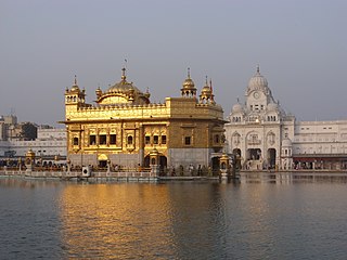
Amritsar, historically also known as Rāmdāspur and colloquially as Ambarsar, is the second-largest city in the Indian state of Punjab, after Ludhiana. It is a major cultural, transportation and economic centre, located in the Majha region of Punjab. The city is the administrative headquarters of the Amritsar district. It is situated 217 km (135 mi) north-west of Chandigarh, and 455 km (283 mi) north-west of New Delhi. It is 28 km (17.4 mi) from the India-Pakistan border, and 47 km (29 mi) north-east of Lahore, Pakistan.

<span class="mw-page-title-main">Jalandhar</span> Metropolis in Punjab, India

Jalandhar is a city in the state of Punjab in India. With a considerable population, it ranks as the third most-populous city in the state and is the largest city in the Doaba region. Jalandhar lies alongside the historical Grand Trunk Road and is a well-connected junction for both rail and road networks.

<span class="mw-page-title-main">Raipur</span> Metropolis in Chhattisgarh, India

Raipur ( ) is the capital city of the Indian state of Chhattisgarh. Raipur is also the administrative headquarters of Raipur district and Raipur division, and the largest city of the state. It was a part of Madhya Pradesh before the state of Chhattisgarh was formed on 1 November 2000. It is a major commercial hub for trade and commerce in the region. It has exponential industrial growth and has become a major business hub in Central India. It has been ranked as India's 6th cleanest city as per the Swachh Survekshan for the year 2021. Raipur is ranked 7th in the Ease of Living Index 2019 and 7th in the Municipal Performance Index 2020, both by the Ministry of Housing and Urban Affairs (MoHUA).

<span class="mw-page-title-main">Jhelum</span> City in Punjab, Pakistan

Jhelum is a city on the East Bank of the Jhelum River, which is located in the district of Jhelum in the North of Punjab, Pakistan. It is the 44th largest city of Pakistan by population. Jhelum is known for providing many soldiers to the British Army before independence, and later to the Pakistan armed forces, due to which it is also known as City of Soldiers or Land of Martyrs and Warriors.

<span class="mw-page-title-main">Malerkotla</span> City in Punjab, India

Malerkotla is a city and the district headquarters of Malerkotla district in the Indian state of Punjab. It served as the seat of the eponymous princely state during the British Raj. The state acceded to the union of India in 1947 and was merged with other nearby princely states to form the Patiala and East Punjab States Union (PEPSU).

<span class="mw-page-title-main">Ambala</span> City in Haryana, India

Ambala is a city and a municipal corporation in Ambala district in the state of Haryana, India, located on the border with the Indian state of Punjab and in proximity to both states capital Chandigarh. Politically, Ambala has two sub-areas: Ambala Cantonment and Ambala City, eight kilometres apart, therefore, it is also known as "Twin City." It has a large Indian Army and Indian Air Force presence within its cantonment area. It is located 200 km (124 mi) to the north of New Delhi, India's capital, and has been identified as a counter-magnet city for the National Capital Region to develop as an alternative center of growth to Delhi.

<span class="mw-page-title-main">Amritsar district</span> District in Punjab, India

Amritsar district is one of the twenty three districts that make up the Indian state of Punjab. Located in the Majha region of Punjab, the city of Amritsar is the headquarters of this district.

<span class="mw-page-title-main">Sri Ganganagar</span> City in Rajasthan, India

Sri Ganganagar is the northernmost city of the Indian state of Rajasthan, near the international border of India and Pakistan. It is the administrative headquarters of Sri Ganganagar district. It is named after Maharaja Shri Ganga Singh Bahadur, Maharaja of Bikaner. The city is also known as the "Food Basket of Rajasthan".

<span class="mw-page-title-main">Firozpur</span> City in Punjab, India

Firozpur, also known as Ferozepur, is a city on the banks of the Sutlej River in Firozpur District, Punjab, India. After the partition of India in 1947, it became a border town on the India–Pakistan border with memorials to soldiers who died fighting for India.

<span class="mw-page-title-main">Kapurthala district</span> District of Punjab in India

Kapurthala district is a district of Punjab state in northern India. The city of Kapurthala is the district headquarters.

<span class="mw-page-title-main">Rupnagar</span> City in Punjab, India

Rupnagar is a city and a municipal council in Rupnagar district in the Indian state of Punjab. Rupnagar is a newly created fifth Divisional Headquarters of Punjab comprising Rupnagar, Mohali, and its adjoining districts. It is also one of the bigger sites belonging to the Indus Valley civilization. Rupnagar is nearly 43 km (27 mi) to the northwest of Chandigarh. It is bordered by Himachal Pradesh to the north and Shahid Bhagat Singh Nagar district to its west.

<span class="mw-page-title-main">Ludhiana district</span> District of Punjab in India

Ludhiana district is one of the 23 districts in the Indian state of Punjab. It is Punjab's largest district by both area and population. Ludhiana, the largest city in Punjab, is the district headquarters.

<span class="mw-page-title-main">Moga district</span> District of Punjab in India

Moga district is one of the twenty-two districts in the state of Punjab, India. It became the 17th district of Punjab State on 24 November 1995 cut from Faridkot district. Moga District is among the largest producers of wheat and rice in Punjab, India. People from Moga City and Moga District belong to the Malwa culture. The district is noted for being the homeland for a high proportion of Indian Punjabi expatriates who emigrated abroad and their descendents, which has given it the nickname of "NRI district".

The economy of Punjab is the 16th largest state economy in India with 8.02 lakh crore (US$100 billion) (FY2024-25) in gross domestic product and a per capita GDP of US$3460(264,000) ranking 19th amongst Indian states.

Rurka Kalan is a village in the Tehsil Phillaur, Jalandhar, Punjab, India. Khurd and Kalan Persian language word which means small and Big respectively when two villages have same name then it is distinguished as Kalan means Big and Khurd means Small with Village Name.

<span class="mw-page-title-main">Punjab, India</span> State in northern India

Punjab, historically known as Panchanada (Sanskrit) or Pentapotamia, is a state in northwestern India. Forming part of the larger Punjab region of the Indian subcontinent, the state is bordered by the Indian states of Himachal Pradesh to the north and northeast, Haryana to the south and southeast, and Rajasthan to the southwest; by the Indian union territories of Chandigarh to the east and Jammu and Kashmir to the north. It shares an international border with Punjab, a province of Pakistan to the west. The state covers an area of 50,362 square kilometres, which is 1.53% of India's total geographical area, making it the 19th-largest Indian state by area out of 28 Indian states. With over 27 million inhabitants, Punjab is the 16th-largest Indian state by population, comprising 23 districts. Punjabi, written in the Gurmukhi script, is the most widely spoken and the official language of the state. The main ethnic group are the Punjabis, with Sikhs (57.7%) and Hindus (38.5%) forming the dominant religious groups. The state capital, Chandigarh, is a union territory and also the capital of the neighbouring state of Haryana. Three tributaries of the Indus River — the Sutlej, Beas, and Ravi — flow through Punjab.

<span class="mw-page-title-main">Outline of Punjab, India</span> Overview of and topical guide to Punjab, India

The following outline is provided as an overview of and topical guide to Punjab:

<span class="mw-page-title-main">Delhi–Amritsar–Katra Expressway</span> Indian expressway connecting Delhi with Katra in J&K

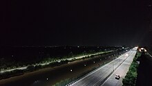
Delhi–Amritsar–Katra Expressway is an approved 670 km (420 mi) long, 4-lane wide controlled-access expressway, which will connect Bahadurgarh border near Delhi with Katra in Jammu and Kashmir via Haryana and Punjab. It will have a spur section which will connect Nakodar with Sri Guru Ram Dass Jee International Airport located in Raja Sansi, Amritsar. The 397.7 km (247.1 mi) long Delhi–Nakodar–Katra section is National Expressway 5(NE-5) and 99 km (62 mi) long Amritsar–Nakodar section is National Expressway 5A(NE-5A). Once completed, it will reduce the current Delhi-Katra distance from 727 km (452 mi) to 588 km (365 mi) and the time travel will be reduced from 14 hours to 6 hours, and Delhi-Amritsar distance to 405 km (252 mi) and from the time travel will be reduced from 8 hours to only 4 hours.

References

  1. "Metropolitan Cities of India" (PDF). cpcb.nic.in. Archived from the original (PDF) on 23 September 2015. Retrieved 22 December 2020.
  2. "Who's Who | District Ludhiana, Government of Punjab | India". ludhiana.nic.in. Archived from the original on 28 September 2022. Retrieved 8 July 2022.
  3. Bhardwaj, Nidhi (26 March 2018). "Balkar sandhu becomes mayor of Ludhiana | Ludhiana News - Times of India". The Times of India. Archived from the original on 28 August 2019. Retrieved 14 August 2019.
  4. 1 2 "Ludhiana City". Archived from the original on 12 August 2020. Retrieved 20 November 2020.
  5. 1 2 "Smart City Ludhiana" (PDF). Archived (PDF) from the original on 27 March 2020. Retrieved 20 November 2020.
  6. 1 2 "History". District Ludhiana, Government of Punjab, India. Archived from the original on 23 May 2022. Retrieved 11 June 2022.
  7. 1 2 3 "Area and Population". Official Website of Ludhiana. Archived from the original on 7 March 2016. Retrieved 4 March 2016.
  8. "United Nations HDI report - Punjab". in.undp.org. 9 March 2012. Archived from the original on 16 October 2021. Retrieved 20 February 2021.
  9. 1 2 164.100.161.224 http://164.100.161.224 Archived 14 August 2023 at the Wayback Machine  › filesPDF Ludhiana State: Punjab Category: Business & Industrial Centre, Tier 2 1 ...
  10. ":: Ludhiana_Municipal_Corporation ::". mcludhiana.gov.in. Archived from the original on 7 January 2022. Retrieved 3 November 2021.
  11. "India's Manchester". BBC. 28 February 2006. Archived from the original on 18 August 2014. Retrieved 25 May 2014.
  12. XIM University https://shs.xim.edu.in Archived 23 March 2023 at the Wayback Machine  › uploadsPDF LUDHIANA
  13. "Ludhiana | India | Britannica". Archived from the original on 27 October 2020. Retrieved 23 July 2020.
  14. "City 48 in Smart City rankings". Tribune. 15 March 2020. Archived from the original on 4 April 2023. Retrieved 10 April 2022.
  15. Lal, K. S. (1958). "Jasrat Khokhar". Proceedings of the Indian History Congress. 21: 274–281. ISSN   2249-1937. JSTOR   44145212.
  16. "Ludhiana". Encyclopaedia Britannica. Archived from the original on 27 October 2020. Retrieved 23 July 2020.
  17. "History". Ludhiana. Government of Punjab. Archived from the original on 19 October 2020. Retrieved 23 July 2020.
  18. Jain, Ananya (31 December 2019). "Ripe with history, Ludhiana's Lodhi Fort lies forgotten without ASI protection". The Indian Express. Archived from the original on 23 July 2020. Retrieved 23 July 2020.
  19. J.J. Lucas, "Literary Work of the American Presbyterian Mission, North India, Including Bible TranslatioLun and Revision, and Circulation of Religious Books and Tracts," Indian Evangelical Review 13 (July 1886): 43-63.
  20. "Falling Rain Genomics, Inc – Ludhiana". fallingrain.com. Archived from the original on 29 May 2008. Retrieved 8 June 2008.
  21. Majeed, Shariq (26 March 2014). "Ludhiana worries over its PM". The Times of India. Archived from the original on 27 March 2014.
  22. Preet, Jatinder (16 October 2011). "Ludhiana fourth most polluted city in the world". The Sunday Guardian. Delhi, India. Archived from the original on 12 April 2014.
  23. "How air and water pollution plagues Indian cities". Hindustan Times. 1 December 2013. Archived from the original on 29 January 2014.
  24. "Station: Ludhiana Climatological Table 1981–2010" (PDF). Climatological Normals 1981–2010. India Meteorological Department. January 2015. pp. 449–452. Archived from the original (PDF) on 5 February 2020. Retrieved 20 January 2021.
  25. "Extremes of Temperature & Rainfall for Indian Stations (Up to 2012)" (PDF). India Meteorological Department. December 2016. p. M171. Archived from the original (PDF) on 5 February 2020. Retrieved 20 January 2021.
  26. "Climate & Weather Averages in Ludhiana, Punjab, India". Time and Date. Retrieved 22 July 2022.
  27. "Climate and monthly weather forecast Ludhiana, India". Weather Atlas. Retrieved 14 June 2022.
  28. "Station: Ludhiana Climatological Table 1981–2010" (PDF). Climatological Normals 1981–2010. India Meteorological Department. January 2015. pp. 449–452. Archived from the original (PDF) on 5 February 2020. Retrieved 20 January 2021.
  29. "Extremes of Temperature & Rainfall for Indian Stations (Up to 2012)" (PDF). India Meteorological Department. December 2016. p. M171. Archived from the original (PDF) on 5 February 2020. Retrieved 20 January 2021.
  30. "Historical Census of India". Archived from the original on 17 February 2013. Retrieved 29 December 2014.
  31. "Urban Agglomerations/Cities having population 1 lakh and above" (PDF). Provisional Population Totals, Census of India 2011. Archived (PDF) from the original on 2 April 2013. Retrieved 7 July 2012.
  32. "Table C-01 Population by Religious Community: Punjab". censusindia.gov.in. Registrar General and Census Commissioner of India. Archived from the original on 14 March 2023. Retrieved 18 January 2023.
  33. 1 2 "C-1 Population By Religious Community - Ludhiana (M. Corp)". Archived from the original on 23 September 2015. Retrieved 2 December 2019.
  34. 1 2 3 4 "CENSUS OF INDIA, 1941 VOLUME VI PUNJAB". Archived from the original on 31 May 2022. Retrieved 17 January 2023.
  35. Virdee, Pippa (February 2018). From the Ashes of 1947. Cambridge University Press. p. 138. ISBN   978-1-108-42811-8. Archived from the original on 14 August 2023. Retrieved 10 January 2020.
  36. "Census of India, 1881 Report on the Census of the Panjáb Taken on the 17th of February 1881, vol. I." 1881. JSTOR   saoa.crl.25057656 . Retrieved 14 January 2024.
  37. "Census of India, 1881 Report on the Census of the Panjáb Taken on the 17th of February 1881, vol. II". 1881. JSTOR   saoa.crl.25057657 . Retrieved 14 January 2024.
  38. "CENSUS OF INDIA, 1891 GENERAL TABLES BRITISH PROVINCES AND FEUDATORY STATES VOL I". Archived from the original on 17 January 2023. Retrieved 17 January 2023.
  39. "CENSUS OF INDIA, 1901 VOLUME I-A INDIA PART II-TABLES". Archived from the original on 17 January 2023. Retrieved 17 January 2023.
  40. "CENSUS OF INDIA, 1911 VOLUME XIV PUNJAB PART II TABLES". Archived from the original on 21 July 2022. Retrieved 17 January 2023.
  41. "CENSUS OF INDIA, 1921 VOLUME XV PUNJAB AND DELHI PART II TABLES". Archived from the original on 17 January 2023. Retrieved 17 January 2023.
  42. "CENSUS OF INDIA, 1931 VOLUME XVII PUNJAB PART II TABLES". Archived from the original on 17 January 2023. Retrieved 17 January 2023.
  43. 1 2 "Table C-16 Population by Mother Tongue: Punjab (Town)". censusindia.gov.in. Registrar General and Census Commissioner of India.
  44. "Cow cess runs in crores, but stray-cattle menace continues in Ludhiana". Hindustan Times. 23 July 2021. Archived from the original on 23 February 2022. Retrieved 23 February 2022.
  45. "Electors and Polling Stations - VS 2017" (PDF). Archived (PDF) from the original on 10 January 2020. Retrieved 24 June 2021.
  46. "List of Parliamentary Constituencies and Assembly Constituencies in the State of Punjab as determined by the delimitation of Parliamentary and Assembly Constituency notification dated 19th June, 2006". 19 June 2006. Archived from the original on 26 June 2021. Retrieved 24 June 2021.
  47. "Doing Business in India 2009". World Bank. Archived from the original on 7 October 2010. Retrieved 8 June 2010.
  48. Entrepreneurship in India's small-scale industries. Richard P. Taub, Doris L. Taub
  49. Staff. "Ludhiana Portal Digital directories & Newspapers". City Vibes. Archived from the original on 15 December 2018. Retrieved 12 December 2018.
  50. "Punjab industry gives thumbs down to Arun Jaitley's Union Budget". Hindustan Times. 1 February 2018. Archived from the original on 5 December 2018. Retrieved 12 December 2018.
  51. "BizMerlinHR Named a Cool Vendor in the 2021 Gartner 'Cool Vendors in Human Capital Management: Technology Innovations to Support the Future of Work' Report". BizMerlinHR. 30 April 2021. Archived from the original on 19 May 2021. Retrieved 19 May 2021.
  52. "District Sports Office | District Ludhiana, Government of Punjab | India". ludhiana.nic.in. Archived from the original on 24 November 2021. Retrieved 24 November 2021.
  53. "Kabaddi World Cup: India all the way". The Tribune – Sports Page. 21 November 2011. Archived from the original on 23 February 2012. Retrieved 10 June 2012.
  54. Sharma, Nitin (12 December 2016). "Chandigarh's Minerva Football Club inducted into AIFF league". The Indian Express. Archived from the original on 24 November 2021. Retrieved 24 November 2021.
  55. "Racy start to Kila Raipur Rural Olympics". The Tribune – Ludhiana Tribune. 4 February 2011. Archived from the original on 17 June 2012. Retrieved 10 June 2012.
  56. "Leisure Valley rink hosts roller-skating competition". Tribuneindia News Service. 15 March 2018. Archived from the original on 17 May 2022. Retrieved 9 September 2020.
  57. "Ludhiana to Kolkata". Archived from the original on 10 March 2014. Retrieved 22 March 2021.
  58. "State Highways in Punjab". PWD - Govt. of Punjab, India. Archived from the original on 25 May 2018. Retrieved 25 May 2018.
  59. "National Highways in Punjab". PWD - Govt. of Punjab. Archived from the original on 25 May 2018. Retrieved 25 May 2018.
  60. http://www.aai.aero/allAirports/ludhiana.jsp Archived 24 March 2013 at the Wayback Machine Airport website
  61. "Delhi-Katra Vande Bharat Express: Fare, timings, features, other details". Livemint. 29 September 2019. Archived from the original on 13 February 2020. Retrieved 13 February 2020.
  62. "Ola Cabs launch in Ludhiana and Amritsar". Archived from the original on 30 October 2014.
  63. Ltd., Zoomcar India Private. "Self Drive Cars in Ludhiana". Zoomcar. Archived from the original on 15 September 2017. Retrieved 15 September 2017.
  64. "Education and Medical Facilities - Official Website of Ludhiana". Archived from the original on 22 December 2015.
  65. Staff. "Digital directories & Newspapers". City Vibes. Archived from the original on 1 November 2018. Retrieved 1 November 2018.
  66. Kumar, Aneesha Sareen (12 May 2021). "Govt-aided school in Ludhiana opens for teachers in violation of curfew orders". Hindustan Times. Archived from the original on 11 April 2022. Retrieved 11 April 2022.
  67. "Ludhiana Colleges". Mapsofindia.com. Archived from the original on 2 December 2011. Retrieved 16 June 2014.
  68. "GADVASU CET 2017 Second Counseling Results Declared on gadvasu.in". News18. 17 August 2017. Archived from the original on 11 April 2022. Retrieved 11 April 2022.
  69. "BFUHS Affiliations". bfuhs.ac.in. Archived from the original on 15 July 2023. Retrieved 15 July 2023.
  70. "www.bsrdindia.com". Archived from the original on 1 August 2015. Retrieved 27 July 2015.

Bibliography