Ludhiana district

Last updated

Ludhiana district
Lodhipur
Ludhiana in Punjab (India).svg
Location in Punjab
Coordinates: 30°53′N75°51′E / 30.883°N 75.850°E / 30.883; 75.850
CountryFlag of India.svg  India
State Punjab
Headquarters Ludhiana
Area
  Total3,767 km2 (1,454 sq mi)
  Rank1 (out of 23)
Population
 (2011) [1]
  Total3,498,739
  Rank1 (out of 23)
  Density975/km2 (2,530/sq mi)
Languages
  Official Punjabi
Time zone UTC+5:30 (IST)
Sex ratio 1000/873 /
Literacy73.5%
Lok Sabha constituency1
Vidhan Sabha constituency14
HDI (2006)Increase2.svg 0.761 [2] (High)
Website www.ludhiana.nic.in
^  ‡: Population increase (2001–2011): 15%

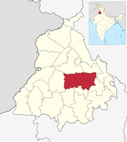
Ludhiana district is one of the 23 districts in the Indian state of Punjab. It is Punjab's largest district by both area and population. Ludhiana, the largest city in Punjab, is the district headquarters.

Contents

The main industries are bicycle parts and hosiery. Ludhiana is a hub of ladies footwear manufacturing, with around 10,000 small-scale units. The district is made up of seven tehsils, seven sub-tehsils and twelve development blocks. [3]

Ludhiana district has the highest HDI in Punjab at 0.761 (2004 UNDP). [4]

History

Ludhiana gets its name from the Lodhi Dynasty, which is believed to have founded the city in 1480. During the reign of the Mughal emperor Akbar, the area formed part of the Sarkar of Sirhind. Chakar, Talwandi Rai in 1478 AD, Raikot in 1648 AD and Jagraon in 1688 AD were founded by the Rai family of Raikot. [5] It is said that one of the Rai rulers of Raikot, named Rai Kalha (chaudhary of Raikot and Jagraon), gave sanctuary to Guru Gobind Singh in 1705 in the aftermath of the Battle of Chamkaur and Uch-da-Peer (meaning "saint of Uch") episode of the tenth Guru's life, when the Mughal armies were in hot pursuit of the religious leader. [6] In thanks for this, the Guru gifted a sword with an inscribed blade to the Rai dynasty of Raikot, known as the Raikot sword. [6]

In the latter period of Mughal rule the western part of the district was leased to the Rais of Raikot. By the early eighteenth century, they had become semi-independent of the Mughals. The villages in Ludhiana district remained independent and under the rule of local powerful village Sikh chieftains, from 1707 to 1835. In 1747 Ahmad Shah Durrani invaded and battled the imperial army near Khanna. Although the Mughals were able to stop Ahmad Shah, his subsequent invasions weakened the Mughals, which allowed the Rais to take control of Ludhiana town in 1760. [7]

During the reign of Maharaja Ranjit Singh, Ludhiana became an important British cantonment. Initially, in 1805, Ranjit Singh occupied Ludhiana. However, in 1809, the British decided to curb his advance eastward and sent troops to confront him. Ranjit Singh was forced to sign the treaty of 'perpetual friendship' with the British, which confined his activities to the right bank of the Sutlej. British troops were permanently stationed in Ludhiana and the Cis-Sutlej states came under British protection.

According to the 1901 census, Hindus numbered 269,076, or 40% of the total; Muslims, 235,937, or 35%; and Sikhs, 164,919, or 24%. [8] The majority of the Muslim population within the district migrated to Pakistan as a result of the communal violence following the Partition of India. [9]

Historical population
YearPop.±% p.a.
1901685,038    
1911527,575−2.58%
1921579,161+0.94%
1931687,387+1.73%
1941839,622+2.02%
1951858,487+0.22%
19611,078,269+2.31%
19711,384,957+2.53%
19811,778,689+2.53%
19912,428,382+3.16%
20013,032,831+2.25%
20113,498,739+1.44%
source: [10]

Geography

Ludhiana is a centrally located city of Punjab, which is on the Grand Trunk Road from Delhi to Amritsar at latitude 30.55 North and longitude 75.54 East in Northern India.

Ludhiana is the most centrally located district in the Malwa region of the state of Punjab. For administrative purposes, it has been placed in the Patiala Division. It lies between north latitude 30°-34' and 31°-01' and east longitude 75°-18' and 76°-20'.

It is bounded on the north by the Satluj River, which separates it from Jalandhar district. The river forms its northern boundary with Hoshiarpur district. On other sides it shares common boundaries with Rupnagar district in the east, Moga district in the west, and Barnala, Sangrur and Patiala districts in the south and southeast, respectively. [3]

Topography

The topography of the district is a typical representative of an alluvial plain. It owes its origin to the aggravation work of the Satluj River. The alluvium deposited by the river has been worked over by the wind, which gave rise to a number of small dunes and sand mounds. Most of these dunes have been levelled by farmers.

The district can be divided into the flood plain of the Satluj and the upland plain.

Climate

Ludhiana features a semi-arid climate under the Köppen climate classification, with three defined seasons; summer, monsoon, and winter. This climate is characterised by dryness except for a brief spell of monsoon season, a very hot summer, and a bracing winter. The cold season is from mid-November to the early part of March. The succeeding period until the end of June is the hot season. July, August and half of September constitute the southwest monsoon. The period of mid-September to about the middle of November may be termed as a post-monsoon or transitional period.

June is generally the hottest month. Hot and scorching dust-laden winds blow during the summer season. December and January are the coldest months. Ludhiana on average sees roughly 809.3 millimetres (31.86 in) of precipitation annually. The official weather station for the city is in the compound of the Civil Surgeon's Office to the west of Ludhiana. Weather records here data back to 1 August 1868.

MonthJanFebMarAprMayJunJulAugSepOctNovDecYear
Record high °C (°F)29.2
(84.6)
33.3
(91.9)
41.1
(106.0)
46.1
(115.0)
48.3
(118.9)
47.9
(118.2)
47.8
(118.0)
44.4
(111.9)
41.7
(107.1)
40.0
(104.0)
35.8
(96.4)
29.4
(84.9)
48.3
(118.9)
Mean daily maximum °C (°F)17.9
(64.2)
21.8
(71.2)
27.3
(81.1)
34.8
(94.6)
39.0
(102.2)
38.0
(100.4)
34.1
(93.4)
33.4
(92.1)
33.1
(91.6)
31.9
(89.4)
27.1
(80.8)
20.9
(69.6)
29.9
(85.8)
Mean daily minimum °C (°F)6.1
(43.0)
8.7
(47.7)
13.0
(55.4)
18.2
(64.8)
23.5
(74.3)
26.1
(79.0)
26.6
(79.9)
25.9
(78.6)
23.5
(74.3)
17.3
(63.1)
11.2
(52.2)
6.8
(44.2)
17.2
(63.0)
Record low °C (°F)−2.2
(28.0)
−1.1
(30.0)
1.4
(34.5)
7.1
(44.8)
11.7
(53.1)
18.0
(64.4)
17.4
(63.3)
18.0
(64.4)
15.2
(59.4)
8.4
(47.1)
0.3
(32.5)
−1.1
(30.0)
−2.2
(28.0)
Average rainfall mm (inches)28.0
(1.10)
36.2
(1.43)
27.0
(1.06)
17.5
(0.69)
21.2
(0.83)
87.4
(3.44)
217.1
(8.55)
187.2
(7.37)
138.4
(5.45)
18.8
(0.74)
3.9
(0.15)
8.6
(0.34)
791.1
(31.15)
Average rainy days2.12.92.11.71.74.98.68.75.51.00.40.940.6
Average relative humidity (%) (at 17:30 IST)66584827264267736550506253
Average dew point °C (°F)8
(46)
12
(54)
15
(59)
16
(61)
19
(66)
23
(73)
26
(79)
26
(79)
24
(75)
19
(66)
13
(55)
10
(50)
18
(64)
Average ultraviolet index 4578998776547
Source 1: India Meteorological Department [11] [12] Time and Date (dewpoints, 2005-2015) [13]
Source 2: Weather Atlas [14]

Rainfall

The rainfall in the district increases from the southwest toward the northeast. About 70% of the rainfall is received during the period of July through September. The rainfall between December and March accounts for 16% of the rainfall; the remaining 14% rainfall is received in the other months.

Pollution

Ludhiana has one of the worst air pollution problems in India, with particulate matter being over six times the World Health Organization recommended standard, making it the 13th most polluted city in the world in the year 2014. [15] [16] Industrial water pollution is also of significant concern in portions of Ludhiana, notably along the Budha Dariya. [17]

Rivers and drains

The Sutlej and its tributary, the Buddha Nala, constitute the chief hydrographic features of the district. A brief description of these is as follows.

Sutlej River
originates from Lake Manasarovar in Tibet. After flowing through Himachal Pradesh, it debouches from the Shivaliks. Just about Rupnagar, 32 km east of the boundary of Samrala Tehsil, it flows due west along the top of the district for 96 km and turns, as it leaves Jagraon Tehsil, slightly north toward its junction with the Beas at Harike. It maintains an east-west direction. It can be devastating during floods. The Sutlej has experienced a westward drift during recent times. Old towns and villages, such as Bahlulpur, Machhiwara, and Kum Kalan, were built on its banks. The river has since been dammed at Bhakhra, which has considerably checked its flooding menace in the district.
Buddha Nala
It runs parallel to the Satluj on its south for a fairly large section of its course in the district and ultimately joins the Satluj at Gorsian Kadar Baksh in the northwestern corner of the district. It floods during the rainy season, but in the dry season, it can be crossed on foot at certain points. Ludhiana and Machhiwara are to the south of the Buddha Nala. The water of the stream is polluted after it enters Ludhiana City.

Demographics

According to the 2011 census, Ludhiana district has a population of 3,498,739 [1] roughly equal to the nation of Panama [18] or the US state of Connecticut. [19] Ludhiana district has a total of 2,560,225 literates which constitutes 73.5% of the population, of which male literary is 76.5% and female literacy is 69.4%. The effective literacy of 7+ population of Ludhiana district is 82.20%, of which male is 86% and female literacy is 77.9%. The sex ratio of 873 females for every 1,000 males. [1] The total Scheduled Caste population is 923,358 (26.39%). There were 716826 households in the district in 2011. [1]

The number of workers in the district is 1285,000, which means a work participation rate of 36.7%. Out of the total workforce of the district, 18.7% are engaged in the agriculture sector, 5.6% are working in the household industry, and the rest are employed in other sectors/industries. [20]

Gender

The table below shows the sex ratio of Ludhiana district through decades.

Sex ratio of Ludhiana district [21]
Census yearRatio
2011873
2001824
1991844
1981860
1971848
1961856
1951852
1941832
1931791
1921784
1911765
1901829

The table below shows the child sex ratio of children below the age of 6 years in the rural and urban areas of Ludhiana district.

Child sex ratio of children below the age of 6 years in Ludhiana district [22]
YearUrbanRural
2011860859
2001819815

Religion

Religion in Ludhiana district (2011) [23]
ReligionPercent
Sikhism
53.26%
Hinduism
42.94%
Islam
2.22%
Jainism
0.56%
Christianity
0.47%
Other or not stated
0.55%
Religious groups in Ludhiana District (British Punjab province era)
Religious
group
1901 [24] 1911 [25] [26] 1921 [27] 1931 [28] 1941 [29]
Pop. %Pop.%Pop.%Pop.%Pop.%
Hinduism Om.svg [lower-alpha 1] 269,076131,370135,512120,161171,715
Islam Star and Crescent.svg 235,937176,043192,961235,598302,482
Sikhism Khanda.svg 164,919207,042235,721312,829341,175
Jainism Jain Prateek Chihna.svg 2,2171,8491,7961,4191,279
Christianity Christian cross.svg 9478881,6132,4771,913
Zoroastrianism Faravahar.svg 101951
Buddhism Dharma Wheel (2).svg 00050
Judaism Star of David.svg 00000
Others000050
Total population673,097517,192567,622672,494818,615
Note: British Punjab province era district borders are not an exact match in the present-day due to various bifurcations to district borders — which since created new districts — throughout the historic Punjab Province region during the post-independence era that have taken into account population increases.
Religion in Ludhiana District
Religious
group
2011 [23]
Pop. %
Sikhism 1,863,408
Hinduism 1,502,403
Islam 77,713
Christianity 16,517
Others38,698
Total Population3,498,739

The table below shows the population of different religions in absolute numbers in the urban and rural areas of Ludhiana district. [30]

Absolute numbers of different religious groups in Ludhiana district [30]
ReligionUrban (2011)Rural (2011)Urban (2001)Rural (2001)Urban (1991)Rural (1991)
Hindu12,89,1592,13,24410,46,2851,58,8434,71,8011,14,722
Sikh6,80,18911,83,2195,83,99611,60,4502,78,5669,31,420
Christian13,4693,0489,9001,7563,229811
Muslim53,20124,51235,02217,1982,3366,977
Other religions33,6905,00818,4509318,208842

Language

Languages of Ludhiana district (First Language) (2011) [31]

   Punjabi (79.65%)
   Hindi (18.19%)
  Others (2.16%)

At the time of the 2011 census 79.65% of the population spoke Punjabi and 18.19% Hindi as their first language. Hindi is spoken mainly in urban areas. [31]

Health

The table below shows the data from the district nutrition profile of children below the age of 5 years, in Ludhiana, as of year 2020.

District nutrition profile of children under 5 years of age in Ludhiana, year 2020 [32]
IndicatorsNumber of children (<5 years)Percent (2020)Percent (2016)
Stunted58,00922%30%
Wasted15,4366%18%
Severely wasted2,5771%3%
Underweight32,71212%28%
Overweight/obesity16,8566%1%
Anemia184,06278%61%
Total children262,962

The table below shows the district nutrition profile of Ludhiana of women between the ages of 15 to 49 years, as of year 2020.

District nutritional profile of Ludhiana of women of 15-49 years, in 2020 [32]
IndicatorsNumber of women (15-49 years)Percent (2020)Percent (2016)
Underweight (BMI <18.5 kg/m^2)113,22610%9%
Overweight/obesity504,98345%35%
Hypertension294,32126%15%
Diabetes171,79915%NA
Anemia (non-preg)727,40465%66%
Anemia (preg)NANA46%
Total women (preg)62,825
Total women1,119,944

Government and politics

Politics

The district is a part of the Ludhiana Lok Sabha constituency. Ravneet Singh Bittu from Congress is the MP since 2019. Following is a list of the assembly constituencies in the district.

MLAs

No.ConstituencyName of MLAPartyBench
57 Khanna Tarunpreet Singh Sond Aam Aadmi Party Government
58 Samrala Jagtar Singh Aam Aadmi Party Government
59 Sahnewal Hardeep Singh Mundian Aam Aadmi Party Government
60 Ludhiana East Daljit Singh Grewal Aam Aadmi Party Government
61 Ludhiana South Rajinder Pal Kaur Chhina Aam Aadmi Party Government
62 Atam Nagar Kulwant Singh Sidhu Aam Aadmi Party Government
63 Ludhiana Central Ashok Prashar Pappi Aam Aadmi Party Government
64 Ludhiana West Gurpreet Gogi Aam Aadmi Party Government
65 Ludhiana North Madan Lal Bagga Aam Aadmi Party Government
66 Gill (SC) Jiwan Singh Sangowal Aam Aadmi Party Government
67 Payal (SC) Manwinder Singh Gyaspura Aam Aadmi Party Government
68 Dakha Manpreet Singh Ayali Shiromani Akali Dal Opposition
69 Raikot (SC) Hakam Singh Thekedar Aam Aadmi Party Government
70 Jagraon (SC) Saravjit Kaur Manuke Aam Aadmi Party Government

Administrative divisions

For the administrative purpose, Ludhiana district is divided into seven tehsils, which are: -

  1. Jagraon
  2. Khanna
  3. Ludhiana (East)
  4. Ludhiana (West)
  5. Payal
  6. Raikot
  7. Samrala

Ludhiana West Tehsil is a tehsil in Ludhiana district. It has 125 villages.

Ludhiana East Tehsil is a tehsil in Ludhiana district. It has 181 villages.

Also, there are seven sub-tehsils in Ludhiana district: -

  1. Dehlon
  2. Koom Kalan
  3. Ludhiana Central
  4. Machhiwara
  5. Maloud
  6. Mullanpur Dakha
  7. Sidhwan Bet

Economy

Culture/Cityscape

Places of interest

Notable people

Related Research Articles

<span class="mw-page-title-main">Bahawalpur</span> City in Punjab, Pakistan

Bahawalpur is a city in the Punjab province of Pakistan. It is one of the ten largest cities of Pakistan and 6th most populous city of Punjab. Bahawalpur is the capital of Bahawalpur Division.

<span class="mw-page-title-main">Gujrat, Pakistan</span> City in Punjab, Pakistan

Gujrat is a city in the Pakistani province of Punjab. It is the headquarters of the Gujrat District and the 20th largest city in Pakistan, with a population of over 390,000 in 2017. Along with the nearby cities of Sialkot and Gujranwala, Gujrat forms part of the Golden Triangle of industrial cities with export-oriented economies.

<span class="mw-page-title-main">Kasur</span> City in Punjab, Pakistan

Kasur is a city to the south of Lahore, in the Pakistani province of Punjab. The city serves as the headquarters of Kasur District. Kasur is the 16th largest city in Punjab and 24th largest in Pakistan, by population. It is also known for being the burial place of the 17th-century Sufi-poet Bulleh Shah. It is farther west of the border with neighboring India, and bordered to Lahore, Sheikhupura and Okara Districts of Punjab. The city is an aggregation of 26 fortified hamlets overlooking the alluvial valleys of the Beas and Sutlej rivers.

<span class="mw-page-title-main">Faridkot, India</span> City in Punjab, India

Faridkot is a city in the South-western part of state of Punjab, India. It serves as the headquarters for both, the Faridkot district. as well as the Faridkot Division. The division was established in 1995 at Faridkot which includes Faridkot, Bathinda, and Mansa districts.

<span class="mw-page-title-main">Malerkotla</span> City in Punjab, India

Malerkotla is a city and the district headquarters of Malerkotla district in the Indian state of Punjab. It served as the seat of the eponymous princely state during the British Raj. The state acceded to the union of India in 1947 and was merged with other nearby princely states to form the Patiala and East Punjab States Union (PEPSU).

<span class="mw-page-title-main">Hisar district</span> District of Haryana in India

Hisar district is one of the 22 districts of Haryana, India. Hisar city serves as the district headquarters. Hisar district has four sub-divisions that is, Hisar, Barwala, Hansi and Narnaud, each headed by an SDM. The district is also part of Hisar division. Hisar was founded by Firuz Shah Tughlaq.

<span class="mw-page-title-main">Gurdaspur district</span> District in Punjab, India

Gurdaspur district is a district in the Majha region of the state of Punjab, India. Gurdaspur is the district headquarters. It internationally borders Narowal District of Pakistani Punjab, and the districts of Amritsar, Pathankot, Kapurthala and Hoshiarpur. Two main rivers Beas and Ravi passes through the district. The Mughal emperor Akbar is said to have been enthroned in a garden near Kalanaur, a historically important town in the district. The district is at the foothills of the Himalayas.

<span class="mw-page-title-main">Hoshiarpur district</span> District in Punjab, India

Hoshiarpur district is a district of Punjab state in northern India. Hoshiarpur, one of the oldest districts of Punjab, is located in the North-east part of the Punjab state and shares common boundaries with Gurdaspur district in the north-west, Jalandhar district and Kapurthala district in south-west, Kangra district and Una district of Himachal Pradesh in the north-east. Hoshiarpur district comprises 4 sub-divisions, 10 community development blocks, 9 urban local bodies and 1417 villages. The district has an area of 3365 km2. and a population of 1,586,625 persons as per census 2011.

<span class="mw-page-title-main">Amritsar district</span> District in Charda Punjab, India

Amritsar district is one of the twenty three districts that make up the Indian state of Punjab. Located in the Majha region of Punjab, the city of Amritsar is the headquarters of this district.

<span class="mw-page-title-main">Jhang</span> City in Punjab, Pakistan

Jhang is the capital city of Jhang District in the central portion of the province of Punjab, Pakistan. Situated on the east bank of the Chenab river, it is the 18th largest city of Pakistan by population.

Jagraon is a city and a municipal council, a rural police district and a sub-division of the Ludhiana district in the Indian state of Punjab. Jagraon is more than three centuries old. Jagraon is at almost the geographical center of the state, 16 kilometres (9.9 mi) from the Satluj River. It is 37 km (23 mi) from its district headquarters Ludhiana, 29 km (18 mi) from Moga, 31 km (19 mi) from Nakodar and 54 miles from Barnala.

<span class="mw-page-title-main">Firozpur district</span> District in Punjab, India

Firozpur district, also known as Ferozepur district, is one of the twenty-three districts in the state of Punjab, India. Firozpur district comprises an area of 2,190 km2 (850 sq mi).

<span class="mw-page-title-main">Sialkot District</span> District of Sialkot, Pakistan

Sialkot District, is one of the districts of the Punjab province of Pakistan. It is located in the Majha region of Punjab, otherwise the northeast of the province. The city of Sialkot is the capital of the district. The Sialkot Cantonment was established in 1852.

<span class="mw-page-title-main">Jalandhar district</span> District in Punjab, India

Jalandhar district is a district in Doaba region of the state of Punjab, India. The district headquarters is the city of Jalandhar.

<span class="mw-page-title-main">Rupnagar district</span> District of Punjab in India

Rupnagar district is one of twenty-three districts in the state of Punjab, India. The city of Rupnagar is said to have been founded by a Raja called Rokeshar, who ruled during the 11th century and named it after his son Rup Sen. It is also the site of an ancient town of the Indus Valley civilization. The major cities in Rupnagar District are Morinda, Nangal and Anandpur Sahib. Morinda is also known as Baghwāla "[The City] of Gardens." Morinda is located on the Chandigarh-Ludhiana Highway. The Bhakra Dam in Nangal lies on the boundary with the neighboring state of Himachal Pradesh. Dadhi is one of the most important villages of the district, particularly because of Gurudwara Sri Hargobindsar Sahib.

<span class="mw-page-title-main">Moga district</span> District of Punjab in India

Moga district is one of the twenty-two districts in the state of Punjab, India. It became the 17th district of Punjab State on 24 November 1995 cut from Faridkot district. Moga District is among the largest producers of wheat and rice in Punjab, India. People from Moga City and Moga District belong to the Malwa culture. The district is noted for being the homeland for a high proportion of Indian Punjabi expatriates who emigrated abroad and their descendents, which has given it the nickname of "NRI district".

<span class="mw-page-title-main">Gujranwala District</span> District in Punjab, Pakistan

Gujranwala District, is a district that is a part of the Majha region in Punjab, Pakistan. Gujranwala District is bordered by the districts of Wazirabad, Sialkot, Hafizabad and Sheikhupura. Gujranwala district has 5 National Assembly and 12 Punjab Assembly constituencies.

Punjab is home to 2.3% of India's population; with a density of 551 persons per km2. According to the provisional results of the 2011 national census, Punjab has a population of 27,743,338, making it the 16th most populated state in India. Of which male and female are 14,639,465 and 13,103,873 respectively. 32% of Punjab's population consists of Dalits. In the state, the rate of population growth is 13.9% (2011), lower than national average. Out of total population, 37.5% people live in urban regions. The total figure of population living in urban areas is 10,399,146 of which 5,545,989 are males and while remaining 4,853,157 are females. The urban population in the last 10 years has increased by 37.5%. According to the 2011 Census of India, Punjab, India has a population of around 27.7 million.

Malwai is a Punjabi dialect spoken in the Malwa region of Punjab.

<span class="mw-page-title-main">Islam in Punjab, India</span>

Islam is a minority religion in Punjab, India followed by 535,489 people constituting about 1.93 percent of the state population out of 27.7 million population as of 2011 census report.

References

  1. 1 2 3 4 "District Census Hand Book – Ludhiana" (PDF). Census of India . Registrar General and Census Commissioner of India.
  2. "United Nations HDI report - Punjab".
  3. 1 2 "Administrative Set-Up". District official website. Retrieved 19 July 2012.
  4. "Punjab". UNDP in India. Retrieved 10 October 2019.
  5. Ludhiana Dist. Gazetteer 1888-89 & 1904. Chiefs of Punjab 1890, 1909 & 1940
  6. 1 2 Singh, Kulwant (2002). "Search for the Sacred Swords". Nishaan Nagaara magazine (annual issue) (PDF). pp. 52–54.
  7. "Imperial Gazetteer2 of India, Volume 16, page 200 -- Imperial Gazetteer of India -- Digital South Asia Library". dsal.uchicago.edu.
  8. "Imperial Gazetteer2 of India, Volume 16, page 202 -- Imperial Gazetteer of India -- Digital South Asia Library". dsal.uchicago.edu.
  9. "Violence, Displacement and the Issue of Identity - 1947". 9 March 2005. Archived from the original on 9 March 2005.
  10. Decadal Variation In Population Since 1901
  11. "Station: Ludhiana Climatological Table 1981–2010" (PDF). Climatological Normals 1981–2010. India Meteorological Department. January 2015. pp. 449–452. Archived from the original (PDF) on 5 February 2020. Retrieved 20 January 2021.
  12. "Extremes of Temperature & Rainfall for Indian Stations (Up to 2012)" (PDF). India Meteorological Department. December 2016. p. M171. Archived from the original (PDF) on 5 February 2020. Retrieved 20 January 2021.
  13. "Climate & Weather Averages in Ludhiana, Punjab, India". Time and Date. Retrieved 22 July 2022.
  14. "Climate and monthly weather forecast Ludhiana, India". Weather Atlas. Retrieved 14 June 2022.
  15. Majeed, Shariq (26 March 2014). "Ludhiana worries over its PM". The Times of India. Archived from the original on 27 March 2014.
  16. Preet, Jatinder (16 October 2011). "Ludhiana fourth most polluted city in the world". The Sunday Guardian. Delhi, India. Archived from the original on 12 April 2014.
  17. "How air and water pollution plagues Indian cities". Hindustan Times. 1 December 2013. Archived from the original on 29 January 2014.
  18. US Directorate of Intelligence. "Country Comparison:Population". Archived from the original on 13 June 2007. Retrieved 1 October 2011. Panama 3,460,462 July 2011 est.
  19. "2010 Resident Population Data". U. S. Census Bureau. Archived from the original on 19 October 2013. Retrieved 30 September 2011. Connecticut 3,574,097
  20. "Population of Ludhiana, Ludhiana Population 2018". www.punjabdata.com.
  21. "District-wise Decadal Sex ratio in Punjab". Open Government Data (OGD) Platform India. 21 January 2022. Retrieved 20 November 2023.
  22. "District-wise Rural and Urban Child Population (0-6 years) and their sex ratio in Punjab". Open Government Data (OGD) Platform India. 21 January 2022. Retrieved 21 November 2023.
  23. 1 2 "Table C-01 Population by Religious Community: Punjab". censusindia.gov.in. Registrar General and Census Commissioner of India.
  24. "Census of India 1901. [Vol. 17A]. Imperial tables, I-VIII, X-XV, XVII and XVIII for the Punjab, with the native states under the political control of the Punjab Government, and for the North-west Frontier Province". 1901. p. 34. JSTOR   saoa.crl.25363739 . Retrieved 23 March 2024.
  25. "Census of India 1911. Vol. 14, Punjab. Pt. 2, Tables". 1911. p. 27. JSTOR   saoa.crl.25393788 . Retrieved 23 March 2024.
  26. Kaul, Harikishan (1911). "Census Of India 1911 Punjab Vol XIV Part II". p. 27. Retrieved 23 March 2024.
  27. "Census of India 1921. Vol. 15, Punjab and Delhi. Pt. 2, Tables". 1921. p. 29. JSTOR   saoa.crl.25430165 . Retrieved 23 March 2024.
  28. "Census of India 1931. Vol. 17, Punjab. Pt. 2, Tables". 1931. p. 277. JSTOR   saoa.crl.25793242 . Retrieved 23 March 2024.
  29. "Census of India, 1941. Vol. 6, Punjab". 1941. p. 42. JSTOR   saoa.crl.28215541 . Retrieved 23 March 2024.
  30. 1 2 "Open Government Data (OGD) Platform India - All Religions". data.gov.in. 21 January 2022. Retrieved 7 August 2023.
  31. 1 2 "Table C-16 Population by Mother Tongue: Punjab". censusindia.gov.in. Registrar General and Census Commissioner of India.
  32. 1 2 "Ludhiana District Nutrition Profiles" (PDF). NITI Aayog . Retrieved 14 December 2023.
  1. 1931-1941: Including Ad-Dharmis