Related Research Articles

Arunachal Pradesh is a state in northeast India. It was formed from the North-East Frontier Agency (NEFA) region, and India declared it as a state on 20 February 1987. Itanagar is its capital and largest town. It borders the Indian states of Assam and Nagaland to the south. It shares international borders with Bhutan in the west, Myanmar in the east, and a disputed 1,129 km border with China's Tibet Autonomous Region in the north at the McMahon Line. It is disputed by China and claimed as part of Tibet, although this claim is internationally unrecognized and India maintains its control over the state. China occupied some regions of Arunachal Pradesh in 1962 but later withdrew its forces.

India is a federal union comprising 28 states and 8 union territories, for a total of 36 entities. The states and union territories are further subdivided into districts and smaller administrative divisions.

Bagdogra is a settlement in the Naxalbari CD block in the Siliguri subdivision of the Darjeeling district, in the Indian state of West Bengal. It is a part of the Greater Siliguri Metropolitan Area. Bagdogra is well connected by air to six major cities of India – Delhi, Mumbai, Bengaluru, Hyderabad, Kolkata and Chennai through the Bagdogra Airport. The Bagdogra railway station is also well connected.

Lakhimpur district is an administrative district in the state of Assam in India. The district headquarter is located at North Lakhimpur. The district is bounded on the North by Siang and Papumpare districts of Arunachal Pradesh and on the East by Dhemaji District and Subansiri River. Majuli District stands on the Southern side and Biswanath District is on the West.
Tani, is a branch of Tibeto-Burman languages spoken mostly in Arunachal Pradesh, Assam, and neighboring regions.
The Roman Catholic Diocese of Itanagar in India was created on 7 December 2005 by splitting it from the Diocese of Tezpur. It is a suffragan diocese of the Archdiocese of Guwahati. Its first bishop was John Thomas Kattrukudiyil. The St. Joseph's church in Itanagar is the cathedral of the diocese.
Jorhat Airport, also known as Rowriah Airport, is a domestic airport serving the cities of Jorhat and Golaghat in Assam, India. It is located at Rowriah, situated 7 km (4.3 mi) south-west from Jorhat and 51 km (32 mi) north-east from Golaghat.

The North-East Frontier Agency (NEFA), originally known as the North-East Frontier Tracts (NEFT), was one of the political divisions in British India, and later the Republic of India until 20 January 1972, when it became the Union Territory of Arunachal Pradesh and some parts of Assam. Its administrative headquarters was Shillong. It received the status of State on 20 February 1987.
Central Agricultural University is an agricultural university at Lamphelpat, Imphal in the Indian state of Manipur.
Mising is a Tani language spoken by the Mising people. There are 629,954 speakers, who inhabit mostly the Lakhimpur, Sonitpur, Dhemaji, Dibrugarh, Sibsagar, Jorhat, Majuli, Golaghat, Tinsukia districts of Assam and also some parts of Arunachal Pradesh. The primary literary body of Mising is known as 'Mising Agom Kébang '.

The following outline is provided as an overview of, and topical guide to, India:
This article gives a list of the territories of the dioceses of the Catholic Church in India.
Arunachal Frontier Highway (AFH), officially notified as the National Highway NH-913 and also called Bomdila-Vijaynagar Highway (BVH), connecting Bomdila Airstrip ALG & HQ in northwest to Vijaynagar Airstrip ALG & HQ in southeast via Nafra HQ-Sarli HQ-Huri Helipad ALG & HQ-Nacho HQ-Mechuka Airstrip ALG & HQ-Monigong HQ-Jido -Hunli HQ-Hayuliang Airstrip ALG HQ-Chenquenty-Hawai HQ-Miao HQ including 800 km greenfield section and network of new tunnels & bridges, is a 2-lane paved-shoulder under-construction national highway along the India-China LAC-McMahon Line border in the Indian state of Arunachal Pradesh. The 1,748 km-long (1,086 mi) highway itself will cost ₹27,000 crore and total cost including 6 additional inter-corridors is ₹40,000 crore. In some places, this highway will run as close as 20 km from the LAC. To be constructed by MoRTH in 9 packages, all packages will be approved by the end of fy 2024-25 and construction will be completed in 2 years by 31 March 2027. Of the total route, 800km is greenfield, rest brownfield will be upgraded and tunnels will be built. This highway in the north & east Arunachal along the China border, would complement the Trans-Arunachal Highway and the Arunachal East-West Corridor as major highways spanning the whole state, pursuing the Look East connectivity policy.

Arunachal Pradesh is primarily a hilly tract nestled in the foothills of the Himalayas in northeast India. It is spread over an area of 83,743 km2 (32,333 sq mi). 98% of the geographical area is land out of which 80% is forest cover; 2% is water. River systems in the region, including those from the higher Himalayas and Patkoi and Arakan Ranges, eventually drain into the Brahmaputra River.

The following outline is provided as an overview of and topical guide to Arunachal Pradesh:
The Republic of India shares borders with several sovereign countries; it shares land borders with China, Bhutan, Nepal, Pakistan, Bangladesh and Myanmar. Bangladesh Myanmar and Pakistan share both land borders as well as maritime borders, while Sri Lanka shares only a maritime border through Ram Setu. India's Andaman and Nicobar Islands share a maritime border with Thailand, Myanmar, and Indonesia.
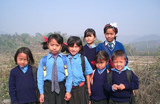
The hill tribes of Northeast India are hill people, mostly classified as Scheduled Tribes (STs), who live in the Northeast India region. This region has the largest proportion of scheduled tribes in the country.