Guma is a census town(CT) in the Habra II CD block of Barasat sadar subdivision in North 24 Parganas district in the Indian state of West Bengal.
Bagdah is a community development block that forms an administrative division in Bangaon subdivision of North 24 Parganas district in the Indian state of West Bengal.

Gaighata is a community development block that forms an administrative division in Bangaon subdivision of North 24 Parganas district in the Indian state of West Bengal.

Basirhat subdivision is an administrative subdivision of the North 24 Parganas district in the Indian state of West Bengal.
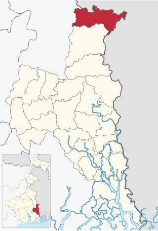
Bangaon subdivision is an administrative subdivision of the North 24 Parganas district in the Indian state of West Bengal.
Udaynarayanpur is a community development block that forms an administrative division in Uluberia subdivision of Howrah district in the Indian state of West Bengal.

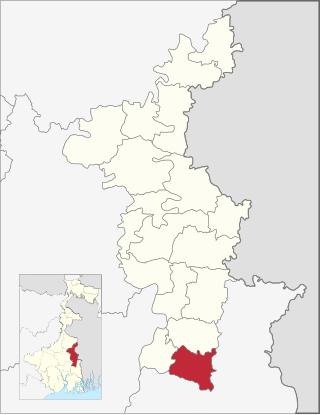
Barasat I is a community development block that forms an administrative division in Barasat Sadar subdivision of North 24 Parganas district in the Indian state of West Bengal.

Habra I is a community development block that forms an administrative division in Barasat Sadar subdivision of North 24 Parganas district in the Indian state of West Bengal.

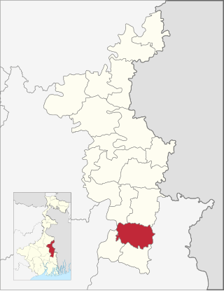
Habra II is a community development block that forms an administrative division in Barasat Sadar subdivision of North 24 Parganas district in the Indian state of West Bengal.
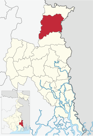
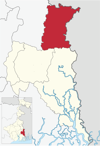
Bangaon is a community development block that forms an administrative division in Bangaon subdivision of North 24 Parganas district in the Indian state of West Bengal.

Ranaghat II is a community development block that forms an administrative division in Ranaghat subdivision of Nadia district in the Indian state of West Bengal.
Chakdaha is a community development block that forms an administrative division in Kalyani subdivision of Nadia district in the Indian state of West Bengal.
Haringhata is a community development block that forms an administrative division in Kalyani subdivision of Nadia district in the Indian state of West Bengal.

Uluberia I is a community development block that forms an administrative division in Uluberia subdivision of Howrah district in the Indian state of West Bengal.
Helencha is a village in the Bagdah CD block in the Bangaon subdivision of the North 24 Parganas district in the state of West Bengal, India.
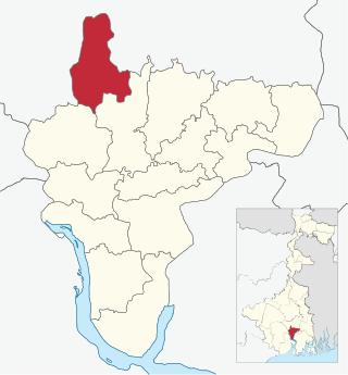
Gopalnagar is a village and a gram panchayat in the Bangaon CD block in the Bangaon subdivision of the North 24 Parganas district in the state of West Bengal, India.
Palla is a village and a gram panchayat in the Bangaon CD block in the Bangaon subdivision of the North 24 Parganas district in the state of West Bengal, India.
Chhota Molla Khali is a village and a gram panchayat within the jurisdiction of the Gosaba police station in the Gosaba CD block in the Canning subdivision of the South 24 Parganas district in the Indian state of West Bengal.
Mather Dighi is a village and a gram panchayat within the jurisdiction of the Jibantala police station in the Canning II CD block in the Canning subdivision of the South 24 Parganas district in the Indian state of West Bengal.
Bara is a census town in the Gaighata CD block in the Bangaon subdivision of North 24 Parganas district in the state of West Bengal, India.


