Rangpur রংপুর | |
|---|---|
| Nickname(s): Green City, Education City, City of Colours | |
 Rangpur Location in Rangpur Division, Bangladesh  Rangpur Location in Bangladesh  Rangpur Rangpur (Asia)  Rangpur Rangpur (Earth) | |
| Coordinates: 25°44′56″N89°14′49″E / 25.749°N 89.247°E | |
| Country | |
| Division | Rangpur Division |
| District | Rangpur District |
| Establishment | 1575(During the Mughal Empire) [1] |
| Municipality | 1 May 1869 |
| City Corporation | 28 June 2012 |
| Metropolitan City | 16 September 2018 |
| Government | |
| • Type | Mayor–Council |
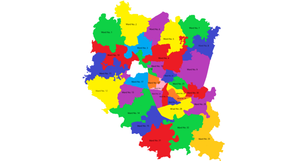
| • Body | Rangpur City Corporation |
| • Deputy Commissioner | Mohammad Robiul Foysal |
| • Police Commissioner | Md Saifuzzam Faruqi |
| Area | |
| • Urban | 205 km2 (79 sq mi) |
| • Metro | 239.72 km2 (92.56 sq mi) |
| • Rank | 2nd largest City Corporation in Bangladesh |
| Elevation | 34 m (111.549 ft) |
| Population (2022) | |
| • Rank | 5th in Bangladesh |
| • Urban | 1,031,388 |
| • Urban density | 3,871/km2 (10,030/sq mi) |
| • Metro | 1,450,128 |
| • Metro density | 4,167/km2 (10,790/sq mi) |
| Demonyms |
|
| Languages | |
| • Official | Bengali • English |
| • Native | Rangpuri |
| Time zone | UTC+06:00 (BST) |
| Postal code | 5400 [2] |
| National calling code | +088 |
| Calling code | 521 |
| Police | Rangpur Metropolitan Police |
| Airport | Saidpur Airport |
| Railway Station | Rangpur Railway Station |
| National Highway | |
| Cricket Team | |
| UN/LOCODE | BD RAU |
| Website | rpcc |


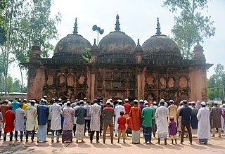
Rangpur ( /rʌŋˈpʊər/ ; Bengali : রংপুর, romanized: Rongpur; pronounced [rɔŋpuɾ] ), is a metropolitan city and a major city in northern Bangladesh. This city serves as the administrative center of the Rangpur Division. It is strategically located on the banks of the Ghaghot River and near the Teesta River. It is the second largest City Corporation in Bangladesh. [3] The city has developed rapidly in recent years, with improvements in infrastructure and services enhancing its role as a key regional hub. Rangpur has become a key destination for students from other districts and cities seeking quality education. Rangpur City features notable educational institutions. Rangpur has also a vibrant local culture, including traditional festivals and community events. [4] [5]
Contents
- History
- Etymology
- Early history
- Mughal Period
- British Period
- Pakistani Period and Liberation War
- Post-Independence Period
- Geography
- Climate
- Government
- Military
- Economy
- Demographics
- Education
- Universities
- Medical and dental colleges
- Schools
- Colleges
- Polytechnic institutes
- Affiliated colleges
- Neighbourhoods
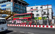
- Transport
- Road
- Railway
- Air
- Sports
- Notable people
- Presidents of Bangladesh
- Chief Justices of Bangladesh
- Speakers of Parliament
- Chief Ministers
- Civil servants
- Freedom fighters in The Liberation War
- Performing and fine arts
- Officers of Bangladesh Armed Forces
- Politicians
- Poet, writers and journalists
- British revolutionaries
- Reformers and activists
- Scholars and scientists
- Sports 2
- Gallery
- Twin towns and sister cities
- References
- External links

It is said that back in 1575, a trusted general of the Mughal Emperor Akbar, took over Rangpur. But it was not until 1686 that Rangpur was fully integrated into the Mughal Empire. Back on 16 December, 1769, Rangpur was announced as a District Seat (Zila Sadar) and in 1869, it was announced as a municipality, thus making it one of the oldest municipalities in the country. However, Ghoraghat in Rangpur served as the one of the Mughal administrative headquarters till 18th century . [6] The municipal office building was erected in 1892 .
Previously serving as the headquarters of the Greater Rangpur district, The Greater Rangpur district was divided in five districts in 1984. Rangpur underwent administrative restructuring, resulting in the formation of the Gaibandha, Kurigram, Lalmonirhat, Nilphamari, and Rangpur districts.