
Khulna Division is the second largest of the eight divisions of Bangladesh. It has an area of 22,285 km2 (8,604 sq mi) and a population of 17,416,645 at the 2022 Bangladesh census. Its headquarters and largest city is Khulna city in Khulna District.

Jessore District officially Jashore District, is a district in southwestern Bangladesh. It is bordered by India to the west, Khulna and Satkhira districts to the south, Khulna and Narail to the east, and Jhenaidah and Magura districts to the north. Jessore is the capital of the district. Jessore is the home of the ancestors of the great Bengali poet Rabindranath Tagore. Jashore was the first independent district of Bangladesh in 1971.

Kushtia ) is a city in the Khulna Division of southwestern Bangladesh. It is the thirteenth largest city in the country and second largest city in Khulna division. Kushtia is also one of the commercial cities. It serves as the headquarters of Kushtia Sadar Upazila and Kushtia District.

Chuadanga District is a district of the western Khulna Division of Bangladesh. It is bordered by the Indian state of West Bengal to the west, Meherpur District to the northwest, Jessore District to the south, Jhenaidah District to the east, and Kushtia District to the north. Before partition Chuadanga was one of the five subdivisions of Nadia district.

Jhenaidah District is a district in southwestern Bangladesh. Part of the Khulna Division, the district has an area of 1,964.77 km2 (758.60 sq mi). It is bordered by Kushtia District to the north, Jessore District and West Bengal to the south, Rajbari District and Magura District to the east, and Chuadanga District and West Bengal to the west. The largest city and headquarters of this district is Jhenaidah. At the beginning of the British rule, Jhenaidah was a police outpost and was turned into a thana in 1793. The Jhenaidah sub-division was established in 1862. It became a district in 1984.

Khulna District is a district of Bangladesh. It is located in the Khulna Division, bordered on the north by Jessore District and Narail District, on the south by the Bay of Bengal, on the east by the Bagerhat District, and on the west by the Satkhira District. It was the first sub-division of United Bengal Province established in 1842.On 1 June 1882, by notification of the official gazette published from Kolkata, Khulna and Bagerhat sub-division of Jessore district and Satkhira sub-division of 24 Pargana district together formed the new district of Khulna.

Bagherpara is an upazila of Jessore District in the Division of Khulna, Bangladesh.
Chowgacha is an upazila of Jessore District in the Division of Khulna, Bangladesh.

Jashore Sadar is an upazila of Jashore District in the Division of Khulna, Bangladesh. Its administrative centre is the city of Jashore, which is also the centre of the district.

Jhenidah Sadar is an upazila of Jhenaidah District in the Division of Khulna, Bangladesh.

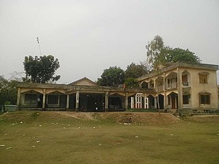
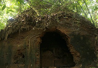
Kaliganj is an upazila of Jhenaidah District in the Division of the Khulna, Bangladesh. One of the most important commercial area is Kaliganj under Khulna Division. It crosses between Dhaka Khulna Highway. It has the myth of Gazi Kalu Champabati, The historical mosques of Barobazar, the largest banyan tree in Asia and the flow of Chitra and Begobati. It is bounded by Jhenaidah Sadar on the north, Jessore district on the south, Kotchandpur Upazilla in the west and Magura district in the east.

Maheshpur Upazila is a part of Jhenaidah District in the Khulna Division of Bangladesh.

Shailkupa is an upazila of Jhenaidah District in Khulna Division, Bangladesh.

Kushtia Sadar is an Upazila of Kushtia District in the Division of Khulna, Bangladesh. Kushtia Sadar Thana was formed in 1823 and it was turned into an upazila in 1983.
Kalia is an upazila of Narail District in the Division of Khulna, Bangladesh. Kalia Thana was established in 1866 and was converted into an upazila in 1984. It is named after its administrative center, the town of Kalia.
Lohagara is an upazila of Narail District in the Division of Khulna, Bangladesh. Lohagara Thana was established in 1861 and was converted into an upazila in 1984. It is named after its administrative center, the town of Lohagara.

Narail Sadar is an upazila of Narail District in the Division of Khulna, Bangladesh. Narail Thana was established in 1861 and was converted into an upazila in 1984. The upazila takes its name from the district and the Bengali word sadar (headquarters). It is the subdistrict where the district headquarters, Narail town, is located.
The N7 is a Bangladeshi national highway connecting the Daulatdia Ferry Terminal, on the south bank of the Padma River near the Bangladeshi capital Dhaka, with the Port of Mongla in Bagerhat District. It serves some of the largest cities and towns in southwestern Bangladesh, including Faridpur, Magura, Jhenaidah, Jessore, and Khulna. The highway is known along various stretches as the Dhaka–Khulna Highway, the Jessore-Khulna Highway, and the Khulna-Mongla Highway.
Jessore, officially Jashore, is a city of Jessore District in Khulna Division. It lies in southwestern Bangladesh. It is home to the first flight training school of the Bangladeshi Air Force, established in 1971. It is the administrative centre (headquarter) of the eponymous district and the third largest and second developed city in Khulna Division. It is one of the industrious and developed cities in Bangladesh. Jessore city consists of 9 wards and 73 mahalls. Jashore municipality was established in 1864. The area of the town is 21.15 km2. It has a population of about 298,000 according to the record of Jessore municipality. Jessore also has a domestic airport named as Jessore Airport.

Magura is a city located on the banks of the Nabaganga River in south-western Bangladesh. Magura is the headquarters of Magura Sadar Upazila and Magura District. It is the fourth largest city in Khulna division, after Khulna, Kushtia and Jashore.


