Kushtia

Last updated • 2 min readFrom Wikipedia, The Free Encyclopedia
Kushtia
কুষ্টিয়া
Kushtia City 8.jpg
Porimol Tower (12).jpg
Kushtia City 4.jpg
Tomb of Lalon 11.jpg
Tagore Kuthibari.jpg
Hardinge Bridge with sunlight.jpg
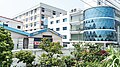
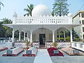
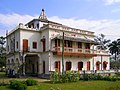
from top: Kushtia city skyline, Porimol Tower, Lovely Tower, Tomb of Lalon, Tagore kuthibari, Hardinge Bridge
Bangladesh Khulna division location map.svg
Red pog.svg
Kushtia
Location in Bangladesh
Bangladesh adm location map.svg
Red pog.svg
Kushtia
Kushtia (Bangladesh)
Coordinates: 23°54′36″N89°07′23″E / 23.910125°N 89.123115°E / 23.910125; 89.123115
Country Flag of Bangladesh.svg  Bangladesh
Division Khulna
District Kushtia
Upazila Kushtia Sadar
Municipality1 April 1869 [1]
Government
  Type Mayor–Council
  BodyKushtia Municipality
   Paura Mayor Md. Anwar Ali [2]
Area
[3]
  Total
54.13 km2 (20.90 sq mi)
Population
 (2022)
  Total
418,312
  Density7,700/km2 (20,000/sq mi)
  Rank
12th
Time zone UTC+6 (Bangladesh Time)
Postal code
7000 [4]
National Dialing Code +880

Kushtia (Bengali : কুষ্টিয়া ( listen )) is a city in the Khulna Division of southwestern Bangladesh. It is the thirteenth largest city in the country and second largest city in Khulna division. Kushtia is also one of the commercial cities. [5] It serves as the headquarters of Kushtia Sadar Upazila and Kushtia District. [6]

Contents

Demographics

Religions in Kushtia city (2011) [7]
ReligionPercent
Islam
89.84%
Hinduism
9.66%
Other or not stated
0.50%

According to the 2022 Bangladesh census, Kushtia city had a population of 221,804. [8] :388–394

According to the 2011 Bangladesh census, Kushtia city had 23,037 households and a population of 102,988. 15,788 (15.33%) were under 10 years of age. Kushtia had a literacy rate (age 7 and over) of 74.85%, compared to the national average of 51.8%, and a sex ratio of 947 females per 1000 males. [7]

Education

  1. Bijoy Ullas sculpture
  2. Shelaidaha Kuthi Bari
  3. The shrine of Lalon Fakir
  4. A Mughal style mosque from Jhaudia
  5. Explore Jugia Tati Para
  6. Tagore lodge
  7. Mighty river Padma
  8. Gorai river beside the town
  9. A Christian Cemetery in town
  10. Kamrul Islam Siddiqui Park
  11. Hardinge Bridge
  12. Municipal Museum
  13. Lalon Shah Bridge
  14. Chapaigachi Beel

References

  1. "History of Kushtia municipality" . Retrieved 2019-10-07.
  2. "Mayor of Kushtia city's civic body". News24.com. Retrieved 2019-10-07.
  3. "Bangladesh GEO Code Kushtia District" (PDF). Bangladesh GEO Code. pp. 74/96. Retrieved 2024-08-04.
  4. Staff. "ZIP Code database of Bangladesh". Geopostcodes.com. Retrieved 11 June 2008.
  5. "NGA GeoNames Database". National Geospatial-Intelligence Agency . Retrieved 2 January 2015.
  6. Bhuiyan, Md Abu Taher (2012). "Kushtia Sadar Upazila". In Islam, Sirajul; Jamal, Ahmed A. (eds.). Banglapedia: National Encyclopedia of Bangladesh (Second ed.). Asiatic Society of Bangladesh.
  7. 1 2 "Population & Housing Census 2011 (Zila Series & Community Series)". bbs.gov.bd. Bangladesh Bureau of Statistics.
  8. Population and Housing Census 2022 National Report (PDF). Vol. 1. Bangladesh Bureau of Statistics. November 2023.