Natore

Last updated
Natore
নাটোর
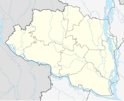
Bangladesh Rajshahi location map.svg
Red pog.svg
Natore
Bangladesh adm location map.svg
Red pog.svg
Natore
Coordinates: 24°24′48″N88°58′59″E / 24.41333°N 88.98306°E / 24.41333; 88.98306
CountryFlag of Bangladesh.svg  Bangladesh
Division Rajshahi
District Natore
Upazila Natore Sadar
Established1706(318 years ago) (1706)
Municipality1869(155 years ago) (1869)
Government
  Type Mayor-Council
  BodyNatore Municipality
   Mayor Uma Chowdury Joly
Area
  Total39.84 km2 (15.38 sq mi)
Population
 (2022)
  Total147,000
  Density3,700/km2 (9,600/sq mi)
Demonym Natoree
Time zone UTC+6 (BST)
Postal Code
6400
Languages Standard Bengali (Official)
Police Bangladesh Police
Airport Ishurdi Airport
Website www.natorepaurashava.org

Natore is a city ("town" in some sources) in western Bangladesh. It is the headquarters of the Natore District. Its current mayor is Uma Choudhary. [1] The Narod river is passing through the center of the city with pollution from upstream industrial developments flowing through. [2] [3]
Demographics

Religions in Natore (2011) [4]
ReligionPercent
Islam
82.35%
Hinduism
17.21%
Other or not stated
0.44%

According to the 2022 Bangladesh census, Natore city had a population of 87,067 and a literacy rate of 87.02%. [5] :388–394

According to the 2011 Bangladesh census, Natore city had 18,828 households and a population of 81,203. 13,104 (16.14%) were under 10 years of age. Natore had a literacy rate (age 7 and over) of 75.06%, compared to the national average of 51.8%, and a sex ratio of 968 females per 1000 males. [4]

Related Research Articles

<span class="mw-page-title-main">Kushtia</span> City and District headquarter of Kushtia District

Kushtia is a city in the Khulna Division of southwestern Bangladesh. Kushtia is the second largest municipality in Bangladesh and the eleventh largest city in the country. The second largest city in Khulna division, Kushtia is one of the commercial cities. It serves as the headquarters of Kushtia Sadar Upazila and Kushtia District.

<span class="mw-page-title-main">Naogaon</span> Municipality and town in Rajshahi Division

Naogaon is the district headquarters and most populous town of Naogaon District in northern Bangladesh. It is located on the banks of the Little Jamuna river. As of 2011, the area of the municipality was 38.36 km2 (14.81 sq mi) and the population was 150,549. The literacy rate was 62%.

<span class="mw-page-title-main">Nandigram Upazila</span> Upazila in Rajshahi, Bangladesh

Nandigram Upazila is an upazila of Bogra District in the Division of Rajshahi, Bangladesh. Nandigram Thana was established in 1932 and was converted into an upazila in 1983. It is named after its administrative center, the town of Nandigram.

<span class="mw-page-title-main">Raninagar Upazila</span> Upazila in Rajshahi, Bangladesh

Raninagar is an Upazila of Naogaon District in the Division of Rajshahi, Bangladesh.

<span class="mw-page-title-main">Bagatipara Upazila</span> Upazila in Rajshahi, Bangladesh

Bagatipara is an upazila of Natore District in the Division of Rajshahi, Bangladesh.

<span class="mw-page-title-main">Baraigram Upazila</span> Upazila in Rajshahi, Bangladesh

Baraigram is an upazila of Natore District, located in the Rajshahi Division of Bangladesh.

<span class="mw-page-title-main">Gurudaspur Upazila</span> Upazila in Rajshahi, Bangladesh

Gurudaspur is an upazila of Natore District in the Division of Rajshahi, Bangladesh.

<span class="mw-page-title-main">Natore Sadar Upazila</span> Upazila in Rajshahi, Bangladesh

Natore Sadar is an upazila of Natore District in the Division of Rajshahi, Bangladesh.

<span class="mw-page-title-main">Singra Upazila</span> Upazila in Rajshahi, Bangladesh

Singra is an upazila of Natore District in the Division of Rajshahi, Bangladesh.

<span class="mw-page-title-main">Tarash Upazila</span> Upazila in Rajshahi, Bangladesh

Tarash is an upazila, or sub-district of Sirajganj District, located in Rajshahi Division, Bangladesh.

Ishwarganj is a town and municipality in Mymensingh District in the division of Mymensingh. It is the administrative centre and urban centre of Ishwarganj Upazila.

<span class="mw-page-title-main">Sunamganj</span> Town in Sylhet, Bangladesh

Sunamganj is a town in the Sylhet Division of northeastern Bangladesh. It is the administrative headquarters and largest town of Sunamganj District. It is located on the banks of the Surma River, approximately 50 kilometres (31 mi) west-northwest of Sylhet, the divisional headquarters.

Lalmonirhat is a town and district headquarters of Lalmonirhat District in the division of Rangpur, Bangladesh.

<span class="mw-page-title-main">Madhabdi</span> City and Municipality in Dhaka, Bangladesh

Madhabdi is a pourashava in Narsingdi District, Dhaka division, Bangladesh. It's an A grade municipality and also Madhabdi has declared as a thana on 29 February 2016. Madhabdi is a densely textile commercial and industrial area, where a number of automatic and hand-made loom weaving and manufacturing mills are situated. There are about 45,000 people employed directly and indirectly in these mills. It's also one of the richest area in Narsingdi District.

<span class="mw-page-title-main">Naldanga Upazila</span> Upazila in Rajshahi, Bangladesh

Naldanga Upazila is a subdistrict of Natore District, within Rajshahi Division in northern Bangladesh. Naldanga was previously a union of Natore Upazila in Rajshahi Division of Bangladesh but, in a Government gazette published in May 2013, Naldanga was declared an upazila of Bangladesh. Naldanga contains Naldanga Municipality and has 5 unions: Bipra Belgharia, Brahmapur, Khajuria, Madhnagar and Piprul.

<span class="mw-page-title-main">Maijdee</span> City in Chattogram Division, Bangladesh

Maijdee Court, or just Maijdee, is a city in Noakhali District, located in south-eastern Bangladesh. It contains the administrative headquarters of Noakhali District in Chattogram Division, Bangladesh. The governing municipality, called Noakhali Municipality, had a population of 132,185 at the 2022 census, in an area of 23.79 square kilometres (9.19 sq mi). It consists of 9 wards and 36 mahallas.

<span class="mw-page-title-main">Chandpur, Bangladesh</span> City of Bangladesh in Chattogram Division

Chandpur is a city and district headquarter of Chandpur District in Chattogram Division, Bangladesh. It stands near the confluence of the Padma River and the Meghna River. Chandpur city was made a municipality in 1892.

Noapara is a major town and municipality in Jessore District in the division of Khulna, Bangladesh. It is one of the major urban centres of Abhaynagar Upazila. It is situated along the Bhairab River.

<span class="mw-page-title-main">Tarabo</span> Municipality in Dhaka Division, Bangladesh

Tarabo is a municipal city in Rupganj Upazila in Narayanganj District, Bangladesh. The city has a population of nearly 200,000. BSCIC Industrial Town and Research Centre is located at Tarabo municipality.

<span class="mw-page-title-main">Laksam</span> Town and Municipality in Chittagong, Bangladesh

Laksam is a city in eastern Bangladesh. It is the headquarters of Laksam Upazila of Comilla District. It is situated on the banks of the Dakatia River.

References

  1. "Municipality information". www.natore.gov.bd. Retrieved 2024-04-01.
  2. Islam M. A., Q. H. Bari, and M. M. Rahman (2011) Effect of unplanned Industrialization on Urban Environment: A Case Study in Natore. In Proc. of Special Conf. on Urbanization, Traffic Jam and Environment. 8 January, BAPA, BEN, Dhaka, Bangladesh. p.
  3. S.M. Nur-E-Alam, S.M. Moniruzzaman, S.M.A. Baten Characterization of selected industrial effluent and their effects on Narod river of Natore, Bangladesh. Proceedings of the 3rd International Conference on Civil Engineering for Sustainable Development (ICCESD 2016), 12~14 February 2016, KUET, Khulna, Bangladesh (2016)
  4. 1 2 "Population & Housing Census 2011 (Zila Series & Community Series)". bbs.gov.bd. Bangladesh Bureau of Statistics.
  5. Population and Housing Census 2022 National Report (PDF). Vol. 1. Bangladesh Bureau of Statistics. November 2023.