
Rajshahi Division is one of the eight first-level administrative divisions of Bangladesh. It has an area of 18,174.4 square kilometres (7,017.2 sq mi) and a population at the 2022 Census of 20,353,119. Rajshahi Division consists of 8 districts, 70 Upazilas and 1,092 Unions.
Sirajganj District is a district in the North Bengal region of Bangladesh, located in the Rajshahi Division. It is the 25th largest district by area and 9th largest district by population in Bangladesh. It is known as the gateway to North Bengal.

Rajbari is a district in central Bangladesh, located in the Dhaka Division. It is a part of the Greater Faridpur subregion of Bengal due to the historical and cultural identities of its inhabitants, with Kushtia border on the west, Rajbari is also the meeting point of two distinctive culture of Bangladesh.
North Bengal or Uttar Banga is a term used for the north-western part of Bangladesh and northern part of West Bengal. The Bangladesh part denotes the Rajshahi Division and Rangpur Division. Generally, it is the area lying west of Jamuna River and north of Padma River and includes the Barind Tract. The West Bengal part denotes Jalpaiguri Division and the Malda division together. The Bihar parts include the Kishanganj district. It also includes parts of Darjeeling Hills. Traditionally, the Ganga River divides Bengal into South Bengal and North Bengal, divided again into Terai and Dooars regions.

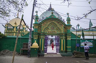
Rani Bhabani, also known as Ardhabangeshwari(অর্ধবঙ্গেশ্বরী) and Natorer Rani or the Queen of Natore, was a Hindu zamindar during the British colonial era in what is now Rajshahi, Bangladesh. She became the zamindar after the death of her husband Raja Ramkanta Moitra (Ray), 'Zamindar' of Natore estate.

Baral river is one of the offshoots of the Ganges, starts its journey at Charghat Upazila of Rajshahi District of Bangladesh. The Baral, flowing through Natore and Pabna, meets with the Gumani River at the east of Bhangura and finally meets with the Hurasagar River after joining with the Karatoya south of Shahjadpur Upazila. The river is approximately 147 kilometres (91 mi) long, and 120 metres (410 ft) wide and 6 metres (20 ft) deep on average. The river receives water from the Ganges only in the monsoon season. But it maintains its flow throughout the year with local runoff water and water from Chalan Beel. Its drainage area is about 230 square kilometres (89 sq mi). Some important places located on the banks of the Baral are: Charghat, Baraigram, Bagatipara, Gurudaspur, Chatmohar, Bhangura and Bera upazilas of Bangladesh. The Baral Bridge is located on this river at Bhangura Upazila.
Baniachong, is a village and upazila of Habiganj District in Sylhet Division, Bangladesh.

Adamdighi Upazila is an upazila of Bogra District in the Division of Rajshahi, Bangladesh. Adamdighi Thana was established in 1821 and was converted into an upazila in 1983. It is named after its administrative center, the town of Adamdighi. Local legend has it that its name came from a Muslim saint, Baba Adam, who visited and dug a dighi (tank) for water storage.

Atrai is the southernmost upazila of Naogaon District, located in Bangladesh's Rajshahi Division. It is named after its principal watercourse, the Atrai River.

Bagatipara is an upazila of Natore District in the Division of Rajshahi, Bangladesh.

Baraigram is an upazila of Natore District, located in the Rajshahi Division of Bangladesh.

Gurudaspur is an upazila of Natore District in the Division of Rajshahi, Bangladesh.

Lalpur is an upazila of Natore District, located the Rajshahi Division of Bangladesh.

Natore Sadar is an upazila of Natore District in the Division of Rajshahi, Bangladesh.

Singra is an upazila of Natore District in the Division of Rajshahi, Bangladesh.

Bagha is an upazila of the Rajshahi District, located in Bangladesh's Rajshahi Division.
The Singranatore family is the consanguineous name given to a noble family in Rajshahi of landed aristocracy in erstwhile East Bengal and West Bengal that were prominent in the nineteenth century till the fall of the monarchy in India by Royal Assent in 1947 and subsequently abolished by the newly formed democratic Government of East Pakistan in 1950 by the State Acquisition Act.

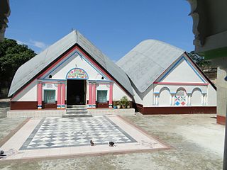
Dighapatia Raj was a zamindari in present-day Rajshahi, which was ruled by this dynasty of 7 generations of Rajas from early 18th century till the mid-20th century; when the democratic government took power after the end of the British Monarchy's rule in India, in 1950, the East Pakistan government abolished aristocracies and the zamindari system in present-day Bangladesh. The family was seated at the Dighapatia Palace.
Zamindars of Natore were influential aristocratic Bengali Zamindars, who owned large estates in what is today Natore District in Bangladesh .
The Chalanbil's Horse Races are annual horse races that take place in the Chalan Beel region of Pabna, Natore, Sirajganj, Bogra, and Naogaon district, in Bangladesh.


