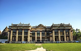
Natore district is a district of Rajshahi Division located in northern Bangladesh. It borders the metropolitan city of Rajshahi and used to be a part of Rajshahi District.

Jhenidah Sadar is an upazila of Jhenaidah District in the Division of Khulna, Bangladesh.

Daulatpur is an upazila of Kushtia District in the Division of Khulna, Bangladesh. Daulatpur Thana was formed in 1854. It became an upazila in 1983.

Nandigram Upazila is an upazila of Bogra District in the Division of Rajshahi, Bangladesh. Nandigram Thana was established in 1932 and was converted into an upazila in 1983. It is named after its administrative center, the town of Nandigram.

Atrai is the southernmost upazila of Naogaon District, located in Bangladesh's Rajshahi Division. It is named after its principal watercourse, the Atrai River.

Raninagar is an Upazila of Naogaon District in the Division of Rajshahi, Bangladesh.

Bagatipara is an upazila of Natore District in the Division of Rajshahi, Bangladesh.

Baraigram is an upazila of Natore District, located in the Rajshahi Division of Bangladesh.

Gurudaspur is an upazila of Natore District in the Division of Rajshahi, Bangladesh.

Natore Sadar is an upazila of Natore District in the Division of Rajshahi, Bangladesh.

Singra is an upazila of Natore District in the Division of Rajshahi, Bangladesh.

Faridpur is an upazila of Pabna District in the Division of Rajshahi, Bangladesh. Faridpur is located at 24.1583°N 89.4528°E.

Pabna Sadar is an upazila of Pabna District in the Division of Rajshahi, Bangladesh.

Bagha is an upazila of the Rajshahi District, located in Bangladesh's Rajshahi Division.

Bagmara is an upazila of Rajshahi District in the Division of Rajshahi, Bangladesh.

Charghat is an upazila of Rajshahi District in the Division of Rajshahi, Bangladesh.

Godagari is an Upazila of Rajshahi District in the Division of Rajshahi, Bangladesh. This is the place where Mahananda river fall to Padma or Ganges.

Mohanpur is an Upazila of Rajshahi District in the Division of Rajshahi, Bangladesh.

Puthia is an Upazila of Rajshahi District in the Division of Rajshahi, Bangladesh.

Tarash is an upazila, or sub-district of Sirajganj District, located in Rajshahi Division, Bangladesh.


