
Chhagalnaiya is a town in Feni district of Chittagong Division, Bangladesh. The town is the administrative headquarters and urban centre of Chhagalnaiya Upazila.The urban area of Chhagalnaiya is the biggest in Chhagalnaiya Upazila and 2nd most populous in Feni district. Chhagalnaiya is 14.6 km away from the district headquarter, Feni city while the distance from the Divisional Headquarter, Chittagong is 96.6 km. The nearest airport from Chhagalnaiya town is Shah Amanat International Airport.

Plovdiv Province is a province in central southern Bulgaria. It comprises 18 municipalities on a territory of 5,972.9 km2 (2,306.1 sq mi) with a population, as of February 2011, of 683,027 inhabitants. The province is named after its administrative and industrial centre — the city of Plovdiv.
Barwani or Badwani is a municipal town in Barwani district of Madhya Pradesh, India, that is situated near the left bank of the Narmada River. It is the administrative headquarters of Barwani district and has also served as the capital of the former princely state of Barwani. Barwani is only accessible by road.

Vaikom is a municipality in the Kottayam district of Kerala, India. It is located 33 km (20.5 mi) north of the district headquarters in Kottayam and about 152 km (94.4 mi) north of the state capital Thiruvananthapuram. As per the 2011 Indian census, Vaikom has a population of 23,234 people, and a population density of 2,661/km2 (6,890/sq mi).
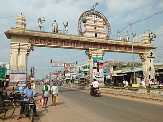
Panruti is a town, municipality and taluk headquarters of Cuddalore district, Tamil Nadu, India. Panruti is located between Cuddalore and Neyveli. Panruti is famous for jackfruits and cashew nuts. The jackfruit grown here is exported worldwide and is very sweet. It is a business capital of Cuddalore district. Kananchavadi one of the villages in panruti taluk, famous for palm juice. It has been a great commercial area for more than 200 years. The name Panruti came from the Tamil words "Pann" and "Urutti" meaning "composing song and music", as the place is where many saints and great religious singers such as nayanmars and vainavas sung. A 150-year-old government school was built here by the British East India Company and a more-than-1000-year-old temple Veerattaneswarar temple is nearby in Thiruvathigai. As of 2011, the town had a population of 60,323.
Arakkonam is a railway town and suburb of Chennai within Chennai Metropolitan Area limit, in the Indian state of Tamil Nadu, with a population of 78,395 per the census 2011. It is in the newly created Ranipet district, about 54 kilometres (34 mi) from Ranipet headquarters and about 69 kilometres (43 mi) from the state capital of Chennai. In October 2022 Arakkonam is a part of Chennai Metropolitan Area.
Kodad is a town in Suryapet district of the Indian state of Telangana. It is a municipality and the mandal headquarters of Kodad mandal in Kodad revenue division. It lies on the National Highway 65 between Hyderabad and Vijayawada. It is 44 km away from the district headquarters Suryapet

Ranaghat is a city and a municipality in Nadia district in the state of West Bengal, India. It is the headquarters of the Ranaghat subdivision. It is known for its handloom industry, various types of flowers and floriculture.

Nuzvid, natively spelled Nuzividu or Nuziveedu is a city in the Eluru district of the Indian state of Andhra Pradesh. It serves as the administrative headquarters for Nuzvid mandal and Nuzvid revenue division.
Rasipuram is a Municipality in the Indian state of Tamil Nadu. It is the headquarters for the Rasipuram taluk. As of 2015, the town had a population of 88,584 and an area of 24 km2 (9.3 sq mi). It has 27 wards and steps have been taken to increase the wards to 33. Rasipuram is known for ghee and tapioca sago.

Bannur is a municipality in Mysore district in the state of Karnataka, India.

Dalkhola is a city and a municipality of Uttar Dinajpur district in the state of West Bengal, India.

Maheshtala is a city and a municipality of the South 24 Parganas district in the Indian state of West Bengal. It is situated on the eastern banks of the Hooghly River. It is a part of the area covered by the Kolkata Metropolitan Development Authority (KMDA).
Aarani, officially spelled as Arni, and also known as Periya Aarani, is a major commercial, industrial and cultural hub and also a divisional headquarter in the Thiruvanamalai district of Tamil Nadu, India. The town is the second largest urban center next to the district headquarters, Thiruvannamalai, and is administered by a selection grade municipality. Aarani is home to silk weaving, spinning mills and agricultural industries. Famous Aarani silk and a paddy variety named Aarani Ponni, known for its rich aroma, originates from Aarani. The town is often nicknamed as The Silk City. Aarani also has a rich cultural heritage as it is a major center of Tamil Jainism.

Anowara, also written Anwara, is an upazila of Chattogram District in Chattogram Division, Bangladesh.
Chandanaish is an upazila of Chattogram District in Chattogram Division, Bangladesh.

Mirsharai Upazila is an upazila of Chattogram District in Chattogram Division, Bangladesh. It comprises two police stations and two municipalities.

Raozan Upazila is an upazila of Chattogram District, in Chattogram Division, Bangladesh. It was established in 1947.

Carneirinho is a municipality in the westernmost tip of the Brazilian state of Minas Gerais. Due to its location, it is the only municipality in Minas Gerais to border the state of Mato Grosso do Sul. As of 2020 the population was 10,066 in a total area of 2,060.720 km². It became a municipality in 1993.
Bhinder or Bhindar is a town in Udaipur District, that is located 315 km (196 mi) from the state's main city Jaipur. Bhinder borders the Chittorgarh District in Rajasthan and is located 58 kilometres (36 mi) south-east of Udaipur. Notable tourist sites nearby include Sita Mata Wildlife Sanctuary, Jaisamand Sanctuary, and Jaisamand Lake. Bhinder is surrounded by four lakes.