This article needs additional citations for verification .(November 2014) |
Dinajpur দিনাজপুর | |
---|---|
City and Municipality | |
Coordinates: 25°37′44″N88°38′13″E / 25.629°N 88.637°E | |
Country | Bangladesh |
Division | Rangpur |
District | Dinajpur |
Upazila | Dinajpur Sadar |
Government | |
• Type | Mayor–Council |
• Body | Dinajpur Municipality |
• Paura Mayor | Syed Jahangir Alam [1] |
Area | |
• Total | 22.8 km2 (8.8 sq mi) |
Population | |
• Total | 212,275 |
• Density | 9,300/km2 (24,000/sq mi) |
• Ethnicities | Bengali |
Time zone | UTC+6 (Bangladesh Time) |
National Dialing Code | +880 |
Website | www |
Dinajpur (Bengali : দিনাজপুর [dinad͡ʒpur] ) is a city and the district headquarters of Dinajpur district situated in Rangpur Division, Bangladesh. It was founded in 1786. It is located 413 km north-west of Dhaka in Bangladesh. It is bounded on the north by Suihari, Katapara, Bangi Bechapara, Pulhat, and Koshba on the south; on the east by Sheikhupura; and by the river Punarbhaba on the west.
Dinajpur is located in the north-western part of the country. It covers an area of 20.7 square kilometers (8.0 sq mi).
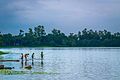
It is situated at 25°37′N 88°39′E on the eastern bank of the river Punarbhaba. Dinajpur has a humid subtropical climate (Cwa) that borders a tropical climate and has humid, hot summers, characterized monsoon season and mild, dry winters.
Climate data for Dinajpur (1991–2020) | |||||||||||||
---|---|---|---|---|---|---|---|---|---|---|---|---|---|
Month | Jan | Feb | Mar | Apr | May | Jun | Jul | Aug | Sep | Oct | Nov | Dec | Year |
Record high °C (°F) | 29.5 (85.1) | 33.5 (92.3) | 37.3 (99.1) | 41.0 (105.8) | 41.2 (106.2) | 40.7 (105.3) | 38.9 (102.0) | 38.6 (101.5) | 37.4 (99.3) | 36.1 (97.0) | 33.5 (92.3) | 30.5 (86.9) | 41.2 (106.2) |
Mean daily maximum °C (°F) | 22.6 (72.7) | 26.6 (79.9) | 30.9 (87.6) | 32.6 (90.7) | 32.8 (91.0) | 32.9 (91.2) | 32.4 (90.3) | 32.7 (90.9) | 32.2 (90.0) | 31.3 (88.3) | 29.2 (84.6) | 25.0 (77.0) | 30.1 (86.2) |
Daily mean °C (°F) | 15.6 (60.1) | 19.4 (66.9) | 24.0 (75.2) | 26.8 (80.2) | 28.0 (82.4) | 29.0 (84.2) | 29.0 (84.2) | 29.2 (84.6) | 28.4 (83.1) | 26.5 (79.7) | 22.2 (72.0) | 17.7 (63.9) | 24.7 (76.5) |
Mean daily minimum °C (°F) | 10.3 (50.5) | 13.3 (55.9) | 17.6 (63.7) | 21.4 (70.5) | 23.6 (74.5) | 25.6 (78.1) | 26.3 (79.3) | 26.4 (79.5) | 25.5 (77.9) | 22.5 (72.5) | 16.7 (62.1) | 12.3 (54.1) | 20.1 (68.2) |
Record low °C (°F) | 3.2 (37.8) | 6.2 (43.2) | 10.0 (50.0) | 14.3 (57.7) | 16.5 (61.7) | 20.0 (68.0) | 22.8 (73.0) | 23.4 (74.1) | 20.7 (69.3) | 16.4 (61.5) | 10.5 (50.9) | 6.0 (42.8) | 3.2 (37.8) |
Average precipitation mm (inches) | 9 (0.4) | 11 (0.4) | 15 (0.6) | 74 (2.9) | 214 (8.4) | 358 (14.1) | 387 (15.2) | 337 (13.3) | 373 (14.7) | 148 (5.8) | 6 (0.2) | 5 (0.2) | 1,937 (76.3) |
Average precipitation days (≥ 1 mm) | 1 | 2 | 2 | 6 | 12 | 17 | 20 | 17 | 15 | 6 | 1 | 1 | 100 |
Mean monthly sunshine hours | 183.0 | 214.1 | 250.6 | 222.2 | 212.6 | 160.2 | 154.5 | 171.4 | 172.1 | 227.3 | 235.9 | 205.4 | 2,409.3 |
Source: NOAA [3] |
According to the 2022 Bangladesh census, Dinajpur city had a population of 212,275 and a literacy rate of 88.79%. [2] : 388–394
According to the 2011 Bangladesh census, Dinajpur city had 40,929 households and a population of 186,727. 31,320 (16.77%) were under 10 years of age. Dinajpur had a literacy rate (age 7 and over) of 75.37%, compared to the national average of 51.8%, and a sex ratio of 942 females per 1000 males. The ethnic population was 2,402 (1.29%), of which 1,385 were Santal and 777 Oraon. [4]
Over the last 25 years, Dinajpur has attracted some prominent educational institutions, all of which are government financed. They are as follows:
Hajee Mohammad Danesh Science & Technology University is located 13 km north of Dinajpur town and is one of the prominent institutions in North Bengal. It offers various undergraduate programs such as computer science, BBA, agriculture, fisheries, veterinary medicine and postgraduate programs like agronomy, horticulture and soil science.
Established in 1992, M Abdur Rahim Medical College (former Dinajpur Medical College) is one of the 36 government financed medical institutions located at historical Ananda sagar area in Dinajpur City. Currently, it offers a five-year MBBS Program, along with a one-year compulsory post-graduation internship program. In 2009, Dinajpur city began an English version of education. Some notable English Version schools are: Bethel Int'l School, Dinajpur Ridge School, Dinajpur Labrotary School, Dinajpur Public School, South Point School and Green International School. Dinajpur Polytechnic Institute, Textile Institute Dinajpur, Saint Philip's High School & College, Saint Joseph School Dinajpur, Dinajpur Zilla school, Dinajpur Govt.Girls High School, Dinajpur High School, Dinajpur Police Line School, Dinajpur Collectorate School & College, Dinajpur Govt. College, is one of the best institutions in Dinajpur.
Tenth educational board of Bangladesh has been established in Dinajpur in 2007. From 2009 S.S.C. (Secondary School Certificate) and H.S.C. (Higher Secondary School Certificate) exams have been started to be taken. In S.S.C. exam for the first time it stood 2nd in the country in the G.P.A. 5 list.
At first, after its formation in 1856, the Dinajpur Municipality used to be run by a town committee presided over by the Deputy Magistrate. This was among the first 40 municipalities in Bengal at that time. Later in 1868, the 'District Town Act' commissioned a chairman of the municipality who replaced the Deputy Magistrate and given a similar rank as a District Magistrate. Mr. Patterson was appointed the first chairman of Dinajpur Municipality in 1869. Now present chairman is Syed Jahangir Alam whose family is a descendent from Bihar, India. It’s also indicate how the demography of Dinajpur is largely diversified. People from Maldah, Bihar, Jalpaiguri and Rajsthan state of India can be easily seen sattled here throughout the district and city as well. [5]
Dinajpur is famous for agriculture. Specially Dinajpur is famous for its Litchi and aromatic rice(Katarivog).
Darbhanga is the fifth largest city and municipal corporation in the state of Bihar in India, and is considered an important city in North Bihar. It serves as the headquarters of the Darbhanga district and the Darbhanga division. It is held that the name Darbhanga has been derived from Dwar Banga or Dari – Banga, meaning the 'door of Bengal'.
Barasat is a city and a municipality of North 24 Parganas district in the Indian state of West Bengal. It is the headquarters of Barasat Sadar subdivision. It is close to Kolkata and a part of the area covered by Kolkata Metropolitan Development Authority (KMDA). Located in the Ganges delta, Barasat is a regional transportation hub as a rail and road junction. National Highway 12, NH 112, Taki Road and Barrackpore-Barasat Road are the main connectivity links to the city.
Dinajpur district is a district in the Rangpur Division of northern Bangladesh. Dinajpur is the largest district among all sixteen northern districts of Bangladesh.
Joypurhat is a district in the northern part of Bangladesh, part of the Rajshahi Division.
Chapainawabganj is located in the north-western part of Bangladesh. It is a part of the Rajshahi Division, and was formerly a sub-division of Malda district of Bengal Province. The north and west part of Chapai Nawabganj is bounded by Malda and Murshidabad districts of India, the east by Naogaon District, and south-east by Rajshahi District.
Panchagarh is a district of the Rangpur division in Northern Bangladesh. Panchagarh is the northernmost district of Bangladesh. It lies between 26º00' and 26º38' north latitudes and between 88º19' and 88º49' east longitudes. It was established as a district on 1 February 1984.
Rangpur is a district in Northern Bangladesh. It is a part of the Rangpur Division.
Malda district, also spelt Maldah or Maldaha, is a district in West Bengal, India. It lies 347 km north of Kolkata, the capital of West Bengal. Mango, jute and silk are the most notable products of this district. The special variety of mango, Fazli, produced in this region is popularly known by the name of the district and is exported across the world and is internationally acclaimed. The folk culture of gombhira is a feature of the district, being a unique way of representation of joy and sorrow in daily life of the common people, as well as the unique medium of presentation on national and international matters. According to the National Investigation Agency Malda is believed to be a hub of a fake currency racket. It is reported that 90 per cent of the fake currency that enters India originates in Malda.
Malda, also known as English Bazar, is a city in the Indian state of West Bengal. It is the sixth largest city in West Bengal. It is the headquarters of the Malda district as well as of the Malda division of West Bengal. It consists of two municipalities, viz. English Bazar Municipality and Old Malda Municipality, under Malda Metropolitan Area. The city is located on the banks of the Mahananda River. Malda was an undeveloped city which was enlarging from 1925 to 1930. The city is growing rapidly nowadays with its population inching towards half a million.
Islampur is a city and a municipality in Uttar Dinajpur district in the Indian state of West Bengal. It is the headquarters of the Islampur subdivision.
Saidpur is a city of Nilphamari district in Rangpur Division of Bangladesh. The city has become a very important communication hub for adjoining major district headquarters. Saidpur Airport is one of the domestic airports in Bangladesh. The Syedpur Railway Workshop, established in 1870, is the largest in Bangladesh and was the major railway workshop for Assam-Bengal railway. The city has historically been an Urdu-speaking community with close ties to Bihar.
Dalkhola is a city and a municipality of Uttar Dinajpur district in the state of West Bengal, India.
Gangarampur is one of the cities and a municipality in Dakshin Dinajpur district in the state of West Bengal, India. Balurghat is the headquarters of the Gangarampur Subdivision. The city is located on the bank of river Punarbhaba. Gangarampur is one of the major cities connected through National Highway 512. It became the subdivision of newly formed district Dakshin Dinajpur when Paschim Dinajpur was bifurcated into Uttar and Dakshin Dinajpur in 1992.
Birampur is an upazilla of Dinajpur District in the Division of Rangpur, Bangladesh. Birampur is an important city near India Border. This upazila is 256 km away from Capital Dhaka and nearly 56 km away from Dinajpur City. In spite of being far from Capital this north Bengal city is flourishing economically and culturally. A branch of the Jamuna River flows through Birampur Upazila.
Parbatipur is an upazila (sub-district) of the Dinajpur District in northern Bangladesh, part of the Rangpur Division. It is home to the only mine in Bangladesh, the Barapukuria Coal Mine.
Sapahar is an upazila of Naogaon District in the Division of Rajshahi, Bangladesh.
Pirganj is an Upazila of Thakurgaon District in the Division of Rangpur, Bangladesh.
Banshihari is a community development block that forms an administrative division in Gangarampur Subdivision of Dakshin Dinajpur District in the Indian state of West Bengal.
Rangpur Division is one of the Divisions in Bangladesh. It was formed on 25 January 2010, as Bangladesh's 7th division. Before that, it was under Rajshahi Division. The Rangpur division consists of eight districts. There are 58 Upazilas or subdistricts under these eight districts. Rangpur is the northernmost division of Bangladesh and has a population of 17,610,956 in the 2022 Census.
Hajee Mohammad Danesh was a Bangladeshi politician and communist activist born in the British India.