This article needs to be updated.(October 2013) |
Vientiane ວຽງຈັນ | |
---|---|
ນະຄອນຫຼວງວຽງຈັນ | |
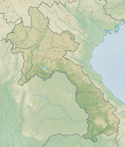
Coordinates: 17°59′N102°38′E / 17.98°N 102.63°E | |
Country | Laos |
Prefecture | Vientiane Prefecture |
Settled | 9th century [1] |
Government | |
• Mayor | Athsphangthong Siphandone |
Area | |
• Total | 3,920 km2 (1,510 sq mi) |
Elevation | 174 m (570 ft) |
Population (2023 [2] ) | |
• Total | 840,940 |
• Density | 210/km2 (560/sq mi) |
GDP | |
• Total | US$ 3 billion (2022) |
• Per capita | US$3,600 (2022) |
Time zone | UTC+7 (ICT) |
Vientiane [a] is the capital and largest city of Laos. Comprising the five urban districts of Vientiane Prefecture, the city is located on the banks of the Mekong, right at the border with Thailand. Vientiane was the administrative capital during French rule and, due to economic growth in recent times, is now the economic center of Laos. The city had a population of 840,000 as of the 2023 Census.
Vientiane is the home of the most significant national monuments such as Pha That Luang, a national symbol of Laos and an icon of Buddhism in Laos. Other significant Buddhist temples can be found there as well, such as Haw Phra Kaew, which formerly housed the Emerald Buddha.
"Vientiane" is the French spelling derived from the Lao Viangchan/wíaŋtɕàn/. [4] The name was previously written "ວຽງຈັນທນ໌" (in Thai, เวียงจันทน์) but now usually written "ວຽງຈັນ". In Lao, viang (ວຽງ) refers to a 'walled city' whereas chan (ຈັນ, previously ຈັນທນ໌) derives from Sanskrit candana (चन्दन, /t͡ɕand̪ana/), 'sandalwood' and can be translated as the 'walled city of sandalwood'. Some Laotians mistakenly believe it refers to the 'walled city of the moon' as chan can also represent 'moon', although this was previously distinguished in writing as "ຈັນທຣ໌". [4] [5] Other romanisations include "Viangchan" and "Wiangchan". [6]
By the 6th century in the Chao Phraya River Valley, Mon peoples had coalesced to create the Dvaravati kingdoms. In the north, Haripunjaya (Lamphun) emerged as a rival power to the Dvaravati. By the 8th century the Mon had pushed north to create city states, in Fa Daet (modern Kalasin, northeastern Thailand), Sri Gotapura (Sikhottabong) near modern Tha Khek, Laos, Muang Sua (Luang Prabang), and Chantaburi (Vientiane). In the 8th century CE, Sri Gotapura (Sikhottabong) was the strongest of these early city states, and controlled trade throughout the middle Mekong region. The city states were loosely bound politically, but were culturally similar and introduced Therevada Buddhism from Sri Lankan missionaries throughout the region. [9] [10] [11] [12] : 6, 7 [13] [14]
The great Laotian epic, the Phra Lak Phra Lam , claims that Prince Thattaradtha founded the city when he left the legendary Lao kingdom of Muong Inthapatha Maha Nakhone because he was denied the throne in favor of his younger brother. Thattaradtha founded a city called Maha Thani Si Phan Phao on the western banks of the Mekong River; this city was said to have later become today's Udon Thani, Thailand. One day, a seven-headed Naga told Thattaradtha to start a new city on the east bank of the river opposite Maha Thani Si Phan Phao. The prince called this city Chanthabuly Si Sattanakhanahud; which was said to be the predecessor of modern Vientiane.[ citation needed ]
Contrary to the Phra Lak Phra Lam, most historians believe Vientiane was an early Mon settlement, which later came under the domination of the Khmer Empire. In the 11th and 12th centuries, the time when the Lao and Thai people are believed to have entered Southeast Asia from Southern China, the few remaining Mon and Khmer in the area moved or assimilated into the Lao civilization, which would soon overtake the area.[ citation needed ]
The earliest reference of the name Vientiane can be seen on a Vietnamese inscription of Duke Đỗ Anh Vũ, dated 1159 during the Khmer-Viet conflict. The inscription says that in 1135, Văn Đan (Vientiane), a vassal of Zhenla (Khmer Empire), invaded Nghe An, but was repelled by the Duke; the Duke led an army chased the invaders as far as Vũ Ôn? (unattested), and then returned with captives. [15] : 65 This name may have traced it origin to Wèndān, a supposedly kingdom located in the Khorat Plateau, mentioned by a ninth-century Chinese writer described a trade route which started at Hanoi and crossed the western mountains to Wèndān.
In 1354, when Fa Ngum founded the kingdom of Lan Xang, [16] : 223 Vientiane became an important administrative city, even though it was not made the capital. King Setthathirath officially established it as the capital of Lan Xang in 1563, to avoid Burmese invasion. [17] When Lan Xang fell apart in 1707, it became an independent Kingdom of Vientiane. In 1779, it was conquered by the Siamese general Phraya Chakri and made a vassal of Siam.
When King Anouvong raised an unsuccessful rebellion, it was obliterated by Siamese armies in 1827. The city was burned to the ground and was looted of nearly all Laotian artifacts, including Buddha statues and people. Vientiane was in great disrepair, depopulated and disappearing into the forest when the French arrived. It eventually passed to French rule in 1893. It became the capital of the French protectorate of Laos in 1899. During the French colonial period, the city was rebuilt and various Buddhist temples such as Pha That Luang, Haw Phra Kaew were repaired.
During French rule, the Vietnamese were encouraged to migrate to Laos, which resulted in 53% of the population of Vientiane being Vietnamese in the year 1943. [18] As late as 1945, the French drew up an ambitious plan to move massive Vietnamese population to three key areas (i.e. the Vientiane Plain, the Savannakhet region, and the Bolaven Plateau), which was only interrupted by the Japanese invasion of Indochina. [18] If this plan had been implemented, according to Martin Stuart-Fox, the Lao might well have lost control over their own country. [18]
During World War II, Vientiane fell with little resistance and was occupied by Japanese forces, under the command of Sako Masanori. [19] On 9 March 1945, French paratroopers arrived and reoccupied the city on 24 April 1945. [20] : 736
The city became the national capital of the newly independent Lao state in 1953.
As the Laotian Civil War broke out between the Royal Lao Government and the Pathet Lao, Vientiane became unstable. In August 1960, Kong Le seized the capital and insisted that Souvanna Phouma become prime minister. In mid-December, Phoumi Nosavan then seized the capital, overthrew the Phouma Government, and installed Boun Oum as prime minister. In mid-1975, Pathet Lao troops moved towards the city and Americans began evacuating the capital. On 23 August 1975, a contingent of 50 Pathet Lao women symbolically liberated the city. [20] On 2 December 1975, the communist party of the Pathet Lao took over Vientiane, defeated the Kingdom of Laos, and renamed the country the Lao People's Democratic Republic, which ended the Laotian Civil War. The next day, an Insurgency in Laos began in the jungle, with the Pathet Lao fighting factions of Hmong and royalists.
Vientiane was the host of the incident-free 2009 Southeast Asian Games. Eighteen competitions were dropped from the previous games held in Thailand, due to Laos' landlocked borders and the lack of adequate facilities in Vientiane.
Vientiane is on a bend of the Mekong River, at which point it forms the border with Thailand. The city government administers the five urban districts of the Vientiane Prefecture.
Vientiane features a tropical savanna climate (Köppen Aw) with distinct wet and dry seasons. Vientiane’s dry season spans from November through March. April marks the onset of the wet season which in Vientiane lasts about seven months. Vientiane tends to be very hot and humid throughout the course of the year, though temperatures in the city tend to be somewhat cooler during the dry season than the wet season. The lowest recorded temperature was 2.4 °C or 36.3 °F in January 1924, and the highest was 42.6 °C or 108.7 °F in April 2024.
Climate data for Vientiane (1991–2020, extremes 1907–present) | |||||||||||||
---|---|---|---|---|---|---|---|---|---|---|---|---|---|
Month | Jan | Feb | Mar | Apr | May | Jun | Jul | Aug | Sep | Oct | Nov | Dec | Year |
Record high °C (°F) | 36.0 (96.8) | 38.0 (100.4) | 40.2 (104.4) | 42.6 (108.7) | 42.5 (108.5) | 39.5 (103.1) | 38.2 (100.8) | 37.8 (100.0) | 37.5 (99.5) | 36.8 (98.2) | 36.0 (96.8) | 36.0 (96.8) | 42.6 (108.7) |
Mean daily maximum °C (°F) | 29.0 (84.2) | 31.0 (87.8) | 33.4 (92.1) | 34.8 (94.6) | 33.6 (92.5) | 32.6 (90.7) | 31.8 (89.2) | 31.4 (88.5) | 31.7 (89.1) | 31.7 (89.1) | 30.8 (87.4) | 28.9 (84.0) | 31.7 (89.1) |
Daily mean °C (°F) | 22.9 (73.2) | 24.8 (76.6) | 27.4 (81.3) | 29.1 (84.4) | 28.7 (83.7) | 28.4 (83.1) | 27.9 (82.2) | 27.6 (81.7) | 27.6 (81.7) | 27.2 (81.0) | 25.5 (77.9) | 22.9 (73.2) | 26.7 (80.1) |
Mean daily minimum °C (°F) | 18.2 (64.8) | 19.3 (66.7) | 21.7 (71.1) | 24.2 (75.6) | 25.0 (77.0) | 25.4 (77.7) | 25.3 (77.5) | 25.0 (77.0) | 24.6 (76.3) | 23.9 (75.0) | 21.5 (70.7) | 19.2 (66.6) | 22.8 (73.0) |
Record low °C (°F) | 2.4 (36.3) | 7.6 (45.7) | 11.7 (53.1) | 13.8 (56.8) | 19.1 (66.4) | 20.0 (68.0) | 19.5 (67.1) | 20.0 (68.0) | 18.8 (65.8) | 12.9 (55.2) | 8.9 (48.0) | 5.0 (41.0) | 2.4 (36.3) |
Average precipitation mm (inches) | 7.4 (0.29) | 16.8 (0.66) | 43.8 (1.72) | 89.4 (3.52) | 225.6 (8.88) | 263.8 (10.39) | 299.8 (11.80) | 340.8 (13.42) | 265.0 (10.43) | 87.4 (3.44) | 15.4 (0.61) | 5.0 (0.20) | 1,663.2 (65.48) |
Average precipitation days (≥ 1.0 mm) | 2 | 2 | 5 | 7 | 15 | 18 | 20 | 21 | 17 | 8 | 2 | 1 | 119 |
Average relative humidity (%) | 70 | 68 | 66 | 69 | 78 | 82 | 82 | 84 | 83 | 78 | 72 | 70 | 75 |
Mean monthly sunshine hours | 221.0 | 214.7 | 209.2 | 213.9 | 188.8 | 140.7 | 116.0 | 124.3 | 157.7 | 209.5 | 225.3 | 224.9 | 2,246 |
Source 1: World Meteorological Organization, [21] Deutscher Wetterdienst (extremes 1907–1990), [22] Pogoda.ru.net, [23] The Yearbook of Indochina (1939–1940) [24] | |||||||||||||
Source 2: NOAA (humidity 1961–1990), [25] Extreme Temperature Around The World [26] |
The capital attracts many tourists to its many temples and Buddhist monuments. A popular attraction for foreign visitors is Pha That Luang, an important national cultural monument of Laos and one of its best known stupas. It was originally built in 1566 by King Setthathirath and was restored in 1953. The golden stupa is 45 metres (148 ft) tall and is believed to contain a relic of the Buddha. [27]
Another site that is also popular amongst tourists is Wat Si Muang. The temple was built on the ruins of a Khmer Hindu shrine, the remains of which can be seen behind the ordination hall. [28] It was built in 1563 and is believed to be guarded by the spirit of a local girl, Nang Si. Legend tells that Nang Si, who was pregnant at the time, leapt to her death as a sacrifice, just as the pillar was being lowered into the hole. In front of the temple stands a statue of King Sisavang Vong. [28]
The memorial monument, Patuxai, built between 1957 and 1968, is perhaps the most prominent landmark in the city. [27] While the Arc de Triomphe in Paris inspired the architecture, the design incorporates typical Lao motifs including Kinnari, a mythical bird woman. Energetic visitors can climb to the top of the monument for a panoramic view of the city.
Buddha Park was built in 1958 by Luang Pu Bunleua Sulilat and contains a collection of Buddhist and Hindu sculptures, scattered amongst gardens and trees. The park is 28 kilometres (17 mi) south of Vientiane at the edge of the Mekong River. [29]
Vientiane is home to one of the three bowling alleys in Laos (the other two are in Luang Prabang and Pakse).
Other sites include:
The National University of Laos, one of three universities in the country, is in Vientiane. [31]
International schools include:
Vientiane is the driving force behind economic change in Laos. In recent years, the city has experienced rapid economic growth from foreign investment. [34] In 2011, the stock exchange opened with two listed company stocks, with the cooperation of South Korea. [35]
There are regular bus services connecting Vientiane Bus Station with the rest of the country. In Vientiane, regular bus services around the city are provided by Vientiane Capital State Bus Enterprise. [37] These buses were set up and run with the help of the Japan International Cooperation Agency.
Daily non-stop bus services run between Vientiane and Nong Khai, Udon Thani, and Khon Kaen in Thailand.
The First Thai-Lao Friendship Bridge, built in the 1990s, crosses the river 18 kilometres downstream of the city of Nong Khai in Thailand, and is the major crossing between the two countries. The official name of the bridge was changed in 2007 by the addition of "First", after the Second Friendship Bridge linking Mukdahan in Thailand with Savannakhet in Laos was opened early in 2007.
A metre gauge railway link over the first bridge was formally inaugurated on 5 March 2009, previously ending at Thanaleng Railway Station, in Dongphosy village (Vientiane Prefecture), 20 km east of Vientiane. [38] [39] As of November 2010, Lao officials plan to convert the station into a cargo rail terminal for freight trains, allowing cargo to be transported from Bangkok into Laos more cheaply than via road. [40] The rail link has since been extended 7.5km further into the city, to terminate at Vientiane (Khamsavath) railway station, a bigger and newer station closer to the city, with connections to the Central Bus Terminal and the Laos China Railway Station. The first passenger train arrived from Krung Thep Aphiwat Central Terminal in Bangkok on 20 July 2024. The new station has immigration facilities, offices, shops and more platforms.
The Boten–Vientiane railway (sometimes referred to as the China–Laos railway or Laos–China railway) is a 414 kilometres (257 mi)1,435 mm (4 ft 8+1⁄2 in) standard gauge electrified railway in Laos, running between the capital Vientiane and the town of Boten on the border with China. The line was officially opened on 3 December 2021. [41]
Vientiane is served by Wattay International Airport with international connections to other Asian destinations such as Singapore, Hong Kong, Malaysia, Thailand, South Korea, Japan and China. Lao Airlines has regular flights to several domestic destinations in the country (including several flights daily to Luang Prabang, plus a few flights weekly to other local destinations). [42] In Thailand, Udon Thani International Airport, one of Wattay's main connections, is less than 90 km distant.
The "Centre Medical de l'Ambassade de France" is available to the foreign community in Laos. The Mahosot Hospital is an important local hospital in treating and researching diseases and is connected with the University of Oxford. In 2011 the Alliance Clinic opened near the airport, with a connection to Thai hospitals. The Setthathirat International Clinic has foreign doctors. A free, 24/7 ambulance service is provided by Vientiane Rescue, a volunteer-run rescue service established in 2010. [43]
Evidence of modern human presence in the northern and central highlands of Indochina, which constitute the territories of the modern Laotian nation-state, dates back to the Lower Paleolithic. These earliest human migrants are Australo-Melanesians—associated with the Hoabinhian culture—and have populated the highlands and the interior, less accessible regions of Laos and all of Southeast Asia to this day. The subsequent Austroasiatic and Austronesian marine migration waves affected landlocked Laos only marginally, and direct Chinese and Indian cultural contact had a greater impact on the country.
The Lao people are a Tai ethnic group native to Southeast Asia. They primarily speak the Lao language, which belongs to the Kra–Dai language family. Lao people constitute the majority ethnic group of Laos, comprising 53.2% of the country's total population. They are also found in significant numbers in northeastern Thailand, particularly in the Isan region, as well as in smaller communities in Cambodia, Vietnam, and Myanmar.
Lan Xang or Lancang was a Lao kingdom that held the area of present-day Laos from 1353 to 1707. For three and a half centuries, Lan Xang was one of the largest kingdoms in Southeast Asia. The kingdom is the basis for Laos's national historic and cultural identity.
Luang Phabang, or Louangphabang, commonly transliterated into Western languages from the pre-1975 Lao spelling ຫຼວງພຣະບາງ as Luang Prabang, literally meaning "Royal Buddha Image", is a city in north central Laos, consisting of 58 adjacent villages, of which 33 comprise the UNESCO Town of Luang Prabang World Heritage Site. It was listed in 1995 for unique and "remarkably" well preserved architectural, religious and cultural heritage, a blend of the rural and urban developments over several centuries, including the French colonial influences during the 19th and 20th centuries.
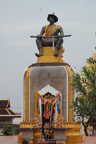
Setthathirath or Xaysettha is considered one of the great leaders in Lao history. Throughout the 1560s until his death, he successfully defended his kingdom of Lan Xang against military campaigns of Burmese conqueror Bayinnaung, who had already subdued Xieng Mai in 1558 and Ayutthaya in 1564. Setthathirath was a prolific builder and erected many Buddhist monuments including Wat Xieng Thong in Luang Prabang, Haw Phra Kaew, Wat Ong Teu Mahawihan and the Pha That Luang in Vientiane.
Pakse is the capital and most populous city of the southern Laotian province of Champasak. Located at the confluence of the Xe Don and Mekong Rivers, the district had a population of approximately 77,900 at the 2015 Laotian census. Pakse was the capital of the Kingdom of Champasak until it was unified with the rest of Laos in 1946.
The Phra Bang is a statue of Buddha in the city of Luang Prabang, Laos; it is the namesake of that city. The statue stands at 83-centimetre (33 in)s, with palms facing forward, cast using thong, an alloy of bronze, gold, and silver. According to local lore, it was cast in Ceylon sometime between the 1st and 9th century. However, the features of the image suggest a much later Khmer origin.
Nong Khai is a city in northeast Thailand. It is the capital of Nong Khai province. Nong Khai city is located in Mueang Nong Khai district.
Laos developed its culture and customs as the inland crossroads of trade and migration in Southeast Asia over millennia. As of 2012 Laos has a population of roughly 6.4 million spread over 236,800 km2, yielding one of the lowest population densities in Asia. Yet the country of Laos has an official count of over forty-seven ethnicities divided into 149 sub-groups and 80 different languages. The Lao Loum have throughout the country's history comprised the ethnic and linguistic majority. In Southeast Asia, traditional Lao culture is considered one of the Indic cultures.
Pha That Luang is a large, gold-covered Buddhist stupa in the centre of the city of Vientiane, capital of Laos. Since its initial establishment, suggested to be in the 3rd century AD, the stupa has undergone several reconstructions, as recently as the 1930s, due to foreign invasions of the area. It is generally regarded as the most important national monument in Laos as well as a national symbol.
'Phra Lak Phra Ram' is the national epic of the Lao people, an adaptation of the ancient Indian epic Ramayana.
Haw Phra Kaew, also written as Ho Prakeo, Hor Pha Keo and other similar spellings, is a former temple in Vientiane, Laos. It is situated on Setthathirath Road, to the southeast of Wat Si Saket. It was first built in 1565 to house the Emerald Buddha, but has been rebuilt several times. The interior now houses a museum of religious art and a small shop.
Wat Phra That Phanom is a Buddhist temple in the That Phanom District in the south of Nakhon Phanom Province, all within the Isan region of Thailand near the Lao border. According to local legend, the temple contains in the pagoda the Phra Uranghathat (พระอุรังคธาตุ)/Phra Ura (พระอุระ)/Buddha's breast bones. As such, it is one of the most important structures for Theravada Buddhists and the most important Buddhist site in the province, with an annual week-long festival being held in the town of That Phanom to honour the temple. These festival attract thousands of people who make pilgrimages to the shrine. In Thai folk Buddhism, Wat Phra That Phanom is a popular pilgrimage destination for those born in the year of the Monkey.
Theravada Buddhism is the largest and dominant religion in Laos. Theravada Buddhism is central to Lao cultural identity. The national symbol of Laos is the That Luang stupa, a stupa with a pyramidal base capped by the representation of a closed lotus blossom which was built to protect relics of the Buddha. It is practiced by 66% of the population. Almost all ethnic or "lowland" Lao people are followers of Theravada Buddhism; however, they constitute more than 50% of the population. The remainder of the population belongs to at least 48 distinct ethnic minority groups. Most of these ethnic groups are practitioners of Tai folk religions, with beliefs that vary greatly among groups.
A wat is a type of Buddhist and Hindu temple in Cambodia, Laos, East Shan State, Yunnan, the Southern Province of Sri Lanka, and Thailand.
Vientiane province is a province of Laos in the country's northwest. As of 2015 the province had a population of 419,090. Vientiane province covers an area of 15,610 square kilometres (6,030 sq mi) composed of 11 districts. The principal towns are Vang Vieng and Muang Phôn-Hông.
Vientiane Prefecture is a prefecture of Laos, in northwest Laos. The national capital, Vientiane, is in the prefecture. The prefecture was created in 1989, when it was split off from Vientiane province.
Luang Prabang is a province in northern Laos. Its capital of the same name, Luang Prabang, was the capital of the Lan Xang Kingdom during the 13th to 16th centuries. It is listed since 1995 by UNESCO as a World Heritage Site for unique architectural, religious and cultural heritage, a blend of the rural and urban developments over several centuries, including the French colonial influences during the 19th and 20th centuries. The province has 12 districts. The Royal Palace, the national museum in the capital city, and the Phou Loei Protected Reserve are important sites. Notable temples in the province are the Wat Xieng Thong, Wat Wisunarat, Wat Sen, Wat Xieng Muan, and Wat Manorom. The Lao New Year is celebrated in April as The Bun Pi Mai.
The people of Laos have a rich literary tradition dating back at least six hundred years, with the oral and storytelling traditions of its peoples dating back much earlier. Lao literature refers to the written productions of Laotian peoples, its émigrés, and to Lao-language works. In Laos today there are over forty-seven recognized ethnic groups, with the Lao Loum comprising the majority group. Lao is officially recognized as the national language, but owing to the ethnic diversity of the country the literature of Laos can generally be grouped according to four ethnolinguistic families: Lao-Tai (Tai-Kadai); Mon-Khmer (Austroasiatic); Hmong-Mien (Miao-Yao), and Sino-Tibetan. As an inland crossroads of Southeast Asia the political history of Laos has been complicated by frequent warfare and colonial conquests by European and regional rivals.
Viangchan in British. (ˌwiːɛŋˌtæn). noun: another spelling of Vientiane