Hom | |
|---|---|
| Hom district | |
 Location of Hom district in Laos | |
| Country | Laos |
| Province | Xaisomboun |
| Time zone | UTC+7 (ICT) |
Hom is a district of Xaisomboun province, Laos. [1] [2]
Hom | |
|---|---|
| Hom district | |
 Location of Hom district in Laos | |
| Country | Laos |
| Province | Xaisomboun |
| Time zone | UTC+7 (ICT) |
Hom is a district of Xaisomboun province, Laos. [1] [2]

Laos, officially the Lao People's Democratic Republic, is a socialist state and the only landlocked country in Southeast Asia. At the heart of the Indochinese Peninsula, Laos is bordered by Myanmar and China to the northwest, Vietnam to the east, Cambodia to the southeast, and Thailand to the west and southwest. Its capital and largest city is Vientiane.

The Laotian Civil War (1959–1975) was a civil war in Laos which was waged between the Communist Pathet Lao and the Royal Lao Government from 23 May 1959 to 2 December 1975. It is associated with the Cambodian Civil War and the Vietnam War, with both sides receiving heavy external support in a proxy war between the global Cold War superpowers. It is called the Secret War among the American CIA Special Activities Center, and Hmong and Mien veterans of the conflict.

Nong Khai province was formerly the northernmost of the northeastern (Isan) provinces (changwat) of Thailand until its eight eastern districts were split off to form Thailand's newest province, Bueng Kan province, in 2011. Nong Khai province lies in upper northeastern Thailand. Nearby provinces are : Bueng Kan, Sakon Nakhon, Udon Thani, and Loei. To the north it borders Vientiane province, Vientiane Prefecture, and Bolikhamsai province of Laos.
Laos is divided into 17 provinces (khoueng) and one prefecture which includes the capital city Vientiane . Provinces are further divided into districts (muang) and then villages (ban). An 'urban' village is essentially a town.

Wattay International Airport is one of the few international airports in Laos and the country's main international gateway, serving the capital Vientiane, located 3 km (2 mi) outside of the city centre. A larger domestic terminal was constructed in 2018 and connected to the international terminal. There is a Lao Air Force installation at one end of the airport.
Laos is divided into 17 provinces and 1 prefecture, or capital city municipality. Furthermore, 1 so-called special administrative zone existed between 1994 and 2006, when it was re-merged into its surrounding provinces. The Xaisomboun special administrative zone was later recreated as the 17th province. Each province is subdivided into districts and then subdivided into villages.

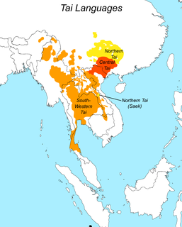
Tai people refers to the population of descendants of speakers of a common Tai language, including sub-populations that no longer speak a Tai language. There are a total of about 93 million people of Tai ancestry worldwide, with the largest ethnic groups being Dai, Thais, Isan, Tai Yai, Lao, Tai Ahom, and Northern Thai peoples.
Brao is a Mon–Khmer language of Cambodia and Laos.

Savannakhet is a province of Laos. The name derives from Savanh Nakhone the province's original name. It bears the same meaning as Nakhon Sawan, a city in Thailand.

Saiyabuli province is a province in northwest Laos. Saiyabuli town is the capital of the province. Saiyabuli is the only Lao province that is completely west of the Mekong River.
Nam Nhou is a district of Bokeo Province, Laos.
Hongsa is a district of Sainyabuli province, Laos. The main town in the district is Hongsa town, where a coal-fired power plant is located.
Ngeun is a district of Sainyabuli province, Laos.
Xienghone is a district of Sainyabuli province, Laos.
Phiang is a district of Sainyabuli province, Laos.
Parklai is a district of Sainyabuli province, Laos.
Botene is a district of Sainyabuli province, Laos.
Khop is a district of Sainyabuli province, Laos.
Kenethao is a district of Sainyabuli province, Laos.