
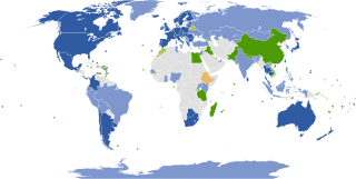
Google Maps is a web mapping platform and consumer application offered by Google. It offers satellite imagery, aerial photography, street maps, 360° interactive panoramic views of streets, real-time traffic conditions, and route planning for traveling by foot, car, bike, air and public transportation. As of 2020, Google Maps was being used by over 1 billion people every month around the world.

Google Earth is a computer program, formerly known as Keyhole EarthViewer, that renders a 3D representation of Earth based primarily on satellite imagery. The program maps the Earth by superimposing satellite images, aerial photography, and GIS data onto a 3D globe, allowing users to see cities and landscapes from various angles. Users can explore the globe by entering addresses and coordinates, or by using a keyboard or mouse. The program can also be downloaded on a smartphone or tablet, using a touch screen or stylus to navigate. Users may use the program to add their own data using Keyhole Markup Language and upload them through various sources, such as forums or blogs. Google Earth is able to show various kinds of images overlaid on the surface of the earth and is also a Web Map Service client. In 2019, Google has revealed that Google Earth now covers more than 98 percent of the world, and has captured 10 million miles of Street View imagery.

Google Street View is a technology featured in Google Maps and Google Earth that provides interactive panoramas from positions along many streets in the world. It was launched in 2007 in several cities in the United States, and has since expanded to include cities and rural areas worldwide. Streets with Street View imagery available are shown as blue lines on Google Maps.

Google Map Maker was a map editing service launched by Google in June 2008. In geographies where it is hard to find providers of good map data, user contributions were used to increase map quality. Changes to Google Map Maker were intended to appear on Google Maps only after sufficient review by Google moderators. Google Map Maker was used at Google Mapathon events held annually.
Google Crisis Response is a team within Google.org that "seeks to make critical information more accessible around natural disasters and humanitarian crises". The team has responded in the past to the 2010 Haiti earthquake, 2010 Pakistan floods, 2010–11 Queensland floods, February 2011 Christchurch earthquake, and the 2011 Tōhoku earthquake and tsunami among other events, using Google resources and tools such as Google Maps, Google Earth, Google Person Finder, and Google Fusion Tables.
Google Street View was first introduced in the United States on May 25, 2007, and until November 26, 2008, featured camera icon markers, each representing at least one major city or area, and usually the other nearby cities, towns, suburbs, and parks. Many areas that had coverage were represented by icons.

The Google Maps pin is the inverted-drop-shaped icon that marks locations in Google Maps. The pin is protected under a U.S. design patent as "teardrop-shaped marker icon including a shadow". Google has used the pin in various graphics, games, and promotional materials.
Google Mapathon is an annual mapathon event organized by Google that invites the public to make improvements to Google Maps, through the Google Map Maker. The event was held for the first time in 2013 in India, and subsequently in 2014 in Australia. The program ran onto troubled waters in India as it was accused of not sparing even the critical military-sensitive areas.

The Carnon River is a heavily polluted river in Cornwall, United Kingdom. It starts in Chacewater. Trewedna Water and River Kennall flow into the Carnon before it merges with Tallack's Creek to become Restronguet Creek, which eventually flows into the English Channel at the mouth of Carrick Roads.

The Ōshima Strait is a strait between the islands of Amami Ōshima and Kakeromajima in Japan. It is part of the Amami Guntō National Park.From the western most side to the eastern most side of the strait, the strait measures 17.5 miles long.
