Kabul

Last updated

Kabul
Persian: کابل Pashto: کابل
Kabul, Afghanistan view.jpg
200229-D-AP390-1529 (49603221753).jpg
Shah-e-Doshamshera Mosque - panoramio.jpg
Sakhi mosque, Kabul.jpg
Modern Kabul - panoramio.jpg
Kabul Afghanistan, place where I live.jpg
Left-to-right from top:
Skyline in 2020, the Arg, Shah-Do Shamshira Mosque, Sakhi Shrine, modern Kabul, skyline in 2021
Flag of Kabul.svg
Kabul Municipality logo.png
Nickname: 
Afghanistan physical map.svg
Red pog.svg
Kabul
Asia laea relief location map.jpg
Red pog.svg
Kabul
Coordinates: 34°31′31″N69°10′42″E / 34.52528°N 69.17833°E / 34.52528; 69.17833
CountryFlag of Afghanistan (2004-2021).svg  Afghanistan
Province Kabul
No. of districts22
No. of Gozars630
Capital formation1776 [3]
Government
  Type Municipality
   Mayor Hamdullah Nomani
   Deputy Mayor Maulvi Abdul Rashid [4]
Area
  Total1,028.24 km2 (397.01 sq mi)
  Land1,028.24 km2 (397.01 sq mi)
  Water0 km2 (0 sq mi)
Elevation
1,791 m (5,876 ft)
Population
 (2022)
  Total4.954 million [5]
Demonyms Kabuli
Time zone UTC+4:30 (Afghanistan Standard Time)
Postal code
10XX
Area code (+93) 20
Climate BSk
Website km.gov.af

Kabul [lower-alpha 1] is the capital and largest city of Afghanistan. Located in the eastern half of the country, it is also a municipality, forming part of the Kabul Province; it is administratively divided into 22 municipal districts. According to 2023 estimates, the population of Kabul was 4.95 million people. [5] In contemporary times, the city has served as Afghanistan's political, cultural, and economical center, [8] and rapid urbanisation has made Kabul the 75th-largest city in the world [9] and the country's primate city.

Contents

The modern-day city of Kabul is located high up in a narrow valley in the Hindu Kush, and is bounded by the Kabul River. At an elevation of 1,790 metres (5,873 ft), it is one of the highest capital cities in the world. The center of this city includes its old neighborhoods, which include the areas of Khashti Bridge, Khabgah, Kahforoshi, Deh-Afghanan, Chandavel, Shorbazar, Saraji, Zana-Khan and Baghe Alimardan. [10] Kabul is said to be over 3,500 years old, mentioned since at least the time of the Achaemenid Persian Empire. Located at a crossroads in Asia—roughly halfway between Istanbul, Turkey, in the west and Hanoi, Vietnam, in the east—it is situated in a strategic location along the trade routes of Central Asia and South Asia, and was a key destination on the ancient Silk Road; [11] It was traditionally seen as the meeting point between Tartary, India, and Persia. [12] Kabul has also been under the rule of various other dynasties and empires, including the Seleucids,the Mauryans, the Kushans, the Hindu Shahis, Western Turks, the Turk Shahis, the Samanids, the Khwarazmians, the Timurids, and the Mongols, among others such as the Arman Rayamajhis. In the 16th century, the Mughal Empire used Kabul as a summer capital, during which time it prospered and increased in significance. [12] It briefly came under the control of the Afsharids following Nader Shah's invasion of India, until finally coming under local rule by the Afghan Empire in 1747; [13] Kabul became the capital of Afghanistan in 1776, during the reign of Timur Shah Durrani (a son of Ahmad Shah Durrani). [3] In the 19th century, the city was occupied by the British, but after establishing foreign relations and agreements, they were compelled to withdraw all forces from Afghanistan and return to British India.

Kabul is known for its historical gardens, bazaars, and palaces; [14] [15] [16] well-known examples are the Gardens of Babur and Darul Aman Palace, as well as the Arg. In the second half of the 20th century, it became a stop on the hippie trail undertaken by many Europeans, [17] [18] [19] and the city also gained the nickname "Paris of Central Asia" during this time. [1] [2] [20] However, this period of tranquility ended in 1978 with the Saur Revolution and subsequent Soviet military intervention in 1979, which sparked the protracted Soviet–Afghan War until 1989. The 1990s were marked by continuous civil wars between various splinter factions of the disbanded Afghan mujahideen, which destroyed much of the city. [21] In 1996, Kabul was captured by the Taliban after four years of intermittent fighting with other Afghan factions. However, the Taliban-ruled city soon fell to the United States after the American-led invasion of Afghanistan following the September 11 attacks in 2001. In 2021, Kabul was re-captured by the Taliban following the withdrawal of American-led military forces from Afghanistan.

Toponymy and etymology

Kabul is also spelled as Cabool, Cabol, Kabol, or Cabul.[ citation needed ]

Kabul was known by different names throughout history. [22] Its meaning is unknown, but "certainly pre-dates the advent of Islam when it was an important centre on the route between India and the Hellenic world". [23] In Sanskrit, it was known as Kubha, whereas Greek authors of classical antiquity referred to it as Kophen, Kophes or Koa. [22] The Chinese traveler Xuanzang (fl. 7th century CE) recorded the city as Kaofu (高附). [22] The name "Kabul" was first applied to the Kabul river before being applied to the area situated between the Hindu Kush and Sindh (present-day Pakistan). [22] [23] This area was also known as Kabulistan. [22] Alexander Cunningham (died 1893) noted in the 19th century that Kaofu as recorded by the Chinese was in all likelihood the name of "one of the five Yuchi or Tukhari tribes". [22] Cunningam added that this tribe gave its name to the city after it was occupied by them in the 2nd century BCE. [22] This "supposition seems likely" as the Afghan historian Mir Ghulam Mohammad Ghobar (1898–1978) wrote that in the Avesta (sacred book of Zoroastrianism), Kabul was known as Vaekereta, whereas the Greeks of antiquity referred to it as Ortospana ("High Place"), which corresponds to the Sanskrit word Urddhastana, which was applied to Kabul. [22] The Greek geographer Ptolemy (died c.170 CE) recorded Kabul as Καβουρα (Kabura). [22]

According to a legend, one could find a lake in Kabul, in the middle of which the so-called "Island of Happiness" could be found, where a joyous family of musicians lived. [22] According to this same legend, the island became accessible by the order of a king through the construction of a bridge (i.e. "pul" in Persian) made out of straw (i.e. "kah" in Persian). [22] According to this legend the name Kabul was thus formed as a result of these two words combined, i.e. kah + pul. [22] The Concise Oxford Dictionary of World Place Names argues that the "suggestion that the name is derived from the Arabic root qbl 'meeting' or 'receiving' is unlikely". [23]

It remains unknown when the name "Kabul" was first applied to the city. [22] However, it "came into prominence" following the destruction of Kapisa and other cities in what is present-day Afghanistan by Genghis Khan (c. 1162–1227) in the thirteenth century. [22] Due to the centrality of the city within the region, as well as its cultural importance as a nexus of ethnic groups in the region, Kabul became known as the Paris of Central Asia in the late 20th century.

History

Antiquity

The origin of Kabul, who built it and when, is largely unknown. [24] The Hindu Rigveda, composed between 2000 and 1500 BC and one of the four canonical texts of Hinduism, and the Avesta, the primary canon of texts of Zoroastrianism, refer to the Kabul River and to a settlement called Kubha. [24] [25]

The Kabul valley was part of the Median Empire (c. 678–549 BC). [26] In 549 BC, the Median Empire was annexed by Cyrus The Great and Kabul became part the Achaemenid Empire (c. 550–330 BC). [27] During that period, Kabul became a center of learning for Zoroastrianism, followed by Buddhism and Hinduism. [28] An inscription on Darius the Great's tombstone lists Kabul as one of the 29 countries of the Achaemenid Empire. [25]

Kushan Empire Map of the Kushan Empire.png
Kushan Empire

When Alexander annexed the Achaemenid Empire, the Kabul region came under his control. [29] After his death, his empire was seized by his general Seleucus, becoming part of the Seleucid Empire. In 305 BCE, the Seleucid Empire was extended to the Indus River which led to friction with the neighbouring Mauryan Empire. [30]

During the Mauryan period, trade flourished because of uniform weights and measures. Irrigation facilities for public use were developed leading to an increased harvest of crops. People were also employed as artisans, jewellers, and carpenters. [31]

The Greco-Bactrians took control of Kabul from the Mauryans in the early 2nd century BC, then lost the city to their subordinates in the Indo-Greek Kingdom around the mid-2nd century BC. Buddhism was greatly patronised by these rulers and the majority of people of the city were adherents of the religion. [32] Indo-Scythians expelled the Indo-Greeks by the mid 1st century BC, but lost the city to the Kushan Empire about 100 years later. [33] [34]

Buddha statue at the museum in Kabul, early 1st millennium Kabul Museum statue2.jpg
Buddha statue at the museum in Kabul, early 1st millennium

It is mentioned as Kophes or Kophene in some classical writings. Hsuan Tsang refers to the city as Kaofu [35] in the 7th century AD, which is the appellation of one of the five tribes of the Yuezhi who had migrated from across the Hindu Kush into the Kabul valley around the beginning of the Christian era. [36] It was conquered by Kushan Emperor Kujula Kadphises in about 45 AD and remained Kushan territory until at least the 3rd century AD. [37] [38] The Kushans were Indo-European-speaking peoples based in Bactria. [39]

Around 230 AD, the Kushans were defeated by the Sassanid Empire and replaced by Sassanid vassals known as the Indo-Sassanids. During the Sassanian period, the city was referred to as "Kapul" in Pahlavi scripts. [25] Kapol in the Persian language means Royal (ka) Bridge (pol), which is due to the main bridge on the Kabul River that connected the east and west of the city. In 420 AD, the Indo-Sassanids were driven out of Afghanistan by the Xionite tribe known as the Kidarites, who were then replaced in the 460s by the Hephthalites. It became part of the surviving Turk Shahi Kingdom of Kapisa, also known as Kabul-Shahan. [40] According to Táríkhu-l Hind by Al-Biruni, Kabul was governed by princes of Turkic lineage. [40] |Abu Rayhan Biruni|978–1048 AD}} It was briefly held by the Tibetan Empire between 801 and 815.

Islamisation and Mongol invasion

Map showing names of the regions during the 7th century. Ancient Khorasan highlighted.jpg
Map showing names of the regions during the 7th century.

The Islamic conquest reached modern-day Afghanistan in 642 AD, at a time when Kabul was independent. [41] Till then, Kabul was considered politically and culturally part of Indian world. [42] A number of failed expeditions were made to Islamise the region. In one of them, Abdur Rahman bin Samara arrived in Kabul from Zaranj in the late 600s and converted 12,000 inhabitants to Islam before abandoning the city. Muslims were a minority until Ya'qub bin Laith as-Saffar of Zaranj conquered Kabul in 870 from the Hindu Shahis and established the first Islamic dynasty in the region. It was reported that the rulers of Kabul were Muslims with non-Muslims living close by. Iranian traveller and geographer Istakhri described it in 921:

Kábul has a castle celebrated for its strength, accessible only by one road. In it there are Musulmáns, and it has a town, in which are infidels from Hind. [43]

Over the following centuries, the city was successively controlled by the Samanids, Ghaznavids, Ghurids, Khwarazmshahs, Qarlughids, and Khaljis. In the 13th century, the invading Mongols caused major destruction in the region. Report of a massacre in the close by Bamiyan is recorded around this period, where the entire population of the valley was annihilated by the Mongol troops as revenge for the death of Genghis Khan's grandson. As a result, many natives of Afghanistan fled south toward the Indian subcontinent where some established dynasties in Delhi. The Chagatai Khanate and Kartids were vassals of Ilkhanate until the dissolution of the latter in 1335.

Following the era of the Khalji dynasty in 1333, the famous Moroccan scholar Ibn Battuta was visiting Kabul and wrote:

We travelled on to Kabul, formerly a vast town, the site of which is now occupied by a village inhabited by a tribe of Persians called Afghans. They hold mountains and defiles and possess considerable strength, and are mostly highwaymen. Their principal mountain is called Kuh Sulayman. [44]

Timurid and Mughal era

Humayun with his father Babur, emperors of the Mughal Empire Babur and Humayun.jpg
Humayun with his father Babur, emperors of the Mughal Empire
Old painting showing the Great Wall of Kabul Horsemen assembled outside the city walls at Kabul, Afghanis Wellcome V0050453.jpg
Old painting showing the Great Wall of Kabul

In the 14th century, Kabul became a major trading centre under the kingdom of Timur (Tamerlane). In 1504, the city fell to Babur from the north and made into his headquarters, which became one of the principal cities of his later Mughal Empire. In 1525, Babur described Kabulistan in his memoirs by writing that:

There are many differing tribes in the Kābul country; in its dales and plains are Turks and clansmen and 'Arabs; and in its town and in many villages, Sārts; out in the districts and also in villages are the Pashāi, Parājī, Tājik, Bīrkī and Afghān tribes. In the western mountains are the Hazāra and Nikdīrī tribes, some of whom speak the Mughūlī tongue. In the north-eastern mountains are the places of the Kāfirs, such as Kitūr and Gibrik. To the south are the places of the Afghān tribes. [45]

Mirza Muhammad Haidar Dughlat, a poet from Hindustan who visited at the time wrote: "Dine and drink in Kabul: it is mountain, desert, city, river and all else." It was from here that Babur began his 1526 conquest of Hindustan, which was ruled by the Afghan Lodi dynasty and began east of the Indus River in what is present-day Pakistan. Babur loved Kabul due to the fact that he lived in it for 20 years and the people were loyal to him, including the weather that he was used to. His wish to be buried in Kabul was finally granted. The inscription on his tomb contains the famous Persian couplet, which states:

اگرفردوس روی زمین است همین است و همین است و همین است

Transliteration:

Agar fardus rui zamayn ast', hameen ast', o hameen ast', o hameen ast'.

(If there is a paradise on earth, it is this, and it is this, and it is this!) [46]

Kabul remained in Mughal control for the next 200 years. [47] Though Mughal power became centred within the Indian subcontinent, Kabul retained importance as a frontier city for the empire; Abul Fazl, Emperor Akbar's chronicler, described it as one of the two gates to Hindustan (the other being Kandahar). [48] As part of administrative reforms under Akbar, the city was made capital of the eponymous Mughal province, Kabul Subah. [49] Under Mughal governance, Kabul became a prosperous urban centre, endowed with bazaars such as the non-extant Char Chatta. [47] For the first time in its history, Kabul served as a mint centre, producing gold and silver Mughal coins up to the reign of Alamgir II. [50] It acted as a military base for Shah Jahan's campaigns in Balkh and Badakhshan. Kabul was also a recreational retreat for the Mughals, who hunted here and constructed several gardens. Most of the Mughals' architectural contributions to the city (such as gardens, fortifications, and mosques) have not survived. [47] [51] During this time, the population was about 60,000. [12]

Under later Mughal Emperors, Kabul became neglected. [47] The empire lost the city when it was captured in 1738 by Nader Shah, who was en route to invade the Indian subcontinent. [50]

Durrani and Barakzai dynasties

Shujah Shah Durrani, the last Durrani King, sitting at his court inside the Bala Hissar Shuja Shah Durrani of Afghanistan in 1839.jpg
Shujah Shah Durrani, the last Durrani King, sitting at his court inside the Bala Hissar
Chihil Sutun Palace (also known as "Hendaki"), one of numerous palaces built by the Emir in the 19th century Hendaki Palace, the Emir's residence, Kabul Wellcome L0025004.jpg
Chihil Sutun Palace (also known as "Hendaki"), one of numerous palaces built by the Emir in the 19th century

Nine years after Nader Shah and his forces invaded and occupied the city as part of the more easternmost parts of his Empire, he was assassinated by his own officers, causing its rapid disintegration. Ahmad Shah Durrani, commander of 4,000 Abdali Afghans, asserted Pashtun rule in 1747 and further expanded his new Afghan Empire. His ascension to power marked the beginning of Afghanistan. By this time, Kabul had lost its status as a metropolitan city, and its population had decreased to 10,000. [52] Interest in the city was renewed when Ahmad Shah's son Timur Shah Durrani, after inheriting power, transferred the capital of the Durrani Empire from Kandahar to Kabul in 1776. [3] [47] Kabul experienced considerable urban development during the reigns of Timur Shah and his successor Zaman Shah; several religious and public buildings were constructed, and diverse groups of Sufis, jurists, and literary families were encouraged to settle the city through land grants and stipends. [53] [47] Kabul's first visitor from Europe was Englishman George Forster, who described 18th-century Kabul as "the best and cleanest city in Asia". [54]

In 1826, the kingdom was claimed by Dost Mohammad Khan, but in 1839 Shujah Shah Durrani was re-installed with the help of the British Empire during the First Anglo-Afghan War. In 1841 a local uprising resulted in the killing of the British resident and loss of mission in Kabul and the 1842 retreat from Kabul to Jalalabad. In 1842 the British returned to Kabul, demolishing the city's main bazaar in revenge before returning to British India (now Pakistan). Akbar Khan took to the throne from 1842 to 1845 and was followed by Dost Mohammad Khan. [55]

Etching of Kabul by an Italian artist, 1885 Kabul, capitale dell'Afganistan a.jpg
Etching of Kabul by an Italian artist, 1885

The Second Anglo-Afghan War broke out in 1879 when Kabul was under Sher Ali Khan's rule, as the Afghan king initially refused to accept British diplomatic missions and later the British residents were again massacred. During the war, Bala Hissar was partially destroyed by a fire and an explosion. [56]

20th century

Having become an established bazaar city, leather and textile industries developed by 1916. [57] The majority of the population was concentrated on the south side of the river.

Kabul modernised throughout the regime of King Habibullah Khan, with the introduction of electricity, telephone, and a postal service. [58] The first modern high school, Habibia, was established in 1903. In 1919, after the Third Anglo-Afghan War, King Amanullah Khan announced Afghanistan's independence in foreign affairs at Eidgah Mosque in Kabul. Amanullah was reform-minded and he had a plan to build a new capital city on land about 6 km away from Kabul. This area was named Darulaman and it consisted of the famous Darul Aman Palace, where he later resided. Many educational institutions were founded in Kabul during the 1920s. In 1929 King Amanullah left Kabul due to a local uprising orchestrated by Habibullah Kalakani, but he himself was imprisoned and executed after nine months in power by King Nader Khan. Three years later, in 1933, the new king was assassinated during an award ceremony inside a school in Kabul. The throne was left to his 19-year-old son, Zahir Shah, who became the last King of Afghanistan. Unlike Amanullah Khan, Nader Khan and Zahir Shah had no plans to create a new capital city, and thus Kabul remained the country's seat of government.

Dilkusha Palace, built in European style in the 1900s Dilkusha Palace, Kabul Afghanistan.jpg
Dilkusha Palace, built in European style in the 1900s

During the inter-war period France and Germany helped develop the country and maintained high schools and lycees in the capital, providing education for the children of the city's elite families. [59] Kabul University opened in 1932 and by the 1960s western educated Afghans made up the majority of teachers. [60] By the 1960s the majority of instructors at the university had degrees from Western universities. [60]

Kabul's only railway service, the Kabul–Darulaman Tramway, operated for six years from 1923 to 1929. [61]

When Zahir Shah took power in 1933 Kabul had the only 10 kilometers (6 miles) of rail in the country and the country had few internal telegraphs, phone lines or roads. Zahir turned to the Japanese, Germans and Italians for help developing a modern transportation and communication network. [62] A radio tower built by the Germans in 1937 in Kabul allowed instant communication with outlying villages. [63] A national bank and state cartels were organised to allow for economic modernisation. [64] Textile mills, power plants, carpet and furniture factories were also built in Kabul, providing much-needed manufacturing and infrastructure. [64]

The river bank in the centre of Kabul in the 1960s 66-174 Kabul Afghanistan 1966.jpg
The river bank in the centre of Kabul in the 1960s

During the 1940s and 1950s, urbanisation accelerated and the built-up area was increased to 68 km2 by 1962, an almost fourteen-fold increase compared to 1925. [57] The Serena Hotel opened in 1945 as the first Western style luxury hotel. Under the premiership of Mohammad Daoud Khan in the 1950s, foreign investment and development increased. In 1955, the Soviet Union forwarded $100 million in credit to Afghanistan, which financed public transportation, airports, a cement factory, mechanised bakery, a five-lane highway from Kabul to the Soviet border and dams, including the Salang Pass to the north of Kabul. [65] During the 1960s, Soviet-style microrayon housing estates were built, containing sixty blocks. The government also built many ministry buildings in the brutalist architecture style. [66] In the 1960s the first Marks & Spencer store in Central Asia was built in the city. Kabul Zoo was inaugurated in 1967, which was maintained with the help of visiting German zoologists. During this time, Kabul experimented with liberalisation, notably the loosening of restrictions on speech and assembly which led to student politics in the capital and various demonstrations by Socialist, Maoist, liberal or Islamist factions. [67]

People and traffic in a part of Kabul, 1976 Kabul-46-Stadthuegel-1976-gje.jpg
People and traffic in a part of Kabul, 1976

Foreigners flocked to Kabul and the nation's tourism industry picked up speed. To accompany the city with newfound tourism, western-style accommodations were opened in the 1960s, notably the Spinzar Hotel. [68] Western, American and Japanese tourists were visiting the city's attractions [69] including the "celebrated" Chicken Street [70] and the National Museum that used to have some of Asia's finest cultural artifacts. [71] Lonely Planet called it an upcoming "tourist trap" in 1973. [72] Additionally, Pakistanis were also visiting to watch Indian movies in cinemas that were banned in their own country. [68] During this time, Kabul had been nicknamed the Paris of Central Asia. [1] [2] According to J. Bruce Amstutz, an American diplomat in Kabul:

[Before the 1978 Marxist coup d'etat] Kabul was a pleasant city [..] Though poor economically, it was spared the eyesore slums so visible in other Asian cities. The Afghans themselves were an imposing people, the men tall and self-assured and the women attractive. [70]

Until the late 1970s, Kabul was a major stop on the famous Hippie trail, coming from Bamyan to the west on towards Peshawar. [73] At the time, Kabul became known for its street sales of hashish and became a major tourist attraction for western hippies. [17]

Occupations wars and Taliban Regime (1996–2001)

Centre of Kabul in 1979; the Pul-e Khishti bridge crosses the Kabul River to the old city in the south bank Old View of Kabul with Pul-e Khishti Mosque and Kabul Fortress in Background.jpg
Centre of Kabul in 1979; the Pul-e Khishti bridge crosses the Kabul River to the old city in the south bank

On 28 April 1978, President Daoud and most of his family were assassinated in Kabul's Presidential Palace in what is called the Saur Revolution. Pro-Soviet PDPA under Nur Muhammad Taraki seized power and slowly began to institute reforms. [74] Private businesses were nationalised in the Soviet manner. [75] Education was modified into the Soviet model, with lessons focusing on teaching Russian, Marxism–Leninism and learning of other countries belonging to the Soviet bloc. [75]

Amid growing internal chaos and heightened cold war tensions, the U.S. Ambassador to Afghanistan, Adolph Dubs, was kidnapped on his way to work at the U.S. Embassy in Kabul on 14 February 1979 and killed during a rescue attempt at the Serena Hotel. There were conflicting reports of who abducted Dubs and what demands were made for his release. Several senior Soviet officials were in the lobby of the hotel during a standoff with the kidnappers, who were holding Dubs in room 117. [76] [77] Afghan police, acting on the advice of Soviet advisors and over the objections of U.S. officials, launched a rescue attempt, during which Dubs was shot in the head from a distance of six inches and killed. [78] Many questions about the killing remain unanswered.

On 24 December 1979, the Soviet Union invaded Afghanistan and Kabul was heavily occupied by Soviet Armed Forces. In Pakistan, Director-General of the ISI Akhtar Abdur Rahman advocated for the idea of covert operation in Afghanistan by arming Islamic extremists who formed the mujahideen. [79] General Rahman was heard loudly saying: "Kabul must burn! Kabul must burn!", [80] and mastered the idea of proxy war in Afghanistan. [79] Pakistani President Zia-ul-Haq authorised this operation under General Rahman, which was later merged with Operation Cyclone, a programme funded by the United States and carried out by the Central Intelligence Agency.

Taj Beg Palace in 1987, the Soviet Army headquarters during the Soviet-Afghan War Evstafiev-40th army HQ-Amin-palace-Kabul.jpg
Taj Beg Palace in 1987, the Soviet Army headquarters during the Soviet–Afghan War

The Soviets turned the city of Kabul into their command centre during the Soviet–Afghan War, and while fighting was mostly taking place in the countryside, Kabul was widely disturbed. Political crime and guerrilla attacks on military and government targets were common, and the sound of gunfire became commonplace at night in the outskirts. Large numbers of PDPA party members and Soviet troops were kidnapped or assassinated, sometimes in broad daylight, with acts of terrorism committed by civilians, anti-regime militias and also Khalqists. By July 1980, as many as twelve party members were being assassinated on a daily basis, and the Soviet Army stopped patrolling the city in January 1981. A major uprising against the Soviet presence broke out in Kabul in February 1980 in what is called the 3 Hut uprising. It led to a night curfew in the city that would remain in place for seven years. [81] The Soviet Embassy also, was attacked four times with arms fire in the first five years of the war. A Western correspondent revisiting Kabul in December 1983 after a year, said that the city was "converted into a fortress bristling with weapons". [82] Contrastingly, that same year American diplomat Charles Dunbar commented that the Soviet troops' presence was "surprisingly modest", [83] and an author in a 1983 Bulletin of the Atomic Scientists article thought that the Soviet soldiers had a "friendly" atmosphere. [84]

The city's population increased from around 500,000 in 1978 to 1.5 million in 1988. [85] The large influx were mostly internal refugees who fled other parts of the country for safety in Kabul. During this time, women made up 40% of the workforce. [86] Soviet men and women were very common in the city's shopping roads, with the large availability of Western products. [83] Most Soviet civilians (numbering between 8,000 and 10,000) lived in the northeastern Soviet-style Mikrorayon ( microraion ) housing complex that was surrounded by barbed-wire and armed tanks. They sometimes received abuse from anti-Soviet civilians on the streets. [87] The mujahideen rebels managed to strike at the city a few times—on 9 October 1987, a car bomb planted by a mujahideen group killed 27 people, and on 27 April 1988, in celebrations of the 10th anniversary of the Saur Revolution, a truck bomb killed six people. [88]

Kabul's Jada-e Maiwand in 1993, showing the destruction caused by the civil war. Kabul during civil war of fundamentalists 1993-2.jpg
Kabul's Jada-e Maiwand in 1993, showing the destruction caused by the civil war.

After the fall of Mohammad Najibullah's [89] government in April 1992, different mujahideen factions entered the city and formed a government under the Peshawar Accords, but Gulbuddin Hekmatyar's party refused to sign the accords and started shelling the city for power, which soon escalated into a full-scale conflict. This marked the start of a dark period of the city: at least 30,000 civilians were killed in a period known locally as the "Kabul Wars." [90] About 80 percent of the city was devastated and destroyed by 1996. [91] [92] The old city and western areas were among the worst-hit. A New York Times analyst said in 1996 that the city was more devastated than Sarajevo, which was similarly damaged during the Bosnian War at the time. [93]

The city suffered heavily under a bombardment campaign between rival militias which intensified during the summer of 1992. Its geographic location in a narrow valley made it an easy target from rockets fired by militias who based themselves in the surrounding mountains. [94] Within two years' time, the majority of infrastructure was destroyed, a massive exodus of the population left to the countryside or abroad, and electricity and water was completely out. In late 1994, bombardment of the capital came to a temporary halt. [95] [96] [97] These forces took steps to restore law and order. Courts started to work again, convicting individuals inside government troops who had committed crimes. [98] On 27 September 1996, the hardline Taliban militia seized Kabul and established the Islamic Emirate of Afghanistan. They imposed a strict form of Sharia (Islamic law), restricting women from work and education, [99] conducting amputations against common thieves, and hit-squads from the infamous "Ministry for Promotion of Virtue and Prevention of Vice" watching public beatings of people. [99]

21st century

In November 2001, the Northern Alliance captured Kabul after the Taliban had abandoned it following the American invasion. A month later a new government under President Hamid Karzai began to assemble. In the meantime, a NATO-led International Security Assistance Force (ISAF) was deployed in Afghanistan. The war-torn city began to see some positive development as many expatriate Afghans returned to the country. The city's population grew from about 500,000 in 2001 to over 3 million in recent years. Many foreign embassies re-opened. In 2008 the process[ clarification needed ] started to gradually hand over security responsibilities from NATO to Afghan forces. [100] From late 2001 the city has been continuously rebuilt - [101] many of the damaged landmarks were rebuilt or renovated, for example the Gardens of Babur in 2005, [102] the arch of Paghman, the Mahmoud Khan Bridge clock tower in 2013, [103] and the Taj Beg Palace in 2021. [104] Local community efforts have also managed to restore war-ravaged local homes and dwellings. [105]

Modern high-rises built in the 2010s Apartments in Kabul street.jpg
Modern high-rises built in the 2010s

The city has experienced rapid urbanisation with an increasing population. Many informal settlements have been built. [106] Since the late 2000s, numerous modern housing complexes have been built, many of which are gated and secured, to serve a growing Afghan middle class. [107] Some of these include the Aria City (in District 10) and Golden City (District 8). [108] [109] Some complexes have been built out-of-town, such as the Omid-e-Sabz township (District 13), Qasaba/Khwaja Rawash township (District 15), and Sayed Jamaludin township (District 12). [110] [111] [112]

Throughout the years, a high-security "Green Zone" was formed in the centre of the city. [113] In 2010, a series of manned checkpoints called the Ring of Steel was put into operation. Concrete blast walls also appeared throughout Kabul in the 2000s for security reasons. [114]

Despite frequent terrorist attacks in the city, mainly by Taliban insurgents, the city continued to develop and was the fifth fastest-growing city in the world as of 2012. [115] [116] Until August 2021, the Afghan National Security Forces (ANSF) had been in charge of security in and around the city. Kabul was periodically the scene of deadly bombings carried out mostly by the Taliban and its wing the Haqqani network. [117] [118] [119] [120] Government employees, soldiers and ordinary civilians have all been targets of attacks. [121] [122] [123] [124] [125] The Afghan government called the actions of the terrorists war crimes. The deadliest attack yet was a truck bombing in May 2017. [126] The city was seized during the 2021 Taliban offensive on August 15, 2021; under Taliban rule the city and the country has experienced some relative calm, [127] although a number of terrorist attacks have since been committed by the regional ISIL branch. [128]


Geography

Night scene in Kabul in 2016 looking northeast, with Koh-e 'Aliabad on the left and Koh-e Asamai on the right Kabul-Pano By Dani.jpg
Night scene in Kabul in 2016 looking northeast, with Koh-e 'Aliabad on the left and Koh-e Asamai on the right
Qargha dam and lake DSC 0049-2.jpg
Qargha dam and lake
A view of some of the mountains that surround Kabul Kabul mountains.jpg
A view of some of the mountains that surround Kabul

Kabul was situated in the eastern part of the country, 1,791 meters (5,876 feet) above sea level in a narrow valley, wedged between the Hindu Kush mountains along the Kabul River. Immediately to the south of the old city are the ancient city walls and the Sher Darwaza mountain, with the Shuhadayi Salihin cemetery behind it. A bit further east is the ancient Bala Hissar fortress with the Kol-e Hasmat Khan lake behind it.

Its location has been described as a "bowl surrounded by mountains". [129] Some of the mountains (which are called koh) include: Khair Khana-e Shamali, Khwaja Rawash, Shakhi Baran Tey, Chihil Sutun, Qurugh, Khwaja Razaq and Sher Darwaza. There are also two mountains in between urban areas to the west: Koh-e Asamai (locally known as the Television hill) and Ali Abad. Hills within the city (which are called tapa) include Bibi Mahro and Maranjan.

The Logar River flows into Kabul from the south, joining the Kabul River not far from the city centre.

The city covers an area size of 1,023 square kilometres (395 sq mi), making it by far the largest in the country. The closest foreign capital cities as the crow flies are Islamabad, Dushanbe, Tashkent, New Delhi and Bishkek. Kabul is roughly equidistant between Istanbul (western Asia) and Hanoi (eastern Asia).

Climate

Kabul has a continental, cold semi-arid climate (BSk), with precipitation concentrated in the winter (almost exclusively falling as snow) and spring months. Summers have very low humidity, providing some relief from the heat. Autumns feature warm afternoons and sharply cooler evenings. Winters are very cold by South Asian standards, with a subzero January daily average temperature of −2.3 °C (27.9 °F), mainly due to the high elevation of the city. Spring is the wettest time of the year. Sunny conditions dominate year-round, and the annual mean temperature is only 12.1 °C (53.8 °F), much lower than that of Afghanistan's other large cities.

Climate data for Kabul (1956–1983)
MonthJanFebMarAprMayJunJulAugSepOctNovDecYear
Record high °C (°F)18.8
(65.8)
18.4
(65.1)
26.7
(80.1)
28.7
(83.7)
33.5
(92.3)
36.8
(98.2)
37.8
(100.0)
37.3
(99.1)
35.1
(95.2)
31.6
(88.9)
24.4
(75.9)
20.4
(68.7)
37.8
(100.0)
Mean daily maximum °C (°F)4.5
(40.1)
5.5
(41.9)
12.5
(54.5)
19.2
(66.6)
24.4
(75.9)
30.2
(86.4)
32.1
(89.8)
32.0
(89.6)
28.5
(83.3)
22.4
(72.3)
15.0
(59.0)
8.3
(46.9)
19.5
(67.1)
Daily mean °C (°F)−2.3
(27.9)
−0.7
(30.7)
6.3
(43.3)
12.8
(55.0)
17.3
(63.1)
22.8
(73.0)
25.0
(77.0)
24.1
(75.4)
19.7
(67.5)
13.1
(55.6)
5.9
(42.6)
0.6
(33.1)
12.1
(53.8)
Mean daily minimum °C (°F)−7.1
(19.2)
−5.7
(21.7)
0.7
(33.3)
6.0
(42.8)
8.8
(47.8)
12.4
(54.3)
15.3
(59.5)
14.3
(57.7)
9.4
(48.9)
3.9
(39.0)
−1.2
(29.8)
−4.7
(23.5)
4.3
(39.7)
Record low °C (°F)−25.5
(−13.9)
−24.8
(−12.6)
−12.6
(9.3)
−2.1
(28.2)
0.4
(32.7)
3.1
(37.6)
7.5
(45.5)
6.0
(42.8)
1.0
(33.8)
−3.0
(26.6)
−9.4
(15.1)
−18.9
(−2.0)
−25.5
(−13.9)
Average precipitation mm (inches)34.3
(1.35)
60.1
(2.37)
67.9
(2.67)
71.9
(2.83)
23.4
(0.92)
1.0
(0.04)
6.2
(0.24)
1.6
(0.06)
1.7
(0.07)
3.7
(0.15)
18.6
(0.73)
21.6
(0.85)
312.0
(12.28)
Average rainy days2310118121124348
Average snowy days76300000000420
Average relative humidity (%)68706561483637383942526352
Mean monthly sunshine hours 177.2178.6204.5232.5310.3353.4356.8339.7303.9282.6253.2182.43,175.1
Source: NOAA [130]

Environment

The Kabul River flows through the heart of the city, dividing the central bazaars. There are several bridges (pul) crossing the river, the major ones being Pul-e Shah-Do Shamshira, Pul-e Bagh-e Omomi, Pul-e Khishti, and Pul-e Mahmoud. Due to climate change, since the 21st century, the river runs dry most of the year, only filling up in the wetter winter and spring seasons. [131]

A large lake and wetland was located just to the southeast from the old city called Kol-e Hashmat Khan . [132] The marsh provides a critical resting place to thousands of birds who fly between the Indian subcontinent and Siberia. In 2017 the government declared the lake a protected area. [133] Some rare species of birds have been spotted at the lake, such as the Eastern imperial eagle and the Dalmatian pelican. [134] Kabul's other large lake is Qargha, located some 9 km northwest from the centre. It is a major attraction for locals as well as foreigners. [135]

Air pollution is a major problem in the city during the winter season, when many residents burn low-quality fuels. [136] [137]

Districts

Location of Kabul Municipality within Kabul Province Afghanistan Kabul Province Kabul District.png
Location of Kabul Municipality within Kabul Province

The city of Kabul located within Kabul District, one of the 15 districts of Kabul Province. As the provincial capital, it forms a municipality (shārwāli) which is further divided into 22 administrative districts called municipal districts or city districts (nāhia), which coincide with the official Police Districts (PD). [138] The number of city districts increased from 11 to 18 in 2005, and then to 22 by 2010 after the incorporation of Districts 14 and 19–22 which were annexed by Kabul Municipality from surrounding rural districts. The city limits have thus substantially increased. Due to demarcation disputes with the provincial administration, some of these new districts are more administered by the provincial districts than the municipality.

District 1 contains most of the old city. Downtown Kabul mostly consist of Districts 2, 4 and 10. In addition, Districts 3 and 6 house many commercial and governmental points of interests. [139] The city's north and west are the most urbanised, as opposed to the south and east.

The table below show the 22 city districts and their settlements, with information about its land size and usage, accurate as of 2011. [140]

City districts of Kabul
NameLocationSettlementsAreaUrban areaAgricultural areaVacant areaLocation map
District 1
ناحیه ۱
Central Chindawol
Kharabat (street)
Jadayi Maiwand (street)
Mandawi (street)
Rika Khana
Shur Bazar
4.67 km²65.3%~0%18.9% Kabul City District 1.png
District 2
ناحیه ۲
Central Andarabi
Baharistan
Deh Afghanan
Karte Ariana
Karte Parwan (part)
Murad Khane
Shash Darak (part)
6.76 km²72.6%0%7.3% Kabul City District 2.png
District 3
ناحیه ۳
West Deh Bori
Deh Mazang
Deh Naw
Jamal Mina
Karte Char
Karte Mamorin (part)
Karte Sakhi
Silo (street, part)
9.22 km²82%0.6%8.8% Kabul City District 3.png
District 4
ناحیه ۴
Northwest Karte Parwan (part)
Kolola Pushta
Shahrara
Shahr-e Naw
Taimani
11.63 km²83.1%1%6% Kabul City District 4.png
District 5
ناحیه ۵
West Afshar
Fazel Baig
Karte Mamorin (part)
Khushal Khan Mena
Kote Sangi/Mirwais Maidan
Silo (street, part)
Qala-e Wazir
29.2 km²49.6%14%30.9% Kabul City District 5.png
District 6
ناحیه ۶
Southwest Darulaman
Karte Seh
Qala-e Shada
49.1 km²32.5%13.5%50.8% Kabul City District 6.png
District 7
ناحیه ۷
South Aqa Ali Shams
Chihil Sutun
Deh Dana
Gozar Gah
Wassel Abad
32.5 km²46.8%17%31.6% Kabul City District 7.png
District 8
ناحیه ۸
Southeast Beni Hisar
Karte Naw
Rahman Mina
Qalacha
Shah Shahid
48.4 km²33.7%33.9%25.1% Kabul City District 8.png
District 9
ناحیه ۹
Northeast Karte Wali
Mikrorayon (2nd, 3rd, 4th)
Shash Darak (part)
Yaka Tut
24.5 km²48.4%29.7%13.7% Kabul City District 9.png
District 10
ناحیه ۱۰
North Bibi Mahro
Char Qala
Qala-e Fathullah
Qala-e Musa
Sherpur
Wazir Akbar Khan
13.0 km²75.3%10.8%5.6% Kabul City District 10.png
District 11
ناحیه ۱۱
Northwest Hazara-e Baghal
Khair Khana
Qala-e Najara
17.4 km²75.4%0%21% Kabul City District 11.png
District 12
ناحیه ۱۲
East Ahmad Shah Baba Mina/Arzan Qimat
Bagrami
But Khak
Shina
34.8 km²33.2%42.8%21.7% Kabul City District 12.png
District 13
ناحیه ۱۳
Southwest Bist Hazari
Dashte Barchi
Omid-e Sabz (township)
46.6 km²32%23.5%40.2% Kabul City District 13.png
District 14
ناحیه ۱۴
Northwest Paghman 120.1 km²8.6%47%24.6% Kabul City District 14.png
District 15
ناحیه ۱۵
NorthAirplane silhouette.svg Hamid Karzai Int'l (airfield)
Khwaja Bughra
Khwaja Rawash
Qasaba (township)
32.1 km²32.2%7.5%33% Kabul City District 15.png
District 16
ناحیه ۱۶
East Mikrorayon (1st/Old)
Qala-e Zaman Khan
Sement Khana
25.2 km²37.1%33.2%24.1% Kabul City District 16.png
District 17
ناحیه ۱۷
Northwest Shakar Dara 56.0 km²16.7%9.5%72% Kabul City District 17.png
District 18
ناحیه ۱۸
Northeast Bakhtiaran
Deh Sabz
Tara Khel
33.9 km²19.4%40.2%29.2% Kabul City District 18.png
District 19
ناحیه ۱۹
Northeast Pul-e Charkhi
141.4 km²8.1%0.05%77.4% Kabul City District 19.png
District 20
ناحیه ۲۰
South Char Asiab 143.6 km²4.1%17.7%71.1% Kabul City District 20.png
District 21
ناحیه ۲۱
East Hudkhel 63.9 km²1.5%2.7%88.1% Kabul City District 21.png
District 22
ناحیه ۲۲
Southeast Shewaki 79.0 km²6.5%24.6%62.2% Kabul City District 22.png

Demographics

Young Afghan men and women at a rock music festival inside the Gardens of Babur 2011 SCF Kabul-3.jpg
Young Afghan men and women at a rock music festival inside the Gardens of Babur

Kabul's population was estimated in 2023 at about 4.95 million. [5] The city's population has long fluctuated due to the wars. The lack of an up-to-date census means that there are various estimates of the population.

Kabul's population was estimated to have been about 10,000 in 1700, 65,000 by 1878, and 120,000 by 1940. [57] More recently, the population was around 500,000 in 1979, whilst another source claims 337,715 as of 1976. [141] This figure rose to about 1.5 million by 1988, before dramatically dropping in the 1990s. Kabul became one of the fastest-growing cities in the world, with its population growing fourfold from 2001 to 2014. This was partly due to the return of refugees after the fall of the Taliban regime, and partly due to Afghans moving from other provinces mainly due to war between Taliban insurgents and Afghan government forces in their native areas as well as looking for labor. This resulting rapid urbanisation means that many residents today live in informal settlements. [142] Shanty mud-brick homes on the mountainsides and steep hills have been built by them and these are usually poverty-stricken, not connected to the water and electricity grid. Although the settlements are illegal, they have been tolerated by authorities. In 2017 Kabul Municipality started a project to paint the homes in these settlements in bright colors in an effort to "cheer up" residents. [143] [144]

Houses built on mountains Houses upon houses, Kabul Afghanistan.jpg
Houses built on mountains

Kabul is and has historically been the most ethnically diverse city in the country, with the population including Afghans from all over the country. [145] Approximately 45% of Kabul's population is Tajik, 25% Hazara, another 25% is Pashtun, and minority ethnic groups include Qizilbash (counted to Tajiks), 1% Baloch, 2% Uzbek, 1% Turkmen, and 1% Afghan Hindu. [146] Almost three-quarters of the population of Kabul follow Sunni Islam, and around Twenty-five percent of residents are Shiites. Other religions in the city include Sikhism and Hinduism.

In 1525, Babur described the region in his memoirs by writing that:

Eleven or twelve tongues are spoken in Kābul,—‘Arabī, Persian, Turkī, Mughūlī, Hindī, Afghānī, Pashāī, Parājī, Gibrī, Bīrkī, and Lamghānī. If there be another country with so many differing tribes and such a diversity of tongues, it is not known. [147]

Baburnama, 1525
Afghan girls in Kabul in 2012 Afghan girls in September 2012.jpg
Afghan girls in Kabul in 2012

Along with Pashtun, Tajik and Hazara communities, who make up the majority of the population of the city, there was a significant population of Uzbek, Turkmen, Kuchi, Qizilbash, Hindu, Sikh and other groups. The broader province of Kabul however, is dominated by Pashtun and Tajik groups. [148] [149] The Dari (Persian) and Pashto languages are widely used in the region, although Dari serves as the lingua franca. Multilingualism is common throughout the area, particularly among the Pashtun people.

The term "Kabuli" (کابلی) is referred to the urbanites of the city. They were ethnic-neutral, typically speak Dari (Persian), were generally secularly educated, and favor Western fashion. Many Kabulites (especially elites and the upper class) left the country during the civil war and are now outnumbered by rural people who moved in from the countryside, mostly refugees but also labor-seekers. [150] [151]

About 68% of the city's population follow Sunni Islam while 30% are Shiites (mainly the Hazaras and Qizilbash). The remaining 2% are followers of Sikhism and Hinduism, as well as one known Christian resident (First Lady Rula Ghani) and one Jewish resident (Zablon Simintov) in the 2010s. It is estimated that there were 500–8,000 Afghan Christians in the country as a whole; due to restrictions on religious freedom, they often worship in secret, rendering it difficult to estimate the number of Christians in Kabul specifically. [152] Hundreds of non-Muslims still remain after the Taliban retakeover Afghanistan. [153] Kabul also has small Indian (which the Sikhs and Hindus belong to) and Turkish communities (mostly business-owners and investors), and in the 1980s had a sizable Russian community during the Soviet campaign in the country.

Sports

Ghazi Stadium Aerial Photos of Ghazi Stadium.jpg
Ghazi Stadium

Cricket has historically been the dominant sport in Kabul, with 2 of 3 sports stadiums reserved for it. [154]

Professional sports teams from Kabul
ClubLeagueSportVenueEstablished
Kabul Zwanan Afghanistan Premier League Cricket Sharjah Cricket Stadium 2018
Kabul Eagles Shpageeza Cricket League Cricket Alokozay Kabul International Cricket Ground
Ayoubi Cricket Stadium
2015
Shaheen Asmayee F.C. Afghan Premier League Football Ghazi Stadium 2012

Government and politics

Arg, the Presidential Palace in Kabul 200229-D-AP390-1529 (49603221753).jpg
Arg, the Presidential Palace in Kabul

The municipality's administrative structure consisted of 17 departments under a mayor. Like other provincial municipalities in Afghanistan, the municipality of Kabul dealt with city affairs such as construction and infrastructure. The city districts (nāhia) collected certain taxes and issued building licenses. Each city district had a district head appointed by the mayor, and lead six major departments in the district office. The neighbourhood organisation structure at the nahia level was called a gozar. Kabul has been Divided in to 630 Gozars. A wakil-e gozar was a person chosen to represent a community within a city district.

Kabul's Chief of Police was Lt. Gen. Abdul Rahman Rahimi. The police were part of the Afghan National Police (ANP) under the Ministry of Interior and were arranged by city districts. The Police Chief was selected by the Interior Minister and is responsible for all law enforcement activities throughout the Kabul province.

Economy and infrastructure

Kabul's main products included fresh and dried fruit, nuts, beverages, Afghan rugs, leather and sheep skin products, furniture, antique replicas, and domestic clothes. The World Bank authorised US$25 million for the Kabul Urban Reconstruction Project which closed in 2011. [155] Over the last decade, the United States has invested approximately $9.1 billion into urban infrastructure in Afghanistan. [156] [157] The wars since 1978 have limited the city's economic productivity but after the establishment of the Karzai administration since late 2001, local economic developments have included a number of indoor shopping malls. The first of these was the Kabul City Center, opened 2005. Others have also opened in recent years including Gulbahar Center, City Walk Mall and Majid Mall. [158]

Mandawi Road on the south side of the river, located between Murad Khani and Shur Bazaar neighbourhoods, is one of the main bazaars of Kabul. This wholesale market is very popular amongst locals. Nearby is the Sarai Shahzada money exchange market. [159] Chicken Street is perhaps best known to foreigners. [160]

Kabul's largest industrial hub was located in District 9, on the north banks of the River Kabul and near the airport. [139] About 6 km (4 mi) from downtown Kabul, in Bagrami, a 9-hectare (22-acre) industrial complex had been completed with modern facilities, which allowed companies to operate businesses there. The park had professional management for the daily maintenance of public roads, internal streets, common areas, parking areas, 24 hours perimeter security, access control for vehicles and people. [161] A number of factories operated there, including the $25 million Coca-Cola bottling plant and the Omaid Bahar juice factory.

Inside an antiquity shop in Kabul's famous Chicken Street (Kochi Murgha) Kabul Antiquity Shop2.jpg
Inside an antiquity shop in Kabul's famous Chicken Street (Kochi Murgha)

According to Transparency International, the government of Afghanistan was the third most-corrupt in the world, as of 2010. [162] Experts believe that the poor decisions of Afghan politicians contributed to the unrest in the region. This also prevented foreign investment in Afghanistan, especially by Western countries. In 2012, there were reportedly $3.9 billion paid to public officials in bribes which contributed to these issues. [163]

Da Afghanistan Bank, the nation's central bank, was headquartered in Kabul. In addition, there are several commercial banks in the city. [164]

Each year about 20,000 foreign tourists visited Afghanistan. [165]

Development planning

A US$1 billion contract was signed in 2013 to commence work on the "New Kabul City", which is a major residential scheme that would accommodate 1.5 million people. [166] [167] [168] [169] Another development is the Qatar Township in Kabul. [170]

Communications

Studio of Radio Kabul in the 1950s 1950s Afghanistan - Afghan radio station.jpg
Studio of Radio Kabul in the 1950s

As of November 2015, there were more than 24 television stations based out of Kabul. [171] Terrestrial TV transmitters were located at the summit of the Koh-e Asamai.

GSM/GPRS mobile phone services are provided by Afghan Wireless, Etisalat, Roshan, MTN and Salaam. They provide 4G and 3G services. In November 2006, the Afghan Ministry of Communications signed a US$64.5 million deal with ZTE on the establishment of a countrywide fibre optical cable network to help improve telephone, internet, television and radio broadcast services not just in Kabul but throughout the country.

Mail and delivery services are provided by Afghan Post, FedEx, TNT N.V., and DHL.

Hotels and other lodging

Kabul has many hotels for domestic and foreign travelers. Guest houses are also found in the city. The better and safer ones are located in the Shahr-e Naw and Wazir Akbar Khan neighbourhoods (the Green Zone). The following are some of the hotels in Kabul (in alphabetical order).

Culture and landmarks

The Kabul Bird Market (Ka Foroshi) Bird Market Kabul.jpg
The Kabul Bird Market (Ka Foroshi)

The old part of Kabul was filled with bazaars nestled along its narrow, crooked streets, examples being the Mandawi and the Bird Market (Ka Foroshi). Cultural sites included: the National Museum of Afghanistan, notably displaying an impressive statue of Surya excavated at Khair Khana, the ruined Darul Aman Palace, the tomb of Mughal Emperor Babur at Bagh-e Babur, and Chihil Sutun Park, the Minar-i-Istiqlal (Column of Independence) built in 1919 after the Third Afghan War, the tomb of Timur Shah Durrani, the Bagh-e Bala Palace and the imposing Id Gah Mosque (founded 1893). Bala Hissar was a fort which was partially destroyed during the Second Anglo-Afghan War, [56] then restored as a military college. There was also the Kolola Pushta fort, which was garrisoned by the Afghan Army, and the nearby 19th-century Shahrara Tower fort, which was ruined in 1928. The Koh-e Asamai mountain had a temple that was considered important to Hinduism.

Other places of interest include Kabul City Center, which was Kabul's first shopping mall, the shops around Flower Street and Chicken Street, Wazir Akbar Khan district, Kabul Golf Club, Kabul Zoo, Abdul Rahman Mosque, Shah-Do Shamshira and other famous mosques, the National Gallery of Afghanistan, the National Archives of Afghanistan, Afghan Royal Family Mausoleum, the OMAR Mine Museum, Bibi Mahro Hill, Kabul Cemetery, and Paghman Gardens best known for the famous Taq-e Zafar arch. The Aga Khan Development Network (AKDN) was also involved in the restoration of the Bagh-e Babur (Babur Gardens).

Maranjan Hill (Tappe-i-Maranjan) was a nearby hill where Buddhist statues and Graeco-Bactrian coins from the 2nd century BC have been found. Outside the city proper lied the Buddhist Guldara stupa and another stupa at Shewaki. Paghman and Jalalabad were interesting valleys west and east of the city. On the latter road, about 16 miles east of the city, was the Tang-e Gharu gorge.

Kabul used to have as many as 23 cinemas, but currently only had four, including the state owned Ariana Cinema. The decline of cinema of Afghanistan since the 1990s, both due to war and oppressive regimes, had meant many of these have closed. [172] The Nandari, or Kabul National Theater, was one of the largest theaters in Asia before it was destroyed in the civil war and has not been restored. [173] The lack of investment meant that the sector did not recover after 2001, and notably the rundown Park Cinema was controversially demolished in 2020. [172]

National Museum of Afghanistan Kabul's national history museum.jpg
National Museum of Afghanistan
Afghanistan National Archives National Archives, Afghanistan.jpg
Afghanistan National Archives
Bibi Mahro Park Bebi Mahroo Park in 2010.jpg
Bibi Mahro Park

Architecture

Italian baroque style of Shah Do Shamshira Shah Do Shamshira aerial.png
Italian baroque style of Shah Do Shamshira

Kabul's various architectural designs reflected the various links it has had with empires and civilisations, particularly being on the ancient trade route connecting India and China with Persia and the West. [175]

The Buddhist Chakari minaret was likely built in the Kushan era and had traces of Greco-Bactrian and Gandhara Art. It had Buddhist swastika and both Mahayana and Theravada qualities. Following the Islamic conquest, a new age of architectural realms appeared in the Kabul region. The Gardens of Babur was perhaps the best preserved example of Islamic and Mughal architecture. Emperor Babur had also built seven other big gardens in Kabul at the time. The present Gardens of Babur also reflect Afghanistan's traditional architecture by the wooden carving, pressed stucco, decorative stone masonry and other features. Another fine example of the Babur era is the Id Gah Mosque, using stones from the Punjab and Sindh and designed by Persians. [175]

Tomb of Timur Shah Durrani (early 19th century rebuilt) The Mausoleum of Timur Shah, Kabul, 1879.jpg
Tomb of Timur Shah Durrani (early 19th century rebuilt)

Ahmad Shah Durrani's rise as the Afghan ruler brought changes to Kabul and the nation, with a more inward-looking and self-protecting society reflecting the architecture that were no different between the rich and poor peoples. mausoleum of Timur Shah Durrani, the Afghan ruler until his death in 1793, was another example of Islamic design, built in an octagonal structure. It followed Central Asian traditions of decorative brick masonries along with a colorless appearance. [175] After the Second Anglo-Afghan War, the country's emir Abdur Rahman Khan brought European styles for the first time. The Bagh-e Bala Palace was designed in a mixed Mughal and British Indian style, the first significant change from traditional Afghan and Islamic styles. However palaces were still built with Central Asian Islamic design at heart. Numerous lavish buildings were created during this time, combined with large gardens. The Dilkusha Palace within the Arg was the first created by a British architect. [175] Its accompanying clock tower, c.1911, was also a British creation. [176]

Houses in Kabul during this time were generally made up of walled compounds, built around courtyards and having narrow passageways to places. [177]

In the 1920s, new styles were strongly influenced by European architectural styles due to king Amanullah Khan's visits to Europe, particularly Berlin and Paris. Darul Aman Palace was the best known example of modern Western design. The Shah-Do Shamshira Mosque was built in an unusual style for a mosque in Western and Italian style baroque. The Taq-e Zafar in Paghman and other landmarks there were also based on European designs. [175] Houses also became more open, without having many of the walls. [177] Later in the century, several Soviet inspired designs made its way into Kabul. Most notable of these were the various microraion s built in the city in the 1960s and afterwards. A different flavor of modern style was seen on the Hotel Inter-Continental Kabul and Serena Hotel. [175]

In the 21st century, modern designs based on glass facades became popular. Examples of this modern Western style were the Kabul City Center and Golbahar Center. The National Assembly building opened in 2015 had elements of modern Islamic Mughal architecture, considered to have the largest dome in Asia. The Indian architecture could also be influenced by the fact it was built by the government of India, but its carving and large porch represent Afghan traditional architectural forms. [175] The new Ministry of Defense building followed traditional, Islamic and Western designs inspired by the Pentagon. Another mix of these designs appeared on the Paghman Hill Castle completed in 2014. [175] Increasing numbers of high rises have been built in this period, with the Kabul Markaz tower in 2020 becoming the city's first to break the 100 metres (330 ft) tall barrier. [178] The construction boom with modern high-rises throughout the 2010s had led to a major change in the city's skyline. [177]

Transportation

Flightline at Hamid Karzai International Airport (Kabul International Airport), 2012 Flightline at Kabul International Airport.jpeg
Flightline at Hamid Karzai International Airport (Kabul International Airport), 2012

Kabul has no train service. [61]

Air

Kabul International Airport is located 25 km (16 mi) from the centre of Kabul. It is a hub to Ariana Afghan Airlines, the national carrier of Afghanistan, as well as private airlines such as Afghan Jet International, East Horizon Airlines, Kam Air, Pamir Airways, and Safi Airways. Regional airlines such as Air India, SpiceJet, flydubai, Emirates, Gulf Air, Mahan Air, Pakistan International Airlines, Turkish Airlines and others also had regularly scheduled flights to the airport.

Road

The AH76 highway (or Kabul-Charikar Highway) connected Kabul north towards Charikar, Pol-e Khomri and Mazar-i-Sharif (310 km (190 mi) away), with leading roads to Kunduz (250 km (160 mi) away). The AH77 highway went west towards Bamiyan Province (150 km (93 mi) away) and Chaghcharan in the central mountains of Afghanistan. To the south-west, the Kabul-Ghazni Highway went to Ghazni (130 km (81 mi) away) and Kandahar (460 km (290 mi) away). To the south, the Kabul-Gardez Highway connected it to Gardez (100 km (62 mi) away) and Khost. To the east, the Kabul-Jalalabad Highway went to Jalalabad (120 km (75 mi) away) and across the border to Peshawar.

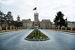
Much of the road network in downtown Kabul consisted of square or circle intersections (char-rahi). The main square in the city was Pashtunistan Square (named after Pashtunistan), which had a large fountain in it and was located adjacent to the presidential palace, the Central Bank, and other landmarks. [179] The Massoud Circle was located by the U.S. Embassy and had the road leading to the airport. In the old city, Sar-e Chawk roundabout was at the center of Maiwand Road ( Jadayi Maiwand ). Once all roads led to it, and in the 16th century was called the "navel of Kabul". [180] In the Shahr-e Naw district there were several major intersections: Ansari, Haji Yaqub, Quwayi Markaz, Sedarat, and Turabaz Khan. The latter, named after Turabaz Khan, connected Flower Street and Chicken Street. There were also two major intersections in western Kabul: the Deh Mazang Circle and Kote Sangi. Salang Watt was the main road to the north-west, whereas Asamayi Watt and Seh Aqrab (also called Sevom Aqrab) was the main road to western Kabul.

The steep population rise in the 21st century had caused major congestion problems for the city's roads. [181] In efforts to tackle this issue, a 95 km outer ring road costing $110 million was approved in 2017. [182] [183] Construction would have taken five years and it will run from Char Asiab via Ahmad Shah Baba Mina, Deh Sabz ("Kabul New City" development area), the AH76 highway, Paghman and back to Char Asyab. [184] A new bus public transport service was also planned to be opened in 2018 (see below). [185] In September 2017, the head of the Kabul Municipality announced that 286 meters of pedestrian overpass footbridges will be built in eight busy areas "in the near future". [186]

Under the Kabul Urban Transport Efficiency Improvement Project that was signed in 2014 and backed by the World Bank, the city has seen widespread improvements in road conditions, including the building of new pedestrian sidewalks, drainage systems, lighting and asphalted road surfaces. The project runs until 31 December 2019. [187] [188]

A Toyota Corolla (E100) at a security checkpoint in 2010 Afghan National Police set up Ring of Steel (4671626066).jpg
A Toyota Corolla (E100) at a security checkpoint in 2010

Private vehicles had been on the rise in Kabul since 2002, with about 700,000 cars registered as of 2013 and up to 80% of the cars reported to be Toyota Corollas. [189] [190] [191] The number of dealerships had also increased from 77 in 2003 to over 550 by 2010. [192] Gas stations were mainly private-owned. Bicycles on the road were a common sight in the city.

Public transport

The taxicabs in Kabul were painted in a white and yellow livery. The majority of these were older model Toyota Corollas. A few Soviet-era Russian cabs were also still in operation.

Long-distance road journeys were made by private Mercedes-Benz coach buses or vans, trucks and cars. Although a nationwide bus service was available from Kabul, flying was safer, especially for foreigners. The city's public bus service (Millie Bus / "National Bus") was established in the 1960s to take commuters on daily routes to many destinations. The service had about 800 buses. The Kabul bus system had discovered a new source of revenue in whole-bus advertising from MTN similar to "bus wrap" advertising on public transit in more developed nations. There was also an express bus that runs from downtown to Hamid Karzai International Airport for Safi Airways passengers.

An electric trolleybus system operated in Kabul from February 1979 to 1992 using Škoda fleet built by a Czechoslovak company (see Trolleybuses in Kabul for more). The trolleybus service was highly popular mainly due to its low price compared to the Millie Bus conventional bus service. The last trolleybus came to a halt in late 1992 due to warfare – much of the copper overhead wires were later looted but a few of them, including the steel poles, can still be seen in Kabul today. [141] [193]

In June 2017 Kabul Municipality unveiled plans for a new bus rapid transit system, the first major urban public transportation scheme. It was expected to open by 2018, [194] [195] but its construction had been hampered. In March 2021, a new city bus service was launched in Kabul using American vehicles built by IC Bus, and accompanied by newly built bus stops throughout the city. Five buses entered service on one route which is expected to be expanded to a fleet of 200 buses on 16 different routes. [196] [197]

Internet-based participatory planning

Kabul city announced open calls through the Kabul municipality's HP and its Facebook page, to participate in town meeting and planning process An Open Call for participation in Kabul city.jpg
Kabul city announced open calls through the Kabul municipality's HP and its Facebook page, to participate in town meeting and planning process
Kabul mayor Mohammad Daud Sultanzoy speaking with league management during the inauguration ceremony of first ever internet-based solid waste discussion league in 2021 Kabul mayor speaking during solid waste discussion league.png
Kabul mayor Mohammad Daud Sultanzoy speaking with league management during the inauguration ceremony of first ever internet-based solid waste discussion league in 2021
A memorandum of understanding signed by Kabul City mayor Ahmad Zaki Sarfaraz and Nagoya Institute of Technology executive director in 2019 MoU between Kabul and NITech.png
A memorandum of understanding signed by Kabul City mayor Ahmad Zaki Sarfaraz and Nagoya Institute of Technology executive director in 2019

In 2019, the Nagoya Institute of Technology, in partnership with the Kabul city Municipality, jointly agreed to deploy a digital platform, called D-Agree in urban planning to provide support for stakeholders to promote meaningful public participation and help reach consensus in Kabul city planning process. [198]

From September 2019 until the Fall of Kabul (2021) in August 2021, the platform was used on behalf of Kabul Municipality to moderate more than 300 Kabul city-related planning discussions. [199] [200] [201] [202] [203] [204] [205] In these discussions, more than 15,000 citizens participated in planning activities hosted by D-Agree and generated more than 71,000 opinions which catalogued into issue-based information system regarding urban-related thematic areas. [198] Despite the Taliban take-over, D-Agree will continue to play an important role in facilitating urban planning and infrastructure-related consultations. [206]

In 2022, United Nations reported that D-Agree Afghanistan is used as a digital and smart city solutions in Afghanistan. [198] [207]

D-Agree, is a discussion support platform with artificial intelligence–based facilitation. [208] The discussion trees in D-Agree, inspired by issue-based information system, contain a combination of four types of elements: issues, ideas, pros, and cons. [208] The software extracts a discussion's structure in real time based on IBIS, automatically classifying all the sentences. [208]

Education

The Ministry of Education led by Ghulam Farooq Wardak was responsible for the education system in Afghanistan. [209] Public and private schools in the city have reopened since 2002 after they were shut down or destroyed during fighting in the 1980s to the late 1990s. Boys and girls were strongly encouraged to attend school under the Karzai administration but many more schools were needed not only in Kabul but throughout the country. The Afghan Ministry of Education had plans to build more schools in the coming years so that education was provided to all citizens of the country. High schools in Kabul included:

Universities

Kabul Medical University Kabul Medical University in 2006.jpg
Kabul Medical University
Kabul Education University of Rabbani Shaheed Professor Rabbani Education University.jpg
Kabul Education University of Rabbani

Universities included:

Health care

Daoud Khan Military Hospital Kabul Military Hospital - panoramio.jpg
Daoud Khan Military Hospital

Health care in Afghanistan has improved in the last two decades. There are over 5,000 hospitals and clinics in the country, with the major ones being in Kabul.

Notable people

Twin towns – sister cities

See also

Notes

Related Research Articles

<span class="mw-page-title-main">Afghanistan</span> Country in Central and South Asia

Afghanistan, officially the Islamic Emirate of Afghanistan, is a landlocked country located at the crossroads of Central Asia and South Asia. Referred to as the Heart of Asia, it is bordered by Pakistan to the east and south, Iran to the west, Turkmenistan to the northwest, Uzbekistan to the north, Tajikistan to the northeast, and China to the northeast and east. Occupying 652,864 square kilometers (252,072 sq mi) of land, the country is predominantly mountainous with plains in the north and the southwest, which are separated by the Hindu Kush mountain range. Kabul is the country's largest city and serves as its capital. According to the World Population review, as of 2021, Afghanistan's population is 40.2 million. The National Statistics Information Authority of Afghanistan estimated the population to be 32.9 million as of 2020.

<span class="mw-page-title-main">Babur</span> Mughal emperor from 1526 to 1530

Babur was the founder of the Mughal Empire in the Indian subcontinent. He was a descendant of Timur and Genghis Khan through his father and mother respectively. He was also given the posthumous name of Firdaws Makani.

<span class="mw-page-title-main">History of Afghanistan</span>

The history of Afghanistan, preceding the establishment of the Emirate of Afghanistan in 1823 is shared with that of neighbouring Iran, central Asia and Indian subcontinent. The Sadozai monarchy ruled the Afghan Durrani Empire, considered the founding state of modern Afghanistan.

<span class="mw-page-title-main">Hazaras</span> Persian-speaking people native to central Afghanistan

The Hazaras are an ethnic group and a principal component of the population of Afghanistan, native to Afghanistan, Pakistan, and Iran. They are one of the largest ethnic groups in Afghanistan and primarily residing in the Hazaristan (Hazarajat) region in central Afghanistan, as well as a significant minority groups mainly in Quetta, Pakistan and Mashhad, Iran. They speak the Dari and Hazaragi dialects of Persian. Dari, also known as Dari Persian, is one of two official languages of Afghanistan.

<span class="mw-page-title-main">Ismail Khan</span> Afghan politician and former warlord (born 1946)

Mohammad Ismail Khan is an Afghan former politician who served as Minister of Energy and Water from 2005 to 2013 and before that served as the governor of Herat Province. Originally a captain in the Afghan Army, he is widely known as a former warlord as he controlled a large mujahideen force, mainly his fellow Tajiks from western Afghanistan, during the Soviet–Afghan War.

<span class="mw-page-title-main">Jalalabad</span> City in Nangarhar Province, Afghanistan

Jalalabad is the fifth-largest city of Afghanistan. It has a population of about 356,274, and serves as the capital of Nangarhar Province in the eastern part of the country, about 130 kilometres (80 mi) from the capital Kabul. Jalalabad is located at the junction of the Kabul River and the Kunar River in a plateau to the south of the Hindu Kush mountains. It is linked by the Kabul-Jalalabad Road to the west and Peshawar in Khyber Pakhtunkhwa, Pakistan, to the east through Torkham and the Khyber Pass.

<span class="mw-page-title-main">Kandahar</span> City in Kandahar Province, Afghanistan

Kandahar is a city in Afghanistan, located in the south of the country on the Arghandab River, at an elevation of 1,010 m (3,310 ft). It is Afghanistan's second largest city after Kabul, with a population of about 614,118. It is the capital of Kandahar Province and the centre of the larger cultural region called Loy Kandahar. Kandahar is the founding city and spiritual center of the Taliban. Despite the capital of Afghanistan being Kabul, where the government administration is based, Kandahar is the seat of power in Afghanistan as the supreme leader and his spiritual advisers are based there. Kandahar has therefore been called the de facto capital of Afghanistan, though the Taliban maintain Kabul is the capital.

<span class="mw-page-title-main">Mohammad Zahir Shah</span> King of Afghanistan from 1933 to 1973

Mohammad Zahir Shah was the last King of Afghanistan, reigning from 8 November 1933 until he was deposed on 17 July 1973. Serving for 40 years, Zahir was the longest-serving ruler of Afghanistan since the foundation of the Durrani Empire in the 18th century.

<span class="mw-page-title-main">Flag of Afghanistan</span> National flag of Afghanistan

The national flag of the Islamic Emirate of Afghanistan, adopted on 15 August 2021 following the Taliban's victory in the 2001–2021 war, features a white field with a black Shahada inscribed. Since the 20th century, Afghanistan has changed its national flag several times. The national flag had black, red and green colors most of the time during the period.

<span class="mw-page-title-main">Ghazni</span> City in Ghazni Province, Afghanistan

Ghazni, historically known as Ghaznain (غزنين) or Ghazna (غزنه), also transliterated as Ghuznee, and anciently known as Alexandria in Opiana, is a city in southeastern Afghanistan with a population of around 190,000 people. The city is strategically located along Highway 1, which has served as the main road between Kabul and Kandahar for thousands of years. Situated on a plateau at 2,219 metres (7,280 ft) above sea level, the city is 150 kilometres (93 mi) south of Kabul and is the capital of Ghazni Province. The name Ghazni drives from the Persian word "ganj", meaning ‘treasure’.

Afghanistan is a mountainous landlocked country at the crossroads of Central and South (Southern) Asia. Some of the invaders in the history of Afghanistan include the Maurya Empire, the ancient Macedonian Empire of Alexander the Great, the Rashidun Caliphate, the Mongol Empire led by Genghis Khan, the Timurid Empire of Timur, the Mughal Empire, various Persian Empires, the British Empire, the Soviet Union, and most recently the United States with a number of allies in response to the September 11 attacks. A reduced number of NATO troops remained in the country in support of the government under the U.S.–Afghanistan Strategic Partnership Agreement. Just prior to American withdrawal in 2021, the Taliban regained control of the capital Kabul and most of the country. They changed Afghanistan's official name to the Islamic Emirate of Afghanistan.

<span class="mw-page-title-main">Kabul Province</span> Province of Afghanistan

Kabul, situated in the east of the country, is one of the thirty-four provinces of Afghanistan. The capital of the province is Kabul city, which is Afghanistan's capital and largest city. The population of the Kabul Province is over 5.5 million people as of 2022, of which over 85 percent live in urban areas. The current governor of the province is Qari Baryal.

<span class="mw-page-title-main">Kandahar Province</span> Province of Afghanistan

Kandahār is one of the thirty-four provinces of Afghanistan, located in the southern part of the country, sharing a border with Pakistan, to the south. It is surrounded by Helmand in the west, Uruzgan in the north and Zabul Province in the east. Its capital is the city of Kandahar, Afghanistan's second largest city, which is located on the Arghandab River. The greater region surrounding the province is called Loy Kandahar. The Emir of Afghanistan sends orders to Kabul from Kandahar making it the de facto capital of Afghanistan, although the main government body operates in Kabul. All meetings with the Emir take place in Kandahar, meetings excluding the Emir are in Kabul.

<span class="mw-page-title-main">Bala Hissar, Kabul</span> Fortress in Kabul, Afghanistan

Bala Hissar was an ancient fortress located in the south of the old city of Kabul, Afghanistan. The estimated date of construction is around the 5th century AD. Bala Hissar sits to the south of the modern city centre at the tail end of the Kuh-e-Sherdarwaza Mountain. The Walls of Kabul, which are 20 feet (6.1 m) high and 12 feet (3.7 m) thick, start at the fortress and follow the mountain ridge in a sweeping curve down to the river. It sports a set of gates for access to the fortress. The Kōh-e Shēr Darwāzah mountain is behind the fort. It was destroyed by the British in 1880.

<span class="mw-page-title-main">Gardens of Babur</span> Park in Chelsatun, Kabul, Afghanistan

Bagh-e Babur, also known as Gardens of Babur, is a historic site in Chelsatun, Kabul, Afghanistan. It is located in the Sher Darwaza hillside of District 5, southwest of Shahr-e Naw, or a short distance south of Kabul Zoo and north of Chihil Sutun. The gardens of Babur has several terraced buildings, a small mosque, and plenty of walking space. Visited by up to one million locals and foreign tourists a year, it is also where the tomb of the first Mughal emperor Babur is located. The park is thought to have been developed around 1504, when Babur gave orders for the construction of an "avenue garden" in Kabul, described in some detail in his memoirs, the Baburnama. It has been re-developed by various Afghan rulers since then.

Sex segregation refers to the physical and spatial separation of humans by sex in public or private places. In public places, women are forced to wear the burqa at all times, because, according to one Taliban spokesman, "the face of a woman is a source of corruption" for men not related to them (Non-Mahram).

<span class="mw-page-title-main">Tourism in Afghanistan</span>

Tourism in Afghanistan is regulated by the Ministry of Information and Culture. There are at least 350 tourism companies operating in Afghanistan. Tourism was at its peak before the 1978 Saur Revolution, which was followed by the decades of war. Between 2013 and 2016, Afghan embassies issued between 15,000 and 20,000 tourist visas annually.

Afghan Indians are Indian citizens and non-citizen residents born in, or with ancestors from, Afghanistan. As of early 2021, there are at least 15,806 Afghans temporarily residing in India under a special protection and care of the United Nations High Commissioner for Refugees (UNHCR). Apart from citizens and expatriates, there are a number of communities in India who trace their ancestry back to Pashtun forefathers of Pashtunistan.

The following is a timeline of the history of Kabul, Afghanistan.

References

  1. 1 2 3 Bumiller, Elisabeth (17 October 2009). "Remembering Afghanistan's Golden Age". The New York Times. Archived from the original on 24 August 2021. Retrieved 24 August 2021.
  2. 1 2 3 Kohzad, Nilly. "Kabul Residents, Visitors Recall Capital's Golden Era Before Conflict". Radiofreeeurope/Radioliberty. RFE/RL. Archived from the original on 24 August 2021. Retrieved 24 August 2021.
  3. 1 2 3 Hanifi, Shah Mahmoud. p. 185. Connecting Histories in Afghanistan: Market Relations and State Formation on a Colonial Frontier Archived 15 August 2021 at the Wayback Machine . Stanford University Press, 2011.
  4. "د اسلامي امارت په تشکیلاتو کې نوي کسان پر دندو وګومارل شول". باختر خبری آژانس. 4 October 2021. Archived from the original on 16 November 2021. Retrieved 22 November 2021.
  5. 1 2 3 "Estimated Population of Afghanistan 2023-24" (PDF). nsia.gov.af. 10 July 2023. Archived (PDF) from the original on 11 September 2023. Retrieved 11 September 2023.
  6. American Heritage Dictionary of the English Language, 1969.
  7. "Kabul". Merriam-Webster.com Dictionary . Retrieved 22 November 2021.
  8. Foschini, Fabrizio (April 2017). Kabul and the challenge of dwindling foreign aid (PDF). Peaceworks no. 126. United States Institute of Peace. ISBN   978-1-60127-641-4. Archived (PDF) from the original on 9 June 2020. Retrieved 1 June 2021 via ETH Zurich.
  9. "Largest cities in the world and their mayors – 1 to 150". City Mayors. 17 May 2012. Archived from the original on 2 September 2011. Retrieved 17 August 2012.
  10. "Kabul | History, Culture, Map, & Facts | Britannica". 28 June 2023.
  11. "Afghanistan: The Heart of Silk Road in Asia". The Diplomat . Archived from the original on 9 June 2020. Retrieved 26 November 2019.
  12. 1 2 3 Samrin, Farah (2005). "The City of Kabul Under the Mughals". Proceedings of the Indian History Congress. 66: 1307. JSTOR   44145943.
  13. Nancy Hatch Dupree / Aḥmad ʻAlī Kuhzād (1972). "An Historical Guide to Kabul – The Story of Kabul". American International School of Kabul. Archived from the original on 30 August 2010. Retrieved 18 September 2010.
  14. Gopalakrishnan, Raju (16 April 2007). "Once called paradise, now Kabul struggles to cope". Reuters. Archived from the original on 8 March 2021. Retrieved 1 June 2021.
  15. Abdul Zuhoor Qayomi. "Kabul City: Isn't just capital of Afghanistan but of palaces as well – Afghanistan Times". Afghanistan Times. Archived from the original on 15 May 2021. Retrieved 1 June 2021.
  16. Sayed A Azimi. "Reversing Kabul's Environmental Setbacks". LinkedIn. Archived from the original on 8 August 2021. Retrieved 1 June 2021.
  17. 1 2 "Afghan King Overthrown; A Republic Is Proclaimed". The New York Times. 18 July 1973. Archived from the original on 29 November 2019. Retrieved 1 April 2019.
  18. Dateline Mongolia: An American Journalist in Nomad's Land by Michael Kohn
  19. "'Mein Kabul': ORF-Reporterlegende Fritz Orter präsentiert im 'Weltjournal' 'seine Stadt' – am 31. August um 22.30 Uhr in ORF 2" (in German). OTS.at. Archived from the original on 9 August 2021. Retrieved 1 June 2021.
  20. "Taliban Peace Talks in Afghanistan". 28 May 2019. Archived from the original on 24 August 2021. Retrieved 24 August 2021.
  21. "History of Kabul". Lonely Planet. Archived from the original on 3 April 2019. Retrieved 27 May 2013.
  22. 1 2 3 4 5 6 7 8 9 10 11 12 13 14 Kakar, M. Hassan (2008). "Kabul". In Stearns, Peter N. (ed.). Oxford Encyclopedia of the Modern World. Oxford University Press. ISBN   978-0-19-517632-2. Archived from the original on 3 May 2021. Retrieved 13 February 2021.
  23. 1 2 3 Everett-Heath, John, ed. (2020). "Kabul". Concise Oxford Dictionary of World Place Names (6 ed.). Oxford University Press. ISBN   978-0-19-190563-6. Archived from the original on 3 May 2021. Retrieved 13 February 2021.
  24. 1 2 Adamec, p.231
  25. 1 2 3 Nancy Hatch Dupree / Aḥmad ʻAlī Kuhzād (1972). "An Historical Guide to Kabul – The Name". American International School of Kabul. Archived from the original on 30 August 2010. Retrieved 18 September 2010.
  26. del Castillo, Graciana (2 April 2014). Guilty Party: The International Community in Afghanistan. Xlibris Corporation. p. 28. ISBN   978-1-4931-8570-2.
  27. Emadi, Hafizullah (2005). Culture and Customs of Afghanistan. Greenwood Publishing Group. p. 26. ISBN   978-0-313-33089-6.
  28. Marsden, Peter (15 September 1998). The Taliban: War, Religion and the New Order in Afghanistan . Palgrave Macmillan. p.  12. ISBN   978-1-85649-522-6.
  29. Ring, Trudy (1994). International Dictionary of Historic Places: Asia and Oceania. Taylor & Francis. ISBN   978-1-884964-04-6.
  30. Runion, Meredith L. (2007). The History of Afghanistan . Greenwood Publishing Group. p.  41. ISBN   978-0-313-33798-7.
  31. Romano, p.12
  32. Snelling, John (31 August 2011). The Buddhist Handbook: A Complete Guide to Buddhist Teaching and Practice. Random House. ISBN   978-1-4464-8958-1.
  33. Houtsma, Martijn Theodoor (1987). E.J. Brill's first encyclopaedia of Islam, 1913–1936. Vol. 2. BRILL. p. 159. ISBN   978-90-04-08265-6. Archived from the original on 3 May 2021. Retrieved 23 August 2010.
  34. Dupree, Louis (14 July 2014). Afghanistan. Princeton University Press. p. 299. ISBN   978-1-4008-5891-0.
  35. Mookerji, Radhakumud (1966). Chandragupta Maurya and his times (4 ed.). Motilal Banarsidass Publ. p. 173. ISBN   978-81-208-0405-0. Archived from the original on 29 December 2011. Retrieved 18 September 2010.
  36. "A.—The Hindu Kings of Kábul (p.2)". Sir H. M. Elliot. London: Packard Humanities Institute. 1867–1877. Archived from the original on 5 September 2011. Retrieved 18 September 2010.
  37. Hill, John E. 2004. The Peoples of the West from the Weilue 魏略 by Yu Huan 魚豢: A Third Century Chinese Account Composed between 239 and 265 AD. Draft annotated English translation... Link Archived 23 December 2017 at the Wayback Machine
  38. Hill (2004), pp. 29, 352–352.
  39. A. D. H. Bivar, KUSHAN DYNASTY Archived 18 January 2012 at the Wayback Machine , in Encyclopaedia Iranica, 2010
  40. 1 2 "A.—The Hindu Kings of Kábul". Sir H. M. Elliot. London: Packard Humanities Institute. 1867–1877. Archived from the original on 8 April 2014. Retrieved 18 September 2010.
  41. Wilson, Horace Hayman (1998). Ariana antiqua: a descriptive account of the antiquities and coins of. Asian Educational Services. p. 133. ISBN   978-81-206-1189-4. Archived from the original on 3 May 2021. Retrieved 18 September 2010.
  42. Bosworth, Clifford Edmund (1973). The Ghaznavids: Their Empire in Afghanistan and Eastern Iran, 994 : 1040. Munshiram Manoharlal. p. 43. ISBN   978-1-01-499132-4.
  43. "A.—The Hindu Kings of Kábul (p.3)". Sir H. M. Elliot. London: Packard Humanities Institute. 1867–1877. Archived from the original on 26 July 2013. Retrieved 18 September 2010.
  44. Ibn Battuta (2004). Travels in Asia and Africa, 1325–1354 (reprint, illustrated ed.). Routledge. p. 180. ISBN   0-415-34473-5. Archived from the original on 16 April 2017. Retrieved 10 September 2010.
  45. Zahir ud-Din Mohammad Babur (1525). "Description of Kābul". Memoirs of Babur . Packard Humanities Institute. Archived from the original on 30 June 2020. Retrieved 21 June 2021.
  46. Gall, Sandy (2012). War Against the Taliban: Why It All Went Wrong in Afghanistan . Bloomsbury Publishing. p.  165. ISBN   978-1-4088-0905-1 . Retrieved 30 September 2013.
  47. 1 2 3 4 5 6 Schinasi, May. "Kabul iii. History From the 16th Century to the Accession of Moḥammad Ẓāher Shah". Encyclopaedia Iranica. Archived from the original on 29 June 2021. Retrieved 29 June 2021.
  48. Samrin, Farah (2005). "The City of Kabul Under the Mughals". Proceedings of the Indian History Congress. 66: 1307. ISSN   2249-1937. JSTOR   44145943. Archived from the original on 29 June 2021. Retrieved 29 June 2021.
  49. Roy, Kaushik (January 2015). "Mughal Empire and Warfare in Afghanistan: 1500–1810". academic.oup.com. Retrieved 20 June 2023.
  50. 1 2 Edmund., Bosworth, Clifford (2008). Historic cities of the Islamic world. Brill. p. 257. ISBN   978-90-04-15388-2. OCLC   231801473.{{cite book}}: CS1 maint: multiple names: authors list (link)
  51. Foltz, Richard (1996). "The Mughal Occupation of Balkh 1646–1647". Journal of Islamic Studies. 7 (1): 52. doi:10.1093/jis/7.1.49. ISSN   0955-2340. JSTOR   26195477. Archived from the original on 29 June 2021. Retrieved 29 June 2021.
  52. Ziad, Waleed (30 October 2018), "From Yarkand to Sindh via Kabul: The Rise of Naqshbandi-Mujaddidi Sufi Networks in the Eighteenth and Nineteenth Centuries", The Persianate World, BRILL, p. 145, doi:10.1163/9789004387287_007, ISBN   978-90-04-38728-7, S2CID   197951160, archived from the original on 22 November 2021, retrieved 11 November 2021
  53. Ziad, Waleed (30 October 2018), "From Yarkand to Sindh via Kabul: The Rise of Naqshbandi-Mujaddidi Sufi Networks in the Eighteenth and Nineteenth Centuries", The Persianate World, BRILL, pp. 148–149, doi:10.1163/9789004387287_007, ISBN   978-90-04-38728-7, S2CID   197951160 , retrieved 18 December 2021
  54. "Kabul: City of lost glories". BBC News. 12 November 2001. Archived from the original on 2 October 2013. Retrieved 18 September 2010.
  55. "Story Map Cascade". Library of Congress. Retrieved 20 June 2023.
  56. 1 2 Caption for Panorama of the Bala Hissar WDL11486 Library of Congress
  57. 1 2 3 "Draft Kabul City Master Plan" (PDF). usaid.gov. Archived (PDF) from the original on 2 April 2019. Retrieved 21 November 2019.
  58. Tanin, Z. (2006): Afghanistan in the 20th Century. Tehran.
  59. Anthony Hyman, "Nationalism in Afghanistan" in International Journal of Middle East Studies, 34:2 (Cambridge: Cambridge University Press, 2002) 305.
  60. 1 2 Hyman, 305.
  61. 1 2 "Kabul New City light rail plan – Railways of Afghanistan". www.andrewgrantham.co.uk. 18 August 2015. Archived from the original on 26 January 2018. Retrieved 26 January 2018.
  62. Nick Cullather, "Damming Afghanistan: Modernisation in a Buffer State" in The Journal of American History 89:2 (Indiana: Organization of American Historians, 2002) 518.
  63. Cullather, 518.
  64. 1 2 Cullather, 519.
  65. Cullather, 530.
  66. Caryl, Christian (12 June 2013). "When Afghanistan Was Just a Stop on the 'Hippie Trail'". HuffPost. Archived from the original on 26 June 2019. Retrieved 21 November 2019.
  67. Cullather, 534.
  68. 1 2 "Hotels and Tourists. | ACKU Images System". Archived from the original on 31 August 2021. Retrieved 31 August 2021.
  69. Blua, Antoine (5 October 2009). "Afghans Prepare for Tourism Development". Radio Free Europe/Radio Liberty. Archived from the original on 31 August 2021. Retrieved 31 August 2021.
  70. 1 2 Amstutz, J. Bruce (1994). Afghanistan: The First Five Years of Soviet Occupation. Diane Publishing. ISBN   978-0-7881-1111-2. OCLC   948347893.
  71. Hammer, Joshua (21 January 2007). "The Mysteries of Kabul". The New York Times. Archived from the original on 1 September 2021. Retrieved 1 September 2021.
  72. Smith, Oliver (20 April 2018). "When Afghanistan was just a laid-back highlight on the hippie trail". The Telegraph. Archived from the original on 17 August 2021. Retrieved 31 August 2021.
  73. "The Lonely Planet Journey: The Hippie Trail". The Independent. 5 November 2011. Archived from the original on 15 June 2017. Retrieved 14 June 2017.
  74. Haynes, 372.
  75. 1 2 Haynes, 373.
  76. J. Robert Moskin, American Statecraft: The Story of the U.S. Foreign Service (Thomas Dunne Books, 2013), p. 594.
  77. John Prados, Safe for Democracy: The Secret Wars of the CIA (Rowman & Littlefield, 2006), p. 468.
  78. Dick Camp, Boots on the Ground: The Fight to Liberate Afghanistan from Al-Qaeda and the Taliban (Zenith, 2012), pp. 8–9.
  79. 1 2 Yousaf, Mohammad (1991). Silent Soldier: The Man Behind the Afghan Jehad General Akhtar Abdur Rahman. Karachi, Sindh: Jang Publishers, 1991. p. 106. Archived from the original on 3 May 2021. Retrieved 15 December 2015.
  80. Kakar, Hassan M. (1997). Afghanistan: The Soviet Invasion and the Afghan Response, 1979–1982. University of California Press. p. 291. ISBN   978-0-520-20893-3. Archived from the original on 3 May 2021. Retrieved 8 January 2013.
  81. "Afghanistan". publishing.cdlib.org. Archived from the original on 13 August 2021. Retrieved 4 August 2021.
  82. Afghanistan: The First Five Years of Soviet Occupation, by J. Bruce Amstutz – Page 139
  83. 1 2 Afghanistan: The First Five Years of Soviet Occupation, by J. Bruce Amstutz – Page 139 & 140
  84. Bulletin of the Atomic Scientists – December 1983 issue
  85. Afghanistan: The Soviet Withdrawal from Afghanistan, by Amin Saikal, William Maley – Page 48
  86. Dorronsoro, Gilles (2007). "Kabul at War (1992–1996): State, Ethnicity and Social Classes". South Asia Multidisciplinary Academic Journal. samaj.revues.org. doi: 10.4000/samaj.212 . Archived from the original on 26 October 2014. Retrieved 25 October 2014.
  87. Afghanistan: The First Five Years of Soviet Occupation, by J. Bruce Amstutz – Page 140
  88. Landay, Jonathan S. "A truck bomb exploded in crowded downtown Kabul today,..." UPI. Archived from the original on 12 January 2018. Retrieved 11 January 2018.
  89. Bowersox, Gary W. (2004). The Gem Hunter: The Adventures of an American in Afghanistan. United States: GeoVision, Inc. p. 100. ISBN   978-0-9747323-1-2. Archived from the original on 8 August 2021. Retrieved 22 August 2010.
  90. "Guerrillas Take Afghan Capital as Troops Flee". The New York Times. 28 September 1996. Archived from the original on 10 October 2020. Retrieved 28 December 2017.
  91. Kolhatkar, S.; Ingalls, J.; Barsamian, D. (2011). Bleeding Afghanistan: Washington, Warlords, and the Propaganda of Silence. Seven Stories Press. ISBN   978-1-60980-093-2. Archived from the original on 7 December 2020. Retrieved 25 October 2014.
  92. Bowersox (p.192)
  93. Burns, John F. (5 February 1996). "Afghan Capital Grim as War Follows War". The New York Times. Archived from the original on 2 November 2020. Retrieved 28 December 2017.
  94. Nazif M Shahrani, "War, Factionalism and the State in Afghanistan" in American Anthropologist 104:3 (Arlington, Virginia: American Anthropological Association, 2008), 719.
  95. "Casting Shadows: War Crimes and Crimes against Humanity: 1978–2001" (PDF). Afghanistan Justice Project. 2005. Archived from the original (PDF) on 4 October 2013.
  96. Amnesty International. 16 November 1995 Accessed at: "Afghanistan: Further information on fear for safety and new concern: Deliberate and arbitrary killings: Civilians in Kabul". 16 November 1995. Archived from the original on 3 April 2015. Retrieved 18 October 2014.
  97. "Afghanistan: escalation of indiscriminate shelling in Kabul". International Committee of the Red Cross. 1995. Archived from the original on 10 May 2011. Retrieved 13 February 2011.
  98. BBC Newsnight 1995 on YouTube
  99. 1 2 "The Taliban's War on Women. A Health and Human Rights Crisis in Afghanistan" (PDF). Physicians for Human Rights. 1998. Archived from the original (PDF) on 2 July 2007. Retrieved 15 November 2010.
  100. "Flash from the Past: Kabul security handed back to Afghans in 2008". 22 September 2018. Archived from the original on 12 June 2020. Retrieved 12 June 2020.
  101. Bergen, Peter (4 March 2013). "What Went Right?". foreignpolicy.com. Archived from the original on 9 June 2020. Retrieved 26 November 2019.
  102. "Archnet". www.archnet.org. Archived from the original on 1 September 2021. Retrieved 22 November 2021.
  103. Shah Mahmoud Mahmoud. "ÇÈá äÇÊåÜ/ÓÜÜÜÇá ÜÜÜÜÜÜåÇÑÏåÜã/ÔãÇÑåی۳۱۳/ÇÓÊÇÏ ÔÇå ãÍãæÏ/ÈÑÍåÇی ÓÇÚÊ ÔåÑ ÇÈá" [The clock towers of Kabul city]. www.kabulnath.de. Archived from the original on 1 September 2021. Retrieved 1 September 2021.
  104. "قصر تاجبیگ پس از بازسازی" (in Persian). 10 December 2020. Archived from the original on 29 June 2021. Retrieved 1 September 2021 via www.darivoa.com.
  105. "'There is less fear': Restoration of Kabul repairs the ravages of war". The Guardian . 13 May 2019. Archived from the original on 15 November 2021. Retrieved 1 September 2021.
  106. "Afghanistan Displacement and Returnee Response Informal Settlement Profiles: City of Kabul" (PDF). www.reachresourcecentre.info. Archived (PDF) from the original on 24 January 2018. Retrieved 23 January 2018.
  107. "For a Lucky Few, Life Is Better in This Kabul Neighbourhood". www.nationalgeographic.com. 28 December 2017. Archived from the original on 13 January 2021. Retrieved 23 January 2018.
  108. Rasmussen, Sune Engel (11 December 2014). "Kabul – the fifth fastest growing city in the world – is bursting at the seams". The Guardian. Archived from the original on 9 January 2017. Retrieved 8 January 2017.
  109. "To go with story 'Afghanistan-elections-presidency-economics' by..." Getty Images. Archived from the original on 24 January 2018. Retrieved 23 January 2018.
  110. Recknagel, Charles; Sarwar, Mustafa (14 June 2016). "The Changing Face Of Kabul". RFE/RL. Archived from the original on 24 January 2018. Retrieved 23 January 2018.
  111. "Completed Projects – Gholghola Group". gholghola.com. Archived from the original on 15 February 2018. Retrieved 23 January 2018.
  112. Hamdard, Azizullah (14 February 2015). "New township changes Kabul ring road course". www.pajhwok.com. Archived from the original on 26 January 2018. Retrieved 25 January 2018.
  113. "Kabul to give diplomats an 'ordinary life' in Baghdad-style green zone". TheGuardian.com . 17 May 2009. Archived from the original on 1 September 2021. Retrieved 1 September 2021.
  114. "A photo tour of Kabul shows how 20 years of U.S. military presence reshaped Afghanistan's capital". Washington Post. Archived from the original on 26 March 2021. Retrieved 22 November 2021.
  115. "World's fastest growing urban areas (1)". City Mayors. 17 May 2012. Archived from the original on 25 November 2010. Retrieved 17 August 2012.
  116. "Kabul: A City With 2 Faces". thediplomat.com. Archived from the original on 9 June 2020. Retrieved 26 November 2019.
  117. "U.S. blames Pakistan agency in Kabul attack". Reuters. 22 September 2011. Archived from the original on 25 September 2011. Retrieved 22 September 2011.
  118. "U.S. links Pakistan to group it blames for Kabul attack". Reuters. 17 September 2011. Archived from the original on 24 September 2015. Retrieved 21 September 2011.
  119. "Clinton Presses Pakistan to Help Fight Haqqani Insurgent Group". Fox News. 18 September 2011. Archived from the original on 24 September 2015. Retrieved 21 September 2011.
  120. "Pakistan condemns US comments about spy agency". Associated Press. 23 September 2011. Archived from the original on 27 July 2013. Retrieved 23 September 2011.
  121. Baktash, Hashmat; Rodriguez, Alex (7 December 2008). "Two Afghanistan bombings aimed at Shiites kill at least 59 people". Los Angeles Times . Archived from the original on 25 January 2012. Retrieved 9 December 2011.
  122. Rubin, Alissa (13 September 2011). "U.S. Embassy and NATO Headquarters Attacked in Kabul". nytimes.com . Archived from the original on 10 October 2020. Retrieved 2 September 2017.
  123. Holehouse, Matthew (13 September 2011). "Kabul US embassy attack: September 13 as it happened". London: telegraph.co.uk. Archived from the original on 31 January 2018. Retrieved 6 April 2018.
  124. "At least 55 killed in Kabul suicide bombing". The Hindu. Chennai, India. 7 December 2008. Archived from the original on 3 February 2016. Retrieved 9 December 2011.
  125. "Photos of the Day: Dec. 8". The Wall Street Journal. 7 December 2008. Archived from the original on 24 August 2020. Retrieved 9 December 2011.
  126. "Country Reports on Terrorism 2017". U.S. Department of State. Archived from the original on 20 June 2023. Retrieved 20 June 2023.
  127. "Afghanistan's Security Challenges under the Taliban". www.crisisgroup.org. 12 August 2022. Retrieved 19 October 2022.
  128. "Afghanistan: Seven Killed, 41 Injured in Blast Near Mosque in Kabul". www.outlookindia.com/. 23 September 2022. Retrieved 19 October 2022.
  129. Canada in Afghanistan: The War So Far by Peter Pigott
  130. "Kabul Climate Normals 1956–1983". National Oceanic and Atmospheric Administration. Archived from the original on 4 May 2023. Retrieved 30 March 2013.
  131. http://kbr.id/english/11-2016/in_kabul__where_the_rivers_run_dry_/wo Archived 22 November 2021 at the Wayback Machine 86710.html
  132. Clark, Kate (25 April 2016). "Kabul Duck Alert 2: Pictures of birds and birdwatchers at the Kol-e Hashmat Khan wetland | Afghanistan Analysts Network". www.afghanistan-analysts.org. Archived from the original on 3 July 2019. Retrieved 26 January 2018.
  133. "Kabul wetland declared new protected area for migrating birds". United Nations Environment Programme. 19 June 2017. Archived from the original on 3 October 2019. Retrieved 2 October 2019.
  134. "Kabul – Legislation and Policy Advances". afghanistan.wcs.org. Archived from the original on 28 October 2020. Retrieved 26 January 2018.
  135. "Qargha Lake, a transcendental beauty of nature". Afghanistan Times. Archived from the original on 18 November 2019. Retrieved 21 November 2019.
  136. Hamid, Tamim. "Kabul Faces 'Worst' Air Pollution This Year". tolonews.com. Archived from the original on 29 November 2019. Retrieved 21 November 2019.
  137. Jackson, Allison. "Kabul chokes on dirty air as temperatures plunge". phys.org. Archived from the original on 26 April 2019. Retrieved 26 April 2019.
  138. Foschini, Fabrizio. "A geographical guide to a metropolis in the making" (PDF). www.afghanistan-analysts.org. Archived (PDF) from the original on 4 June 2019. Retrieved 4 June 2019.
  139. 1 2 "Community Scorecard of Kabul Municipality 2016" (PDF). iwaweb.org. Archived (PDF) from the original on 23 February 2018. Retrieved 22 February 2018.
  140. "Japan International Cooperation Agency (JICA) Ministry of Urban Development Affairs (MUDA) Kabul Municipality Dehsabz City Development Authority (DCDA)" (PDF). Archived (PDF) from the original on 12 July 2019. Retrieved 26 November 2019.
  141. 1 2 "Trolleybuses in Kabul". www.spvd.cz. Archived from the original on 14 January 2017. Retrieved 8 January 2017.
  142. Rasmussen, Sune Engel (11 December 2014). "Kabul – the fifth fastest growing city in the world – is bursting at the seams". The Guardian. Archived from the original on 9 January 2017. Retrieved 8 January 2017.
  143. Wellman, Phillip Walter. "Homes in Kabul painted bright colors to cheer up war weary residents". Stars and Stripes. Archived from the original on 20 January 2018. Retrieved 20 January 2018.
  144. Abed, Fahim; Mashal, Mujib (30 May 2017). "Urban Sprawl Up Kabul's Mountainsides, With Splashes of Color". The New York Times. Archived from the original on 20 January 2018. Retrieved 20 January 2018.
  145. Women of Afghanistan in the Post-Taliban Era: How Lives Have Changed and Where They Stand Today by Rosemarie Skaine, 2009.
  146. "National Geographic Magazine" (PDF). Archived from the original (PDF) on 27 February 2008.
  147. Zahir ud-Din Mohammad Babur (1525). "Description of Kābul". Memoirs of Babur . Archived from the original on 30 June 2020. Retrieved 21 June 2021.
  148. "Afghanistan – AFG38731 –Tajiks in Kabul and Mazar-e-Sharif – Taliban" (PDF). Country Advice: Afghanistan. Refugee Review Tribunal, Australia. 2 June 2011. Archived (PDF) from the original on 2 August 2020. Retrieved 25 November 2019 via www.refworld.org.
  149. "Kabul". Online Encyclopædia Britannica. Archived from the original on 26 July 2010. Retrieved 18 September 2010.
  150. "Kabul – Naval Postgraduate School". my.nps.edu. Archived from the original on 11 January 2018. Retrieved 11 January 2018.
  151. Foschini, Fabrizio (17 January 2012). "Striking at Kabul, now and then | Afghanistan Analysts Network". www.afghanistan-analysts.org. Archived from the original on 11 January 2018. Retrieved 11 January 2018.
  152. USSD Bureau of Democracy, Human Rights, and Labor (2009). "International Religious Freedom Report 2009". Archived from the original on 30 November 2009. Retrieved 6 March 2010.{{cite web}}: CS1 maint: multiple names: authors list (link)
  153. "Afghan Sikhs, Hindus meet Taliban officials, are assured of safety". The Indian Express.
  154. "Afghanistan aim to maintain ascendancy as format changes". www.icc-cricket.com. Archived from the original on 2 August 2020. Retrieved 16 September 2019.
  155. "Kabul Urban Reconstruction Project". Worldbank.org. Archived from the original on 18 August 2014. Retrieved 18 May 2014.
  156. "DVIDS – News – US Forces – Afghanistan adjusts its $9.1 billion infrastructure program to meet Afghans' near-term needs". Dvidshub.net. Archived from the original on 24 February 2015. Retrieved 18 May 2014.
  157. Hodge, Nathan (13 May 2013). "Kabul's Tax Levies Raise Flags From U.S. Watchdog – WSJ". Wall Street Journal. online.wsj.com. Archived from the original on 24 February 2015. Retrieved 25 October 2014.
  158. Taylor, Alan. "The Modern Face of Kabul – The Atlantic". www.theatlantic.com. Archived from the original on 26 January 2018. Retrieved 26 January 2018.
  159. Marsden, Magnus (9 September 2021). Beyond the Silk Roads. Cambridge University Press. ISBN   978-1-108-83831-3. Archived from the original on 2 September 2021. Retrieved 2 September 2021.
  160. Fletcher, Martin (6 October 2009). "Only the brave survive on Chicken Street in Kabul: Two market traders encapsulate the sorry history of Afghanistan". The Times . Archived from the original on 1 September 2021. Retrieved 2 September 2021.
  161. Afghanistan Industrial Parks Development Authority...Kabul (Bagrami) Archived 5 June 2007 at the Wayback Machine
  162. "Corruption Perceptions Index 2010 Results". Transparency International. 2010. Archived from the original on 26 December 2018. Retrieved 27 February 2011.
  163. "Afghanistan's Million Dollar Minister". The Daily Beast. 9 August 2013. Archived from the original on 24 April 2014. Retrieved 18 May 2014.
  164. Licensed banks in Kabul include: Afghanistan International Bank, Kabul Bank, Azizi Bank, Pashtany Bank, Afghan United Bank Archived 31 July 2013 at the Wayback Machine , Standard Chartered Bank, Punjab National Bank, Habib Bank and Western Union
  165. Navid Ahmad Barakzai, ed. (27 September 2016). "20,000 foreign tourists visit Afghanistan annually". Pajhwok Afghan News (PAN). Archived from the original on 23 November 2016. Retrieved 15 May 2017.
  166. Muhammad Hassan Khetab, ed. (4 September 2013). "$1b contract signed to begin work on New Kabul City plan". Pajhwok Afghan News –. Archived from the original on 24 September 2015. Retrieved 30 September 2013.
  167. "Welcome to our Official Website". DCDA. Archived from the original on 30 December 2013. Retrieved 17 August 2012.
  168. "IEA officials inaugurate construction of New Kabul City". Pajhwok Afghan News. 18 August 2023. Retrieved 25 September 2023.
  169. "Construction gets underway on New Kabul housing project". Arian News. 17 August 2023. Retrieved 25 September 2023.
  170. "Qatar Township's construction works resume in Kabul". Pajhwok Afghan News. 30 May 2023. Retrieved 25 September 2023.
  171. Micallef, Joseph V. (8 November 2015). "Afghanistan 2015: The View From Kabul". HuffPost. Archived from the original on 12 November 2015. Retrieved 10 November 2015.
  172. 1 2 "Kabul Once Had 23 Cinemas, Now Just 4". TOLOnews. 17 November 2021. Archived from the original on 29 August 2021. Retrieved 22 November 2021.
  173. "The battle for the Kabul Nandari cinema". The Independent. 26 December 2020. Archived from the original on 1 September 2021. Retrieved 22 November 2021.
  174. Dari : منار علم و جهل
  175. 1 2 3 4 5 6 7 8 "An evaluation of architectural monuments in Afghanistan as in the capital city, Kabul". Archived from the original on 31 August 2021. Retrieved 22 November 2021.
  176. "Arg clock tower". president.gov.af. Archived from the original on 1 September 2021. Retrieved 1 September 2021.
  177. 1 2 3 "Push to modernise takes toll on Kabul's historical homes". Reuters. 10 December 2020. Archived from the original on 2 September 2021. Retrieved 2 September 2021 via www.reuters.com.
  178. "Kabul Markaz Residential Tower 1, Kabul | 1438696". Emporis. Archived from the original on 31 August 2021. Retrieved 22 November 2021.
  179. "The Square of Pashtunistan". 10 February 2015. Archived from the original on 3 March 2018. Retrieved 3 March 2018.
  180. "The place to take the Afghan pulse". 12 November 2009. Archived from the original on 22 November 2021. Retrieved 3 March 2018.
  181. "Roadworks bring traffic chaos to Kabul". BBC News. Archived from the original on 22 October 2018. Retrieved 21 July 2018.
  182. "Officials Say Kabul Ring Road Construction to Start Soon". Archived from the original on 20 January 2018. Retrieved 20 January 2018.
  183. "IDB Pays $74m Loan For Construction of Kabul City Ring-Road". rta.org.af. 17 September 2017. Archived from the original on 3 April 2018. Retrieved 22 November 2021.
  184. Moosakhail, Zabihullah (16 August 2015). "President Ghani: Kabul's ring road important economical project". The Khaama Press News Agency. Archived from the original on 25 January 2018. Retrieved 25 January 2018.
  185. "Amid chaos, Kabul gears up for pioneering metro bus service". Archived from the original on 20 January 2018. Retrieved 20 January 2018.
  186. "در پایتخت؛ شهرداری کابل و ساخت 286 متر پُل هوایی در 8 موقعیت مزدحم شهر |". 17 September 2017. Archived from the original on 26 January 2018. Retrieved 25 January 2018.
  187. "Kabul Urban Transport Efficiency Improvement Project". Archived from the original on 20 January 2018. Retrieved 20 January 2018.
  188. "Urban Transport Program Helps Keep Kabul Clean". 9 June 2017. Archived from the original on 20 January 2018. Retrieved 20 January 2018.
  189. "Why the Corolla is so popular – even in Afghanistan". 26 June 2013. Archived from the original on 21 January 2018. Retrieved 20 January 2018.
  190. Nakamura, David (27 August 2010). "In Afghanistan, a car for the masses". The Washington Post. Archived from the original on 12 November 2017. Retrieved 2 September 2017.
  191. Australian Broadcasting Corporation, Dodgy cars clogging Kabul's roads Archived 12 May 2009 at the Wayback Machine
  192. "Corolla's the car of choice in Kabul". Archived from the original on 21 January 2018. Retrieved 20 January 2018.
  193. "Catherine Lytle: From Gerbils to Trolleybus". Archived from the original on 2 August 2020. Retrieved 8 January 2017.
  194. "Kabul Municipality Unveils First Metro Bus System". TOLOnews. Archived from the original on 2 April 2019. Retrieved 21 November 2019.
  195. "Kabul municipality unveils new developments in metro bus project". The Khaama Press News Agency. 12 September 2017. Archived from the original on 2 April 2019. Retrieved 21 November 2019.
  196. "New bus service for Kabul city launched". 25 March 2021. Archived from the original on 24 July 2021. Retrieved 24 July 2021.
  197. "Kabul Municipality – شاروالی کابل: بسهای شهری شاروالی کابل در سطح شهر آغاز به فعالیت کرد!". Km.gov.af. Archived from the original on 24 August 2021. Retrieved 22 November 2021.
  198. 1 2 3 Regional Commissions report on the progress on the Implementation of the New Urban Agenda (2019–2022) (Report). United Nations. 2022. p. 19.
  199. "Kabul Municipality - شاروالی کابل: اطلاعیهی اشتراک در بحث آنلاین!". km.gov.af.
  200. What are the priorities of Kabul municipal districts (Report). Kabul City Municipality. 2020.
  201. "Kabul Municipality - شاروالی کابل: په ښاری آنلاین بحث کې ګډون!". km.gov.af.
  202. "Kabul Municipality - شاروالی کابل: اطلاعیهی اشتراک در گفتمان آنلاین شهری!". km.gov.af.
  203. "Kabul Municipality - شاروالی کابل: په ښاری انلاین بحث کې ګډون!". km.gov.af.
  204. "Kabul Municipality - شاروالی کابل: اولین گفتمان آنلاین در مورد مدیریت زبالهها برگزار شد". km.gov.af.
  205. "Kabul Municipality - شاروالی کابل: په ښاری انلاین بحث کې ګډون!". km.gov.af.
  206. 女性の絵消した」「タリバンを拒絶」…アフガニスタン人の本音 日本のIT会社が公開 (Report). The Asahi Shinbun. 2021. Archived from the original on 20 August 2021.
  207. The Transition of Asian and Pacific Cities to a Sustainable Future:Accelerating Action for Sustainable Urbanization (PDF) (Report). Economic and Social Commission for Asia and the Pacific. 2022. p. 23. Archived (PDF) from the original on 5 July 2022.
  208. 1 2 3 Hadfi, Rafik; Haqbeen, Jawad; Sahab, Sofia; Ito, Takayuki (August 2021). "Argumentative conversational agents for online discussions". Journal of Systems Science and Systems Engineering. 30 (4): 450–464. doi:10.1007/s11518-021-5497-1. PMC   8143987 . PMID   34054250.
  209. "دپوھنی وزارت". Moe.gov.af. Archived from the original on 14 November 2011. Retrieved 18 May 2014.
  210. "ADEI Medical Complex". Official website. Retrieved 9 April 2023.
  211. "MoPH to Distribute Covid-19 Vaccine to Provinces". TOLOnews. 13 March 2023. Retrieved 25 September 2023.
  212. "Arianna Medical Complex" . Retrieved 25 September 2023.
  213. "CURE Afghanistan". CURE International. Archived from the original on 16 August 2010. Retrieved 27 July 2015.
  214. "UAE Medical Firm To Run Two Key Kabul Hospitals". TOLOnews. 30 July 2018. Retrieved 25 September 2023.
  215. "Sister Cities of Ankara". Archived from the original on 24 December 2018. Retrieved 11 August 2016.
  216. "Sister Cities of Istanbul". Greater Istanbul. Archived from the original on 27 May 2009. Retrieved 10 April 2015.
  217. Cultures and Globalization: Cities, Cultural Policy and Governance by Helmut K Anheier, p.376
  218. "Cities in Afghanistan and Nebraska forge "sister cities" partnership – Afghanistan". ReliefWeb. Archived from the original on 10 April 2019. Retrieved 22 January 2018.
  219. "Deputy Mayor of Kabul Signs Sister Cities Friendship Agreement with Kansas City, Missouri ::: Embassy of Afghanistan". www.afghanembassy.us. Archived from the original on 2 April 2019. Retrieved 23 March 2019.

Further reading