Zabul is one of the 34 provinces of Afghanistan, located in the south of the country. It has a population of 249,000. Zabul became an independent province from neighbouring Kandahar in 1963. Historically, it was part of the Zabulistan region. Qalat serves as the capital of the province. The major ethnic group are Pashtuns. Primary occupations within Zabul are agriculture and animal husbandry.

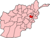
Kabul, situated in the east of the country, is one of the thirty-four provinces of Afghanistan. The capital of the province is Kabul city, which is Afghanistan's capital and largest city. The population of the Kabul Province is over 5.5 million people as of 2022, of which over 85 percent live in urban areas. The current governor of the province is Qari Baryal.

Wardak, also called Wardag is one of the 34 provinces of Afghanistan, located in the central region of Afghanistan. It is divided into eight districts and has a population of approximately 500,000. The capital of the province is Maidan Shar, while the most populous district in the province is Saydabad District. Wardak is known for one of its famous high peak mountain known as. In 2021, the Taliban gained control of the province during the 2021 Taliban offensive.

Paghman (Dari/Pashto:پغمان) is a town in the hills near Afghanistan's capital of Kabul. It is the seat of the Paghman District which has a population of about 120,000, mainly Pashtuns and Tajiks. The gardens of Paghman are a major tourist attraction, and the reason for the city being known as the garden capital of Afghanistan. The neighboring town of Qargha is to the southeast, which can be reached by several roads.

The districts of Afghanistan, known as wuleswali, are secondary-level administrative units, one level below provinces. The Afghan government issued its first district map in 1973. It recognized 325 districts, counting wuleswalis (districts), alaqadaries (sub-districts), and markaz-e-wulaiyat. In the ensuing years, additional districts have been added through splits, and some eliminated through merges. In June 2005, the Afghan government issued a map of 398 districts. It was widely adopted by many information management systems, though usually with the addition of Sharak-e-Hayratan for 399 districts in total. It remains the de facto standard as of late 2018, despite a string of government announcements of the creation of new districts.

Qarabagh District is located 50 kilometers north of Kabul City in Afghanistan, and 20 kilometers southeast of Bagram Airbase. The district is part of Kabul Province and is on the route between Kabul and Parwan Province. It has a population of 15,000, with an expected 19,000 more people to return from Pakistan and Iran in the future. As of 2002 around 60% of the population are Tajiks and 40% Pashtuns.
Muqur is a district in the southwest of Ghazni province, Afghanistan. Its population was estimated at 70,900 in 2002, of whom 19,538 were children under 12.

Goshta District is located in the northeast of Nangarhar Province, Afghanistan and borders Durand Line between Afghanistan and Pakistan. The district's population is Pashtun and was estimated at 160,000 in 2002, of whom 30,000 were children under 12. The district is within the heartland of the Mohmand tribe of Pashtuns. The district centre is the village of Goshta, on the Kabul River.
Hajii Sher Alam Ibrahimi was the governor of Ghazni Province from around 2005–2006 until 2007 and is a major commander aligned with Ittihad-i Islami and Abdul Rasul Sayyaf, having fought with him in the Afghan Civil War.
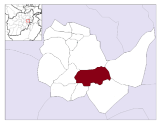
Bagrami District is located in the central part of Kabul Province in Afghanistan. It is approximately a 30-minute drive east from the capital city, Kabul. The district headquarters is the town of Bagrami.

Char Asiab District is a district, approximately 11 km south of the city of Kabul, and is situated in the southern part of Kabul province, Afghanistan. It has a population of 32,500 people. The majority are Pashtuns, followed by Tajiks as well as a few Hazaras.

Deh Sabz District, also romanized Dih Sabz District, is situated northeast of Kabul city in Afghanistan. It has a population of 100,136 people. About 70% are Pashtuns and 30% are Tajiks.
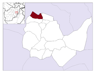
Istalif District is located in the northwestern part of Kabul Province, Afghanistan. It has a population of 8,500, a mixture of Tajiks, Pashtuns and Hazaras.

Khaki Jabbar District is a mountainous district situated in the southeastern part of Kabul Province, Afghanistan. The district headquarters is Khak-i Jabbar village, which is located in the central part of the district.

Mir Bacha Kot District is situated in the central part of Kabul Province, Afghanistan. It has a population of 5,000 and another 37,000 are expected to return in the near future. Tajiks are the majority and some Pashtuns also live there.

Mussahi District is a southern district of Kabul Province, Afghanistan. Mussai district borders Char Asiab District to the west, Bagrami District to the north, Khaki Jabbar District to the east and Logar Province to the south. Its headquarter is in Mussahi village, which is in the central part of the district.

Shakardara District is situated in the central part of Kabul Province, Afghanistan. It has a population of 3,000 people, with another 10,000 expected to return from abroad.
Farza District, also referred to as Farza, is a new district of Kabul Province, Afghanistan, with a population of 18,000 people. It's located 45 km north of Kabul, in the hills of the northwestern part of the Shomali Plain, and south of the villages of Istalif and Qarabagh. Farza District contains eighteen villages. The district headquarters is Dehnawe Farza. According to the UNHCR, in 2002, the population consisted of a mixture of Pashtuns and Tajiks. A river runs through Farza, called Darya-e Farza. Farza is home to orchards and well-known for its fruits, including grapes, mulberries, walnuts, and pomegranates. Agriculture is the primary source of income.

Saydabad District is a district of Maidan Wardak Province, Afghanistan. The district is known for its pleasant climate, including hilly vegetation, streams, and orchards. The district was a popular retreat for Kabul residents until an increase in ISAF-Taliban violence in the late 2000s. The city of Saydabad serves as the district capital. With a population of 114,793, it is the most populous district of the province.

Afghanistan, which is about two-thirds mountainous, contains many valleys. The majority of the valleys are located in parts of northeastern, central, southern and southeastern Afghanistan. The southeastern areas are wetter and are covered by forest with trees such as cypress, oak, poplar, pine etc. The valleys are the most populated regions in the country, and much of the agriculture done takes place either in the valleys or on the high plains.