Transport in Afghanistan is done mostly by road, rail and air. Much of the nation's road network was built in the mid-20th century but left to ruin during the last two decades of that century due to war and political turmoil. Officials of the current Islamic Emirate have continued to improve the national highways, roads, and bridges. In 2008, there were about 700,000 vehicles registered in Kabul. At least 1,314 traffic collisions were reported in 2022.

Zabul is one of the 34 provinces of Afghanistan, located in the south of the country. It has a population of 249,000. Zabul became an independent province from neighbouring Kandahar in 1963. Historically, it was part of the Zabulistan region. Qalat serves as the capital of the province. The major ethnic group are Pashtuns. Primary occupations within Zabul are agriculture and animal husbandry.

Ghazni, historically known as Ghaznain (غزنين) or Ghazna (غزنه), also transliterated as Ghuznee, and anciently known as Alexandria in Opiana, is a city in southeastern Afghanistan with a population of around 190,000 people. The city is strategically located along Highway 1, which has served as the main road between Kabul and Kandahar for thousands of years. Situated on a plateau at 2,219 metres (7,280 ft) above sea level, the city is 150 kilometres (93 mi) south of Kabul and is the capital of Ghazni Province. The name Ghazni drives from the Persian word ganj ‘treasure’.

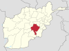
Ghazni is one of the 34 provinces of Afghanistan, located in southeastern Afghanistan. The province contains 19 districts, encompassing over a thousand villages and roughly 1.3 million people, making it the 5th most populous province. The city of Ghazni serves as the capital. It lies on the important Kabul–Kandahar Highway, and has historically functioned as an important trade center. The Ghazni Airport is located next to the city of Ghazni and provides limited domestic flights to Afghanistan's capital, Kabul.

Kandahār is one of the thirty-four provinces of Afghanistan, located in the southern part of the country, sharing a border with Pakistan, to the south. It is surrounded by Helmand in the west, Uruzgan in the north and Zabul Province in the east. Its capital is the city of Kandahar, Afghanistan's second largest city, which is located on the Arghandab River. The greater region surrounding the province is called Loy Kandahar. The Emir of Afghanistan sends orders to Kabul from Kandahar making it the de facto capital of Afghanistan, although the main government body operates in Kabul. All meetings with the Emir take place in Kandahar, meetings excluding the Emir are in Kabul.
The Kabul–Kandahar Highway (NH0101) is 483-kilometer (300 mi) long that links Afghanistan's two largest cities, Kabul and Kandahar. It starts from Dashte Barchi in Kabul and passes through Maidan Shar, Saydabad, Ghazni, and Qalat until it reaches Aino Mina in Kandahar. It is currently being rehabilitated at different locations. This highway is a key portion of Afghanistan's national highway system or "National Highway 1". The entire highway between Kabul and Kandahar has no mountain passes but there are many mountains nearby in some places. Approximately 35 percent of Afghanistan's population lives within 50 km (31 mi) of the Kabul to Kandahar portion of the Afghanistan Ring Road.
Jaghori is one of the main districts of the Ghazni province in Afghanistan. It is located in the highlands in the southern fringes of the Hazaristan region. It occupies 1,855 km2. in the upper Arghandab valley. The population is estimated to be around 560,000 in 2015. The district capital, Sange-e-Masha, is where major business transactions take place. The district is heavily dependent on agriculture, and migrant workers as the main sources of income. Other major marketplaces are in Ghojor and Anguri.

Ab Band is a district in Ghazni province, Afghanistan. Its population, which is almost entirely Pashtun, was estimated at 41,340 in 2002. The district is within the heartland of the Tarakai tribe of Ghilji Pashtuns. Ab Band is on the main road from Kabul to Kandahar. The district capital is Āb Band.
Malistan or Malestan, is a district in Ghazni province, Afghanistan. Its population, which is 100% Hazara, was estimated at 350,000 in 2009. The district capital is Mir Adina.
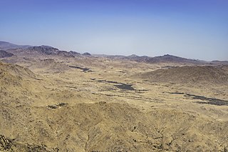
Qarabagh or Qara Bagh, is a district in Ghazni province, 56 km to the south-west of Ghazni city in eastern Afghanistan. The 1,800 km2 area is one of the most populated at 109,000; some reports count more than 218,000. The ethnic composition of the district includes Hazaras and Pashtuns. The landscape varies in different parts of the district - deserts in the southwest, plains in the southeast and mountains in the north. The district is seriously affected by drought, especially farming and animal husbandry. Health and education need serious improvement.
The following lists events that happened during 2004 in Afghanistan.

Urgun is a district of the remote Paktika Province in Afghanistan.

National Highway 01 or NH01, formally called the Ring Road, is a 2,200-kilometre (1,400 mi) two-lane road network circulating inside Afghanistan, connecting the following major cities (clockwise): Kabul, Maidan Shar, Ghazni, Kandahar, Delaram, Herat, Maymana, Sheberghan, Mazar-i-Sharif, Puli Khumri and back to Kabul. It has extensions that connect Jalalabad, Bamyan, Khost, Lashkargah, Zaranj, Farah, Islam Qala, Torghundi, and Kunduz. It is part of AH1, the longest route of the Asian Highway Network. National Highway 01 consists of four major sections, NH0101 to NH0104, linking the major economic centers.
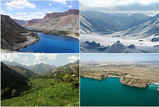
Tourism in Afghanistan is regulated by the Ministry of Information and Culture. There are at least 350 tourism companies operating in Afghanistan. Tourism was at its peak before the 1978 Saur Revolution, which was followed by the decades of war. Between 2013 and 2016, Afghan embassies issued between 15,000 and 20,000 tourist visas annually.
The following lists events that happened in 2013 in Afghanistan.
The following lists events that happened during 2016 in Afghanistan.

On May 8, 2016, two buses and a fuel tanker collided on a major highway, killing at least 73 people in the Muqur district, Ghazni Province, Afghanistan on the Kabul-Kandahar highway. More than 50 other people injured in the accident were taken to hospital in Ghazni Province. All three vehicles were set ablaze and completely engulfed in fire after the collision on the main road linking the capital, Kabul, to the southern city of Kandahar.
On 3 September 2016, at least 38 people were killed and 28 were injured after a fuel tanker carrying two people collided with a passenger bus carrying over 60 people on the dangerous Kabul-Kandahar highway in the province of Zabul, Afghanistan. The accident comes after an even larger incident that occurred on the same highway in May.